This article needs additional citations for verification .(January 2021) |
Alipurduar | |
---|---|
Clockwise from top-left: Evening at Jaldapara National Park, ruins of Buxa Fort, Hut used by Toto aboriginals, Jayanti Hills in Buxa Tiger Reserve, Bhutan gate near Jaigaon | |
Country | India |
State | West Bengal |
Division | Jalpaiguri |
Headquarters | Alipurduar |
Government | |
• Lok Sabha constituencies | Alipurduar |
• Vidhan Sabha constituencies | Alipurduars, Kumargram, Falakata, Madarihat, Kalchini |
Area | |
• Total | 3,136 km2 (1,211 sq mi) |
Population | |
• Total | 1,491,250 |
• Density | 480/km2 (1,200/sq mi) |
• Urban | 307,456 |
Time zone | UTC+05:30 (IST) |
Website | alipurduar |
Alipurduar District is the 20th district in the state of West Bengal, India. [2] The district has its headquarters at Alipurduar. It was made a district by bifurcating Jalpaiguri district in 2014. [3]
The district consists of Alipurduar municipality, Falakata municipality and six community development blocks: Madarihat–Birpara, Alipurduar–I, Alipurduar–II, Falakata, Kalchini and Kumargram. The six blocks contain 66 gram panchayats and nine census towns.
Apart from the Alipurduar municipality and Falakata municipality, the district contains eight census towns and rural areas of 66 gram panchayats under six community development blocks: Madarihat-Birpara, Alipurduar-I, Alipurduar–II, Kalchini, Falakata and Kumargram. [4] Geographically the district lies between 26.4°N to 26.83°N and 89°E to 89.9°E.
The nine census towns are Paschim Jitpur, Chechakhata, Alipurduar Railway Junction, Bholar Dabri, Sobhaganj, Jaygaon and Uttar Latabari and Uttar Kamakhyaguri. [5]
Alipurduar railway division has at least 710 km of railway track. It is the largest division of the Northeast Frontier Railway zone. In Alipurduar district, there are two major stations, Alipurduar Junction (APDJ) and New Alipurduar (NOQ). There are other stations in the district viz. Falakata Railway Station, Kamakhyaguri Railway Station, Dalgaon Railway Station, Hasimara Railway Station, Rajabhatkhawa, Hamiltongunj etc.
There are 5 assembly constituency in Alipurduar district :
S No. | Name | Lok Sabha constituency | MLA | Party | |
---|---|---|---|---|---|
10 | Kumargram (ST) | Alipurduars | Manoj Kumar Oraon | Bharatiya Janata Party | |
11 | Kalchini (ST) | Bishal Lama | Bharatiya Janata Party | ||
12 | Alipurduars | Suman Kanjilal | Bharatiya Janata Party | ||
13 | Falakata (SC) | Dipak Barman | Bharatiya Janata Party | ||
14 | Madarihat (ST) | Manoj Tigga | Bharatiya Janata Party |
As per order of the Delimitation Commission in respect of the delimitation of constituencies in the West Bengal, the area under Kumargram block and seven gram panchayats under Alipurduar–II block, viz. Bhatibari, Kohinoor, Parokata, Mahakalguri, Shamuktala, Turturi and Tatpara–I constitutes the Kumargram assembly constituency of West Bengal. The Majherdabri gram panchayat under Alipurduar–II block and the area under Kalchini block constitutes the Kalchini assembly constituency. The Alipurduar municipality, the Alipurduar Railway Junction census town, and the gram panchayats of Chaporer Par–I, Chaporer Par–II and Tatpara–II under Alipurduar–II block and ten gram panchayats of Alipurduar–I block, viz. Banchukamari, Parorpar, Shalkumar–I, Vivekananda–I, Chakowakheti, Patlakhawa, Shalkumar–II, Vivekananda–II, Mathura and Tapsikhata form the Alipurduars assembly constituency. The other gram panchayat of Alipurduar–I block, viz. Purba Kanthalbari forms the Falakata assembly constituency along with the area under Falakata block. Madarihat block is part of Madarihat assembly constituency. Kumargram, Kalchini and Madarihat constituencies is reserved for Scheduled tribes (ST) candidates. Falakata constituency is reserved for Scheduled castes (SC) candidates. All these five assembly constituencies are part of Alipurduars (Lok Sabha constituency), which is reserved for ST candidates. [6]
As of the 2011 census, Alipurduar district had a population of 1,491,250, of which 1,183,704 were rural and 307,456 were urban. Scheduled Castes and Scheduled Tribes made up 456,706 (30.62%) and 382,112 (25.62%) of the population respectively. [1]
Religion | Population (1941) [8] : 90–91 | Percentage (1941) | Population (2011) [7] | Percentage (2011) |
---|---|---|---|---|
Hinduism | 144,898 | 45.17% | 1,194,102 | 80.07% |
Tribal religion | 141,716 | 44.17% | 14,866 | 1.00% |
Islam | 29,856 | 9.31% | 130,339 | 8.74% |
Christianity | 1,385 | 0.43% | 112,091 | 7.52% |
Buddhism | --- | --- | 35,318 | 2.37% |
Others [lower-alpha 1] | 2,963 | 0.93 | 4,534 | 0.31% |
Total Population | 320,818 | 100% | 1,491,250 | 100% |
Hindus are the majority in all blocks. Muslims are spread evenly throughout the district, but Christians, traditional religions and Buddhists are concentrated in the tea garden areas.
At the time of the 2011 census, 53.93% spoke Bengali, 16.80% Sadri, 9.70% Nepali, 3.67% Hindi, 3.17% Rajbongshi, 3.13% Kurukh, 2.38% Boro, 1.39% Bhojpuri and 1.32% Santali as their first language. [9]
Alipurduar is a city and a municipality in the Indian state of West Bengal. It is the headquarters of the Alipurduar district. Situated on the east bank of Kaljani River in the foothills of the Himalayas, the city is a gateway to Bhutan and the northeastern states of India. Alipurduar was a sub-divisional town of Jalpaiguri district until 2014 when it was created a separate district.
Rajabhatkhawa is a small town situated just outside the Buxa Tiger Reserve in the Kalchini CD block in the Alipurduar subdivision of the Alipurduar district in West Bengal, India. It is known for its natural environment, and is surrounded by forest. Permits for the entry to the Buxa Tiger Reserve are issued here.
Mathabhanga subdivision is a subdivision of the Cooch Behar district in the state of West Bengal, India.
Tufanganj subdivision is a subdivision of the Cooch Behar district in the state of West Bengal, India.
Uluberia subdivision is a subdivision of the Howrah district in the state of West Bengal, India. It consists of Uluberia municipality and nine community development (CD) blocks, including 90 gram panchayats and six census towns. The six census towns are: Khalor, Bagnan, Naupala, Santoshpur, Balaram Pota and Uttar Pirpur. The subdivision has its headquarters at Uluberia. The whole division forms the Lok Sabha constituency of Uluberia.
Jayanti is a village in the Kumargram CD block in the Alipurduar subdivision of the Alipurduar district in West Bengal, India. It is one of the most famous tourist destinations of Dooars. Jayanti shares a border between India and Bhutan.
Madarihat is a census town and a gram panchayat in the Madarihat-Birpara CD block in the Alipurduar subdivision of the Alipurduar district, West Bengal, India. This town is situated on the outskirts of Jaldapara National Park, which is famous for Indian rhinoceros. This is one of the main tourist spots in North Bengal, surrounded by tea gardens, forests, hills, and small rivers, and also having highly diverse population. Madarihat is also world famous for the local wooden furniture.
Kumargarm Assembly constituency is an assembly constituency in Alipurduar district in the Indian state of West Bengal. It is reserved for scheduled tribes.
Kalchini Assembly constituency is an assembly constituency in Alipurduar district in the Indian state of West Bengal. It is reserved for scheduled tribes.
Falakata is an assembly constituency in Alipurduar district in the Indian state of West Bengal. It is reserved for scheduled castes.
Madarihat Assembly constituency is an assembly constituency in Alipurduar district in the Indian state of West Bengal. It is reserved for scheduled tribes.
Madarihat-Birpara is a community development block that forms an administrative division in the Alipurduar subdivision of the Alipurduar district in the Indian state of West Bengal.
Falakata is a community development block that forms an administrative division in the Alipurduar subdivision of the Alipurduar district in the Indian state of West Bengal.
Kalchini is a community development block that forms an administrative division in the Alipurduar subdivision of the Alipurduar district in the Indian state of West Bengal.
Kumargram is a community development block that forms an administrative division in the Alipurduar subdivision of the Alipurduar district in the Indian state of West Bengal.
The New Jalpaiguri–Alipurduar–Samuktala Road line is a railway line that connects New Jalpaiguri- Siliguri Junction with Alipurduar and Samuktala Road in the Indian state of West Bengal. This railway line passes through the beautiful Doars region, which includes Mahananda Wildlife Sanctuary, Dooars-Terai tea gardens, Sevoke Railway Bridge, River Teesta, River Jaldhaka, River Torsha, Gorumara National Park, Buxa Tiger Reserve, Jaldapara National Park, Chapramari Wildlife Sanctuary, Chilapata Forests, Tunnels, Hills, Valleys etc.
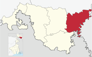
Alipurduar subdivision is an administrative division of the Alipurduar district in the Indian state of West Bengal.
Alipurduar railway division is one of the five railway divisions under Northeast Frontier Railway zone of Indian Railways. This railway division was formed on 15 January 1958 and its headquarter is located at Alipurduar in the state of West Bengal.
Birpara Tea Garden is a village, a tea garden and two gram panchayats in the Madarihat-Birpara CD block in the Alipurduar subdivision of the Alipurduar district in the state of West Bengal, India.
Banarhat is a community development block that forms an administrative division in the Dhupguri subdivision of the Jalpaiguri district in the India state of West Bengal.