Sobhaganj

Last updated

Sobhaganj
Census Town
West Bengal location map.svg
Red pog.svg
Sobhaganj
Location in West Bengal, India
India location map 3.png
Red pog.svg
Sobhaganj
Sobhaganj (India)
Coordinates: 26°29′N89°32′E / 26.48°N 89.54°E / 26.48; 89.54 Coordinates: 26°29′N89°32′E / 26.48°N 89.54°E / 26.48; 89.54
CountryFlag of India.svg  India
State West Bengal
District Alipurduar
Population
 (2011)
  Total4,891
Time zone UTC+5:30 (IST)
Vehicle registration WB
Lok Sabha constituency Alipurduars (ST)
Vidhan Sabha constituency Alipurduars (ST)
Website jalpaiguri.gov.in

Sobhaganj is a census town in the Alipurduar II CD block in the Alipurduar subdivision in the Alipurduar district in the Indian state of West Bengal.

Contents

Geography

Places and tea estates in the eastern portion of Alipurdar subdivision (including Kalchini, Kumargram and Alipuduar II CD blocks) in Alipurduar district
CT: census town, R: rural/ urban centre, N: neighbourhood, A: Air Force Station, NP: national park/ wildlife sanctuary, TE: tea estate, H: historical site
Abbreviations used in names – TG for Tea Garden (town/village), TE for Tea Estate
Owing to space constraints in the small map, the actual locations in a larger map may vary slightly

Location

Sobhaganj is located at 26°29′N89°32′E / 26.48°N 89.54°E / 26.48; 89.54 . [1]

Area overview

Alipurduar district is covered by two maps. It is an extensive area in the eastern end of the Dooars in West Bengal. It is undulating country, largely forested, with numerous rivers flowing down from the outer ranges of the Himalayas in Bhutan. It is a predominantly rural area with 79.38% of the population living in the rural areas. The district has 1 municipal town and 20 census towns and that means that 20.62% of the population lives in the urban areas. The scheduled castes and scheduled tribes, taken together, form more than half the population in all the six community development blocks in the district. There is a high concentration of tribal people (scheduled tribes) in the three northern blocks of the district. [2] [3] [4]

Note: The map alongside presents some of the notable locations in the subdivision. All places marked in the map are linked in the larger full screen map.

Demographics

As of 2001 India census, [5] Sobhaganj had a population of 4891. Males constitute 52% of the population and females 48%. Sobhaganj has an average literacy rate of 66%, higher than the national average of 59.5%: male literacy is 72%, and female literacy is 60%. In Sobhaganj, 13% of the population is under 6 years of age.

Related Research Articles

Alipurduar City in West Bengal, India

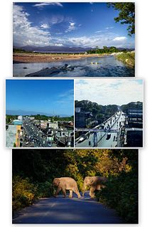
Alipurduar is a city and a municipality in the Indian state of West Bengal. It is the headquarters of the Alipurduar district. Situated on the east bank of Kaljani River on the foothills of the Himalayas, the city is a gateway to Bhutan and northeastern states of India.

Totopara Village in West Bengal, India

Totopara is a village in the Madarihat-Birpara CD block in the Alipurduar subdivision of the Alipurduar district of West Bengal, India.

Birpara Town in West Bengal, India

Birpara is a census town in Alipurduar I CD block in Alipurduar subdivision of Alipurduar district, West Bengal, India.

Alipurduar Railway Junction Census Town in West Bengal, India

Alipurduar Railway Junction is a census town in the Alipurduar I CD block in the Alipurduar subdivision of the Alipurduar district in the state of West Bengal, India.

Bholar Dabri Census Town in West Bengal, India

Bholar Dabri is a census town in the Alipurduar I CD block in the Alipurduar subdivision of the Alipurduar district in the state of West Bengal, India.

Chechakhata Census Town in West Bengal, India

Chechakhata is a census town in the Alipurduar I CD block in the Alipurduar subdivision of the Alipurduar district in the state of West Bengal, India.

Falakata Census Town in West Bengal, India

Falakata is a census town in the Falakata CD block in the Alipurduar subdivision of the Alipurduar district in the state of West Bengal, India.

Paschim Jitpur Census Town in West Bengal, India

Paschim Jitpur is a census town in the Alipurduar I CD block in the Alipurduar subdivision of the Alipurduar district in the Indian state of West Bengal.

Uttar Kamakhyaguri Census Town in West Bengal, India

Uttar Kamakhyaguri is a census town and biggest town in the Kumargram CD block in the Alipurduar subdivision of the Alipurduar district in the Indian state of West Bengal. There are Railway Park, Mini Indoor Stadium, Rasikbill Zoo etc.

Uttar Latabari Census Town in West Bengal, India

Uttar Latabari is a census town in the Kalchini CD block in the Alipurduar subdivision of the Alipurduar district in the Indian state of West Bengal.

Raimatang Village in West Bengal, India

Raimatang is a village in the Kalchini CD block in the Alipurduar subdivision of the Alipurduar district in West Bengal, India. It is about 45 kilometres (28 mi) away from Alipurduar and is a tourist destination. It is part of Buxa Tiger Reserve.It is one of the important picnic spots in Alipurduar district

Kumargram, Alipurduar Village in West Bengal, India

Kumargram is a village in the Kumargram CD block in the Alipurduar subdivision of the Alipurduar district in the state of West Bengal, India.

Kalchini, Alipurduar Neighbourhood in Alipurduar, West Bengal, India

Kalchini is a neighbourhood in the Kalchini CD block in the Alipurduar subdivision of the Alipurduar district in the state of West Bengal, India.

Jashodanga Village in West Bengal, India

Jashodanga is a village in the Alipurduar II CD block in the Alipurduar subdivision of the Alipurduar district in the state of West Bengal, India.

Pachkalguri Village in West Bengal, India

Pachkalguri is a village in the Alipurduar I CD block in the Alipurduar subdivision of the Alipurduar district in the state of West Bengal, India.

Jagijhora Barabak Census Town in West Bengal, India

Jugijhora Barobak is a census town in the Falakata CD block in the Alipurduar subdivision of the Alipurduar district in the state of West Bengal, India.

Laskarpara Census Town in West Bengal, India

Laskarpara is a census town in the Kumargram CD block in the Alipurduar subdivision of the Alipurduar district in the state of West Bengal, India.

Dakshin Rampur Census Town in West Bengal, India

Dakshin Rampur is a census town in the Kumargram CD block in the Alipurduar subdivision of the Alipurduar district in the state of West Bengal, India.

Uttar Mandabari Village in West Bengal, India

Uttar Mandabari is a village and a gram panchayat in the Kalchini CD block in the Alipurduar subdivision of the Alipurduar district in the state of West Bengal, India.

Sonapur, Alipurduar Village in West Bengal, India

Sonapur is a village in the Alipurduar I CD block in the Alipurduar subdivision of the Alipurduar district in the state of West Bengal, India.

References

  1. "Yahoo maps of Sobhaganj". Yahoo maps. Retrieved 29 November 2008.
  2. "District Statistical Handbook 2014 Jalpaiguri". Tables 2.2, 2.4b. Department of Planning and Statistics, Government of West Bengal. Retrieved 29 June 2020.
  3. "CD block Wise Primary Census Abstract Data(PCA)". 2011 census: West Bengal – District-wise CD blocks. Registrar General and Census Commissioner, India. Retrieved 29 June 2020.
  4. "District Census Handbook, Jalpaiguri, Series 20, Part XIIA" (PDF). Census of India 2011, page 13 Physiography. Directorate of Census Operations, West Bengal. Retrieved 18 June 2020.
  5. "Census of India 2001: Data from the 2001 Census, including cities, villages and towns (Provisional)". Census Commission of India. Archived from the original on 16 June 2004. Retrieved 1 November 2008.