Path 66

Last updated
Pacific Intertie transmission routes Pacific intertie geographic map.png
Pacific Intertie transmission routes
A dual-circuit 500 kV line forming a part of the connection between Path 66 and Path 15. Dual Circuit 500kV power lines crossing I580.JPG
A dual-circuit 500 kV line forming a part of the connection between Path 66 and Path 15.

California Oregon Intertie (COI), identified as Path 66 by Western Electricity Coordinating Council (WECC), is a corridor of three roughly parallel 500 kV alternating current power lines connecting the electric grids of Oregon and California. Their combined power transmission capacity is 4800 MW. [1]

Contents

Two of the power lines run from Malin Substation southeast of Klamath Falls, Oregon to Round Mountain Substation northeast of Redding, California. One of them is owned by Western Area Power Administration, the other by Pacific Gas and Electric and PacifiCorp jointly. [1] These lines are a part of Pacific AC Intertie and were completed in the 1960s. The third line runs from Captain Jack Substation near Malin to Olinda Substation south of Redding. It is a part of California-Oregon Transmission Project, the project manager is the Transmission Agency of Northern California (TANC), a joint venture of several public utilities. It was completed in 1993. [2]

Route

Path 66 is composed of one segment of TANC, PG&E and PacifiCorp 500 kV lines. The TANC line route starts at Captain Jack Substation (42° 4' 38.06"N 121° 23' 25.47"W) close to Malin, close to the California-Oregon border, near the Malin Substation, where the other 500 kV lines start (PacifiCorp & PG&E). These substations link to both the PacifiCorp and Bonneville Power Administration (BPA) grid in the Pacific Northwest. [3] [4] [5]

Path 66 - Captain Jack to Olinda

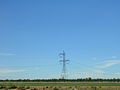
Path 66 consists of the northernmost segment of TANC's 346 mi (557 km) 500 kV line from Captain Jack substation to Tracy substation in California's Central Valley. Leaving Captain Jack substation, the line first heads southeast as a single-circuit line and runs parallel with the other two 500 kV lines across the Modoc Plateau. It then turns west and climbs in elevation and reaches its highest point near Grizzly Peak at about 6,000 ft (1,830 m). [6] From there, it heads south, spanning over the Stonecoal Valley and the Pit River. Near Round Mountain, it turns southwest and the line is joined by two 230-kV lines as all three lines head into the Sacramento Valley. As the line passes by Cottonwood, it turns west and crosses Interstate 5. Near Olinda, it turns south and enters Olinda substation. Here the line interconnects with transmission lines carrying power from Shasta Dam and Keswick Dam. [3]

Connecting wires to Path 15 - Olinda to Tracy

From Olinda Substation, the TANC 500 kV continues as a single-circuit line, although the tower structures change (see photos below) to a two-level pylon. The line proceeds south and then southeast along the western edge of the Sacramento Valley. It parallels Interstate 5 (about four miles (6.5 km) to the west) on its way south, although it's barely visible. It also parallels two 230-kV Pacific Gas and Electric lines for much of this segment and another WAPA 230 kV line. There is a series capacitor station near Maxwell in Colusa County to boost the line across the long Olinda-Tracy segment. [3]

The line crosses the two separated PG&E 500-kV lines, near Woodland and Rio Vista. Near Antioch the line turns and runs parallel with the two PG&E 500 kV lines. All three lines cross both the Sacramento and San Joaquin Rivers on very large pylons. The TANC line turns away from the PG&E lines and heads for another large substation near Tracy. [3]

Connecting wires to Path 15 - Tracy to intersection with PG&E wire

From Tracy Substation, the line again to a rare, tall, double-circuit 500 kV line suspended by a three-level pylon located in the San Joaquin Valley. The line terminates where it intersects with one of the two PG&E 500 kV lines as the PG&E heads south from the Tesla substation towards Los Banos Substation. The PG&E line that the dual-circuit line intersects used to be a second Los Banos-Tesla power line that was split apart. A PG&E tower was removed, although the foundation for the tower is still visible. New towers were built to accompany the line changes. One circuit turns north back into Tesla Substation, effectively linking the Tracy Substation with the Tesla Substation. The other circuit turns south to head for the Los Banos Substation as a southern extension of the third 500 kV line. [3]

Path 66 - Malin to Round Mountain

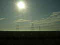
The other two 500 kV lines start in the Malin substation to the east of the Captain Jack substation. One circuit of a rare, tall BPA dual-circuit and one single-circuit 500 kV line connect Captain Jack substation with Malin substation. The PG&E and PacifiCorp 500 kV line both head south together across the Modoc Plateau, generally following the lone WAPA line at a distance. The parallel lines then turn southwestward climb to about 5,400 feet (1,645 m), [6] before descending and turning south once again. Both lines enter the Round Mountain substation. This is the terminus of the Path 66 portion of the parallel 500 kV wires. [3]

Substations

Path 66

TANC line (North to South)

PG&E and PacifiCorp

Connecting power line

Issues

Power transmission capacity

Path 66 can transmit 4,800 MW of electrical power from north to south. From south to north, the system can transmit only 3,675 MW of power. [4]

Environmental impacts

The northern part of this electrical transmission corridor (including Path 15) is visible from space and Google Earth as lines of bare, treeless ground. This is because the power lines here run through forests of conifer trees which appear dark green-green from space. [3] The land through here has been logged and sometimes clear-cut to create a right-of-way for the power lines because a wildfire could start when an electrical arc occurs between the wires and a tree if they come close enough to each other. [7]

Tower design and differences

This TANC 500 kV power line, unlike its PG&E counterparts, is triple-bundled, meaning that it has three-wires per phase, whereas the PG&E lines are only double-bundled, or two wires per phase. In addition, the tower's design is strikingly different from the lighter and wider PG&E tower, and the design also changes significantly as one goes from north to south on WAPA's 346 mi (557 km) 500 kV line. [3]

The TANC line changes design at the Olinda substation from the delta pylon pictured at the Interstate 5 crossing [8] [9] to the two-level pylon pictured above. This is because much of the segment between the Olinda and Tracy substations was constructed by upgrading an existing double-circuit 230 kV line. [3] [10] The segment of TANC's 500 kV line from the Sacramento River crossing south to the Tracy Substation has delta pylons like those found on the Captain Jack-Olinda segment, although they are slightly different. [3] This is because south of the Sacramento River crossing, the original 230 kV line paralleled the two PG&E 500 kV lines almost all the way to Tracy Substation. In order to meet separation requirements, a new alignment for the 500 kV line had to be built some distance to the east, with the exception of the San Joaquin River crossing, which utilizes the former 230 kV facilities. This alignment can be seen from Highway 4 and the western part of the San Joaquin River portion of the Sacramento River Delta. A portion of the former 230-kV line south of the Sacramento River remains in service today as part of the 69 kV system that serves the pumping stations on the Contra Costa Canal. [3]

As for the pylons of the PG&E and PacifiCorp Round Mountain-Malin parallel lines, the PG&E line uses the same tower type as the PG&E Table Mountain-Round Mountain 500 kV segment does. The PacifiCorp 500 kV line uses a pylon that looks similar to the pylon used in WAPA's Olinda-Captain Jack segment. [3]

Visual reference

Problems

Since TANC's Captain Jack-Olinda 500 kV wire rises to almost 6,000 feet (1,800 m) as the line crosses the rugged mountains near Grizzly Peak, [6] that section of 500 kV line is covered with large amounts of snow during the winter. Despite its location far from the Pacific Ocean, 20 feet (6 m) of snow can accumulate near Grizzly Peak's 6,250 feet (1,905 m)-summit. [10] The extreme snowfall there can cause ice and snow to accumulate on the insulators and the wires and sometimes lead to power outages when the wires snap in these extreme conditions. [11] This high-elevation segment of 500 kV line is also said to be problematic. [10]

Map

See also

Related Research Articles

Electrical substation Part of an electrical generation, transmission, and distribution system

A substation is a part of an electrical generation, transmission, and distribution system. Substations transform voltage from high to low, or the reverse, or perform any of several other important functions. Between the generating station and consumer, electric power may flow through several substations at different voltage levels. A substation may include transformers to change voltage levels between high transmission voltages and lower distribution voltages, or at the interconnection of two different transmission voltages.

Transmission tower Structure used to support an overhead power line

A transmission tower, also known as an electricity pylon or simply a pylon in British English and as a hydro tower in Canadian English, is a tall structure, usually a steel lattice tower, used to support an overhead power line.

Pacific DC Intertie HVDC power line in the United States

The Pacific DC Intertie is an electric power transmission line that transmits electricity from the Pacific Northwest to the Los Angeles area using high voltage direct current (HVDC). The line capacity is 3,100 megawatts, which is enough to serve two to three million Los Angeles households and represents almost half of the Los Angeles Department of Water and Power (LADWP) electrical system's peak capacity.

Pylons of Messina

The Pylons of Messina are two free-standing steel towers, the Sicilian one in Torre Faro and the Calabrian one in Villa San Giovanni. They were used from 1955 to 1994 to carry a 220 kilovolt power line across the Strait of Messina, between the Scilla substation in Calabria on the Italian mainland at 38°14′42″N15°40′59″E and the Messina-Santo substation in Sicily at 38°15′57″N15°39′04″E.

Dead-end tower

A dead-end tower is a fully self-supporting structure used in construction of overhead power lines. A dead-end transmission tower uses horizontal strain insulators at the end of conductors. Dead-end towers may be used at a substation as a transition to a "slack span" entering the equipment, when the circuit changes to a buried cable, when a transmission line changes direction by more than a few degrees, or at intervals along a straight run to limit the extent of a catastrophic collapse.

Overhead power line Structure used in electric power transmission and distribution

An overhead power line is a structure used in electric power transmission and distribution to transmit electrical energy across large distances. It consists of one or more uninsulated electrical cables suspended by towers or poles.

Path 27, or the Intermountain Power Project DC Line, or the Southern Transmission System is a HVDC transmission line that carries electricity from the Intermountain Power Plant near Delta, Utah to the city of Los Angeles via the Adelanto Converter Station in Adelanto, California. It is owned and operated by the Intermountain Power Agency, a large cooperative primarily owned by the Los Angeles Department of Water and Power ("LADWP") (50%) along with five other Los Angeles area cities (25%) and 30 small Utah municipalities.

Traction power network

A traction network or traction power network is an electricity grid for the supply of electrified rail networks. The installation of a separate traction network generally is done only if the railway in question uses alternating current (AC) with a frequency lower than that of the national grid, such as in Germany, Austria and Switzerland.

Western Area Power Administration

As one of the four power marketing administrations within the U.S. Department of Energy, the Western Area Power Administration (WAPA)'s role is to market wholesale hydropower generated at 56 hydroelectric federal dams operated by the Bureau of Reclamation, United States Army Corps of Engineers and the International Boundary and Water Commission. WAPA delivers this power through a more than 17,000-circuit-mile, high-voltage power transmission system to more than 700 preference power customers across the West. Those customers, in turn, provide retail electric service to more than 40 million consumers. WAPA is headquartered in the Denver, Colorado suburb of Lakewood, Colorado.

Transposition is the periodic swapping of positions of the conductors of a transmission line, in order to reduce crosstalk and otherwise improve transmission. In telecommunications this applies to balanced pairs whilst in power transmission lines three conductors are periodically transposed.

Path 15 Portion of the north-south power transmission corridor in California

Path 15 is an 84-mile (135 km) portion of the north–south power transmission corridor in California, U.S. It forms a part of the Pacific AC Intertie and the California-Oregon Transmission Project. Path 15 is part of The Western Electricity Coordinating Council's links of electrical intertie paths in the western United States.

Path 26

Path 26 is a set of three Southern California Edison (SCE) 500 kV power lines, located primarily in Los Angeles County, and extending into Kern and Ventura counties, all in California. Path 26 is part of the Western Electricity Coordinating Council's links of electrical intertie paths in the western United States. The Path 26 lines are located in: the San Joaquin Valley of the southern Central Valley; the Tehachapi Mountains and other central Transverse Ranges; and the Antelope Valley section of the Mojave Desert.

Path 64 or the Marketplace - Adelanto line is a 202-mile (325 km) 500-kilovolt power line that runs from the Adelanto substation near Adelanto, California in the High Desert to the Marketplace substation near Boulder City, Nevada. Path 64 is part of The Western Electricity Coordinating Council's links of electrical intertie paths in the western United States. Path 64 is part of the Path 46 transmission system in southeastern California. This power line is operated by Los Angeles Department of Water and Power (LADWP). This line, along with Path 27, the Intermountain DC line and other Path 46 powerlines, supply over 10,000 megawatts of electrical power to the Los Angeles area. Path 64 is an essential line for powering Los Angeles.

Path 46, also called West of Colorado River, Arizona-California West-of-the-River Path (WOR), is a set of fourteen high voltage alternating-current transmission lines that are located in southeast California and Nevada up to the Colorado River.

ITC Transmission

ITC Transmission was founded in 1999 as International Transmission Co., a subsidiary of Detroit Edison, charged in the ownership, operation and maintenance of Detroit Edison's transmission system. In 2003, DTE sold the subsidiary to ITC Holdings Corp. In 2004, ITC Transmission became the first, fully independent electricity transmission company in the United States following the 2003 transfer of ownership from DTE Energy to ITC Transmission’s parent company, ITC Holdings Corp. ITC Transmission owns a fully regulated, high-voltage system that transmits electricity to local electricity distribution facilities. ITC Holdings Corp. became a publicly traded company in 2005 and is headquartered in Novi, Michigan. Today it owns transmission systems in several states under a unique independent business model.

Hydro-Québecs electricity transmission system International power transmission system centred in Quebec, Canada

Hydro-Québec's electricity transmission system is an international electric power transmission system centred in Quebec, Canada. The system pioneered the use of very high voltage 735-kilovolt (kV) alternating current (AC) power lines that link the population centres of Montreal and Quebec City to distant hydroelectric power stations like the Daniel-Johnson Dam and the James Bay Project in northwestern Quebec and the Churchill Falls Generating Station in Labrador.

GKK Etzenricht

GKK Etzenricht, an abbreviation of Gleichstromkurzkupplung Etzenricht, meaning Etzenricht HVDC-back-to-back station, was an HVDC back-to-back facility near Etzenricht in the district of Neustadt an der Waldnaab in Bavaria, Germany. It was built on the site of the Etzenricht substation, a 380 kV/220 kV/110 kV-substation, which went into service in 1970 and expanded afterwards several times. The facility was used between 1993 and 1995 for exchange of power between Germany and the Czech Republic, operated by Bayernwerk AG.

The Mead substation is a major electric power interconnection point in the western United States. The station is located in the El Dorado Valley of Nevada just outside of Boulder City, at the end of Buchanan Boulevard south of its grade separation with Interstate 11. The facility is owned and operated by the Western Area Power Administration.

Line trap

A line trap, also known as wave trap, or high-frequency stopper, is a maintenance-free parallel resonant circuit, mounted inline on high-voltage (HV) AC transmission power lines to prevent the transmission of high frequency carrier signals of power line communication to unwanted destinations. Line traps are cylinder-like structures connected in series with HV transmission lines. A line trap is also called a wave trap.

The TransWest Express Transmission Line Project (TWE) is a planned bipolar HVDC transmission line between Rawlins, Wyoming and Marketplace substation near Las Vegas.

References

  1. 1 2 "COI Utilization Report" (PDF). Transmission Utilization Group. 2011-05-04. Archived from the original (PDF) on 2014-04-07. Retrieved 2014-03-30.
  2. "California-Oregon Transmission Project". Transmission Agency of Northern California. Retrieved 2014-03-31.
  3. 1 2 3 4 5 6 7 8 9 10 11 12 Route descriptions and tower designs are based on Google Earth images.
  4. 1 2 Paths 61-70 (Report). Western Electricity Coordinating Council. 2006.
  5. "California Transmission Lines" (PDF). Retrieved 2007-09-20.
  6. 1 2 3 Google Earth elevation for GNIS coordinates.
  7. "Trees and Power Lines" (PDF). Western Area Power Administration. Retrieved 2007-09-20.
  8. "Picture of TANC's 500 kV line from Interstate 5". WestCoastRoads.com. Archived from the original on 2007-09-27. Retrieved 2007-09-20.
  9. "Picture of WAPA's 500 kV line from Interstate 5". WestCoastRoads.com. Archived from the original on 2007-09-27. Retrieved 2007-09-20.
  10. 1 2 3 "SN foreman outlines 3 decades of t-line ops". Western Area Power Administration. Archived from the original on 2007-09-27. Retrieved 2007-09-20.
  11. "Calif. snow gets SN crew out to repair line". Western Area Power Administration. Archived from the original on 2012-12-14. Retrieved 2007-09-20.