
Henderson Township is a township which is located in Huntingdon County, Pennsylvania, United States. The population was 930 at the time of the 2020 census.

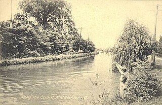
The Delaware and Raritan Canal is a canal in central New Jersey, built in the 1830s, that connects the Delaware River to the Raritan River. It was an efficient and reliable means of transportation of freight between Philadelphia and New York City, transporting anthracite coal from eastern Pennsylvania during much of the 19th and early 20th centuries. The canal allowed shippers to cut many miles off the existing route from the Pennsylvania Coal Region down the Delaware, around Cape May, and up the occasionally treacherous Atlantic Ocean coast to New York City.
The Morris Canal (1829–1924) was a 107-mile (172 km) common carrier anthracite coal canal across northern New Jersey that connected the two industrial canals at Easton, Pennsylvania across the Delaware River from its western terminus at Phillipsburg, New Jersey to New York Harbor and New York City via its eastern terminals in Newark and on the Hudson River in Jersey City. The canal was sometimes called the Morris and Essex Canal, in error, due to confusion with the nearby and unrelated Morris and Essex Railroad.

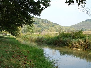
The Union Canal was a towpath canal that existed in southeastern Pennsylvania in the United States during the 19th century. First proposed in 1690 to connect Philadelphia with the Susquehanna River, it ran approximately 82 mi from Middletown on the Susquehanna below Harrisburg to Reading on the Schuylkill River.
The Miami and Erie Canal was a 274-mile (441 km) canal that ran from Cincinnati to Toledo, Ohio, creating a water route between the Ohio River and Lake Erie. Construction on the canal began in 1825 and was completed in 1845 at a cost to the state government of $8,062,680.07. At its peak, it included 19 aqueducts, three guard locks, 103 canal locks, multiple feeder canals, and a few man-made water reservoirs. The canal climbed 395 feet (120 m) above Lake Erie and 513 feet (156 m) above the Ohio River to reach a topographical peak called the Loramie Summit, which extended 19 miles (31 km) between New Bremen, Ohio to lock 1-S in Lockington, north of Piqua, Ohio. Boats up to 80 feet long were towed along the canal by mules, horses, or oxen walking on a prepared towpath along the bank, at a rate of four to five miles per hour.

The Patowmack Canal, sometimes called the Potomac Canal, is a series of five inoperative canals located in Maryland and Virginia, United States, that was designed to bypass rapids in the Potomac River upstream of the present Washington, D.C., area. The most well known of them is the Great Falls skirting canal, whose remains are managed by the National Park Service since it is within Great Falls Park, an integral part of the George Washington Memorial Parkway.

The Ohio and Erie Canal was a canal constructed during the 1820s and early 1830s in Ohio. It connected Akron with the Cuyahoga River near its outlet on Lake Erie in Cleveland, and a few years later, with the Ohio River near Portsmouth. It also had connections to other canal systems in Pennsylvania.
The Main Line of Public Works was a package of legislation passed by the Commonwealth of Pennsylvania in 1826 to establish a means of transporting freight between Philadelphia and Pittsburgh. It funded the construction of various long-proposed canal and road projects, mostly in southern Pennsylvania, that became a canal system and later added railroads. Built between 1826 and 1834, it established the Pennsylvania Canal System and the Allegheny Portage Railroad.

The Raystown Branch Juniata River is the largest and longest tributary of the Juniata River in south-central Pennsylvania in the United States.
The Whitewater Canal, which was built between 1836 and 1847, spanned a distance of 76 miles (122 km) and stretched from Lawrenceburg, Indiana on the Ohio River to Hagerstown, Indiana near the West Fork of the White River.

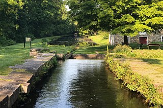
The Lehigh Canal is a navigable canal that begins at the mouth of Nesquehoning Creek on the Lehigh River in eastern Pennsylvania. It was built in two sections over a span of 20 years beginning in 1818. The lower section spanned the distance between Easton and present-day Jim Thorpe. In Easton, the canal met the Delaware and Morris Canals, which allowed anthracite coal and other goods to be transported further up the U.S. East Coast. At its height, the Lehigh Canal was 72 miles (116 km) long.
The Pennsylvania Canal was a complex system of transportation infrastructure improvements including canals, dams, locks, tow paths, aqueducts, and viaducts. The Canal and Works were constructed and assembled over several decades beginning in 1824, the year of the first enabling act and budget items. It should be understood the first use of any railway in North America was the year 1826, so the newspapers and the Pennsylvania Assembly of 1824 applied the term then to the proposed rights of way mainly for the canals of the Main Line of Public Works to be built across the southern part of Pennsylvania.
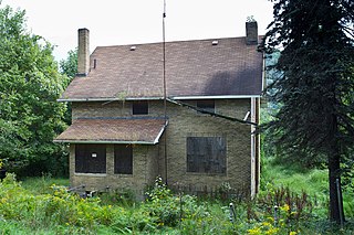
The Bald Eagle and Spring Creek Navigation Company was a canal company in central Pennsylvania intended to link the iron industry of Bellefonte, Pennsylvania, with the Pennsylvania canal system. Opened for half its length in 1837, the remainder of the canal was not completed until 1848. Destroyed by flooding in 1865, it was not rebuilt; a paralleling railroad completed that year replaced it.
Schoharie Crossing State Historic Site, also known as Erie Canal National Historic Landmark, is a historic district that includes the ruins of the Erie Canal aqueduct over Schoharie Creek, and a 3.5-mile (5.6 km) long part of the Erie Canal, in the towns of Glen and Florida within Montgomery County, New York. It was the first part of the old canal to be designated a National Historic Landmark, prior to the designation of the entire New York State Barge Canal as a NHL in 2017.

The West Branch Division of the Pennsylvania Canal ran 73 miles (117 km) from the canal basin at Northumberland, Pennsylvania, at the confluence of the West Branch Susquehanna River with the main stem of the Susquehanna River, north through Muncy, then west through Williamsport, Jersey Shore, and Lock Haven to its terminus in Farrandsville. At its southern terminus in the Northumberland basin, the West Branch Canal met the North Branch Canal and the Susquehanna Division Canal. Through these connections to other divisions of the Pennsylvania Canal, it formed part of a multi-state water transportation system including the Main Line of Public Works.
The Beaver and Erie Canal, also known as the Erie Extension Canal, was part of the Pennsylvania Canal system and consisted of three sections: the Beaver Division, the Shenango Division, and the Conneaut Division. The canal ran 136 miles (219 km) north–south near the western edge of the state from the Ohio River to Lake Erie through Beaver County, Lawrence County, Mercer County, Crawford County, and Erie County, Pennsylvania.

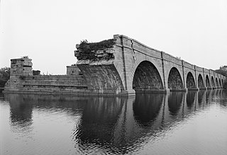
The Black Rock Dam is a low head dam in the Schuylkill River. Originally constructed as a stone filled, timber crib dam in the early 19th century by the Schuylkill Navigation Company, the dam was one of dozens built to create a slack water pools for the Schuylkill Navigation System. The dam is a contributing property of the "Schuylkill Navigation Canal, Oakes Reach Section" registered historic district. The dam is located between Phoenixville and Mont Clare in southeastern Pennsylvania, USA.
Allegheny River Lock and Dam No. 6 is a historic lock and fixed-crest dam complex located at Bethel Township and South Buffalo Township in Armstrong County, Pennsylvania. It was built between 1927 and 1928 by the United States Army Corps of Engineers, and consists of the lock, dam, esplanade, Operations Building, and two locktenders' houses. The lock measures 56 feet by 360 feet, and has a lift of 12.4 feet. The dam measures approximately 20 feet high and 992 feet long. The Operations Building, or powerhouse, is a utilitarian two-story building in a vernacular early-20th century revival style. The locktenders' houses are identical two-story, brick dwellings on concrete foundations. The lock and dam were built by the U.S. Army Corps of Engineers as a part of an extensive system of locks and dams to improve navigation along the Allegheny River.
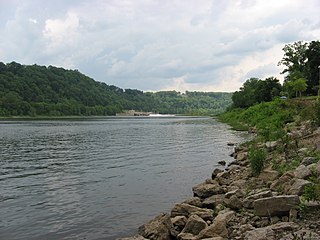
Allegheny River Lock and Dam No. 7 is a historic lock and fixed-crest dam complex located at East Franklin Township, Pennsylvania and Kittanning in Armstrong County, Pennsylvania. It was built between 1928 and 1930 by the United States Army Corps of Engineers, and consists of the lock, dam, esplanade, and Operations Building. The lock measures 56 feet by 360 feet, and has a lift of 13.0 feet. The dam measures approximately 20 feet high and 916 feet long. The Operations Building, or powerhouse, is a utilitarian two-story building in a vernacular early-20th century revival style. The lock and dam were built by the U.S. Army Corps of Engineers as a part of an extensive system of locks and dams to improve navigation along the Allegheny River.

Allegheny River Lock and Dam No. 8 is a historic lock and fixed-crest dam complex located at Boggs Township and Washington Township in Armstrong County, Pennsylvania. It was built between 1929 and 1931 by the United States Army Corps of Engineers, and consists of the lock, dam, esplanade, and Operations Building. The lock measures 56 feet by 360 feet, and has a lift of 17.8 feet. The dam measures approximately 50 feet high and 916 feet long; a three-foot addition was built on top of the dam in 1937. The Operations Building, or powerhouse, is a utilitarian two-story building in a vernacular early-20th century revival style. The lock and dam were built by the U.S. Army Corps of Engineers as a part of an extensive system of locks and dams to improve navigation along the Allegheny River.


