Penobscot, Maine

Last updated

Penobscot, Maine
USA Maine location map.svg
Red pog.svg
Penobscot
Usa edcp location map.svg
Red pog.svg
Penobscot
Coordinates: 44°27′50″N68°42′45″W / 44.46389°N 68.71250°W / 44.46389; -68.71250
Country United States
State Maine
County Hancock
VillagesPenobscot
North Penobscot
South Penobscot
West Penobscot
Area
[1]
  Total46.55 sq mi (120.56 km2)
  Land39.87 sq mi (103.26 km2)
  Water6.68 sq mi (17.30 km2)
Elevation
98 ft (30 m)
Population
 (2020)
  Total1,136
  Density28/sq mi (11.0/km2)
Time zone UTC-5 (Eastern (EST))
  Summer (DST) UTC-4 (EDT)
ZIP code
04476
Area code 207
FIPS code 23-57920
GNIS feature ID0582668
Breakfast in camp, Penobscot, September 1885. Penobscot, Maine - Breakfast in Camp.jpg
Breakfast in camp, Penobscot, September 1885.

Penobscot is a town in Hancock County, Maine, United States. The Bagaduce River flows through the town. [2] The population was 1,136 at the 2020 census. [3]

Contents

Geography

According to the United States Census Bureau, the town has a total area of 46.55 square miles (120.56 km2), of which 39.87 square miles (103.26 km2) is land and 6.68 square miles (17.30 km2) is water. [1]

Demographics

Historical population
CensusPop.Note
1790 1,048
1800 935−10.8%
1810 1,30239.3%
1820 1,009−22.5%
1830 1,27126.0%
1840 1,47416.0%
1850 1,5565.6%
1860 1,5570.1%
1870 1,418−8.9%
1880 1,341−5.4%
1890 1,313−2.1%
1900 1,156−12.0%
1910 985−14.8%
1920 870−11.7%
1930 708−18.6%
1940 680−4.0%
1950 6992.8%
1960 7061.0%
1970 78611.3%
1980 1,10440.5%
1990 1,1312.4%
2000 1,34418.8%
2010 1,263−6.0%
2020 1,136−10.1%
U.S. Decennial Census [4]

2010 census

As of the census [5] of 2010, there were 1,263 people, 593 households, and 347 families living in the town. The population density was 31.7 inhabitants per square mile (12.2/km2). There were 883 housing units at an average density of 22.1 per square mile (8.5/km2). The racial makeup of the town was 97.5% White, 0.2% African American, 0.4% Native American, 0.6% Asian, 0.2% from other races, and 1.2% from two or more races. Hispanic or Latino of any race were 1.0% of the population.

There were 593 households, of which 18.9% had children under the age of 18 living with them, 48.7% were married couples living together, 5.9% had a female householder with no husband present, 3.9% had a male householder with no wife present, and 41.5% were non-families. 32.4% of all households were made up of individuals, and 16.2% had someone living alone who was 65 years of age or older. The average household size was 2.06 and the average family size was 2.57.

The median age in the town was 51.9 years. 14.8% of residents were under the age of 18; 6.1% were between the ages of 18 and 24; 19% were from 25 to 44; 33.9% were from 45 to 64; and 26.1% were 65 years of age or older. The gender makeup of the town was 48.7% male and 51.3% female.

2000 census

As of the census [6] of 2000, there were 1,344 people, 533 households, and 370 families living in the town. The population density was 33.7 inhabitants per square mile (13.0/km2). There were 723 housing units at an average density of 18.1 per square mile (7.0/km2). The racial makeup of the town was 98.07% White, 0.15% African American, 0.37% Native American, 0.30% Asian, 0.30% from other races, and 0.82% from two or more races. Hispanic or Latino of any race were 0.45% of the population.

There were 533 households, out of which 27.6% had children under the age of 18 living with them, 60.0% were married couples living together, 7.1% had a female householder with no husband present, and 30.4% were non-families. 24.0% of all households were made up of individuals, and 11.3% had someone living alone who was 65 years of age or older. The average household size was 2.36 and the average family size was 2.79.

In the town, the population was spread out, with 20.3% under the age of 18, 5.0% from 18 to 24, 25.4% from 25 to 44, 27.5% from 45 to 64, and 21.8% who were 65 years of age or older. The median age was 45 years. For every 100 females, there were 94.8 males. For every 100 females age 18 and over, there were 89.9 males.

The median income for a household in the town was $37,232, and the median income for a family was $42,368. Males had a median income of $30,921 versus $22,417 for females. The per capita income for the town was $20,035. About 4.0% of families and 8.0% of the population were below the poverty line, including 12.5% of those under age 18 and 10.5% of those age 65 or over.

Related Research Articles

<span class="mw-page-title-main">Verona Island, Maine</span> Town in Maine, United States

Verona Island is a town located on an island of the same name in the Penobscot River in Hancock County, Maine, United States. The population was 507 at the 2020 census.

Bradley is a town in Penobscot County, Maine, United States. It is part of the Bangor Metropolitan Statistical Area. The population was 1,532 at the 2020 census. The village of Bradley is in the northwestern corner of the town.

Burlington is a town in Penobscot County, Maine, United States. It is part of the Bangor Metropolitan Statistical Area. The population was 373 at the 2020 census.
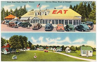
<span class="mw-page-title-main">Carmel, Maine</span> Town in the state of Maine, United States

Carmel is a town in Penobscot County, Maine, United States. It is part of the Bangor Metropolitan Statistical Area. The population was 2,867 at the 2020 census.

Eddington is a town located on the eastern side of the Penobscot River in Penobscot County, Maine, United States. As of the 2020 census, the town had a population of 2,194.

Greenbush, officially the Town of Greenbush, is a town in Penobscot County, Maine, United States, on the Penobscot River. The town's population was 1,444 at the 2020 United States Census.

Hermon is a town in Penobscot County, Maine, United States. The population was 6,461 at the 2020 census.

Holden is a town in Penobscot County, Maine, United States. The population was 3,277 at the 2020 census.

Kenduskeag is a town in Penobscot County, Maine, United States. The population was 1,346 at the 2020 census.

LaGrange is a town in Penobscot County, Maine, United States. The population was 635 at the 2020 census.

Lowell is a town in Penobscot County, Maine, United States. The population was 368 at the 2020 census.

Plymouth is a town in Penobscot County, Maine, United States. The population was 1,325 at the 2020 census.

Springfield is a town in Penobscot County, Maine, United States. The population was 293 at the 2020 census.

Stacyville is a town in Penobscot County, Maine, United States, in the foothills of Mount Katahdin. The population was 380 at the 2020 census.

<span class="mw-page-title-main">Veazie, Maine</span> Town in the state of Maine, United States

Veazie is a town in Penobscot County, Maine, United States. The population was 1,814 at the 2020 census. The town is named after General Samuel Veazie, an early lumber baron and railroad operator. Veazie was originally part of Bangor, using Penobscot River water power to operate sawmills. It became a separate town in 1853 because Gen. Veazie, its wealthiest citizen, thought Bangor's property taxes were too high.

Winn is a town in Penobscot County, Maine, United States, on the east bank of the Penobscot River. The town was named for John M. Winn, an early landholder. The population was 399 at the 2020 census.

Woodville is a town in Penobscot County, Maine, United States. The population was 201 at the 2020 census.

<span class="mw-page-title-main">Frankfort, Maine</span> Town in the state of Maine, United States

Frankfort is a town on the Penobscot River estuary in Waldo County, Maine, United States. The population was 1,231 at the 2020 census.
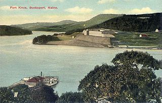
<span class="mw-page-title-main">Prospect, Maine</span> Town in the state of Maine, United States

Prospect is a town in Waldo County, Maine, United States. The population was 698 at the 2020 census.

Lincoln is a town in Penobscot County, Maine, United States. The town's population was 4,853 at the 2020 United States Census. A statue honoring Medal of Honor recipient Gary Gordon was installed in Lincoln, in 2021. The 10-foot (3.0 m) bronze sculpture faces Gordon's grave at Park Street Cemetery.

References

  1. 1 2 "US Gazetteer files 2010". United States Census Bureau . Retrieved December 16, 2012.
  2. "Maps of Penobscot Maine – Official Town of Penobscot, Maine".
  3. "Census - Geography Profile: Penobscot town, Hancock County, Maine" . Retrieved January 21, 2022.
  4. "Census of Population and Housing". Census.gov. Retrieved June 4, 2015.
  5. "U.S. Census website". United States Census Bureau . Retrieved December 16, 2012.
  6. "U.S. Census website". United States Census Bureau . Retrieved January 31, 2008.

Further reading

44°27′52″N68°42′40″W / 44.46444°N 68.71111°W / 44.46444; -68.71111