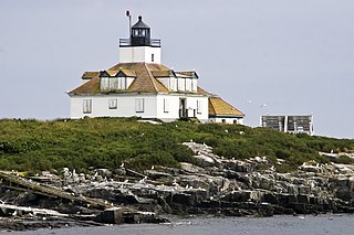
Winter Harbor, Maine

Last updated

Winter Harbor, Maine
Aerial View Winter Harbor, Maine.jpg
Aerial view of Winter Harbor
USA Maine location map.svg
Red pog.svg
Winter Harbor
Usa edcp location map.svg
Red pog.svg
Winter Harbor
Coordinates: 44°23′5″N68°5′41″W / 44.38472°N 68.09472°W / 44.38472; -68.09472
Country United States
State Maine
County Hancock
Villages Winter Harbor
Gerrishville
Summer Harbor
Grindstone Point (Summer Colony)
Area
[1]
  Total69.12 sq mi (179.02 km2)
  Land14.36 sq mi (37.19 km2)
  Water54.76 sq mi (141.83 km2)
Elevation
23 ft (7 m)
Population
 (2020)
  Total461
  Density32/sq mi (12.4/km2)
Time zone UTC-5 (Eastern (EST))
  Summer (DST) UTC-4 (EDT)
ZIP code
04693
Area code 207
FIPS code 23-86655
GNIS feature ID0582821

Winter Harbor is a town on the Schoodic Peninsula in Hancock County, Maine, United States. The population was 461 at the 2020 census. [2] The town is located just outside the Schoodic Peninsula portion of Acadia National Park and is due east of the town of Bar Harbor and Ellsworth. Winter Harbor was once the location of a US Naval Station, NSGA-WH, which closed in the mid-2000s, and is now home to the Schoodic Institute’s Education and Research Center.

Contents

The Schoodic Point District of Acadia National Park is adjacent to the town, and has played an important role in the community’s economic and social development. The Municipality includes the village proper of Winter Harbor, the summer colony of Grindstone Neck, and the hamlets of Gerrishville and Summer Harbor. An iconic, Downeast fishing village, Winter Harbor is home to an active, multigenerational fishing fleet, and is the namesake of the Winter Harbor model boat. In addition, the community is or was a summer residence of several notable figures, such as Frederick Hauck, Fitzgerald Eugene Dixon, among others.

Winter Harbor hosts the annual Winter Harbor Lobster Festival each August, which celebrates the community’s history, culture, and economic activity. The festival draws crowds from across the Peninsula and wider Downeast Acadia Region, and includes activities, markets, boat races, a parade, and other events.

Geography

According to the United States Census Bureau, the town has a total area of 69.12 square miles (179.02 km2), of which 14.36 square miles (37.19 km2) is land and 54.76 square miles (141.83 km2) is water. [1]

History

Winter Harbor was raided various times by French and natives during Queen Anne's War. A United States Navy radio communications station operated here during World War II. [3]

Demographics

Historical population
CensusPop.Note
1900 571
1910 5903.3%
1920 503−14.7%
1930 5172.8%
1940 5180.2%
1950 5689.7%
1960 75633.1%
1970 1,02836.0%
1980 1,1208.9%
1990 1,1573.3%
2000 988−14.6%
2010 516−47.8%
2020 461−10.7%
U.S. Decennial Census [4]
Town of Winter Harbor, Maine 2021-07-27 01 Winter Harbor, Maine USA.jpg
Town of Winter Harbor, Maine

2010 census

As of the census [5] of 2010, there were 516 people, 255 households, and 145 families residing in the town. The population density was 35.9 inhabitants per square mile (13.9/km2). There were 519 housing units at an average density of 36.1 per square mile (13.9/km2). The racial makeup of the town was 96.9% White, 0.4% African American, 0.2% Native American, 0.6% Asian, 1.4% from other races, and 0.6% from two or more races. Hispanic or Latino of any race were 1.7% of the population.

There were 255 households, of which 21.2% had children under the age of 18 living with them, 45.1% were married couples living together, 6.3% had a female householder with no husband present, 5.5% had a male householder with no wife present, and 43.1% were non-families. 36.5% of all households were made up of individuals, and 18.4% had someone living alone who was 65 years of age or older. The average household size was 2.02 and the average family size was 2.59.

The median age in the town was 51.1 years. 18% of residents were under the age of 18; 3% were between the ages of 18 and 24; 20% were from 25 to 44; 33.3% were from 45 to 64; and 25.8% were 65 years of age or older. The gender makeup of the town was 47.3% male and 52.7% female.

2000 census

As of the census [6] of 2000, there were 988 people, 402 households, and 278 families residing in the town. The population density was 68.8 inhabitants per square mile (26.6/km2). There were 558 housing units at an average density of 38.8 per square mile (15.0/km2). The racial makeup of the town was 89.98% White, 2.02% African American, 0.20% Native American, 0.71% Asian, and 7.09% from two or more races. Hispanic or Latino of any race were 3.64% of the population.

There were 402 households, out of which 38.8% had children under the age of 18 living with them, 57.2% were married couples living together, 8.0% households had a female with no husband present, and 30.8% were non-families. 25.6% of all households were made up of individuals, and 11.7% had someone living alone who was 65 years of age or older. The average household size was 2.46 and the average family size was 2.95.

In the town, the population was spread out, with 29.4% under the age of 18, 9.3% from 18 to 24, 30.8% from 25 to 44, 18.4% from 45 to 64, and 12.1% who were 65 years of age or older. The median age was 31 years. For every 100 females, there were 93.3 males. For every 100 females age 18 and over, there were 92.3 males.

The median income for a household in the town was $28,571, and the median income for a family was $32,750. Males had a median income of $24,063 versus $17,448 for females. The per capita income for the town was $15,438. About 5.5% of families and 11.0% of the population were below the poverty line, including 10.3% of those under age 18 and 6.1% of those age 65 or over.

Grindstone Neck

The summer colony of Grindstone Neck lies on a peninsula southwest of the village. In 1889 a group formed “The Gouldsboro Land Improvement Company” with the idea of creating a summer colony much like that of Bar Harbor. [7] Residents of this community share in an association which includes a yacht club, nine-hole golf course, [8] tennis courts and footpaths.

The Winter Harbor Yacht Club purchased and renovated all nine original Winter Harbor 21 sailboats. Designed and launched in 1907, they are thought to be the oldest one-design sailboat fleet in the United States.

Many of the buildings on the neck were designed by Lindley Johnson, though the first few were designed by Wilson Eyre. The homes on Grindstone Neck are called "cottages", though many of them have upwards of 7–12 bedrooms. [9]

Notable person

Related Research Articles

<span class="mw-page-title-main">Hancock County, Maine</span> County in Maine, United States

Hancock County is a county located in the U.S. state of Maine. As of the 2020 census, the population was 55,478. Its county seat is Ellsworth. The county was incorporated on June 25, 1789, and named for John Hancock, the first governor of the Commonwealth of Massachusetts.

Eastbrook is a town in Hancock County, Maine, United States. The population was 424 at the 2020 census.
<span class="mw-page-title-main">Franklin, Maine</span> Town in the state of Maine, United States

Franklin is a town in Hancock County, Maine, United States. The population was 1,567 at the 2020 census. The town's namesake is Benjamin Franklin.

<span class="mw-page-title-main">Gouldsboro, Maine</span> Town in the state of Maine, United States

Gouldsboro is a town and municipality in Hancock County, Maine, United States on the Schoodic Peninsula. The town was named for Robert Gould, a landholder in the town. The town has many historically separate fishing villages, summer colonies and communities, including Birch Harbor, Prospect Harbor, South Gouldsboro, West Gouldsboro, Summer Harbor, Wonsqueak Harbor, Bunker's Harbor, Chicken Mill, Jones' Pond, Westbay, and Corea. The population was 1,703 at the 2020 census.

<span class="mw-page-title-main">Hancock, Maine</span> Town in the state of Maine, United States

Hancock is a town in Hancock County, Maine, United States. The population was 2,466 at the 2020 census. Located on the mainland at the head of Frenchman Bay, Hancock has commanding views of Mount Desert Island.

<span class="mw-page-title-main">Mount Desert, Maine</span> Town in the state of Maine, United States

Mount Desert is a town on Mount Desert Island in Hancock County, Maine, United States. The population was 2,146 at the 2020 census. Incorporated in 1789, the town currently encompasses the villages of Otter Creek, Seal Harbor, Northeast Harbor, Somesville, Hall Quarry, and Pretty Marsh.

Sullivan is a town in Hancock County, Maine, United States. The population was 1,219 at the 2020 census. The town was named for Daniel Sullivan, an early settler. Colloquially referred to as "Sully" or "the Sullivans"—like many Maine municipalities composed of villages with geographic designations of the town proper—the municipality was incorporated in 1789. Located in the Upper Schoodic Peninsula sub-region of Maine's Downeast Acadia region, the municipality has been known as "Waukeag", "New Bristol", and later Sullivan; and once included the nearby communities of Hancock, Sorrento, and what would later be Township 7, South & Middle Districts. Once home to abundant granite quarries, the town of Sullivan is now a residential community for nearby Ellsworth and Mount Desert Island. Located along U.S. Route 1, the Taunton River, and Hog Bay, Sullivan is home to a reversing tidal falls and many scenic turnouts that dot the Schoodic National Scenic Byway along the Upper Schoodic Peninsula.

<span class="mw-page-title-main">Tremont, Maine</span> Town in the state of Maine, United States

Tremont is a town in Hancock County, Maine, United States. It is located on the southwestern side of Mount Desert Island, known to locals as "the quiet side."

<span class="mw-page-title-main">Trenton, Maine</span> Town in the state of Maine, United States

Trenton is a town in Hancock County, Maine, United States, near Acadia National Park. The population was 1,584 at the 2020 census. Hancock County-Bar Harbor Airport is located in Trenton.

<span class="mw-page-title-main">Columbia Falls, Maine</span> Town in the state of Maine, United States

Columbia Falls is a town in Washington County, Maine, United States. The population was 476 at the 2020 census.

<span class="mw-page-title-main">Eastport, Maine</span> City in Maine, United States

Eastport is a city and archipelago in Washington County, Maine, United States. The population was 1,288 at the 2020 census, making Eastport the least-populous city in Maine. The principal island is Moose Island, which is connected to the mainland by a causeway. Eastport is the easternmost city in the continental United States.

<span class="mw-page-title-main">Machiasport, Maine</span> Town in the state of Maine, United States

Machiasport is a town in Washington County, Maine, United States. The population was 962 at the 2020 census. Machiasport is a historic seaport and tourist destination.

<span class="mw-page-title-main">Cooper Township, Clearfield County, Pennsylvania</span> Township in Pennsylvania, United States

Cooper Township is a township in Clearfield County, Pennsylvania, United States. The population was 2,593 at the 2020 census.

<span class="mw-page-title-main">Eldred Township, Jefferson County, Pennsylvania</span> Township in Pennsylvania, United States

Eldred Township is a township in Jefferson County, Pennsylvania, United States. The population was 1,273 at the 2020 census. It was named for Nathaniel B. Eldred, President Judge of the judicial district of which Jefferson County was a part.
<span class="mw-page-title-main">Liberty Township, Tioga County, Pennsylvania</span> Township in Pennsylvania, United States

Liberty Township is a township in Tioga County, Pennsylvania, United States. The population was 1,037 at the 2020 census.

<span class="mw-page-title-main">West Buffalo Township, Union County, Pennsylvania</span> Township in Pennsylvania, United States

West Buffalo Township is a township in Union County, Pennsylvania, United States. The population was 2,820 at the 2020 census.

<span class="mw-page-title-main">Bar Harbor, Maine</span> Town in Maine, United States

Bar Harbor is a resort town on Mount Desert Island in Hancock County, Maine, United States. As of the 2020 census, its population is 5,089. The town is home to the College of the Atlantic, Jackson Laboratory, and MDI Biological Laboratory. During the summer and fall seasons, it is a popular tourist destination.
<span class="mw-page-title-main">Schoodic Peninsula</span> United States historic place

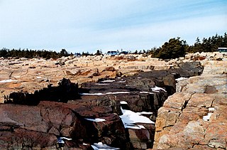
The Schoodic Peninsula is a peninsula in Down East Maine. It is located four miles (6 km) east of Bar Harbor, Maine, as the crow flies. The Schoodic Peninsula contains 2,266 acres (9 km2), or approximately 5% of Acadia National Park. It includes the towns of Gouldsboro and Winter Harbor. The peninsula has a rocky granite shoreline containing many volcanic dikes. The peninsula is home to the former United States Navy base, NSGA Winter Harbor, which has been converted into a National Park Service training center. A 3,300-acre (13 km2) resort development was proposed for land abutting Schoodic Peninsula's national park holdings to the north. An anonymous donor eventually bought the entire 3,200-acre tract and built the Schoodic Woods Campground and miles of gravel bike paths before donating all of it to Acadia National Park. Opening in 2015, Schoodic Woods is the newest campground in Acadia National Park, and the first built in the park since the original campgrounds were built by the Civilian Conservation Corps during the Great Depression beginning in 1936. In the summer, the Schoodic peninsula is currently served by two separate ferry services from Bar Harbor to Winter Harbor that run daily.

Bar Harbor is a census-designated place (CDP) in the town of Bar Harbor in Hancock County, Maine, United States. The CDP population was 2,552 at the 2010 census, out of a population of 5,235 in the town of Bar Harbor as a whole.

Winter Harbor is a census-designated place (CDP) in the town of Winter Harbor in Hancock County, Maine, United States. The CDP population was 426 at the 2010 census, out of 516 people in the town as a whole.

References

  1. 1 2 "US Gazetteer files 2010". United States Census Bureau . Retrieved December 16, 2012.
  2. "Census - Geography Profile: Winter Harbor town, Hancock County, Maine" . Retrieved January 30, 2022.
  3. "U.S.Navy Activities World War II by State". U.S. Naval Historical Center. Retrieved March 7, 2012.
  4. "Census of Population and Housing". Census.gov. Retrieved June 4, 2015.
  5. "U.S. Census website". United States Census Bureau . Retrieved December 16, 2012.
  6. "U.S. Census website". United States Census Bureau . Retrieved January 31, 2008.
  7. Gouldsboro land improvement co.'s Grindstone inn and lands, Grindstone Neck ... - Gouldsboro land improvement company - Google Books. 1892. Retrieved March 4, 2012.
  8. "Grindstone Neck Golf Course / Course". Grindstonegolf.com. Retrieved March 4, 2012.
  9. "Raleigh, Ralph and Rags". Discovermainemagazine.com. Retrieved March 4, 2012.

Further reading

44°23′43″N68°04′59″W / 44.39528°N 68.08306°W / 44.39528; -68.08306