Sedgwick, Maine

Last updated

Sedgwick, Maine
View of the Village, Sedgwick, ME.jpg
View of the village in 1909
USA Maine location map.svg
Red pog.svg
Sedgwick
Usa edcp location map.svg
Red pog.svg
Sedgwick
Coordinates: 44°19′29″N68°38′39″W / 44.32472°N 68.64417°W / 44.32472; -68.64417
Country United States
State Maine
County Hancock
Incorporated 1789
VillagesSedgwick
North Sedgwick
Sargentville
Area
[1]
  Total31.06 sq mi (80.45 km2)
  Land26.99 sq mi (69.90 km2)
  Water4.07 sq mi (10.54 km2)
Elevation
164 ft (50 m)
Population
 (2020)
  Total1,202
  Density45/sq mi (17.2/km2)
Time zone UTC-5 (Eastern (EST))
  Summer (DST) UTC-4 (EDT)
ZIP code
04676
Area code 207
FIPS code 23-67300
GNIS feature ID0582721

Sedgwick is a town in Hancock County, Maine, United States. The population was 1,202 at the 2020 census. [2] The town includes the village of Sargentville.

Contents

The countryside around Sedgwick is a haven for birdwatchers, as well as an out-of-the-way tourist stop with several bed and breakfast locations.

History

It was one of six contiguous townships, each six miles square, granted by Massachusetts in 1761 to David Marsh and 359 others. Called by its Abenaki name Naskeag, meaning "the end or extremity," its first permanent European settler was Andrew Black in 1759. In 1789, the town was incorporated as Sedgwick, named after Major Robert Sedgwick, who in 1654 captured nearby Fort Pentagouet (now Castine) from the French.

In 1817, land was taken from the township to form Brooksville, with more taken in 1849 to form Brooklin. By 1859, the population was 1,235. [3]

Farmers found the surface broken and ledgy, better suited for grazing than cultivation. Gristmills and sawmills were built along various streams, including the Benjamin River. Because of the geology, for decades Sedgwick had operating many granite quarries, where stone was taken for major public buildings. Most of the quarries have been abandoned. Two companies mined for argentiferous galena, a source of silver. But with two excellent harbors, the town was chiefly occupied by fishing, clam digging, shipbuilding and seafaring. Other businesses included tanning and barrel making. [4]

In March 2011, Sedgwick received attention after passing an ordinance declaring food sovereignty for the town's citizens. [5]

Geography

According to the United States Census Bureau, the town has a total area of 31.06 square miles (80.45 km2), of which 26.99 square miles (69.90 km2) is land and 4.07 square miles (10.54 km2) is water. [1] Drained by the Benjamin River, which separates it from Brooklin, Sedgwick overlooks Penobscot Bay. The Deer Isle Bridge spans the Eggemoggin Reach, connecting Sedgwick to the towns of Deer Isle and Stonington.

The town is crossed by state routes 15, 172, 175 and 176.

Climate

This climatic region is typified by large seasonal temperature differences, with warm to hot (and often humid) summers and cold (sometimes severely cold) winters. According to the Köppen Climate Classification system, Sedgwick has a humid continental climate, abbreviated "Dfb" on climate maps. [6]

Demographics

Historical population
CensusPop.Note
1790 569
1800 76033.6%
1810 1,35277.9%
1820 1,4205.0%
1830 1,60413.0%
1840 1,92219.8%
1850 1,235−35.7%
1860 1,2632.3%
1870 1,113−11.9%
1880 1,1281.3%
1890 1,012−10.3%
1900 902−10.9%
1910 9090.8%
1920 830−8.7%
1930 699−15.8%
1940 7182.7%
1950 614−14.5%
1960 574−6.5%
1970 5780.7%
1980 79537.5%
1990 90513.8%
2000 1,10221.8%
2010 1,1968.5%
2020 1,2020.5%
U.S. Decennial Census [7]

2010 census

As of the census [8] of 2010, there were 1,196 people, 529 households, and 344 families living in the town. The population density was 44.3 inhabitants per square mile (17.1/km2). There were 800 housing units at an average density of 29.6 per square mile (11.4/km2). The racial makeup of the town was 98.4% White, 0.3% African American, 0.2% Native American, 0.5% Asian, 0.3% from other races, and 0.3% from two or more races. Hispanic or Latino of any race were 1.8% of the population.

There were 529 households, of which 26.3% had children under the age of 18 living with them, 50.7% were married couples living together, 9.3% had a female householder with no husband present, 5.1% had a male householder with no wife present, and 35.0% were non-families. 29.3% of all households were made up of individuals, and 11.7% had someone living alone who was 65 years of age or older. The average household size was 2.26 and the average family size was 2.73.

The median age in the town was 45.9 years. 20.2% of residents were under the age of 18; 6.7% were between the ages of 18 and 24; 21.4% were from 25 to 44; 32.5% were from 45 to 64; and 19.1% were 65 years of age or older. The gender makeup of the town was 49.6% male and 50.4% female.

2000 census

As of the census [9] of 2000, there were 1,102 people, 470 households, and 307 families living in the town. The population density was 40.8 inhabitants per square mile (15.8/km2). There were 671 housing units at an average density of 24.8 per square mile (9.6/km2). The racial makeup of the town was 96.64% White, 0.18% African American, 0.73% Native American, 0.36% Asian, 0.18% from other races, and 1.91% from two or more races. Hispanic or Latino of any race were 1.09% of the population.

There were 470 households, out of which 29.4% had children under the age of 18 living with them, 55.3% were married couples living together, 7.0% had a female householder with no husband present, and 34.5% were non-families. 29.4% of all households were made up of individuals, and 13.0% had someone living alone who was 65 years of age or older. The average household size was 2.34 and the average family size was 2.93.

In the town, the population was spread out, with 25.0% under the age of 18, 6.4% from 18 to 24, 25.2% from 25 to 44, 27.6% from 45 to 64, and 15.9% who were 65 years of age or older. The median age was 40 years. For every 100 females, there were 100.7 males. For every 100 females age 18 and over, there were 96.9 males.

The median income for a household in the town was $35,000, and the median income for a family was $40,547. Males had a median income of $26,607 versus $21,944 for females. The per capita income for the town was $19,772. About 6.9% of families were below the poverty line.

Notable people

Related Research Articles

<span class="mw-page-title-main">Hancock County, Maine</span> County in Maine, United States

Hancock County is a county located in the U.S. state of Maine. As of the 2020 census, the population was 55,478. Its county seat is Ellsworth. The county was incorporated on June 25, 1789, and named for John Hancock, the first governor of the Commonwealth of Massachusetts.

<span class="mw-page-title-main">Carthage, Maine</span> Town in the state of Maine, United States

Carthage is a town in Franklin County, Maine, United States. The population was 509 at the 2020 census.
<span class="mw-page-title-main">Brooklin, Maine</span> Town in the state of Maine, United States

Brooklin is a town in Hancock County, Maine, United States. The population was 827 at the 2020 census.

<span class="mw-page-title-main">Deer Isle, Maine</span> Town in the state of Maine, United States

Deer Isle is a town in Hancock County, Maine, United States. The population was 2,194 at the 2020 census. Notable landmarks in Deer Isle are the Haystack Mountain School of Crafts, Stonington Opera House, and the town's many art galleries.

Frenchboro is a town in Hancock County, Maine, United States, and a village within this town located on Long Island, southeast of Swans Island. The population was 29 at the 2020 census. The town is accessible by state ferry service from Bass Harbor.

<span class="mw-page-title-main">Monmouth, Maine</span> Town in the state of Maine, United States

Monmouth is a town in Kennebec County, Maine, United States. Monmouth is included in the Lewiston-Auburn, Maine metropolitan New England city and town area. The population was 4,066 at the 2022 census.
<span class="mw-page-title-main">Alna, Maine</span> Town in the state of Maine, United States

Alna is a town in Lincoln County, Maine, United States. The population was 710 at the 2020 census. Alna is home to the Wiscasset, Waterville and Farmington Railway Museum and is noted for its historic architecture, including the early mill village of Head Tide.

<span class="mw-page-title-main">Jefferson, Maine</span> Town in the state of Maine, United States

Jefferson is a town in Lincoln County, Maine, United States. The population was 2,551 at the 2020 census. Damariscotta Lake State Park, a popular Mid Coast swimming, canoeing and picnic area, is located within the town limits.

<span class="mw-page-title-main">Canton, Maine</span> Town in the state of Maine, United States

Canton is a town in Oxford County, Maine, United States. Canton is included in the Lewiston-Auburn, Maine metropolitan New England city and town area. The population was 1,125 at the 2020 census. Located beside Lake Anasagunticook, Canton is a summer recreational area.
<span class="mw-page-title-main">Hebron, Maine</span> Town in the state of Maine, United States

Hebron is a town in Oxford County, Maine, United States. Hebron is included in the Lewiston-Auburn, Maine metropolitan New England city and town area. The town's history has always been interconnected with Hebron Academy, a co-ed college preparatory boarding school which is located in the town's heart. The population was 1,223 at the 2020 census. There is an elementary school, Hebron Station School, located on Station Road.

<span class="mw-page-title-main">Roxbury, Maine</span> Town in the state of Maine, United States

Roxbury is a town in Oxford County, Maine, United States. The population was 361 at the 2020 census. Ellis Pond is popular with recreational fishermen.

Sweden is a town in Oxford County, Maine, United States. The population was 406 at the 2020 census. Set among hills, forests and ponds, Sweden includes the village of East Sweden.

<span class="mw-page-title-main">Bowdoin, Maine</span> Town in the state of Maine, United States

Bowdoin is a town in Sagadahoc County, Maine, United States. Bowdoin is included in the Lewiston-Auburn, Maine metropolitan New England city and town area. The population was 3,136 at the 2020 census. Bowdoin is 31 land miles north of Portland, and 21 land miles south of Augusta.

<span class="mw-page-title-main">Solon, Maine</span> Town in the state of Maine, United States

Solon is a town in Somerset County, Maine, United States. The population was 978 at the 2020 census.
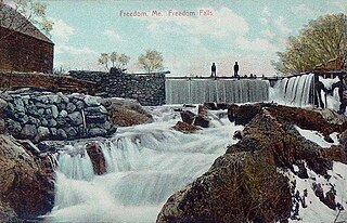
<span class="mw-page-title-main">Freedom, Maine</span> Town in the state of Maine, United States

Freedom is a town in Waldo County, Maine, United States. The population was 711 at the 2020 census. Freedom is a residential and recreational area.
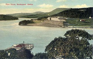
<span class="mw-page-title-main">Prospect, Maine</span> Town in the state of Maine, United States

Prospect is a town in Waldo County, Maine, United States. The population was 698 at the 2020 census.
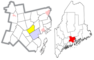
<span class="mw-page-title-main">Waldo, Maine</span> Town in the state of Maine, United States

Waldo is a town in Waldo County, Maine, United States. The population was 795 at the 2020 census. It is the home town of Heather Hemmens, who is known for her role on Hellcats.

<span class="mw-page-title-main">Pembroke, Maine</span> Town in the state of Maine, United States

Pembroke is a town in Washington County, Maine, United States. The population was 788 at the 2020 census. The town is home to a reversing falls on Mahar's Point.

<span class="mw-page-title-main">North Berwick, Maine</span> Town in Maine, United States

North Berwick is a town in York County, Maine, United States. The town was set off from Berwick in 1831, following South Berwick in 1814.

<span class="mw-page-title-main">Blue Hill, Maine</span> Town in the state of Maine, United States

Blue Hill is a town in Hancock County, Maine, United States, located on Blue Hill Bay. The population was 2,792 at the 2020 census. It is home to the Blue Hill Public Library, Blue Hill Memorial Hospital, George Stevens Academy, the Blue Hill Harbor School, The Bay School, New Surry Theatre, Kneisel Hall, Bagaduce Music Lending Library, the Kollegewidgwok Yacht Club, the Shaw Institute and the Blue Hill Country Club. The town also hosts the annual Blue Hill Fair.

References

  1. 1 2 "US Gazetteer files 2010". United States Census Bureau . Retrieved December 16, 2012.
  2. "Census - Geography Profile: Sedgwick town, Hancock County, Maine" . Retrieved January 21, 2022.
  3. Coolidge, Austin J.; John B. Mansfield (1859). A History and Description of New England. Boston, Massachusetts: A.J. Coolidge. pp.  302–303. coolidge mansfield history description new england 1859.
  4. Varney, George J. (1886), Gazetteer of the state of Maine. Sedgwick, Boston: Russell
  5. Food Nullification by Jesse Walker from Reason
  6. Climate Summary for Sedgwick, Maine
  7. "Census of Population and Housing". Census.gov. Retrieved June 4, 2015.
  8. "U.S. Census website". United States Census Bureau . Retrieved December 16, 2012.
  9. "U.S. Census website". United States Census Bureau . Retrieved January 31, 2008.
  10. Weber, Bruce. "Thomas N. Schroth, Influential Washington Editor, Is Dead at 88", The New York Times , August 4, 2009. Accessed August 5, 2009.

44°18′13″N68°36′58″W / 44.30361°N 68.61611°W / 44.30361; -68.61611