MOVE is a black militant anarcho-primitivist group founded in 1972 in Philadelphia, Pennsylvania by John Africa. The name is not an acronym. The group lived in a communal setting in West Philadelphia, abiding by philosophies of anarcho-primitivism. The group combined revolutionary ideology, similar to that of the Black Panthers, with work for animal rights.

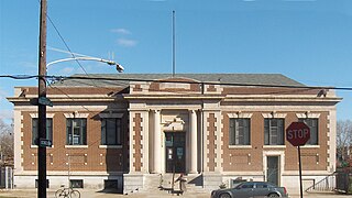
Philadelphia County is the most populous county in the U.S. state of Pennsylvania. As of 2019, Philadelphia County was home to an estimated population of 1,584,064 residents. The county is the second smallest county in Pennsylvania by land area. Philadelphia County is one of the three original counties, along with Chester and Bucks counties, created by William Penn during November 1682. Since 1854, the county has been coextensive with the City of Philadelphia. Philadelphia County is part of the Philadelphia-Camden-Wilmington, PA-NJ-DE-MD, located along the lower Delaware and Schuylkill Rivers, within the Northeast megalopolis. Philadelphia County is the economic and cultural anchor of the Delaware Valley, the ninth-largest combined statistical area in the United States with an estimated population of 7.2 million.

Skippack is a census-designated place (CDP) in Montgomery County, Pennsylvania, United States. The population was 3,758 at the 2010 census.
Kingsessing is a neighborhood in the Southwest section of Philadelphia, Pennsylvania, United States, located next to the neighborhoods of Cedar Park, Southwest Schuylkill, and Mount Moriah, as well as the borough of Yeadon in Delaware County. It is roughly bounded by Cobbs Creek and 60th Street to the southwest, Woodland Avenue to the southeast, 53rd Street to the northeast, and Baltimore Avenue to the northwest.

Wynnefield is a diverse middle-class neighborhood in West Philadelphia. Its borders are 53rd Street at Jefferson to the south, Philadelphia's Fairmount Park to the east, City Avenue to the north and the Amtrak Main Line tracks to the west.

South Philadelphia, nicknamed South Philly, is the section of Philadelphia bounded by South Street to the north, the Delaware River to the east and south and the Schuylkill River to the west. A diverse working class community, South Philadelphia is primarily known for its large Italian American population, but it also contains large Irish American and African American populations.

Mantua is a neighborhood in the West Philadelphia section of Philadelphia, Pennsylvania. It is located north of Spring Garden Street, east of 40th Street, south of Mantua Avenue, and west of 31st Street. The neighborhood's northern and western reaches are predominantly working-class and African American, although its southern border with Powelton Village has seen recent gentrification and an influx of Drexel University and University of Pennsylvania student renters.

Villanova is a suburb of Philadelphia. It straddles Lower Merion Township in Montgomery County and Radnor Township in Delaware County. It is located at the center of the Philadelphia Main Line, a series of highly affluent Philadelphia suburbs located along the original east–west railroad tracks of the Pennsylvania Railroad. It is served by the SEPTA Paoli/Thorndale Line regional rail train and Norristown High Speed Line.

Olney is a neighborhood in North Philadelphia, Pennsylvania, United States. It is roughly bounded by Roosevelt Boulevard to the south, Tacony Creek to the east, Godfrey Avenue to the north, and the railroad right-of-way west of Seventh Street to the west.
Queen Village is a residential neighborhood of Philadelphia, Pennsylvania that lies along the eastern edge of the city, immediately south of Center City. It shares boundaries with Society Hill to the north, Bella Vista to the west and Pennsport to the south. Historically, the area is part of old Southwark, Philadelphia's first suburb, which was incorporated into the city in 1854 and remains the city's oldest residential neighborhood. Street boundaries are the south side of Lombard Street to the north side of Washington Avenue, the Delaware River to 6th Street, encompassing two principal commercial corridors, South Street and Fabric Row on 4th Street.

Somerton is a neighborhood in the Far Northeast section of Philadelphia, Pennsylvania, United States. The neighborhood is bounded by Red Lion Road on the south, Roosevelt Boulevard on the east, East County Line Road and Poquessing Creek on the north, and the Philadelphia County / Montgomery County line on the west. Somerton is adjacent to the Philadelphia neighborhoods of Bustleton, Normandy, and Byberry, the townships of Bensalem and Lower Southampton in Bucks County, and Lower Moreland Township in Montgomery County. The area is home to a large and fast-growing foreign-born population, most notably of Russian and Indian immigrants.

Southwark was originally the Southwark District, a colonial-era municipality in Philadelphia County, Pennsylvania. Today, it is a neighborhood in the South Philadelphia section of Philadelphia, Pennsylvania. Because of its location south of the early Philadelphia, the name was adopted in allusion to the borough of Southwark in the county of London, England, just south of the city of London.

Southwest Philadelphia is a section of Philadelphia, Pennsylvania, United States. The section can be described as extending from the western side of the Schuylkill River to the city line, with the SEPTA. The northern border is defined by the Philadelphia City Planning Commission as east from the city line along Baltimore Avenue moving south along 51st Street to Springfield Ave. It follows the train tracks until 49th Street. From 49th and Kingsessing Ave the line moves east along Kingsessing Ave. The line then moves south along 46th St to Paschall Ave where it jogs to join Grays Ferry where the line runs to the Schuylkill River.
Pennsport is a neighborhood in the South Philadelphia section of Philadelphia, Pennsylvania, United States.

Nicetown–Tioga is a neighborhood in the North Philadelphia section of the city of Philadelphia, in the U.S. state of Pennsylvania. It comprises two smaller, older neighborhoods, Nicetown and Tioga, although the distinction between the two is rarely emphasized today. The name "Nicetown" is often simply used to refer to any part of Nicetown–Tioga.

Carroll Park is a neighborhood in West Philadelphia. Its boundaries are Lansdowne Avenue to the north, West Girard Avenue to the south, North 63rd Street to the west, and North 52nd Street to the east. Along major streets of the neighborhood, the Carroll Park Community Council, Inc. has placed banners that say “Carroll Park: Where our neighbors become friends.” The 10 trolley runs along Lansdowne Avenue and the 15 trolley runs along Girard Avenue. There is a park by the name of Carroll Park between North 59th and North 58th Streets and West Thompson Street and West Girard Avenue. Carroll Park’s residents are primarily working-class and lower-income African-Americans.
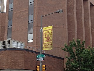
The Odunde Festival is a one-day festival and mostly a street market catered to African-American interests and the African diaspora. It is derived from the tradition of the Yoruba people of Nigeria in celebration of the new year. It is centered at the intersection of Grays Ferry Avenue and South Street in the U.S. city of Philadelphia, Pennsylvania.

Philadelphia is a town in Jefferson County, New York, United States. The population was 1,947 at the 2010 census, down from 2,140 at the 2000 census.
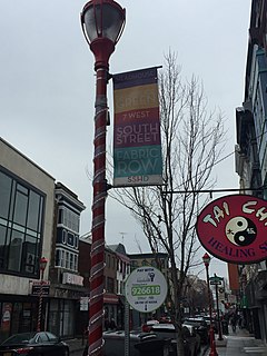
The South Street Headhouse District in Philadelphia is an area with more than 300 stores which includes a diverse urban mix of shops, bars and eateries. The neighborhood is generally bounded between Front Street and Seventh Street and includes Pine Street and is known for its "bohemian", "punk", and generally "alternative" atmosphere. It is one of Philadelphia's largest tourist attractions.


