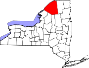
Pierrepont, New York

Last updated

Pierrepont, New York
Pierrepont NY Locator Map.png
Map highlighting Pierrepont's location within St. Lawrence County.
USA New York location map.svg
Red pog.svg
Pierrepont, New York
Location within the state of New York
Coordinates: 44°32′53″N75°0′44″W / 44.54806°N 75.01222°W / 44.54806; -75.01222
CountryUnited States
State New York
County St. Lawrence
Area
[1]
  Total60.72 sq mi (157.26 km2)
  Land60.23 sq mi (156.00 km2)
  Water0.49 sq mi (1.26 km2)
Elevation
922 ft (281 m)
Population
 (2020)
  Total2,523
  Density41.89/sq mi (16.17/km2)
Time zone UTC-5 (Eastern (EST))
  Summer (DST) UTC-4 (EDT)
FIPS code 36-57771
GNIS feature ID0979365
Website Official Town of Pierrepont official website

Pierrepont (traditionally spelled Pierpont) is a town and hamlet in St. Lawrence County, New York, United States. As of the 2020 census, the town population was 2,523. It was named after Hezekiah Pierrepont, the early owner of much of the town's territory. The Town of Pierrepont is centrally located in the county and is southeast of Canton. A hamlet of the same name is in the town of Pierrepont. Pierrepont Manor, however, is located in Jefferson County.

Contents

History

The first European-American settlers arrived around 1806/7, after the American Revolutionary War, when many settlers from New England migrated into upstate New York. [2] The town was established in 1818 from parts of the Towns of Russell and Potsdam. Later the town gave up territory to form, in whole or part, the Towns of Fine (1844), Clifton (1868), and Clare (1882).

Manor House, Pierrepont, NY - c. 1915 Manor House, Pierrepont, NY - c. 1915.jpg
Manor House, Pierrepont, NY - c. 1915

Geography

According to the United States Census Bureau, the town has a total area of 60.7 square miles (157 km2), of which 60.4 square miles (156 km2) is land and 0.3 square miles (0.78 km2) (0.51%) is water.

The Raquette River, which is the longest river in St. Lawrence County and the third longest in New York state, flows through the northeast part of the town.

New York State Route 56 crosses the northeast part of Pierrepont, and New York State Route 68 is an east–west highway.

Notable people

Demographics

Historical population
CensusPop.Note
1820 235
1830 749218.7%
1840 1,43090.9%
1850 1,4592.0%
1860 2,26755.4%
1870 2,3915.5%
1880 2,4944.3%
1890 1,954−21.7%
1900 1,885−3.5%
1910 1,628−13.6%
1920 1,425−12.5%
1930 1,379−3.2%
1940 1,312−4.9%
1950 1,192−9.1%
1960 1,52327.8%
1970 1,72613.3%
1980 2,20727.9%
1990 2,3757.6%
2000 2,67412.6%
2010 2,589−3.2%
2020 2,523−2.5%
U.S. Decennial Census [3]

As of the census [4] of 2000, there were 2,674 people, 1,039 households, and 744 families residing in the town. The population density was 44.3 inhabitants per square mile (17.1/km2). There were 1,233 housing units at an average density of 20.4 per square mile (7.9/km2). The racial makeup of the town was 98.77% White, 0.19% African American, 0.15% Native American, 0.52% Asian, and 0.37% from two or more races. Hispanic or Latino of any race were 0.30% of the population.

There were 1,039 households, out of which 33.9% had children under the age of 18 living with them, 61.2% were married couples living together, 6.5% had a female householder with no husband present, and 28.3% were non-families. 21.0% of all households were made up of individuals, and 7.5% had someone living alone who was 65 years of age or older. The average household size was 2.57 and the average family size was 2.99.

In the town, the population was spread out, with 25.9% under the age of 18, 6.5% from 18 to 24, 29.6% from 25 to 44, 27.6% from 45 to 64, and 10.4% who were 65 years of age or older. The median age was 38 years. For every 100 females, there were 106.3 males. For every 100 females age 18 and over, there were 100.3 males.

The median income for a household in the town was $41,890, and the median income for a family was $44,500. Males had a median income of $36,398 versus $23,438 for females. The per capita income for the town was $19,239. About 7.3% of families and 11.5% of the population were below the poverty line, including 13.1% of those under age 18 and 5.6% of those age 65 or over.

Communities and locations in Pierrepont

Related Research Articles

<span class="mw-page-title-main">Schuyler Falls, New York</span> Town in New York, United States

Schuyler Falls is a town in Clinton County, New York, United States. The population was 5,181 at the 2010 census. The town was named after Peter Schuyler, who bought the mill on the Salmon River from Zephaniah Platt.

<span class="mw-page-title-main">Franklin, Franklin County, New York</span> Town in New York, United States

Franklin is a town located in Franklin County, New York, United States. As of the 2010 census, the town had a population of 1,140.
<span class="mw-page-title-main">Long Lake, New York</span> Town in New York, United States

Long Lake is a town in Hamilton County, New York, United States. The population was 791 at the 2020 census.

Brookfield is a town in Madison County, New York, United States. The population was 2,403 at the 2000 census.

<span class="mw-page-title-main">Marshall, New York</span> Town in New York, United States

Marshall is a town in Oneida County, New York, United States. The population was 2,131 at the 2010 census.

<span class="mw-page-title-main">Orwell, New York</span> Town in New York, United States

Orwell is a town in Oswego County, New York, United States. The population was 1,167 at the 2010 census. The town was named after Orwell, Vermont.
<span class="mw-page-title-main">Halfmoon, New York</span> Town in New York, United States

Halfmoon is a town in Saratoga County, New York, United States. The population was 25,662 at the 2020 census. The town is apparently named for the shape of the lower elevation land north of the junction of the Hudson and Mohawk Rivers. It is also said to be named for Henry Hudson's ship, the Halve Maen.

<span class="mw-page-title-main">Moreau, New York</span> Town in New York, United States

Moreau is a town in Saratoga County, New York, United States. The population was 16,202 at the 2020 census. The town is located in the northeast part of the county, north of Saratoga Springs. Moreau is named after Jean Victor Moreau, a French general, who visited the area just before the town was formed. The town contains a village called South Glens Falls.
<span class="mw-page-title-main">Clare, New York</span> Town in New York, United States

Clare is a town in St. Lawrence County, New York, United States. The population was 105 at the 2010 census.

<span class="mw-page-title-main">Clifton, New York</span> Town in New York, United States

Clifton is a town in St. Lawrence County, New York, United States. The population was 675 at the 2020 census. The town takes its name from a mining company.

<span class="mw-page-title-main">Colton, New York</span> Town in New York, United States

Colton is a town in St. Lawrence County, New York, United States. The population was 1,451 at the 2010 census. The town, originally named "Matildaville", is named after early settler Jesse Colton Higley.

<span class="mw-page-title-main">Madrid, New York</span> Town in New York, United States

Madrid is a town in St. Lawrence County, New York. The population was 1,735 at the time of the 2010 census. The town is named after the capital of Spain. Madrid is in the northern part of the county, north of Canton.
<span class="mw-page-title-main">Parishville, New York</span> Town in New York, United States

Parishville is a town in the east-central part of St. Lawrence County, east of Potsdam, in the state of New York, United States. The population was 2,153 at the 2010 census.

<span class="mw-page-title-main">Piercefield, New York</span> Town in New York, United States

Piercefield is a town in St. Lawrence County, New York, United States. The population was 310 at the 2010 census.
<span class="mw-page-title-main">Russell, New York</span> Town in New York, United States

Russell is a town in St. Lawrence County, New York, United States. The population was 1,856 at the 2010 census. The town is named after Russell Attwater, the pioneer land owner.

<span class="mw-page-title-main">Canton, New York</span> Town in New York, United States

Canton is an incorporated town in St. Lawrence County, New York. The population was 11,638 at the time of the 2020 census. The town contains two villages: one also named Canton, the other named Rensselaer Falls. The town is named after the great port of Canton in China. Canton is the home of St. Lawrence University and the State University of New York at Canton. The Canton Central School District is based in the village of Canton.

<span class="mw-page-title-main">Norfolk, New York</span> Town in New York, United States

Norfolk is a town in St. Lawrence County in the U.S. state of New York. The town is in the northern part of the county and is north of Potsdam. The population was 4,453 at the 2020 census.
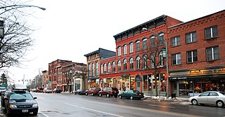
<span class="mw-page-title-main">Potsdam, New York</span> Town in New York, United States

Potsdam is a town in St. Lawrence County, New York, United States. The town population was 14,901 at the 2020 census. When SUNY Potsdam and Clarkson University are in session, the population increases by approximately 8,000 students. The town is named after the city of Potsdam in Germany.

Portage is a town in the southwest corner of Livingston County, New York, United States. The town is at the south end of Letchworth State Park. The name of the town stems from the need to portage (carry) canoes around the falls of the Genesee River. The population of Portage was 884 at the 2010 census.
<span class="mw-page-title-main">New York State Route 56</span> State highway in St. Lawrence County, New York, US

New York State Route 56 (NY 56) is a 51.44-mile-long (82.78 km) north–south state highway in eastern St. Lawrence County, New York, in the United States. The southern terminus of the route is at an intersection with NY 3 in the town of Colton. Its northern terminus is at a junction with NY 37 southwest of Massena in the town of Louisville. NY 56 follows the Raquette River for most of its length and serves the village of Potsdam, where it passes by the campus of State University of New York at Potsdam.

References

  1. "2016 U.S. Gazetteer Files". United States Census Bureau. Retrieved July 5, 2017.
  2. "Pierrepont History", OUR COUNTY AND ITS PEOPLE: A MEMORIAL RECORD OF ST. LAWRENCE COUNTY, NEW YORK, edited by GATES CURTIS, Boston: The Boston History Company, 1894
  3. "Census of Population and Housing". Census.gov. Retrieved March 17, 2022.
  4. "U.S. Census website". United States Census Bureau . Retrieved January 31, 2008.
  5. 1 2 "National Register Information System". National Register of Historic Places . National Park Service. March 13, 2009.

44°32′32″N75°00′43″W / 44.54222°N 75.01194°W / 44.54222; -75.01194