Waddington (village), New York

Last updated

Waddington, New York
USA New York location map.svg
Red pog.svg
Waddington, New York
Location within the State of New York
Coordinates: 44°51′50″N75°11′49″W / 44.86389°N 75.19694°W / 44.86389; -75.19694
CountryUnited States
State New York
County St. Lawrence
Area
[1]
  Total2.37 sq mi (6.13 km2)
  Land2.18 sq mi (5.65 km2)
  Water0.19 sq mi (0.49 km2)
Elevation
272 ft (83 m)
Population
 (2020)
  Total937
  Density429.82/sq mi (165.95/km2)
Time zone UTC-5 (Eastern (EST))
  Summer (DST) UTC-4 (EDT)
FIPS code 36-77728
GNIS feature ID0977173

Waddington is a village located in the Town of Waddington in St. Lawrence County, New York, United States. The population was 972 at the 2010 census. The village is named after James Waddington.

Contents

The Village of Waddington is at the northern edge of the town and is north of Canton.

History

The first settlers arrived around 1798.

The village was originally called "Hamilton" (after Alexander Hamilton), but was changed to Waddington in 1818. Joshua Waddington was a friend of Hamilton and one of the original landowners. The village was incorporated in 1839. When the Town of Waddington was formed afterwards, it adopted the name of the village.

During the construction of the St. Lawrence Seaway part of the village needed to be relocated and some of the old industrial area was destroyed.

The Waddington Historic District was listed on the National Register of Historic Places in 1992. [2]

Geography

According to the United States Census Bureau, the village has a total area of 2.4 sq mi (6.2 km2), of which 2.2 sq mi (5.7 km2) is land and 0.2 sq mi (0.52 km2) (8.82%) is water.

The village is located near the St. Lawrence River and the international border with Canada. The village fronts on Ogden Island in the St. Lawrence River.

Waddington is at the junctions of New York State Route 37 and New York State Route 345. County Road 44 serves the village from the southeast.

Demographics

Historical population
CensusPop.Note
1860 789
1870 710−10.0%
1880 97737.6%
1890 900−7.9%
1900 757−15.9%
1910 731−3.4%
1920 702−4.0%
1930 679−3.3%
1940 671−1.2%
1950 81922.1%
1960 92112.5%
1970 9553.7%
1980 9802.6%
1990 944−3.7%
2000 923−2.2%
2010 9725.3%
2020 937−3.6%
U.S. Decennial Census [3]

As of the census [4] of 2000, there were 923 people, 405 households, and 259 families residing in the village. The population density was 425.3 inhabitants per square mile (164.2/km2). There were 452 housing units at an average density of 208.3 per square mile (80.4/km2). The racial makeup of the village was 99.13% White, 0.33% Native American, 0.11% from other races, and 0.43% from two or more races. Hispanic or Latino of any race were 0.22% of the population.

There were 405 households, out of which 21.7% had children under the age of 18 living with them, 53.8% were married couples living together, 7.4% had a female householder with no husband present, and 36.0% were non-families. 31.1% of all households were made up of individuals, and 15.3% had someone living alone who was 65 years of age or older. The average household size was 2.26 and the average family size was 2.79.

In the village, the population was spread out, with 18.2% under the age of 18, 7.2% from 18 to 24, 23.4% from 25 to 44, 30.8% from 45 to 64, and 20.5% who were 65 years of age or older. The median age was 46 years. For every 100 females, there were 93.1 males. For every 100 females age 18 and over, there were 89.2 males.

The median income for a household in the village was $39,615, and the median income for a family was $46,389. Males had a median income of $39,583 versus $24,773 for females. The per capita income for the village was $22,568. About 5.8% of families and 11.3% of the population were below the poverty line, including 16.2% of those under age 18 and 6.8% of those age 65 or over.

Notable person

Related Research Articles

<span class="mw-page-title-main">Ubly, Michigan</span> Village in Michigan, United States

Ubly is a village in Huron County in the U.S. state of Michigan. The population was 858 at the 2010 census. The village is within Bingham Township.

Walden Township is a township in Cass County, Minnesota, United States. The population was 405 as of the 2000 census. Walden Township was named after Walden Pond, in Massachusetts.

Storden Township is a township in Cottonwood County, Minnesota, United States. The population was 165 at the 2010 census.

Amherst Township is a township in Fillmore County, Minnesota, United States. The population was 405 at the 2000 census.

Lawrence Township is a township in Grant County, Minnesota, United States. The population was 96 at the 2000 census.

Lawrence Township is a township in Itasca County, Minnesota, United States. The population was 438 at the 2010 census.

Racine Township is a township in Mower County, Minnesota, United States. The population was 445 at the time of the 2000 census. The largest town in the township is Racine with a population of 442 as of the 2010 census.. All other area in the township is unincorporated.

<span class="mw-page-title-main">St. Lawrence Township, Scott County, Minnesota</span> Township in Minnesota, United States

St. Lawrence Township is a township in Scott County, Minnesota, United States. The population was 472 at the 2000 census.

Crow River Township is a township in Stearns County, Minnesota, United States. The population was 327 at the 2010 census.

Getty Township is a township in Stearns County, Minnesota, United States. The population was 376 at the 2010 census.

Lynden Township is a township in Stearns County, Minnesota, United States. The population was 1,938 at the 2010 census.

Wykeham Township is a township in Todd County, Minnesota, United States. Wykeham Township was originally called Eden Township and was organized in 1880 under the latter name.

French Lake Township is a township in Wright County, Minnesota, United States. The unincorporated community of French Lake is located within French Lake Township. The population was 1,130 at the 2000 census.

<span class="mw-page-title-main">Madrid, New York</span> Town in New York, United States

Madrid is a town in St. Lawrence County, New York. The population was 1,735 at the time of the 2010 census. The town is named after the capital of Spain. Madrid is in the northern part of the county, north of Canton.

<span class="mw-page-title-main">Boggs Township, Centre County, Pennsylvania</span> Township in Pennsylvania, United States

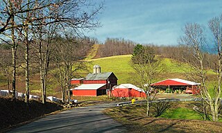
Boggs Township is a township in Centre County, Pennsylvania, United States. It is part of the State College, Pennsylvania Metropolitan Statistical Area. It is located north of Bellefonte at approximately 40°54′48″N77°45′53″W. As of the 2010 census, the township population was 2,985.

<span class="mw-page-title-main">Colley Township, Sullivan County, Pennsylvania</span> Township in Pennsylvania, United States

Colley Township is a township in Sullivan County, Pennsylvania, United States. The population was 626 at the 2020 census. The village of Lopez is located in the township.

<span class="mw-page-title-main">Hamilton Township, Tioga County, Pennsylvania</span> Township in Pennsylvania, United States

Hamilton Township is a township in Tioga County, Pennsylvania, United States. The population was 534 at the 2020 census.

<span class="mw-page-title-main">Lewis Township, Union County, Pennsylvania</span> Township in Pennsylvania, United States

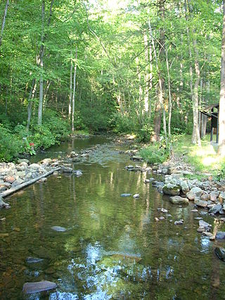
Lewis Township is a township in Union County, Pennsylvania, United States. The population was 1,456 at the 2020 census. Sand Bridge State Park, a Pennsylvania state park, is in Lewis Township along Pennsylvania Route 192.

<span class="mw-page-title-main">Hamilton, Texas</span> City in Texas, United States

Hamilton is a city in and the county seat of Hamilton County, Texas, United States, located in the state's central region. Its population was 3,095 at the 2010 census.

Waddington is a town in St. Lawrence County, New York, United States. The population was 2,266 at the 2010 census. The town was named after its principal village.

References

  1. "ArcGIS REST Services Directory". United States Census Bureau. Retrieved September 20, 2022.
  2. "National Register Information System". National Register of Historic Places . National Park Service. March 13, 2009.
  3. "Census of Population and Housing". Census.gov. Retrieved June 4, 2015.
  4. "U.S. Census website". United States Census Bureau . Retrieved January 31, 2008.