The Shadow Lawn Historic District is a historic district in central Austin, Texas that boasts a cohesive collection houses built in the southeast portion of Hyde Park during the late 1920s and 1930s.

The Lummus Park Historic District or simply Lummus Park, is on the National Register of Historic Places and a locally historic designated district in Miami, Florida. It is roughly bound by Northwest Fifth Street to the north, Flagler Street to the south, Northwest Third Avenue to the east, and the Miami River to the west. On October 25, 2006, it was added to the U.S. National Register of Historic Places. Lummus Park has some of the oldest structures in Miami, and over the decades, has been able to retain a large part of its early pioneer character.
Maple Ridge is a historic district in Tulsa, Oklahoma. It is bounded by the Inner Dispersal Loop on the north, Hazel Boulevard on the south, Peoria Avenue on the east and the Midland Valley Railroad right of way on the west. The northern portion of the district, between 15th Street and 21st Street, has been zoned with Historic Preservation Overlay Zoning by the City of Tulsa and is called North Maple Ridge.

The Arden Park–East Boston Historic District is a neighborhood in the City of Detroit, Michigan, bounded on the west by Woodward Avenue, on the north by East Boston Boulevard, on the east by Oakland Avenue, and on the south by Arden Park Boulevard. The area is immediately adjacent to the larger Boston-Edison Historic District, on the opposite side of Woodward Avenue, and is in close proximity to Atkinson Avenue. There are 92 homes in the district, all on East Boston and Arden Park Boulevards. Arden Park Boulevard and East Boston Boulevard feature prominent grassy medians with richly planted trees and flowers. The setbacks of the homes are deep, with oversized lots. The district was listed on the National Register of Historic Places in 1982.

The Boston–Edison Historic District is a historic neighborhood located in the geographic center of Detroit, Michigan. It consists of over 900 homes built on four east/west streets: West Boston Boulevard, Chicago Boulevard, Longfellow Avenue, and Edison Avenue, stretching from Woodward Avenue on the east to Linwood Avenue on the west. It is one of the largest residential historic districts in the nation. It is surrounded by Sacred Heart Major Seminary to the west, the Arden Park-East Boston Historic District and the Cathedral of the Most Blessed Sacrament to the east, and the Atkinson Avenue Historic District to the south. The district was designated a Michigan State Historic Site in 1973 and listed on the National Register of Historic Places in 1975.

The Virginia Park Historic District is located on the north side of New Center, an area in Detroit, Michigan, along both sides of Virginia Park Street from Woodward Avenue to the John C. Lodge Freeway access road. The district was listed on the National Register of Historic Places in 1982.

The Religious Structures of Woodward Avenue Thematic Resource (TR) is a multiple property submission to the National Register of Historic Places which was approved on August 3, 1982. The structures are located on Woodward Avenue in the cities of Detroit and Highland Park, Michigan.

The East Ferry Avenue Historic District is a historic residential district in Midtown Detroit, Michigan. The nationally designated historic district stretches two blocks from Woodward Avenue east to Brush Street; the locally designated historic district includes a third block between Brush and Beaubien. The district includes the separately designated Col. Frank J. Hecker House and the Charles Lang Freer House. It was designated a Michigan State Historic Site in 1976 and listed on the National Register of Historic Places in 1980.

The Palmer Woods Historic District is a residential historic district bounded by Seven Mile Road, Woodward Avenue, and Strathcona Drive in Detroit, Michigan. There are approximately 295 homes in the 188-acre (0.76 km2) district, which is between the City of Highland Park in Wayne County and the City of Ferndale in Oakland County. It was listed on the National Register of Historic Places in 1983. The Detroit Golf Club is nearby.

The Palmer Park Apartment Building Historic District is a historic district located in Detroit, Michigan. It is roughly bounded by Pontchartrain Boulevard on the west, McNichols Road on the south, and Covington Drive on the northeast. A boundary increase pushed the eastern boundary to Woodward Avenue. The district showcases some of the most ornate and most varied examples of apartment building design in Michigan, and was listed on the National Register of Historic Places in 1983.

Highland Heights–Stevens' Subdivision Historic District is a residential historic district located in Highland Park, Michigan along five east-west streets: Farrand Park, McLean Street, Colorado Street, Rhode Island Street, and Massachusetts Street, between Woodward Avenue on the west and Oakland Avenue on the east. The district was listed on the National Register of Historic Places in 1988.

The Medbury's–Grove Lawn Subdivisions Historic District is a residential historic district located in Highland Park, Michigan. It runs along three east-west streets: Eason Street, Moss Street, and Putitan Street, from Hamilton Avenue on the west to Woodward Avenue on the east. The district was listed on the National Register of Historic Places in 1988.

The Monadnock Road Historic District is a residential historic district encompassing a cohesive subdivision of a former estate in the 1920s in the Chestnut Hill section of Newton, Massachusetts. The development was typical of Newton's explosive residential growth at that time, and includes primarily Tudor Revival houses. The district was listed on the National Register of Historic Places in 1990.

The University-Cultural Center MRA is a pair of multiple property submissions to the National Register of Historic Places which were approved on April 29 and May 1, 1986. The structures included are all located in Midtown, near Woodward Avenue and Wayne State University in Detroit, Michigan. The two submissions are designated the University-Cultural Center MRA Phase I, containing five properties, and the University-Cultural Center MRA Phase II, containing three properties.

The Cass Farm MPS is a US multiple property submission to the National Register of Historic Places which was approved on December 1, 1997. The structures included are all located in Midtown, in the Cass Farm area in Detroit, Michigan, USA. The Cass Farm area is defined as occupying the space between Woodward Avenue on the east, the Lodge Freeway on the west, Warren Avenue on the north, and Martin Luther King Jr. Boulevard on the south.

Highland Park–Overlee Knolls, also known as Fostoria, is a national historic district located in Arlington County, Virginia. It is directly east of the Virginia Heights Historic District. It contains 681 contributing buildings, 3 contributing sites, and 1 contributing structure in a residential neighborhood in North Arlington. The first subdivision was platted in 1890 and known as Fostoria.
Hedge's Wigwam was a popular restaurant in Pleasant Ridge, Michigan, from 1927 until 1967. It was located at 24362 Woodward Avenue, one block from the original Saginaw Trail. The restaurant showcased a Native American theme and was known for good food at a good price.

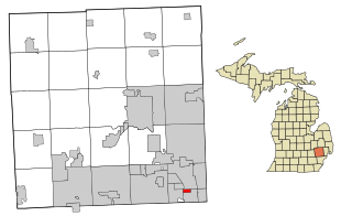
The Springwells Park Historic District is a historic residential neighborhood located in Dearborn, Michigan and bounded by Rotunda Drive, the Michigan Central Railroad line, and Greenfield and Eastham Roads. The district was listed on the National Register of Historic Places in 2015.

The Pleasant Ridge Historic District is a primarily residential historic district located in Pleasant Ridge, Michigan. The original portion of the district was listed on the National Register of Historic Places in 1992, and encompassed an area west of Woodward Avenue to Ridge Road, and running from Willington Road to the city limits of Ferndale. The boundaries of the district were increased in 2010, to include the area west of Ridge Road to the city limits of Royal Oak, Huntington Woods, Oak Park, and Ferndale.