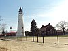
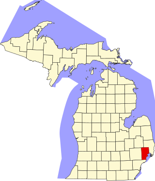
The following is a list of Registered Historic Places in St. Clair County, Michigan.
This National Park Service list is complete through NPS recent listings posted July 28, 2023. [1]
The following is a list of Registered Historic Places in St. Clair County, Michigan.
This National Park Service list is complete through NPS recent listings posted July 28, 2023. [1]
The following listings were located in St. Clair County at the time they were placed on the Register, but have since moved to other locations.
| Name on the Register | Image | Date listed | Current Location | Location when Listed | Description | |
|---|---|---|---|---|---|---|
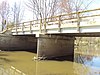
| 1 | Indian Trail Road–Belle River Bridge |  | January 28, 2000 (#00000012) | Steel Bridge Research, Inspection, Training and Engineering Center, S. Sharon Chapel Rd., West Lafayette, Indiana 40°24′31″N86°57′02″W / 40.40875°N 86.950556°W | Indian Trail Rd. over Belle River 42°46′30″N 82°32′58″W | Removed and replaced in 2008, then moved to West Lafayette, Indiana in 2015. [9] |
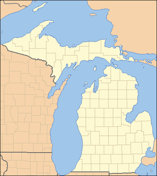
This is a list of properties on the National Register of Historic Places in the U.S. state of Michigan.
This National Park Service list is complete through NPS recent listings posted July 21, 2023.

This is a list of properties and districts in Illinois that are on the National Register of Historic Places. There are over 1,900 in total. Of these, 85 are National Historic Landmarks. There are listings in all of the state's 102 counties.
This National Park Service list is complete through NPS recent listings posted July 21, 2023.

This is a list of the National Register of Historic Places listings in Berrien County, Michigan.

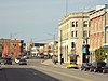
The following is a list of National Register of Historic Places listings in Lapeer County, Michigan. Lapeer County was founded in 1822 and has a current estimated population of almost 90,000. It is officially listed as part of Metro Detroit with Lapeer as a county seat.
The following is a list of Registered Historic Places in Midland County, Michigan.
This National Park Service list is complete through NPS recent listings posted July 28, 2023.
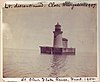
The following is a list of Registered Historic Places in Macomb County, Michigan.
This National Park Service list is complete through NPS recent listings posted July 28, 2023.

This is a list of the National Register of Historic Places listings in Sanilac County, Michigan.

This is a list of the National Register of Historic Places listings in Saginaw County, Michigan.
The following is a list of Registered Historic Places in Shiawassee County, Michigan.

This is a list of the National Register of Historic Places listings in St. Joseph County, Michigan.
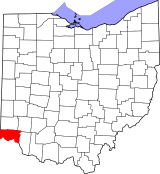
This is a list of the National Register of Historic Places listings in Hamilton County, Ohio.

This is a list of the National Register of Historic Places listings in Fairfield County, Ohio.

This is a list of the National Register of Historic Places listings in Ross County, Ohio.

This is a list of the National Register of Historic Places listings in Clermont County, Ohio.

This is a list of the National Register of Historic Places listings in Highland County, Ohio.

This is a list of the National Register of Historic Places listings in Preble County, Ohio.

This is a list of the National Register of Historic Places listings in Perry County, Ohio.

This is a list of the National Register of Historic Places listings in Tippecanoe County, Indiana.
This is a list of the National Register of Historic Places listings in Vinton County, Ohio.

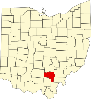
This is a list of the National Register of Historic Places listings in Union County, Ohio.
| Lists by county |
|  |
|---|---|---|
| Other lists | ||
| Topics |  | |
|---|---|---|
| Historic places in central city | ||
| Historic places by county in MSA | ||
| Historic places by county in CSA | ||
| Topics | |
|---|---|
| Lists by state |
|
| Lists by insular areas | |
| Lists by associated state | |
| Other areas | |
| Related | |