National Register of Historic Places listings in Berrien County, Michigan

Last updated

Location of Berrien County in Michigan Map of Michigan highlighting Berrien County.svg
Location of Berrien County in Michigan

This is a list of the National Register of Historic Places listings in Berrien County, Michigan.

Contents

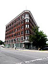
This is intended to be a complete list of the properties and districts on the National Register of Historic Places in Berrien County, Michigan, United States. Latitude and longitude coordinates are provided for many National Register properties and districts; these locations may be seen together in a map. [1]

There are 32 properties and districts listed on the National Register in the county.


    This National Park Service list is complete through NPS recent listings posted May 10, 2024. [2]

Current listings

[3] Name on the Register [4] ImageDate listed [5] Location City or townDescription
1 Avery Road-Galien River Bridge
Avery Road-Galien River Bridge Mill Road-Galien River Bridge (formerly the Avery Road-Galien River Bridge) 01.JPG
Avery Road-Galien River Bridge
December 17, 1999
(#99001577)
Avery Rd. over the Galien River
41°52′27″N86°33′17″W / 41.874167°N 86.554722°W / 41.874167; -86.554722 (Avery Road-Galien River Bridge)
Weesaw Township
2 Berrien Springs Courthouse
Berrien Springs Courthouse Barrien Springs Courthouse.jpg
Berrien Springs Courthouse
February 16, 1970
(#70000265)
Corner of Union and Cass Sts.
41°56′53″N86°20′28″W / 41.948056°N 86.341111°W / 41.948056; -86.341111 (Berrien Springs Courthouse)
Berrien Springs
3 Blossomland Bridge
Blossomland Bridge Michigan Drawbridge.jpg
Blossomland Bridge
December 17, 1999
(#99001576)
M-63 over the St. Joseph River
42°06′45″N86°28′40″W / 42.1125°N 86.477778°W / 42.1125; -86.477778 (Blossomland Bridge)
St. Joseph
4 Buchanan Downtown Historic District
Buchanan Downtown Historic District Buchanan Downtown Historic District 05.JPG
Buchanan Downtown Historic District
September 2, 2009
(#09000678)
Front Street, between 117 West and 256 East; parts of Main Street, between 108 and 210-212; and 114 N. Oak Street
41°49′39″N86°21′37″W / 41.8275°N 86.360278°W / 41.8275; -86.360278 (Buchanan Downtown Historic District)
Buchanan
5 Buchanan North and West Neighborhoods Historic District
Buchanan North and West Neighborhoods Historic District 119 Front St.jpg
Buchanan North and West Neighborhoods Historic District
November 30, 2011
(#11000863)
Roughly bounded by Main, 4th, Chippewa, W. Front, S. Detroit, Chicago, Clark, Roe, and Charles Sts.
41°49′42″N86°21′54″W / 41.828378°N 86.36495°W / 41.828378; -86.36495 (Buchanan North and West Neighborhoods Historic District)
Buchanan
6 Henry A. Chapin House
Henry A. Chapin House Henry A. Chapin House 01.JPG
Henry A. Chapin House
July 30, 1981
(#81000304)
508 E. Main St.
41°49′45″N86°15′12″W / 41.829167°N 86.253333°W / 41.829167; -86.253333 (Henry A. Chapin House)
Niles
7 Clark Equipment Company Administrative Complex
Clark Equipment Company Administrative Complex Clark Equipment Co.jpg
Clark Equipment Company Administrative Complex
March 13, 2023
(#100008725)
301-324 East Dewey St. and 204-302 North Red Bud Trail
41°49′41″N86°21′26″W / 41.828056°N 86.357222°W / 41.828056; -86.357222 (Clark Equipment Company Administrative Complex)
Buchanan
8 Eden Springs Park
Eden Springs Park House of David Eden Springs.jpg
Eden Springs Park
December 26, 2023
(#100009649)
789 M-139
42°06′12″N86°26′05″W / 42.103333°N 86.434722°W / 42.103333; -86.434722 (Eden Springs Park)
Benton Harbor
9 Rock S. Edwards Farmstead
Rock S. Edwards Farmstead Rock Edwards Farmstead.jpg
Rock S. Edwards Farmstead
July 21, 1995
(#95000868)
3503 Edwards Rd. (Sodus Pkwy.)
42°03′10″N86°22′21″W / 42.052704°N 86.372606°W / 42.052704; -86.372606 (Rock S. Edwards Farmstead)
Sodus Township
10 Fidelity Building
Fidelity Building FidelityBldg.jpg
Fidelity Building
February 14, 2002
(#02000042)
162 Pipestone St.
42°06′52″N86°27′15″W / 42.114444°N 86.454167°W / 42.114444; -86.454167 (Fidelity Building)
Benton Harbor
11 Fort St. Joseph Site
Fort St. Joseph Site Fort St. Joseph Site Niles Michigan 068.jpg
Fort St. Joseph Site
May 24, 1973
(#73000944)
Bond St. along the St. Joseph River [6]
41°48′54″N86°15′39″W / 41.815000°N 86.260833°W / 41.815000; -86.260833 (Fort St. Joseph Site)
Niles
12 Lakeside Inn
Lakeside Inn Lakeside Inn.JPG
Lakeside Inn
July 16, 2009
(#09000521)
15251 Lakeshore Rd.
41°50′49″N86°40′32″W / 41.846908°N 86.675422°W / 41.846908; -86.675422 (Lakeside Inn)
Lakeside
13 Ring Lardner House
Ring Lardner House Ring Lardner House 02.JPG
Ring Lardner House
March 16, 1972
(#72000595)
519 Bond St.
41°49′22″N86°15′17″W / 41.822778°N 86.254722°W / 41.822778; -86.254722 (Ring Lardner House)
Niles
14 Mary's City of David
Mary's City of David Mary's City of David.jpg
Mary's City of David
April 15, 2009
(#09000201)
1158 E. Britain Ave.
42°06′32″N86°25′51″W / 42.108783°N 86.430797°W / 42.108783; -86.430797 (Mary's City of David)
Benton Charter Township
15 Moccasin Bluff site
Moccasin Bluff site Moccasin Bluff Site.jpg
Moccasin Bluff site
April 13, 1977
(#77000710)
Red Bud Trail [7]
41°51′20″N86°22′00″W / 41.855556°N 86.366667°W / 41.855556; -86.366667 (Moccasin Bluff site)
Buchanan
16 Niles Downtown Historic District
Niles Downtown Historic District Main Street Niles Michigan 0024.jpg
Niles Downtown Historic District
June 21, 2007
(#07000568)
Sycamore, Main, and Cedar between Front and 5th
41°49′47″N86°15′22″W / 41.829722°N 86.256111°W / 41.829722; -86.256111 (Niles Downtown Historic District)
Niles
17 Niles Railroad Depot
Niles Railroad Depot 20020119 01 Amtrak station Niles, MI.jpg
Niles Railroad Depot
September 19, 1979
(#09000085)
598 Dey St.
41°50′14″N86°15′08″W / 41.837222°N 86.252222°W / 41.837222; -86.252222 (Niles Railroad Depot)
Niles
18 Ninth District Lighthouse Depot
Ninth District Lighthouse Depot Ninth District Lighthouse Depot.JPG
Ninth District Lighthouse Depot
December 2, 1993
(#93001348)
128 N. Pier
42°06′51″N86°29′09″W / 42.114167°N 86.485833°W / 42.114167; -86.485833 (Ninth District Lighthouse Depot)
St. Joseph
19 North Watervliet Road-Paw Paw Lake Outlet Bridge
North Watervliet Road-Paw Paw Lake Outlet Bridge NorthWatervlietRd-PawpawLakeOutlet-Bridge.jpg
North Watervliet Road-Paw Paw Lake Outlet Bridge
December 17, 1999
(#99001575)
N. Watervliet Rd. over Paw Paw Lake outlet
42°12′28″N86°15′00″W / 42.207778°N 86.25°W / 42.207778; -86.25 (North Watervliet Road-Paw Paw Lake Outlet Bridge)
Watervliet Township Demolished in 2008
20 Oak Ridge Cemetery May 8, 2024
(#100010296)
818 Terre Coupe Rd.
41°49′30″N86°22′45″W / 41.825000°N 86.379167°W / 41.825000; -86.379167 (Oak Ridge Cemetery)
Buchanan
21 Old Berrien County Courthouse Complex
Old Berrien County Courthouse Complex The Records Building of Old Berriem County Courthouse Complex.jpg
Old Berrien County Courthouse Complex
April 29, 1982
(#82004941)
Roughly bounded by Cass, Kimmel, Madison, and Union Sts.
41°56′53″N86°20′28″W / 41.948056°N 86.341111°W / 41.948056; -86.341111 (Old Berrien County Courthouse Complex)
Berrien Springs
22 Old US Post Office
Old US Post Office Old Post Office 029.jpg
Old US Post Office
September 12, 1985
(#85002152)
322 E. Main St.
41°49′46″N86°16′02″W / 41.829444°N 86.267222°W / 41.829444; -86.267222 (Old US Post Office)
Niles
23 Paine Bank
Paine Bank Paine Bank.JPG
Paine Bank
May 8, 1973
(#73000945)
1008 Oak St.
41°49′36″N86°14′52″W / 41.826667°N 86.247639°W / 41.826667; -86.247639 (Paine Bank)
Niles
24 Wendell P. and Harriet Rounds Robbins House
Wendell P. and Harriet Rounds Robbins House Round Roberts House.jpg
Wendell P. and Harriet Rounds Robbins House
May 2, 2007
(#07000385)
680 Pipestone St.
42°06′17″N86°26′38″W / 42.104722°N 86.443889°W / 42.104722; -86.443889 (Wendell P. and Harriet Rounds Robbins House)
Benton Harbor
25 Sandburg House
Sandburg House Sandburg House Front.jpg
Sandburg House
April 14, 1972
(#72001470)
Poet's Path [8]
41°53′00″N86°37′50″W / 41.883333°N 86.630550°W / 41.883333; -86.630550 (Sandburg House)
Harbert
26 Shiloh House
Shiloh House Shiloh House.jpg
Shiloh House
September 29, 1972
(#72000594)
1055 E. Britain Rd.
42°06′30″N86°25′57″W / 42.10833°N 86.4325°W / 42.10833; -86.4325 (Shiloh House)
Benton Harbor
27 South Berrien Center Union Church and Cemetery
South Berrien Center Union Church and Cemetery Union Church.jpg
South Berrien Center Union Church and Cemetery
December 12, 2002
(#02001506)
10408 M-140
41°55′46″N86°16′19″W / 41.929444°N 86.271944°W / 41.929444; -86.271944 (South Berrien Center Union Church and Cemetery)
Berrien
28 St. Joseph North Pier Inner and Outer Lights
St. Joseph North Pier Inner and Outer Lights Lighthouse Benton Harbor.jpg
St. Joseph North Pier Inner and Outer Lights
November 9, 2005
(#05001211)
On the north pier of the mouth of the St. Joseph River, 0.9 mi (1.4 km) west of the M-63 bridge
42°06′57″N86°29′32″W / 42.115833°N 86.492222°W / 42.115833; -86.492222 (St. Joseph North Pier Inner and Outer Lights)
St. Joseph
29 Union Block
Union Block Union Block 03.JPG
Union Block
August 22, 2007
(#07000746)
114 E. Front St.
41°49′37″N86°21′38″W / 41.826944°N 86.360556°W / 41.826944; -86.360556 (Union Block)
Buchanan
30 Union Meat Market
Union Meat Market Drier's Meat Market 1.jpg
Union Meat Market
September 22, 1972
(#72000596)
14 S. Elm St.
41°48′01″N86°36′38″W / 41.800139°N 86.610556°W / 41.800139; -86.610556 (Union Meat Market)
Three Oaks
31 Warren Featherbone Company Office Building
Warren Featherbone Company Office Building Warren Featherbone Company Office Building.JPG
Warren Featherbone Company Office Building
January 23, 1986
(#86000117)
3 N. Elm St.
41°48′05″N86°36′38″W / 41.801389°N 86.610556°W / 41.801389; -86.610556 (Warren Featherbone Company Office Building)
Three Oaks
32 Whitcomb Hotel
Whitcomb Hotel Whitcomb Hotel, St. Joseph, Michigan (66308).jpg
Whitcomb Hotel
November 24, 2021
(#100007206)
509 Ship St.
42°06′39″N86°28′54″W / 42.110833°N 86.481667°W / 42.110833; -86.481667 (Whitcomb Hotel)
St. Joseph
33 Zinc Collar Pad Company Building
Zinc Collar Pad Company Building Zinc Collar Pad Company Building 01.JPG
Zinc Collar Pad Company Building
July 1, 2009
(#09000472)
304 S. Oak St.
41°49′30″N86°21′40″W / 41.82489°N 86.36111°W / 41.82489; -86.36111 (Zinc Collar Pad Company Building)
Buchanan

Former listing

[3] Name on the RegisterImageDate listedDate removedLocation City or townDescription
1 Snow Flake Motel
Snow Flake Motel Abandoned William Wesley Peters motel, St. Joseph, Michigan.jpg
Snow Flake Motel
April 13, 1998
(#98000270)
May 26, 20213822 Red Arrow Highway
42°02′55″N86°30′56″W / 42.048611°N 86.515556°W / 42.048611; -86.515556 (Snow Flake Motel)
Lincoln Township Building demolished March 27, 2006 [9]

See also

Related Research Articles

<span class="mw-page-title-main">National Register of Historic Places listings in Alger County, Michigan</span>

This is a list of the National Register of Historic Places listings in Alger County, Michigan.

<span class="mw-page-title-main">National Register of Historic Places listings in Charlevoix County, Michigan</span>

This is a list of the National Register of Historic Places listings in Charlevoix County, Michigan.

<span class="mw-page-title-main">National Register of Historic Places listings in Delta County, Michigan</span>

This is a list of the National Register of Historic Places listings in Delta County, Michigan.

<span class="mw-page-title-main">National Register of Historic Places listings in Mackinac County, Michigan</span>

This is a list of the National Register of Historic Places listings in Mackinac County, Michigan.

<span class="mw-page-title-main">National Register of Historic Places listings in Sanilac County, Michigan</span>

This is a list of the National Register of Historic Places listings in Sanilac County, Michigan.

<span class="mw-page-title-main">National Register of Historic Places listings in Saginaw County, Michigan</span>

This is a list of the National Register of Historic Places listings in Saginaw County, Michigan.

<span class="mw-page-title-main">National Register of Historic Places listings in Lancaster County, Pennsylvania</span>

This is a list of the National Register of Historic Places listings in Lancaster County, Pennsylvania.

<span class="mw-page-title-main">National Register of Historic Places listings in Fayette County, Pennsylvania</span>

This is a list of the National Register of Historic Places listings in Fayette County, Pennsylvania.

<span class="mw-page-title-main">National Register of Historic Places listings in York County, Pennsylvania</span>

This is a list of the National Register of Historic Places listings in York County, Pennsylvania.

<span class="mw-page-title-main">National Register of Historic Places listings in Dauphin County, Pennsylvania</span>

This is a list of the National Register of Historic Places listings in Dauphin County, Pennsylvania.

<span class="mw-page-title-main">National Register of Historic Places listings in Beaver County, Pennsylvania</span>

This is a list of the National Register of Historic Places listings in Beaver County, Pennsylvania.

<span class="mw-page-title-main">National Register of Historic Places listings in Centre County, Pennsylvania</span>

This is a list of the National Register of Historic Places listings in Centre County, Pennsylvania.

<span class="mw-page-title-main">National Register of Historic Places listings in Greene County, Pennsylvania</span>

This is a list of the National Register of Historic Places listings in Greene County, Pennsylvania.

<span class="mw-page-title-main">National Register of Historic Places listings in Scotts Bluff County, Nebraska</span>

This is a list of the National Register of Historic Places listings in Scotts Bluff County, Nebraska.

<span class="mw-page-title-main">National Register of Historic Places listings in Porter County, Indiana</span>

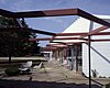
This is a list of the National Register of Historic Places listings in Porter County, Indiana.

<span class="mw-page-title-main">National Register of Historic Places listings in Hamilton County, Indiana</span>

This is a list of the National Register of Historic Places listings in Hamilton County, Indiana.

<span class="mw-page-title-main">National Register of Historic Places listings in Gibson County, Indiana</span>

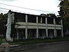
This is a list of the National Register of Historic Places listings in Gibson County, Indiana.

<span class="mw-page-title-main">National Register of Historic Places listings in Henry County, Indiana</span>

This is a list of the National Register of Historic Places listings in Henry County, Indiana.

<span class="mw-page-title-main">National Register of Historic Places listings in Posey County, Indiana</span>

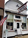
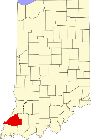
This is a list of the National Register of Historic Places listings in Posey County, Indiana.

<span class="mw-page-title-main">National Register of Historic Places listings in Gratiot County, Michigan</span>

This is a list of the National Register of Historic Places listings in Gratiot County, Michigan.

References

  1. The latitude and longitude information provided in this table was derived originally from the National Register Information System, which has been found to be fairly accurate for about 99% of listings. Some locations in this table may have been corrected to current GPS standards.
  2. National Park Service, United States Department of the Interior, "National Register of Historic Places: Weekly List Actions", retrieved May 10, 2024.
  3. 1 2 Numbers represent an alphabetical ordering by significant words. Various colorings, defined here, differentiate National Historic Landmarks and historic districts from other NRHP buildings, structures, sites or objects.
  4. "National Register Information System". National Register of Historic Places . National Park Service. April 24, 2008.
  5. The eight-digit number below each date is the number assigned to each location in the National Register Information System database, which can be viewed by clicking the number.
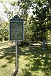
  6. Nassaney, Michael S., et al. "The Search for Fort St. Joseph (1691-1781) in Niles, Michigan". Midcontinental Journal of Archaeology 28.2 (2003): 107-144: 122.
  7. The NRIS lists the Moccasin Bluff site as "address restricted"; however, the State of Michigan has erected a historical marker at the site (Moccasin Bluff from MichMarkers.org).
  8. The NRIS gives the location of the Sandburg House as "address restricted." However, sources give the location as on "Poet's Path". The geo-coordinates are approximate.
  9. "Demolition of Snowflake Motel begins". The Herald-Palladium . 2006-03-28. p. A1. Retrieved 2012-11-20.