Pocono Pines, Pennsylvania

Last updated

Pocono Pines
Pocono Pines, PA.jpg
Aerial view of Pocono Pines at the intersection of PA 940 and PA 423
Coordinates: 41°06′54″N75°27′37″W / 41.11500°N 75.46028°W / 41.11500; -75.46028
CountryUnited States
StatePennsylvania
County Monroe
Township Tobyhanna
Area
[1]
  Total5.68 sq mi (14.71 km2)
  Land5.18 sq mi (13.43 km2)
  Water0.50 sq mi (1.29 km2)
Elevation
1,804 ft (550 m)
Population
 (2020) [2]
  Total2,007
  Density387.08/sq mi (149.45/km2)
Time zone UTC-5 (EST)
  Summer (DST) UTC-4 (EDT)
ZIP Code
18350
Area codes 570 and 272
FIPS code 42-61768

Pocono Pines is a census-designated place (CDP) in Monroe County, Pennsylvania. The population in the 2020 United States Census was 2,007, [3] an increase over the 1,409 population at the 2010 census.

Contents

Geography

Pocono Pines is located at 41°6′54″N75°27′37″W / 41.11500°N 75.46028°W / 41.11500; -75.46028 (41.114976, -75.460408). [4] According to the United States Census Bureau, the CDP has a total area of 4.4 square miles (11 km2), of which 4.0 square miles (10 km2) is land and 0.4 square miles (1.0 km2) (9.95%) is water.

History

An early postcard of the Presbyterian Young People's Conference held at Assembly Lodge in Pocono Pines Pocono Pines PA Presby Conference PHS501.jpg
An early postcard of the Presbyterian Young People's Conference held at Assembly Lodge in Pocono Pines

Pocono Pines is located in the heart of the Pocono Mountains and is home to the communities of Lake Naomi and Pinecrest Lake. Most of the land was originally owned by the Miller family. Frank C. Miller, his brother Rufus W. Miller, and others, bought lands on Tunkhannock Creek in Tobyhanna Township, Monroe County, Pennsylvania, organized a corporation known as the Pocono Spring Water Ice Company sometime in the 1890s. In September 1895, a 14-foot (4.3 m) dam was constructed across the creek and water began backing-up forming "Lake Naomi", a lake more than a mile long and about one-third of a mile wide. The Pocono Spring Water Ice Company was granted a 99-year lease for "the exclusive use of the water and its privileges." It was chartered for the purpose of "erecting a dam, for pleasure, boating, skating, fishing and the cutting, storing and selling of ice."

In 1902, visitors came from many of the surrounding metropolitan areas including New York City and Philadelphia. In the same year, the first bathing beach was created and some lots on the north side of the lake were subdivided and sold to summer cottagers. A sailing camp for girls was set up on the northwest side of the lake. A Lutheran retreat, Lutherland, was erected on the southern side of the lake. The Millers and others utilized the southern and eastern sides of the lake for swimming, sailing, skating, fishing. In 1921, a boathouse and beach were constructed on the site of today's Lake Naomi Clubhouse. In 1938, a famous Pennsylvania Supreme Court case took place over who owned the water rights to Lake Naomi, as the surrounding lands were soon owned by many different parties. See Miller v. Lutheran Conference & Camp Ass'n, 331 Pa. 241 (Pa. 1938).

In 1963, the Logan Steele family purchased 2,600 acres (11 km2) surrounding the lake which eventually was turned into a resort community called the Lake Naomi Club. Logan Steele died in the 1980s, and the club is now owned by its members and run by a board of governors. Lake Naomi Club today includes 1,400 families who own property surrounding Lake Naomi. Lake Naomi itself is a 277-acre (1.12 km2) lake with private beaches and marinas. The Club has a very active sailing organization, three pools, including a 50-meter outdoor Olympic-sized pool with a scenic view of the lake, 18 tennis courts, and full service clubhouse.

There is another community center that lies directly across from Timber Trails (a branch off Lake Naomi) that was completed and opened Memorial Day weekend of 2007 for all community members to enjoy.

Eventually, Naomi Pines was renamed Pocono Pines. Route 940 is the main thoroughfare through the village of Pocono Pines. Various businesses are located at the intersection of Route 940 and Route 423.

Demographics

Historical population
CensusPop.Note
2000 1,013
2010 1,40939.1%
2020 2,00742.4%
Sources: [5] [3]

At the 2020 census, [6] there were 2,007 people residing in the Census Designated Place. The racial makeup was 82.8% White, 4.0% African American, 2.3% Asian, 0.5% American Indian and Alaska Native, 3.7% from other races, and 6.6% from two or more races. Hispanic or Latino of any race were 9.7% of the population.

There were 477 households, of which 13.8% had children under the age of 18 living with them. 41.5% were married couples living together, 28.7% had a male householder with no spouse present, and 28.1% had a female householder with no spouse present. The average family size was 2.6. 19.5% of the population were under the age of 18, 86.1% were 18 years and above, and 39.3% were 65 and above.

The median household income was $92,626, and the median family income was $95,469. 3.1% of individuals were below the poverty line.

Related Research Articles

<span class="mw-page-title-main">Pike County, Pennsylvania</span> County in Pennsylvania, United States

Pike County is a county in the Commonwealth of Pennsylvania. It is part of Northeastern Pennsylvania. As of the 2020 census, the population was 58,535. Its county seat is Milford.

<span class="mw-page-title-main">Monroe County, Pennsylvania</span> County in Pennsylvania, United States

Monroe County is a county in the Commonwealth of Pennsylvania. It is located in Northeastern Pennsylvania, and includes the Pocono Mountains. As of the 2020 census, the population was 168,327. Its county seat is Stroudsburg.

<span class="mw-page-title-main">Carbon County, Pennsylvania</span> County in Pennsylvania, United States

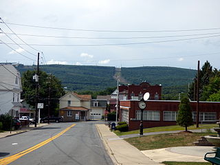
Carbon County is a county in the Commonwealth of Pennsylvania. It is located in Northeastern Pennsylvania. As of the 2020 census, the population was 64,749. The county is also part of Pennsylvania's Coal Region.

<span class="mw-page-title-main">Olympia Heights, Florida</span> Census-designated place in Florida

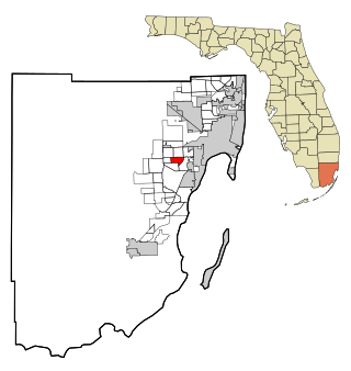
Olympia Heights is a census-designated place in Miami-Dade County, Florida, United States. It is located in the Miami metropolitan area of South Florida. The population was 12,873 at the 2020 census.

<span class="mw-page-title-main">Lake Carmel, New York</span> Census-designated place in New York, United States

Lake Carmel is a hamlet and census-designated place in the town of Kent in Putnam County, New York, United States. The home of over half of the town of Kent's population of 8,282, the hamlet is centered around Lake Carmel, a 1.6 mile long manmade lake in the southeastern corner of the township and just north of hamlet of Carmel within the town of Carmel.

<span class="mw-page-title-main">East Side, Pennsylvania</span> Borough in Pennsylvania, United States

East Side is a borough in Carbon County, Pennsylvania. It is part of Northeastern Pennsylvania. The population was 317 at the 2010 census.

<span class="mw-page-title-main">Kidder Township, Pennsylvania</span> Place in Pennsylvania, United States

Kidder Township is a township in Carbon County, Pennsylvania. It is part of Northeastern Pennsylvania. The population was 1,935 at the 2010 census, up from 1,185 at the 2000 census.

<span class="mw-page-title-main">Jessup, Pennsylvania</span> Borough in Pennsylvania, United States

Jessup is a borough in Lackawanna County, Pennsylvania, United States. The population was 4,532 at the 2020 census.

<span class="mw-page-title-main">Moscow, Pennsylvania</span> Borough in Pennsylvania, United States

Moscow is a borough in Lackawanna County, Pennsylvania, United States. The population was 2,039 at the 2020 census. It is located 11 miles (18 km) southeast of Scranton and 24 miles (39 km) southwest of Honesdale.

<span class="mw-page-title-main">East Stroudsburg, Pennsylvania</span> Borough in Pennsylvania, United States

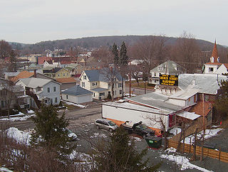
East Stroudsburg is a borough in Monroe County, Pennsylvania, and part of the Pocono Mountains region of the state. Originally known as Dansbury, East Stroudsburg was renamed for geographic reasons when the Delaware, Lackawanna, and Western Railroad opened a station in East Stroudsburg. Despite its name being derivative of its bordering borough, Stroudsburg, it has almost twice the population.

<span class="mw-page-title-main">Mount Pocono, Pennsylvania</span> Place in Pennsylvania, United States

Mount Pocono is a borough in Monroe County, Pennsylvania. It is located nearly centered in the southernmost county of five in the northeastern corner that are part of the Pocono Mountains. The borough serves as a local highway nexus, and sees a lot of tourist traffic making use of resources in the region. As of the 2020 census, the borough population was 3,083 residents.

<span class="mw-page-title-main">Tobyhanna Township, Pennsylvania</span> Place in Pennsylvania, United States

Tobyhanna Township is a township in Monroe County, Pennsylvania, United States. The population was 8,290 at the 2020 census. Tobyhanna Township has Tobyhanna Elementary Center and Locust Lake Village.

<span class="mw-page-title-main">Lehman Township, Pike County, Pennsylvania</span> Township in Pennsylvania, United States

Lehman Township is a township in Pike County, Pennsylvania, United States. The population was 10,843 at the 2020 census.

<span class="mw-page-title-main">Ulysses Township, Pennsylvania</span> Township in Pennsylvania, United States

Ulysses Township is a township in Potter County, Pennsylvania, United States. As of the 2020 census, the township population was 647. There are two Pennsylvania state parks in Ulysses Township. Denton Hill State Park is a ski resort along U.S. Route 6. Lyman Run State Park is in the southern part of the township and is partially in neighboring West Branch Township. Its population includes extreme white supremacy groups, and has done so for about 100 years.

<span class="mw-page-title-main">Pine Grove, Schuylkill County, Pennsylvania</span> Borough in Pennsylvania, United States

Pine Grove is a borough in Schuylkill County, Pennsylvania, United States. As of the 2020 census, the borough population was 2,054.

<span class="mw-page-title-main">Hawley, Pennsylvania</span> Borough in Pennsylvania, United States

Hawley is a borough on the Lackawaxen River in Wayne County, Pennsylvania, United States. The borough's population was 1,229 at the time of the 2020 United States Census.

<span class="mw-page-title-main">Pine Mountain Lake, California</span> Census-designated place in California, United States

Pine Mountain Lake (PML) is a private gated community and a census-designated place (CDP) in Tuolumne County, California. It is located 0.8 miles (1.3 km) north and east of Groveland. Pine Mountain Lake sits at an elevation of 2,795 feet (852 m). The 2010 United States census reported Pine Mountain Lake's population was 2,796.

<span class="mw-page-title-main">Pocono Summit, Pennsylvania</span> Census-designated place in Pennsylvania, United States

Pocono Summit is an unincorporated community and census-designated place that is located in Monroe County, Pennsylvania. Parts of Pocono Summit are located in the municipalities of Coolbaugh and Tobyhanna townships.

Hickory Hills is a census-designated place (CDP) in Foster Township, Luzerne County, Pennsylvania, southwest of the borough of White Haven. The CDP population was 562 at the 2010 census.

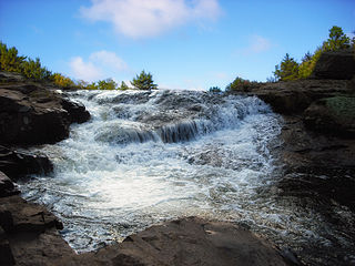
Lake Naomi is a 277-acre (1.12 km2) lake with private beaches and marinas located in Pocono Pines, Pennsylvania in the Pocono Mountains of Northeastern Pennsylvania. The community of Lake Naomi Club is a resort community that includes 1,400 families who own property surrounding Lake Naomi.

References

  1. "ArcGIS REST Services Directory". United States Census Bureau. Retrieved October 16, 2022.
  2. "Census Population API". United States Census Bureau. Retrieved October 12, 2022.
  3. 1 2 Bureau, US Census. "Search Results". The United States Census Bureau. Retrieved January 1, 2023.
  4. "US Gazetteer files: 2010, 2000, and 1990". United States Census Bureau. February 12, 2011. Retrieved April 23, 2011.
  5. "U.S. Census website". United States Census Bureau . Retrieved January 31, 2008.
  6. "U.S. Census Bureau" . Retrieved November 8, 2020.