The division of the country into provinces is laid down in the constitution (Title I, Section II, Article 5)[1] and enacted by law. The latter is currently Law 5220 on the Territorial Division of the Dominican Republic (Ley No. 5220 sobre División Territorial de la República Dominicana), issued 1959 and frequently amended to create new provinces and lower-level administrative units.
The provinces as administrative divisions
The provinces are the first-level administrative subdivisions of the country. The headquarters of the central government's regional offices are normally found in the capital cities of provinces. The president appoints an administrative governor (Gobernador Civil) for each province but not for the Distrito Nacional (Title IX of the constitution).[1]
The provinces are divided into municipalities (municipios), which are the second–level political and administrative subdivisions of the country.[1]
The Distrito Nacional was created in 1936. Prior to this, the Distrito Nacional was the old Santo Domingo Province, in existence since the country's independence in 1844. It is not to be confused with the new Santo Domingo Province, which split off from it in 2001. While it is similar to a province in many ways, the Distrito Nacional differs in its lack of an administrative governor and consisting only of one municipality, Santo Domingo, the city council (ayuntamiento) and mayor (síndico) which are in charge of its administration.[2]
The provinces as constituencies
The provinces are also constituencies for the elections to the bicameralNational Congress (Congreso de la República). Each province elects one member of the Senate (Senado) and a guaranteed minimum of two members of the Chamber of Deputies (Cámara de Diputados).[1][3]
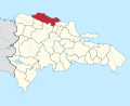
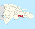
Statistics
The following is a table of the provinces and their capital cities. The population figures are from the 2021 population estimate.[4]
↑ "Oficina Nacional de Estadística". Estimaciones y proyecciones de la población total por año calendario, según región y provincia, 2000–2030. Archived from the original on 2 January 2017. Retrieved 31 December 2016.
This page is based on this Wikipedia article Text is available under the CC BY-SA 4.0 license; additional terms may apply. Images, videos and audio are available under their respective licenses.