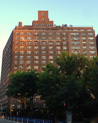
Harlem is a neighborhood in Upper Manhattan, New York City. It is bounded roughly by the Hudson River on the west; the Harlem River and 155th Street on the north; Fifth Avenue on the east; and Central Park North on the south. The greater Harlem area encompasses several other neighborhoods and extends west and north to 155th Street, east to the East River, and south to Martin Luther King Jr. Boulevard, Central Park, and East 96th Street.

Long Island City (LIC) is a residential and commercial neighborhood on the extreme western tip of Queens, a borough in New York City in the United States. It is bordered by Astoria to the north; the East River to the west; New Calvary Cemetery in Sunnyside to the east; and Newtown Creek—which separates Queens from Greenpoint, Brooklyn—to the south.

Murray Hill is a neighborhood on the east side of Manhattan in New York City. Murray Hill is generally bordered to the east by the East River or Kips Bay and to the west by Midtown Manhattan, though the exact boundaries are disputed. Murray Hill is situated on a steep glacial hill that peaked between Lexington Avenue and Broadway. It was named after Robert Murray, the head of the Murray family, a mercantile family that settled in the area in the 18th century.
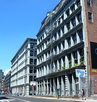
SoHo, sometimes written Soho, is a neighborhood in Lower Manhattan, New York City. Since the 1970s, the neighborhood has been the location of many artists' lofts and art galleries, and has also been known for its variety of shops ranging from trendy upscale boutiques to national and international chain store outlets. The area's history is an archetypal example of inner-city regeneration and gentrification, encompassing socioeconomic, cultural, political, and architectural developments.

Morningside Heights is a neighborhood on the West Side of Upper Manhattan in New York City. It is bounded by Morningside Drive to the east, 125th Street to the north, 110th Street to the south, and Riverside Drive to the west. Morningside Heights borders Central Harlem and Morningside Park to the east, Manhattanville to the north, the Manhattan Valley section of the Upper West Side to the south, and Riverside Park to the west. Broadway is the neighborhood's main thoroughfare, running north–south.

The East Village is a neighborhood on the East Side of Lower Manhattan in New York City, United States. It is roughly defined as the area east of the Bowery and Third Avenue, between 14th Street on the north and Houston Street on the south. The East Village contains three subsections: Alphabet City, in reference to the single-letter-named avenues that are located to the east of First Avenue; Little Ukraine, near Second Avenue and 6th and 7th Streets; and the Bowery, located around the street of the same name.

The Upper West Side (UWS) is a neighborhood in the borough of Manhattan in New York City. It is bounded by Central Park on the east, the Hudson River on the west, West 59th Street to the south, and West 110th Street to the north. The Upper West Side is adjacent to the neighborhoods of Hell's Kitchen to the south, Columbus Circle to the southeast, and Morningside Heights to the north.
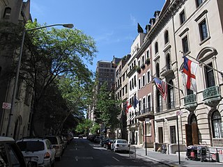
The Upper East Side, sometimes abbreviated UES, is a neighborhood in the borough of Manhattan in New York City, bounded by 96th Street to the north, the East River to the east, 59th Street to the south, and Central Park and Fifth Avenue to the west. The area incorporates several smaller neighborhoods, including Lenox Hill, Carnegie Hill, and Yorkville. Once known as the Silk Stocking District, it has long been the most affluent neighborhood in New York City.

Greenpoint is the northernmost neighborhood in the New York City borough of Brooklyn, in the U.S. state of New York. It is bordered on the southwest by Williamsburg at Bushwick Inlet Park and McCarren Park; on the southeast by the Brooklyn–Queens Expressway and East Williamsburg; on the north by Newtown Creek and the neighborhood of Long Island City in Queens; and on the west by the East River. The neighborhood has a large Polish immigrant and Polish-American community, containing many Polish restaurants, markets, and businesses, and it is often referred to as Little Poland.

Erasmus Hall High School was a four-year public high school located at 899–925 Flatbush Avenue between Church and Snyder Avenues in the Flatbush neighborhood of the New York City borough of Brooklyn. It was founded in 1786 as Erasmus Hall Academy, a private institution of higher learning named for the scholar Desiderius Erasmus, known as Erasmus of Rotterdam, a Dutch Renaissance humanist and Catholic Christian theologian. The school was the first secondary school chartered by the New York State Regents. The clapboard-sided, Georgian-Federal-style building, constructed on land donated by the Flatbush Reformed Dutch Church, was turned over to the public school system in 1896.
Hamilton Heights is a neighborhood in the northern part of Manhattan in New York City. It is the northernmost part of the West Harlem area, along with Manhattanville and Morningside Heights to its south, and it contains the sub-neighborhood and historic district of Sugar Hill. Washington Heights lies to Hamilton Heights' north, and to its east is Central Harlem.

Manhattanville is a neighborhood in the New York City borough of Manhattan bordered on the north by 135th Street; on the south by 122nd and 125th Streets; on the west by Hudson River; and on the east by Adam Clayton Powell Jr. Boulevard and the campus of City College.
The West Village is a neighborhood in the western section of the larger Greenwich Village neighborhood of Lower Manhattan, New York City. The West Village is bounded by the Hudson River to the west and 14th Street to the north. The eastern boundary is variously cited as Greenwich Avenue, Seventh Avenue, or Sixth Avenue, while the southern boundary is either Houston Street or Christopher Street.

Grace Church is a historic parish church in Manhattan, New York City which is part of the Episcopal Diocese of New York. The church is located at 800–804 Broadway, at the corner of East 10th Street, where Broadway bends to the south-southeast, bringing it in alignment with the avenues in Manhattan's grid. Grace Church School and the church houses—which are now used by the school—are located to the east at 86–98 Fourth Avenue between East 10th and 12th Streets. In 2021, it reported 1,038 members, average attendance of 212, and $1,034,712 in plate and pledge income.

Charles B. J. Snyder was an American architect, architectural engineer, and mechanical engineer in the field of urban school building design and construction. He is widely recognized for his leadership, innovation, and transformation of school building construction process, design, and quality during his tenure as Superintendent of School Buildings for the New York City Board of Education between 1891 and 1923.


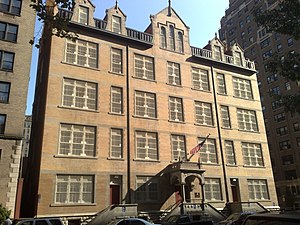
The Wadleigh High School for Girls, which was established by the NYC Board of Education in 1897 and moved into its new building in Harlem in September 1902 It was the first public high school for girls in New York City. At the time, public secondary education for girls was considered highly novel and perhaps a bit scandalous. Newspapers considered it newsworthy enough to devote many stories to describing classroom scenes of girls receiving “higher” education. The building is now shared among several schools including the Wadleigh Secondary School for the Performing and Visual Arts, the Frederick Douglass Academy II, and Success Academy Harlem West.
Public School 9 and Public School 9 Annex are two historic school buildings located at 227 and 279 Sterling Place, respectively, at Vanderbilt Avenue in the Prospect Heights neighborhood of Brooklyn, New York City.
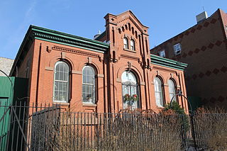
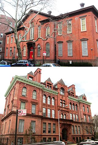
Colored School No. 3 (Former) is an historic public school building and New York City designated landmark located in Williamsburg neighborhood of Brooklyn. It was built in 1879 for the exclusive use of African-American students, and although the school closed in 1934, the building is the only one of its kind still standing in Brooklyn. It is modest in size, just 46 feet wide by 75 feet deep, and has an ornate facade in the Romanesque Revival style, principally of red brick with brownstone trim.