Puente Piedra District

Last updated
Stone Bridge District
Distrito de Puente Piedra (Spanish)
Puentepiedra3.jpg
COA Puente Piedra District in Lima Province.png
Map of Lima highlighting Puente Piedra.PNG
Location of Puente Piedra in Lima
Country Flag of Peru.svg  Peru
Region Lima
Province Lima
FoundedFebruary 14, 1927
Government
   Mayor Rennán Espinoza
(2019-2026)
Area
  Total71.18 km2 (27.48 sq mi)
Population
 (2023) [1]
  Total416,531
Time zone UTC-5 (PET)
UBIGEO 150125
Website munipuentepiedra.gob.pe

The Peruvian district of Puente Piedra is one of the 43 districts in the Lima Province. It is located in the north of the city.

Contents

History

In the era of the Inca Empire, in the government of Topa Inca Yupanqui, after conquering the coastal town of the Chillón river valley, he ordered the construction of bridges and roads in order to facilitate the passage of the Imperial Army to strengthen the expansion of Tahuantinsuyo. It is in this way that a very large stone appears on the ditch that was located on the area where the district capital is located today, which at the time of the Inca era was used to cross the swamps, which allowed taking the roads through the hills to Tambo Inga and continuing to La Ensenada to cross the Chillón River by the Inca bridge.

When the Incas found out about the proximity of the Spanish, they destroyed the bridges and roads; the big stone ended up at the bottom of the ditch.

The Inca bridge of La Ensenada was rebuilt in the Viceroyalty and blown up in 1998 due to the El Niño Phenomenon.

As the swamps dried up, the dry part was covered with grass; This gave rise to Doña Francisca de Aguilar, at that time owner of Copacabana, to buy the gramadales. For those moments the famous stone continued to provide its bridge service even though the step was made from, jump to jump; because the swamps prevented the passage on the other side, for this reason, this swampy and uninhabited area took the name of "Puente Piedra" in Republican times and when the haciendas required a greater number of workers for cotton and sugar cane crops. In the year 1870, the railway from Lima to Ancón was built, and a station was built in the area, which was called "Puente Piedra Station". Around it a hamlet was formed and its agricultural inhabitants dried up the swamps and turned the grasslands into productive areas.

In 1906, the Italian Tomás Marsano appeared, asking the Peruvian government to grant the gramadales under the pretext of an irrigation project. His opponent was, at this time, Rigoberto Molina, owner of Copacabana. Marsano, for his part, insisted on claiming ownership of those lands, which were to the west of the Copacabana hacienda, despite knowing that the land had belonged to the Municipality of Lima since the viceroyalty. The inhabitants confront Tomás Marsano through a judicial process, taking refuge in the possession of the land, which with great effort they managed to put at the service of agriculture.

In 1918, Tomás Marsano legally bought the Copacabana farm and trying to take full possession, Marsano lashes out at the peaceful farmers trying to evict them or impose abusive charges. After that, the inhabitants prevented Tomás Marsano from taking possession and on January 20, 1921 they created the "Society of Puente Piedra Community Members", and later, directed by Juan Lecaros, the Community prosecuted Marsano. In 1922, during the Leguía's Oncenium, the struggle achieved the most resounding triumph: the expropriation law of the Puente Piedra land was promulgated, declaring those who currently own it the owners.

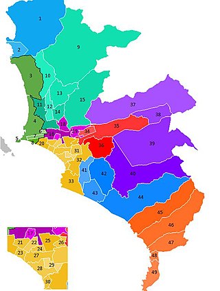
The district was founded on February 14, 1927 by Law No. 5675, segregating itself from the old Carabayllo District. In this way, the Carabayllo District loses its most important homestead, the maritime strip of Ventanilla, the train station, the sugar mill and various haciendas.

Later, until the 60's, the city of Ventanilla was founded in the western part, which finally in the Revolutionary Government of the Armed Forces in 1969 created the Ventanilla District in Lima, but days after it was included within the Constitutional Province of Callao, losing more half of its initial territory.

Economy

After the 'boom' of private and foreign investment in Independencia, San Martin de Porres, Los Olivos and Comas, the Puente Piedra district is now added. which is ready to be rediscovered as a social district, tourist attraction and commercial opportunity that is projected and is on its way to being one of the most developed districts of Cono Norte. In the lower part of the district there is an area full of recreation areas, swimming pools and compestres. In the center is the market area such as Huamantanga and Tres Regiones. In the Zapallal area there is a large amount of commerce as well as in the capital and the road to San Pedro de Carabayllo. The "FAMESA" fuse and explosives factory is located in the central area, which continues to operate despite the incidents in 1980 (big explosion), 1983 and 2009. And in the southern area there are also various cemeteries such as Campo Fe and Parque del Recuerdo.

Coat of arms

Geography

It has an area of 71.18 square kilometers and a population of more than 200,000.

Boundaries

See also

Related Research Articles

<span class="mw-page-title-main">Lima</span> Capital and largest city of Peru

Lima is the capital and largest city of Peru. It is located in the valleys of the Chillón, Rímac and Lurín Rivers, in the desert zone of the central coastal part of the country, overlooking the Pacific Ocean. The city is considered the political, cultural, financial and commercial center of Peru. Due to its geostrategic importance, the Globalization and World Cities Research Network has categorized it as a "beta" tier city. Jurisdictionally, the metropolis extends mainly within the province of Lima and in a smaller portion, to the west, within the Constitutional Province of Callao, where the seaport and the Jorge Chávez Airport are located. Both provinces have regional autonomy since 2002.

<span class="mw-page-title-main">Pueblos jóvenes</span> Shanty town of Peru

Pueblos jóvenes is the term used for the shanty towns that surround Lima and other cities of Peru. Many of these towns have developed into districts of Lima such as Comas, Los Olivos and Villa El Salvador.

<span class="mw-page-title-main">Lima metropolitan area</span> Place in Peru

The Lima Metropolitan Area is an area formed by the conurbation of the Peruvian provinces of Lima and Callao. It is the largest of the metropolitan areas of Peru, the seventh largest in the Americas, the fourth largest in Latin America, and among the thirty largest in the world. The conurbation process started to be evident in the 1980s.

<span class="mw-page-title-main">Ancón District</span> District in Lima, Peru

Ancon is a district of northern Lima Province in Peru. It is the popular beach resort of Lima that is visited every summer by millions of people from Lima. Is the largest district of the Lima Province.

<span class="mw-page-title-main">Rímac District</span> District in Lima, Peru

Rímac is a district in the Lima Province, Peru. It lies directly to the north of downtown Lima, to which it is connected by six bridges over the Rímac River. The district also borders the Independencia, San Martín de Porres, and San Juan de Lurigancho districts. Vestiges of Lima's colonial heyday remain today in an area of the Rímac district known as the Historic centre of Lima, which was declared a UNESCO World Heritage Site in 1988. Downtown Rímac District has, like its southern counterpart, its eastern and western sides divided by Jirón Trujillo, which connects to Lima District's Jirón de la Unión through the Puente de Piedra, the oldest bridge in the whole city. Rímac's East side features the Plaza de Acho, the most famous bullfighting arena in South America and one of the most well known in the world.

<span class="mw-page-title-main">San Martín de Porres District</span> District in Lima, Peru

San Martín de Porres (SMP) is a district in Lima, Peru, located in the north area of the city. It is bordered by the Chillón River, marks its natural border with Ventanilla and Puente Piedra on the north; Callao on the west; Los Olivos, Comas on the northeast; Rímac and Independencia districts on the east; the Rímac River marks its natural border with Lima District and Carmen de la Legua Reynoso on the south. It is the second most populated district of Lima metropolitan area and Peru.

<span class="mw-page-title-main">Callao District</span> District in Callao, Peru

Callao is one of the seven districts of the Constitutional Province of Callao in the Callao Region, Peru. The Chillón River marks the district's northern border with Ventanilla. On the east, the Callao district is bordered by the Carmen de la Legua-Reynoso as well as the Lima Province's districts of San Martín de Porres and Lima. The Bellavista and the La Perla districts are located to the southeast, while La Punta borders the district on the west. The Pacific Ocean borders the province on the west and south. At 1956, it expanded to the north, encompassing latifunds, lands and estates that belonged to the San Martín de Porres District and the Carabayllo district. During this expansion, the Jorge Chávez International Airport is built.

<span class="mw-page-title-main">Ventanilla District</span> District in Callao, Peru

Ventanilla is a district of the Constitutional Province of Callao in Peru, and one of the seven districts that comprise the port city of Callao. Covering more than half of the province's territory, it is Callao's largest district.

<span class="mw-page-title-main">Comas District, Lima</span> District in Lima, Peru

The district of Comas is one of the forty-three districts that make up the province of Lima, located in the department of the same name, in Perú. It is located in the north area of the city. It is one of the most populous districts in Lima.

<span class="mw-page-title-main">Los Olivos District</span> District in Lima, Peru

Los Olivos is a district of the Lima Province in Peru. Is a District of the Cono Norte area in the city of Lima.

<span class="mw-page-title-main">Independencia District, Lima</span> District in Lima, Peru

Independencia is a district of the Lima Province in Peru. It is located in the north area of the city.

A Peruvian postal code is a five-digit string that comprises part of a postal address in Peru. Prior to 2011, only the major cities of Lima and Callao used postal codes. However, in February 2011 a nationwide system was implemented which employs a five-digit numeric format. Similar to the postal codes of Mexico, Brazil, Australia, the United States, and elsewhere, postal codes in Peru are strictly numerical, using only numbers.

<span class="mw-page-title-main">Carabayllo District</span> District in Lima, Peru

Carabayllo is one of the 43 districts of the province Lima in Peru. It is located in the Cono Norte area of the province and was created district by General José de San Martín in August 4, 1821 at which time it was the only district to occupy the area north of the Rímac River up to the province Canta.

<span class="mw-page-title-main">Cono Norte</span> Sector in Lima, Peru

The Cono Norte is one of the five areas that make up the Lima Metropolitan Area. It is located in the northern part of the metropolis, hence its name. The socioeconomic levels of its residents are varied. The districts of Ancón and Santa Rosa are the popular beach resorts for wealthier residents of Lima. The rest of the population comprises middle class and lower class residents. It is one of the most populated areas of Peru.

Chivateros is a prehistoric stone tool quarry and associated workshop located near the mouth of the Chillón river in the Ventanilla District, northwest of Lima, Peru.

The Judicial District of Cono Norte is one of the 28 Judicial Districts of the Judicial System of Peru.

The Judicial District of Lima is one of the 28 Judicial Districts of the Judicial System of Peru.

<span class="mw-page-title-main">Chancay District, Huaral</span> District in Lima, Peru

Chancay District is one of twelve districts of the province Huaral in Peru.

Public transport in Lima is handled by buses, micros, taxicabs, and mototaxis. Micros are the most common means of public transportation in Lima and many other cities in Peru. There are also more than 100 kilometres (62 mi) of cycle paths in the city.

<span class="mw-page-title-main">Ancon (archaeological site)</span> Archaeological site in Peru

Ancon (archaeological site) is located in the north of the Bay of Ancon, in the Ancón District, on the central coast of Peru. It is one of the most important centers of the Peruvian archeology and features a vast necropolis of the pre-Hispanic era, with countless funerary sites. Permanent occupation in Ancon is documented throughout all periods of Andean history. The oldest evidence of human occupation dates back 10,000 years ago to the preceramic period.

References

  1. "Estadística Poblacional - Ministerio de Salud del Perú".

11°52′30″S77°03′55″W / 11.87500°S 77.06528°W / -11.87500; -77.06528