Rantoul, Wisconsin

Last updated

Rantoul, Wisconsin
Rantoul WI Town Hall.jpg
Town hall
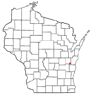
WIMap-doton-Rantoul.png
Location of Rantoul, Wisconsin
Coordinates: 44°6′23″N88°5′53″W / 44.10639°N 88.09806°W / 44.10639; -88.09806
Country Flag of the United States.svg  United States
State Flag of Wisconsin.svg  Wisconsin
County Calumet
Area
  Total32.4 sq mi (83.8 km2)
  Land31.9 sq mi (82.6 km2)
  Water0.5 sq mi (1.2 km2)
Elevation
[1]
843 ft (257 m)
Population
 (2010)
  Total798
  Density25/sq mi (9.7/km2)
Time zone UTC-6 (Central (CST))
  Summer (DST) UTC-5 (CDT)
Area code 920
FIPS code 55-66275 [2]
GNIS feature ID1583998 [1]
Website www.townofrantoul.com

Rantoul is a town in Calumet County in the U.S. state of Wisconsin. The population was 798 at the 2010 census. [3] The unincorporated community of Wells is located partially in the town.

Contents

Geography

The Town of Rantoul is located in northeastern Calumet County. It is bordered by Manitowoc County to the east. The village of Potter is in the center of the town but is a separate municipality, and the village of Hilbert touches the town's northwestern border. According to the United States Census Bureau, the town has a total area of 32.4 square miles (83.8 km2), of which 31.9 square miles (82.6 km2) is land and 0.46 square miles (1.2 km2), or 1.40%, is water. [3]

Demographics

As of the census [2] of 2000, there were 841 people, 261 households, and 222 families residing in the town. The population density was 25.9 people per square mile (10.0/km2). There were 267 housing units at an average density of 8.2 per square mile (3.2/km2). The racial makeup of the town was 96.79% White, 0.83% Native American, 0.83% Asian, and 1.55% from two or more races. Hispanic or Latino of any race were 0.12% of the population.

There were 261 households, out of which 45.6% had children under the age of 18 living with them, 74.3% were married couples living together, 6.1% had a female householder with no husband present, and 14.9% were non-families. 10.3% of all households were made up of individuals, and 3.8% had someone living alone who was 65 years of age or older. The average household size was 3.22 and the average family size was 3.49.

In the town, the population was spread out, with 33.8% under the age of 18, 6.5% from 18 to 24, 31.5% from 25 to 44, 20.0% from 45 to 64, and 8.2% who were 65 years of age or older. The median age was 34 years. For every 100 females, there were 104.1 males. For every 100 females age 18 and over, there were 107.1 males.

The median income for a household in the town was $48,000, and the median income for a family was $50,893. Males had a median income of $35,917 versus $23,214 for females. The per capita income for the town was $18,316. About 2.9% of families and 3.1% of the population were below the poverty line, including 4.0% of those under age 18 and none of those age 65 or over.

Notable people

Related Research Articles

<span class="mw-page-title-main">Paragon, Indiana</span> Town in Indiana, United States

Paragon is a town in Ray Township, Morgan County, in the U.S. state of Indiana. The population was 556 at the 2020 census, down from 659 in 2010.

<span class="mw-page-title-main">Calumet, Iowa</span> City in Iowa, United States

Calumet is a city in O'Brien County, Iowa, United States. The population was 146 at the 2020 census.
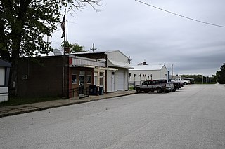
<span class="mw-page-title-main">Rantoul, Kansas</span> City in Franklin County, Kansas

Rantoul is a city in Franklin County, Kansas, United States. As of the 2020 census, the population of the city was 165.

Stoneham is a town in Oxford County, Maine, United States. The population was 261 at the 2020 census.

<span class="mw-page-title-main">Calumet, Minnesota</span> City in Minnesota, United States

Calumet is a city in Itasca County, Minnesota, United States. The population was 367 at the 2010 census.
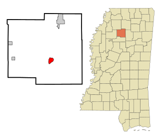
<span class="mw-page-title-main">Coffeeville, Mississippi</span> Town in Mississippi, United States

Coffeeville is a town in and one of two county seats of Yalobusha County, Mississippi, United States. The population was 905 at the 2010 census. It is named after John Coffee (1772–1833), a planter and military leader. The minor American Civil War Battle of Coffeeville took place near here in December 1862.

<span class="mw-page-title-main">Calumet, Oklahoma</span> Town in Oklahoma, United States

Calumet is a town in Canadian County, Oklahoma, United States. It is part of the Oklahoma City Metropolitan Area. The population was 507 at the 2010 census, a 5.23 percent decrease since 2000.

<span class="mw-page-title-main">Mount Pleasant Township, Westmoreland County, Pennsylvania</span> Township in Pennsylvania, United States

Mount Pleasant Township is a township in Westmoreland County, Pennsylvania, United States. As of the 2020 census, the township population was 10,119. Mount Pleasant Township should not be confused with the Borough of Mount Pleasant, which is a separate municipality and comprises the town of that name.

<span class="mw-page-title-main">Brothertown, Wisconsin</span> Town in Wisconsin, United States

Brothertown is a town in Calumet County in the U.S. state of Wisconsin. The population was 1,329 at the 2010 census. The unincorporated communities of Brothertown, Charlesburg, Eckers Lakeland, Jericho, and Maple Heights are located in the town. The unincorporated community of Calumetville is also located partially in the town.
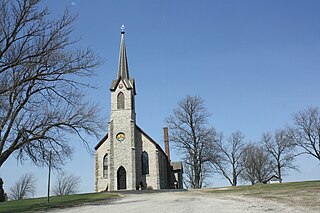
<span class="mw-page-title-main">Charlestown, Wisconsin</span> Town in Wisconsin, United States

Charlestown is a town in Calumet County in the U.S. state of Wisconsin. The population was 775 at the 2010 census. The unincorporated community of Hayton is located in the town.

<span class="mw-page-title-main">Woodville, Calumet County, Wisconsin</span> Town in Wisconsin, United States

Woodville is a town in Calumet County in the U.S. state of Wisconsin. The population was 980 at the 2010 census. The unincorporated communities of Dundas and St. John are located in the community.

Sherwood is a town in Clark County in the U.S. state of Wisconsin. The population was 252 at the 2000 census. The unincorporated community of Nevins is located in the town.
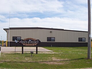
<span class="mw-page-title-main">Calumet, Wisconsin</span> Town in Wisconsin, United States

Calumet is a town in Fond du Lac County, Wisconsin, United States. The population was 1,514 at the 2000 census. The unincorporated communities of Artesia Beach, Calumet Harbor, Garnet, Highland Park, Johnsburg, Laudolff Beach, Marytown, Pipe, Pukwana Beach, Winnebago Heights, and Winnebago Park are located within the town. The unincorporated community of Calumetville is located partially in the town.

<span class="mw-page-title-main">Marshfield, Fond du Lac County, Wisconsin</span> Town in Wisconsin, United States

Marshfield is a town in Fond du Lac County, Wisconsin, United States. The population was 1,118 at the 2000 census. The unincorporated communities of Calvary and St. Joe are located in the town. The unincorporated community of Malone is also located partially in the town.

<span class="mw-page-title-main">Brillion (town), Wisconsin</span>

Brillion is a town in Calumet County in the U.S. state of Wisconsin. The population was 1,486 at the 2010 census.

<span class="mw-page-title-main">Chilton (town), Wisconsin</span>

Chilton is a town in Calumet County in the U.S. state of Wisconsin. The population was 1,143 at the 2010 census. The City of Chilton is located partially within the town. The unincorporated community of Brant is located in the town.
<span class="mw-page-title-main">New Holstein (town), Wisconsin</span>

New Holstein is a town in Calumet County in the U.S. state of Wisconsin. The population was 1,508 at the 2010 census. The City of New Holstein is located in the town, but the two are politically independent. The unincorporated communities of Meggers and St. Anna are located partially in the town.

<span class="mw-page-title-main">Stockbridge (town), Wisconsin</span> Town in Wisconsin, United States

Stockbridge is a town in Calumet County, Wisconsin. The population was 1,456 at the time of the 2010 census. The village of Stockbridge, and the unincorporated communities of Kloten, Quinney, and Saint Catherines Bay are located within the town.
<span class="mw-page-title-main">Calumet Township, Cook County, Illinois</span> Township in Illinois, United States

Calumet Township is one of 29 townships in Cook County, Illinois, United States. As of the 2020 census, its population was 18,609 and it contained 8,210 housing units.

<span class="mw-page-title-main">Rantoul Township, Champaign County, Illinois</span> Township in Illinois, United States

Rantoul Township is a township in Champaign County, Illinois, USA. As of the 2020 census, its population was 10,705 and it contained 4,778 housing units.

References

  1. 1 2 "US Board on Geographic Names". United States Geological Survey. October 25, 2007. Retrieved January 31, 2008.
  2. 1 2 "U.S. Census website". United States Census Bureau . Retrieved January 31, 2008.
  3. 1 2 "Geographic Identifiers: 2010 Demographic Profile Data (G001): Rantoul town, Calumet County, Wisconsin". U.S. Census Bureau, American Factfinder. Retrieved September 9, 2015.[ dead link ]