Related Research Articles

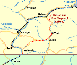
Nelson is a city located in the Selkirk Mountains on the West Arm of Kootenay Lake in the Southern Interior of British Columbia, Canada. Known as "The Queen City", and acknowledged for its impressive collection of restored heritage buildings from its glory days in a regional silver rush, Nelson is one of the three cities forming the commercial and population core of the West Kootenay region, the others being Castlegar and Trail. The city is the seat of the Regional District of Central Kootenay. It is represented in the provincial legislature by the riding of Nelson-Creston, and in the Parliament of Canada by the riding of Kootenay—Columbia.

Port Alberni is a city located on Vancouver Island in the province of British Columbia, Canada.

The Kootenay is a major river in the Northwest Plateau, within the borders of southeastern British Columbia, Canada, and northern Montana and Idaho in the United States. It is one of the uppermost major tributaries of the Columbia River, the largest North American river that empties into the Pacific Ocean. The Kootenay River runs 781 kilometres (485 mi) from its headwaters in the Kootenay Ranges of the Canadian Rockies, flowing from British Columbia's East Kootenay region into northwestern Montana, then west into the northernmost Idaho Panhandle and returning to British Columbia in the West Kootenay region, where it joins the Columbia at Castlegar.

Castlegar is the second largest community in the West Kootenay region of British Columbia, Canada.

New Denver is at the mouth of Carpenter Creek, on the east shore of Slocan Lake, in the West Kootenay region of southeastern British Columbia. The village is 47 kilometres (29 mi) west of Kaslo on Highway 31A, and 47 kilometres (29 mi) southeast of Nakusp and 32 kilometres (20 mi) northeast of Slocan on Highway 6.
Grand Forks, population 4,049, is a city in the Boundary Country of the West Kootenay region of British Columbia, Canada. It is located at the confluence of the Granby and Kettle Rivers, a tributary of the Columbia River. The city is just north of the Canada–United States border, approximately 500 km (310 mi) from Vancouver and 200 km (120 mi) from Kelowna and 23 km (14 mi) west of the resort area of Christina Lake by road.

The era of steamboats on the Arrow Lakes and adjoining reaches of the Columbia River is long-gone but was an important part of the history of the West Kootenay and Columbia Country regions of British Columbia. The Arrow Lakes are formed by the Columbia River in southeastern British Columbia. Steamboats were employed on both sides of the border in the upper reaches of the Columbia, linking port-towns on either side of the border, and sometimes boats would be built in one country and operated in the other. Tributaries of the Columbia include the Kootenay River which rises in Canada, then flows south into the United States, then bends north again back into Canada, where it widens into Kootenay Lake. As with the Arrow Lakes, steamboats once operated on the Kootenay River and Kootenay Lake.
Robson/Raspberry is a designated place located north of Castlegar across the Columbia River combining two historical communities, Robson, formerly a steamboat landing and railway terminal, and Raspberry, formerly encompassing Sproat's Landing and later a Doukhobor colony. It has one school, Robson Community School.
Robson is an unincorporated community in the West Kootenay region of southeastern British Columbia. The former steamboat landing and railway terminal is on the northeast side of the Columbia River. The residential area is off Broadwater Road, within the northwest part of Greater Castlegar.
Lytton was a sternwheel steamboat that ran on the Arrow Lakes and the Columbia River in southeastern British Columbia and northeastern Washington from 1890 to 1904.
Ootischenia is south of Castlegar on the east side of the Columbia River in the West Kootenay region of southern British Columbia.
The Columbia and Western Railway was a historic Canadian narrow gauge railway located in southern British Columbia.
Slocan Park is an unincorporated community on the east side of the Slocan River in the West Kootenay region of southern British Columbia. The neighbourhood on Highway 6 is about 9 kilometres (6 mi) north of Crescent Valley and 36 kilometres (22 mi) south of Slocan.
Brilliant is in the West Kootenay region of southeastern British Columbia. The locality is on the northeast side of the Columbia River, and on the west shore at the mouth of the Kootenay River. This minor residential area, west of Highway 3A, is part of Greater Castlegar.
Fauquier is an unincorporated place on the east shore of Lower Arrow Lake in the West Kootenay region of southeastern British Columbia. The eastern terminal for the Needles Ferry, the landing on Highway 6 is 57 kilometres (35 mi) south of Nakusp.
Pass Creek is an unincorporated community on the east side of Norns Creek in the West Kootenay region of southeastern British Columbia. The rural neighbourhood on Pass Creek Rd is about 11 kilometres (7 mi) north of Castlegar.
Columbia Gardens is in the West Kootenay region of southern British Columbia. The locality is east of Trail, and near the Boundary-Waneta Border Crossing.
Renata is an unincorporated locality just south of the mouth of Renata Creek on the on the west shore of Lower Arrow Lake in the West Kootenay region of southern British Columbia. The locality is about 41 kilometres (25 mi) northwest of Castlegar via Broadwater Rd and a five minute boat ride across the lake.
Champion Creek is a ghost town located in the West Kootenay region of British Columbia. It is a former Doukhobor settlement. The town is near Champion Creek on the east side of Columbia River, between Trail and Castlegar.
Lemon Creek is an unincorporated community about 9 kilometres (6 mi) south of Slocan on the east side of the Slocan River in the West Kootenay region of southern British Columbia.
References
- ↑ "Raspberry (community)". BC Geographical Names.
- ↑ "Sproat's Landing and Robson". www.crowsnest-highway.ca.
- ↑ "Castlegar News, 6 Jul 2017". www.castlegarnews.com.
- ↑ "Memories of orchards and raspberries at Raspberry Village". www.doukhobor.org.
- 1 2 "Nelson Star, 28 Aug 2016". www.nelsonstar.com.
Coordinates: 49°20′08″N117°39′26″W / 49.3355°N 117.6573°W
| This article about a location in the Regional District of Central Kootenay, Canada is a stub. You can help Wikipedia by expanding it. |