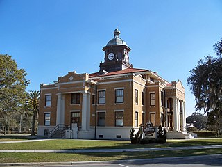
Highlands County is a county located in the U.S. state of Florida. As of the 2010 census, the population was 98,786. Its county seat is Sebring.

Monroe County is a county in the state of Florida. As of the 2010 census, the population was 73,090. Its county seat is Key West. Monroe County includes the islands of the Florida Keys and comprises the Key West Micropolitan Statistical Area.

Washington County is a county located in the state of Florida. As of the 2010 census, the population was 24,935. Its county seat is Chipley. Washington County is a prohibition or entirely dry county, meaning that the sale of alcoholic beverages is banned in the county.

South Florida is a geographic and cultural region that generally comprises Florida's southernmost counties, including Miami-Dade, Broward, and Palm Beach. It is the fourth most populous urban agglomeration in the United States. It is one of Florida's three most common "directional" regions, the others being Central Florida and North Florida. It includes the populous Miami metropolitan area, the Everglades, the Florida Keys, Treasure Coast, and other localities. South Florida is the only part of the continental United States with a tropical climate.

Florida's 1st congressional district is a congressional district in the U.S. state of Florida, covering the state's western Panhandle. It includes all of Escambia, Okaloosa, Santa Rosa, and Walton counties and portions of Holmes county. The district is anchored in Pensacola and also includes the large military bedroom communities and tourist destinations of Navarre and Fort Walton Beach and stretches along the Emerald Coast. The district, as ranked by the Cook Partisan Voting Index, is the most Republican district in Florida and the 15th most in the United States.

Old Cutler Road is an off-grid plan, 14.9-mile (24.0 km) main northeast–southwest road running south of downtown Miami in Miami-Dade County, Florida, United States.

U.S. Route 19 in Florida runs 264 miles (425 km) along Florida's west coast from an interchange with U.S. Route 41 in Memphis, Florida, south of Tampa, and continues to the Georgia border north of Monticello, Florida.
Cambarus cryptodytes, the Dougherty Plain cave crayfish or Apalachicola cave crayfish, is a small, freshwater crayfish endemic to Florida and Georgia in the United States. It is an underground species known only from waters associated with the Floridan aquifer.

The Florida Air National Guard is the air force militia of the State of Florida and, as part of the air force militia of the United States, is part of the Air National Guard. On a state level, along with the Florida Army National Guard, it is also an element of the Florida National Guard.

Florida is the southernmost contiguous state in the United States. The state is bordered to the west by the Gulf of Mexico, to the northwest by Alabama, to the north by Georgia, to the east by the Atlantic Ocean, and to the south by the Straits of Florida. Florida is the 22nd-most extensive, the 3rd-most populous, and the 8th-most densely populated of the U.S. states. Jacksonville is the most populous municipality in the state and the largest city by area in the contiguous United States. The Miami metropolitan area is Florida's most populous urban area. Tallahassee is the state's capital.

Palm River is an unincorporated community located in Hillsborough County, Florida, United States. It shares its name with the Palm River, a waterway sided with trail. Palm River boundaries include McKay Bay to the west, Tampa city limits to the north, the Clair Mel to the east, and Progress Village to the south.

The 1996 United States presidential election in Florida took place on November 5, 1996, as part of the 1996 United States presidential election. Voters chose twenty-five representatives, or electors to the Electoral College, who voted for president and vice president.

The 1988 United States presidential election in Florida took place on November 8, 1988. All fifty states and the District of Columbia, were part of the 1988 United States presidential election. Florida voters chose twenty-one electors to the Electoral College, which selected the president and vice president.
The Little River is a minor river in the Florida Big Bend. A tributary of the Ochlockonee River, it is approximately 14 miles (23 km) in length and is located entirely within Gadsden County.

Rutland is an unincorporated community in Sumter County, Florida, United States. The ZIP Code is 33538, which it shares with Lake Panasoffkee, over nine miles to the southeast.

In the 1976 United States presidential election, Florida was won by the Democratic candidate, former Governor of Georgia Jimmy Carter, over the Republican candidate, incumbent President Gerald Ford. Carter won by a margin of 5.29 points, giving him 17 electoral votes. Other Southern states also went for Carter, especially his home state of Georgia and Arkansas.
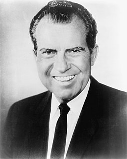
The 1968 United States presidential election in Florida was held on November 5, 1968. Florida voters chose fourteen electors, or representatives to the Electoral College, who voted for president and vice president.

The 1964 United States presidential election in Florida was held November 3, 1964. All contemporary fifty states and the District of Columbia took part, and Florida voters selected fourteen electors to the Electoral College, who voted for president and vice president.
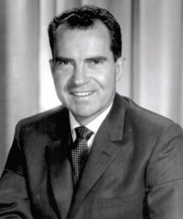
The 1960 United States presidential election in Florida was held on November 8, 1960. All contemporary fifty states took part, and Florida voters selected ten electors to the Electoral College, who voted for president and vice president.

The 1948 United States presidential election in Florida was held on November 2, 1948. Voters chose eight electors, or representatives to the Electoral College, who voted for president and vice president.