
The Waikato River is the longest river in New Zealand, running for 425 kilometres (264 mi) through the North Island. It rises on the eastern slopes of Mount Ruapehu, joining the Tongariro River system and flowing through Lake Taupō, New Zealand's largest lake. It then drains Taupō at the lake's northeastern edge, creates the Huka Falls, and flows northwest through the Waikato Plains. It empties into the Tasman Sea south of Auckland, at Port Waikato. It gives its name to the Waikato region that surrounds the Waikato Plains. The present course of the river was largely formed about 17,000 years ago. Contributing factors were climate warming, forest being reestablished in the river headwaters and the deepening, rather than widening, of the existing river channel. The channel was gradually eroded as far up river as Piarere, leaving the old Hinuera channel through the Hinuera Gap high and dry. The remains of the old course are seen clearly at Hinuera, where the cliffs mark the ancient river edges. The Waikato's main tributary is the Waipā River, which converges with it at Ngāruawāhia.

The Wisconsin River is a tributary of the Mississippi River in the U.S. state of Wisconsin. At approximately 430 miles long, it is the state's longest river. The river's name was first recorded in 1673 by Jacques Marquette as "Meskousing", which is rooted in the Algonquian languages used by the area's Native American tribes. The river's original meaning is obscure, but French explorers who followed in the wake of Marquette later modified the name to "Ouisconsin", and so it appears on Guillaume de L'Isle's map. This was simplified to "Wisconsin" in the early 19th century, before being applied to Wisconsin Territory and finally the state of Wisconsin.
Balclutha is a town in South Otago, lying towards the end of the Clutha River, on the east coast of the South Island of New Zealand. It is about halfway between Dunedin and Gore on the Main South Line railway, State Highway 1 and the Southern Scenic Route. Balclutha has a population of 4,340, and is the largest town in South Otago.

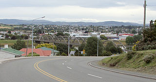
Alexandra is a town in the Central Otago district of the South Island of New Zealand. It is on the banks of the Clutha River, on State Highway 8, 188 kilometres (117 mi) by road from Dunedin and 33 kilometres (21 mi) south of Cromwell. The nearest towns to Alexandra via state highway 8 are Clyde seven kilometres to the northwest and Roxburgh forty kilometres to the south. State highway 85 also connects Alexandra to Omakau, Lauder, Oturehua, Ranfurly and on to Palmerston on the East Otago coast.

The Clutha River is the second longest river in New Zealand and the longest in the South Island. It flows south-southeast 338 kilometres (210 mi) through Central and South Otago from Lake Wānaka in the Southern Alps to the Pacific Ocean, 75 kilometres (47 mi) south west of Dunedin. It is the highest volume river in New Zealand, and the swiftest, with a catchment of 21,000 square kilometres (8,100 sq mi), discharging a mean flow of 614 cubic metres per second (21,700 cu ft/s). The river is known for its scenery, gold-rush history, and swift turquoise waters. A river conservation group, the Clutha Mata-Au River Parkway Group, is working to establish a regional river parkway, with a trail, along the entire river corridor.
The Clyde Dam, New Zealand's third-largest hydroelectric dam, is built on the Clutha River / Mata-Au near the town of Clyde. It is owned and operated by Contact Energy.

The Sava is a river in Central and Southeast Europe, a right-bank and the longest tributary of the Danube. It flows through Slovenia, Croatia and along its border with Bosnia and Herzegovina, and finally through Serbia, feeding into the Danube in its capital, Belgrade. The Sava forms the main northern limit of the Balkan Peninsula, and the southern edge of the Pannonian Plain.

The Waitaki River is a large braided river on the South Island of New Zealand. It drains the Mackenzie Basin and runs 209 kilometres (130 mi) south-east to enter the Pacific Ocean between Timaru and Oamaru on the east coast. It starts at the confluence of the Ōhau and Tekapo rivers, now at the head of the artificial Lake Benmore, these rivers being fed by three large glacial lakes, Pukaki, Tekapo, and Ōhau at the base of the Southern Alps. The Waitaki flows through Lake Benmore, Lake Aviemore and Lake Waitaki, these lakes being contained by hydroelectric dams, Benmore Dam, Aviemore Dam and Waitaki Dam. The Waitaki has several tributaries, notably the Ahuriri River and the Hakataramea River. It passes Kurow and Glenavy before entering the Pacific Ocean. The River lends its name the Waitaki District on the south side of the river bank.

The Taieri River is the fourth-longest river in New Zealand and is in Otago in the South Island. Rising in the Lammerlaw Range, it initially flows north, then east around the Rock and Pillar range before turning southeast, reaching the sea 30 kilometres (19 mi) south of Dunedin.

Lake Hāwea is New Zealand's ninth largest lake.

The Rakaia River is in the Canterbury Plains in New Zealand's South Island. The Rakaia River is one of the largest braided rivers in New Zealand. The Rakaia River has a mean flow of 203 cubic metres per second (7,200 cu ft/s) and a mean annual seven-day low flow of 87 m3/s (3,100 cu ft/s). In the 1850s, European settlers named it the Cholmondeley River, but this name lapsed into disuse. The name Rakaia comes from Māori "Ō Rakaia", meaning the place where people were arranged by ranks

The Whanganui River is a major river in the North Island of New Zealand. It is the country's third-longest river, and has special status owing to its importance to the region's Māori people. In March 2017 it became the world's second natural resource to be given its own legal identity, with the rights, duties and liabilities of a legal person. The Whanganui Treaty settlement brought the longest-running litigation in New Zealand history to an end.
The Waiapu River is a river in the Gisborne District of the North Island of New Zealand, with a total length of approximately 130 kilometres (81 mi). Found in the north-east of the Waiapu Valley, it flows north-east from the joining of the Mata River and the Tapuaeroa River, then passes by Ruatoria before reaching the Pacific Ocean at Rangitukia. Other tributaries of the Waiapu River include the Mangaoporo, Poroporo, Wairoa, Maraehara rivers, and the Paoaruku stream. It is the most well-known river in the region and lies within the rohe (territory) of Ngāti Porou, the largest iwi on the East Coast, and second largest in New Zealand. The area was the site of hostilities during the New Zealand Wars from June to October in 1865, both between Pākehā and Māori, and between factions of Ngāti Porou.

The Wairoa River, also known as Wairoa South, is the second longest river in the Auckland Region of New Zealand's North Island. It flows south from its sources in the Hunua Ranges, then northwards into the Hauraki Gulf. The Wairoa Reservoir and Hūnua Falls form sections of the river, and the Wairoa River flows adjacent to the township of Clevedon.
A water conservation order is a legal ruling to protect aspects of water bodies. It may be to protect the quantity of the water itself or for any issues relating to the water body as a whole.

Hydroelectric power in New Zealand has been a part of the country's energy system for over 100 years and continues to provide more than half of the country's electricity needs. Hydroelectricity is the primary source of renewable energy in New Zealand. Power is generated the most in the South Island and is used most in the North Island.
The following outline is provided as an overview of and topical guide to hydrology:

Water is relatively abundant in New Zealand due to the temperate climate and maritime weather patterns. In recent years, water pollution and draw-down of aquifers have become important environmental issues in New Zealand.

Trevor James Hill Chinn was a New Zealand glaciologist, who conducted extensive surveys of the glaciers of New Zealand's Southern Alps.
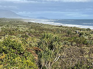
The Barrytown Flats are a 17 km (11 mi) coastal plain north of Greymouth on the West Coast of New Zealand's South Island. A series of postglacial shorelines and dunes backed by a former sea cliff, they was originally covered with wetland and lowland forest, including numerous nīkau palms. The sands were extensively sluiced and dredged for gold from the 1860s, centred on the small settlement of Barrytown. The drier areas of the flats have been converted into pasture, but significant areas of forest remain, including Nikau Scenic Reserve. The flats are bordered by Paparoa National Park and the only breeding site of the Westland petrel. There are significant deposits of ilmenite in the Barrytown sands, and there have been several mining proposals, but the possible environmental consequences have been contentious.


