Riverview, Morgan County, Missouri

Last updated

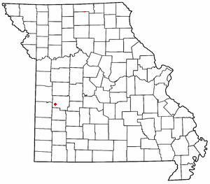
Riverview is an unincorporated community in southwestern Morgan County, in the U.S. state of Missouri. [1]

Morgan County, Missouri county in Missouri, United States

Morgan County is a county located in the central portion of the U.S. state of Missouri. As of the 2010 census, the population was 20,565. Its county seat is Versailles. The county was organized January 5, 1833 and named for General Daniel Morgan of the American Revolutionary War.

U.S. state constituent political entity sharing sovereignty as the United States of America

In the United States, a state is a constituent political entity, of which there are currently 50. Bound together in a political union, each state holds governmental jurisdiction over a separate and defined geographic territory and shares its sovereignty with the federal government. Due to this shared sovereignty, Americans are citizens both of the federal republic and of the state in which they reside. State citizenship and residency are flexible, and no government approval is required to move between states, except for persons restricted by certain types of court orders. Four states use the term commonwealth rather than state in their full official names.

Missouri State of the United States of America

Missouri is a state in the Midwestern United States. With over six million residents, it is the 18th-most populous state of the Union. The largest urban areas are St. Louis, Kansas City, Springfield, and Columbia; the capital is Jefferson City. The state is the 21st-most extensive in area. In the South are the Ozarks, a forested highland, providing timber, minerals, and recreation. The Missouri River, after which the state is named, flows through the center of the state into the Mississippi River, which makes up Missouri's eastern border.

The community sits above the Lake of the Ozarks at the confluence of Big Buffalo Creek with the Osage River. [2]

Lake of the Ozarks

Lake of the Ozarks is a large reservoir created by impounding the Osage River in the northern part of the Ozarks in central Missouri. Extents of three smaller tributaries to the Osage are included in the impoundment: the Niangua River, Grandglaize Creek, and Gravois Creek. The lake has a surface area of 54,000 acres (220 km2) and 1,150 miles (1,850 km) of shoreline, and the main channel of the Osage Arm stretches 92 miles (148 km) from end to end. The total drainage area is over 14,000 square miles (36,000 km2). The lake's serpentine shape has earned it the nickname "The Magic Dragon", which has in turn inspired the names of local institutions such as The Magic Dragon Street Meet.

Big Buffalo Creek is a stream in Morgan and Benton counties in west-central Missouri. It is a tributary of the Osage River within the Lake of the Ozarks.

Osage River one of the larger rivers in Missouri

The Osage River is a 276-mile-long (444 km) tributary of the Missouri River in central Missouri in the United States. The Osage River is the 8th-largest river in Missouri. The river drains a mostly rural area of 15,300 square miles (40,000 km2). The watershed includes an area of east-central Kansas and a large portion of west-central and central Missouri, where it drains northwest areas of the Ozark Plateau.

History

A post office called Riverview was established in 1877, and remained in operation until 1906. [3] The community was named so named on account of scenic views over the nearby Osage River. [4]

Related Research Articles

Taberville, Missouri unincorporated community in Missouri

Taberville is an unincorporated community in southwestern St. Clair County, Missouri, United States. It is located approximately sixteen miles west of Osceola, situated on the north side of the Osage River. Taberville formerly had a post office, but it has closed and mail is now delivered from nearby Rockville.

Pawhuska Township, Camden County, Missouri Township in Missouri, United States

Pawhuska Township is one of eleven townships in Camden County, Missouri, USA. As of the 2000 census, its population was 5,617.

Osage City is an unincorporated community in Cole County, in the U.S. state of Missouri.

Osage Bluff is an unincorporated community in Cole County, in the U.S. state of Missouri.

Osage Bend is an unincorporated community in Cole County, in the U.S. state of Missouri.

Osage Township is a township in Henry County, in the U.S. state of Missouri.

Capps is an unincorporated community in northern Miller County, in the U.S. state of Missouri.

Boylers Mill is an unincorporated community in western Morgan County, in the U.S. state of Missouri. The community is in Pole Hollow just north of the Big Buffalo Creek. The site is on Missouri Route FF.

Buck Creek is a stream in Morgan County in the U.S. state of Missouri. It is a tributary to the Osage River within the Lake of the Ozarks.

Lick Branch is a stream in Morgan County in the U.S. state of Missouri. It is a tributary of the Osage River.

Proctor Creek is a stream in Morgan County in the U.S. state of Missouri. It is a tributary of the Osage River.

Pyrmont is an unincorporated community in Morgan County, in the U.S. state of Missouri.

Roberts Branch is a stream in Morgan County in the U.S. state of Missouri. It is a tributary of Osage River.

Osage Township is a township in Morgan County, in the U.S. state of Missouri.

Castle Rock is an extinct town in Osage County, in the U.S. state of Missouri. The townsite lies is located on the inside curve of an incised meander of the Osage River. The Castle Rock formation for which it was named lies across the river to the north in Cole County just southeast of Wardsville. The Pikes Camp Wildlife Area lies to the west across the river.

Freedom is an unincorporated community in Osage County, in the U.S. state of Missouri. The village lies on Missouri Route N, approximately one mile north of U.S. Route 50 and two miles north of the Gasconade River.

Gascondy is an extinct town in southern Osage County, in the U.S. state of Missouri. The GNIS classifies it as a populated place.

Hope is an unincorporated community in Osage County, in the U.S. state of Missouri.

Monegaw Springs is an unincorporated community in St. Clair County, in the U.S. state of Missouri.

Osage Township is an inactive township in St. Clair County, in the U.S. state of Missouri.

References

  1. U.S. Geological Survey Geographic Names Information System: Riverview, Morgan County, Missouri
  2. Missouri Atlas & Gazetteer, DeLorme, 1998, First edition, p. 44 ISBN   0-89933-224-2
  3. "Post Offices". Jim Forte Postal History. Retrieved 17 November 2016.
  4. "Morgan County Place Names, 1928–1945". The State Historical Society of Missouri. Archived from the original on June 24, 2016. Retrieved November 17, 2016.

Coordinates: 38°16′33″N93°04′11″W / 38.27583°N 93.06972°W / 38.27583; -93.06972

Geographic coordinate system Coordinate system

A geographic coordinate system is a coordinate system that enables every location on Earth to be specified by a set of numbers, letters or symbols. The coordinates are often chosen such that one of the numbers represents a vertical position and two or three of the numbers represent a horizontal position; alternatively, a geographic position may be expressed in a combined three-dimensional Cartesian vector. A common choice of coordinates is latitude, longitude and elevation. To specify a location on a plane requires a map projection.