Related Research Articles

Morgan County is a county located in the central portion of the U.S. state of Missouri. As of the 2020 census, the population was 21,006. Its county seat is Versailles. The county was organized January 5, 1833 and named for General Daniel Morgan of the American Revolutionary War.
Roach is an unincorporated community in southern Camden County, Missouri, United States. It is located north of U.S. Route 54 on Missouri Route AA, approximately five miles west of Camdenton and 2.5 miles west of the Niangua River arm of the Lake of the Ozarks. The ZIP Code for Roach is 65787.
Rocky Mount is an unincorporated community in eastern Morgan County, Missouri, United States. It is located six miles southwest of Eldon, near the Lake of the Ozarks. The ZIP Code for Rocky Mount is 65072.
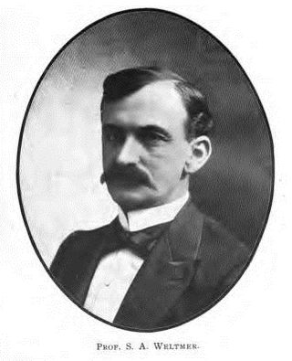
Sidney Abram Weltmer was an author best known for the Weltmer Method and as founder of the Weltmer Institute of Suggestive Therapeutics. Weltmer claimed his method could cure disease through suggestions and hypnosis, a practice he referred to as "magnetic healing".
Purvis is an unincorporated community in northern Camden County, in the U.S. state of Missouri. The community is located on the north shore of the Lake of the Ozarks. The Purvis cemetery is located to the southwest across the Brush Creek arm of the lake. The community of Laurie is located on Missouri Route 5 and is approximately two miles to the north, in Morgan County.
Bowen is an unincorporated community in Henry and Johnson counties, in the U.S. state of Missouri.
Hart is an extinct village on the Santa Fe Railroad in Russell Township, Macon County, Missouri. The GNIS classifies it as a populated place. A variant name was Evelyn, the name of the local post office. A post office called Evelyn was established in 1888, and remained in operation until 1916. Besides the post office, Hart had a railroad depot.
Atwell is an unincorporated community in the southeast corner of Miller County, in the U.S. state of Missouri. The community is on a low ridge between Atwell Creek to the east and Little Tavern Creek to the west. Access is by Missouri Route K from Missouri Route 17. Iberia is 5.5 miles to the northwest.
Faith is an unincorporated community in southern Miller County, in the U.S. state of Missouri. It is located approximately six miles southwest of Iberia near the headwaters of Barren Fork.
Rocky Mount is an unincorporated community in western Miller County, Missouri United States. The site is on Missouri Route Y approximately four miles southwest of Eldon. The Rocky Mount church is located at this location, however the post office was moved into neighboring Morgan County about two miles to the southwest in 1919. The Rocky Mount Lookout Tower and Rocky Mount Towersite State Wildlife Area lie approximately two miles to the east.
Buck Creek is a stream in Morgan County in the U.S. state of Missouri. It is a tributary to the Osage River within the Lake of the Ozarks.
Buck Creek is an unincorporated community in Morgan County, in the U.S. state of Missouri. The community is on Missouri Route O about four miles northeast of Laurie. The location is just west of the Gravois Creek Arm of the Lake of the Ozarks.
Glensted is an unincorporated community in Morgan County, in the U.S. state of Missouri.
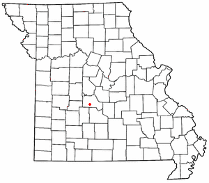
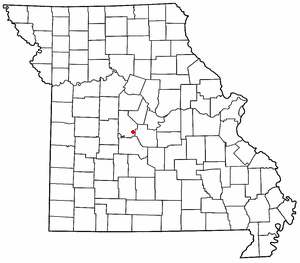
Marvin is an unincorporated community in Morgan County, in the U.S. state of Missouri.
Proctor is an unincorporated community in southwest Morgan County, in the U.S. state of Missouri.
Pyrmont is an unincorporated community in western Morgan County, in the U.S. state of Missouri. The community is located just east of Missouri Route 135 approximately midway between Stover to the south and Florence to the northeast. Gabriel Creek flows past to the east.
Riverview is an unincorporated community in southwestern Morgan County, in the U.S. state of Missouri.
Todd is an extinct town in Morgan County, in the U.S. state of Missouri.
Castle Rock is an extinct town in Osage County, in the U.S. state of Missouri. The townsite lies is located on the inside curve of an incised meander of the Osage River. The Castle Rock formation for which it was named lies across the river to the north in Cole County just southeast of Wardsville. The Pikes Camp Wildlife Area lies to the west across the river.
Luystown is an unincorporated community in Osage County, in the U.S. state of Missouri.
References
- ↑ U.S. Geological Survey Geographic Names Information System: Aikinsville, Missouri
- ↑ "Post Offices". Jim Forte Postal History. Retrieved November 17, 2016.
- ↑ "Morgan County Place Names, 1928–1945". The State Historical Society of Missouri. Archived from the original on June 24, 2016. Retrieved November 17, 2016.
- ↑ Howard Louis Conard, ed. (1901). "Encyclopedia of the history of Missouri: a compendium of history and biography for ready reference". New York: The Southern History Company. Retrieved February 4, 2013.
Municipalities and communities of Morgan County, Missouri, United States | ||
|---|---|---|
| Cities |  | |
| Villages | ||
| Townships | ||
| Unincorporated communities | ||
| Ghost town | ||
| Footnotes | ‡This populated place also has portions in an adjacent county or counties | |
38°33′29″N92°50′11″W / 38.55806°N 92.83639°W
| | This Morgan County, Missouri state location article is a stub. You can help Wikipedia by expanding it. |