Roman Catholic Archdiocese of Mariana

Last updated
Archdiocese of Mariana

Archidioecesis Marianensis

Arquidiocese de Mariana
Igreja da se mariana.jpg
Location
Country Brazil
Statistics
Area22,680 km2 (8,760 sq mi)
Population
- Total
- Catholics
(as of 2013)
1,274,000 (est.)
1,069,000 (est.) (83.9%)
Information
Rite Latin Rite
Established6 December 1745 (278 years ago)
Cathedral Catedral Metropolitana Basílica Nossa Senhora da Assunção
Secular priests 171 (diocesan)
24 (Religious Orders)
Current leadership
Pope Francis
Archbishop Airton José dos Santos
Website
www.arqmariana.com.br
Regional CNBB Leste 2. Regional CNBB Leste 2.png
Regional CNBB Leste 2.
Map of the Roman Catholic Archdiocese of Mariana. Diocese de Mariana (Minas Gerais).png
Map of the Roman Catholic Archdiocese of Mariana.

The Roman Catholic Archdiocese of Mariana (Latin : Archidioecesis Marianensis, Portuguese : Arquidiocese de Mariana) is an archdiocese based in the city of Mariana in the Brazilian state of Minas Gerais. [1]

Contents

Geography

The archdiocese owns the parishes in seventy nine municipalities in four main regions in the state of Minas Gerais. [2]

Intermediate Geographic Region of Belo Horizonte

One region at the Intermediate Geographic Region of Belo Horizonte.

Five municipalities.

Immediate Geographic Region of Santa Bárbara-Ouro Preto

Five municipalities at the Immediate Geographic Region of Santa Bárbara-Ouro Preto.

Intermediate Geographic Region of Barbacena

Two regions at the Intermediate Geographic Region of Barbacena.

Twenty eight municipalities.

Immediate Geographic Region of Barbacena

Ten municipalities at the Immediate Geographic Region of Barbacena.

Immediate Geographic Region of Conselheiro Lafaiete

Eighteen municipalities at the Immediate Geographic Region of Conselheiro Lafaiete.

Intermediate Geographic Region of Juiz de Fora

Six regions at the Intermediate Geographic Region of Juiz de Fora.

Forty five municipalities.

Immediate Geographic Region of Juiz de Fora

Two municipalities at the Immediate Geographic Region of Juiz de Fora.

Immediate Geographic Region of Carangola

One municipality at the Immediate Geographic Region of Carangola.

Immediate Geographic Region of Manhuaçu

Two municipalities at the Immediate Geographic Region of Manhuaçu.

Immediate Geographic Region of Viçosa

Sixteen municipalities at the Immediate Geographic Region of Viçosa.

Immediate Geographic Region of Ponte Nova

Seventeen municipalities at the Immediate Geographic Region of Ponte Nova.

Immediate Geographic Region of Ubá

Seven municipalities at the Immediate Geographic Region of Ubá.

Intermediate Geographic Region of Ipatinga

One region at the Intermediate Geographic Region of Ipatinga.

One municipality.

Immediate Geographic Region of Caratinga

One municipality at the Immediate Geographic Region of Caratinga.

History

On 6 December 1745, the diocese of Mariana was established with territory taken from the Diocese of São Sebastião do Rio de Janeiro.[ citation needed ]

In 1748, after being released from prison, formerly enslaved prostitute Rosa Egipcíaca began to preach to crowds about her religious visions. In 1749, she was accused of witchcraft by the Bishop of Mariana and whipped as a punishment. [3] This punishment paralysed the right side of her body for the rest of her life. [4] She became the first black woman in Brazil to write a book, entitled Sagrada Teologia do Amor Divino das Almas Peregrinas. [5]

On 1 May 1906, it was promoted to Metropolitan Archdiocese of Mariana.[ citation needed ] By 2013 there was one priest for every 5,482 Catholics.[ citation needed ]

Special churches

Archdiocesan Sanctuaries

Parishes of the Archdiocese of Mariana

The Archdiocese of Mariana is divided into 5 Pastoral Regions to give more dynamism in the Evangelization in the communities and parishes that are present in the Archdiocese.

Bishops

Ordinaries, in reverse chronological order

Coadjutor bishops

Auxiliary bishops

Other priests of this diocese who became bishops

Personalities

Suffragan dioceses

Related Research Articles

<span class="mw-page-title-main">Ouro Preto</span> Municipality in Minas Gerais, Brazil

Ouro Preto, formerly Vila Rica, is a Brazilian municipality located in the state of Minas Gerais. The city, a former colonial mining town located in the Serra do Espinhaço mountains, was designated a World Heritage Site by UNESCO due to its Baroque colonial architecture. Ouro Preto used to be the capital of Minas Gerais from 1720 until the foundation of Belo Horizonte in 1897.

<span class="mw-page-title-main">São João del-Rei</span> Municipality in Minas Gerais, Brazil

São João del-Rei is a Brazilian municipality in the state of Minas Gerais. Founded in 1713 in homage to king John V of Portugal, the city is famed for its historic Portuguese colonial architecture. The current population is estimated at 90,225 inhabitants.

<span class="mw-page-title-main">Mineiro</span> Brazilian Portuguese accent of Minas Gerais

Mineiro, Mineirês, or the Brazilian mountain accent is the Brazilian Portuguese term for the accent spoken in the Center, East and Southeast regions of the state of Minas Gerais.

<span class="mw-page-title-main">Alphonsus de Guimaraens</span>

Afonso Henrique da Costa Guimarães, known as Alphonsus de Guimaraens; was a Brazilian poet.
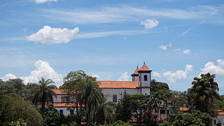
<span class="mw-page-title-main">Sabará</span> Municipality in Southeast, Brazil

Sabará is a Brazilian municipality located in the state of Minas Gerais. The city belongs to the Belo Horizonte metropolitan region and to the associated microregion.

<span class="mw-page-title-main">Roman Catholic Archdiocese of São Paulo</span> Catholic ecclesiastical territory

The Archdiocese of São Paulo is a Latin Metropolitan Archbishopric of the Catholic Church in Brazil.

<span class="mw-page-title-main">Conceição da Barra de Minas</span> Town and municipality in the state of Minas Gerais, Brazil

Conceição da Barra de Minas is a Brazilian municipality located in the state of Minas Gerais. The city belongs to the mesoregion of Campo das Vertentes and to the microregion of Sao Joao del Rei. In 2020, the estimated population was 3,946.

<span class="mw-page-title-main">Roman Catholic Archdiocese of Belém do Pará</span> Catholic ecclesiastical territory

The Roman Catholic Archdiocese of Belém do Pará is an archdiocese located in the city of Belém in Brazil. It covers 3,566,079 square kilometres (1,376,871 sq mi) and is organized into 80 parishes. The Archdiocese covers the municipalities of Belém, Ananindeua, Benevides, Marituba, and Santa Bárbara do Pará.

<span class="mw-page-title-main">Roman Catholic Archdiocese of Belo Horizonte</span> Catholic ecclesiastical territory

The Roman Catholic Archdiocese of Belo Horizonte is an archdiocese located in the city of Belo Horizonte in Brazil.

<span class="mw-page-title-main">Roman Catholic Archdiocese of Pouso Alegre</span> Catholic ecclesiastical territory

The Roman Catholic Archdiocese of Pouso Alegre is an archdiocese located in the city of Pouso Alegre in Brazil.

<span class="mw-page-title-main">Roman Catholic Diocese of Campanha</span> Catholic ecclesiastical territory

The Roman Catholic Diocese of Campanha is a diocese located in the city of Campanha in the ecclesiastical province of Pouso Alegre in Brazil.

<span class="mw-page-title-main">Roman Catholic Diocese of São João da Boa Vista</span> Catholic ecclesiastical territory

The Roman Catholic Diocese of São João da Boa Vista is a diocese located in the city of São João da Boa Vista in the ecclesiastical province of Ribeirão Preto in Brazil.

<span class="mw-page-title-main">Basilica Shrine of Our Lady of the Immaculate Conception, Caconde</span> Church in Caconde, Brazil

The Basilica Shrine of Our Lady of the Immaculate Conception, also known as the Basilica Sanctuary of Our Lady of the Conception, is a temple and seat of the Roman Catholic Diocese of São João da Boa Vista in Brazil. It is under the jurisdiction of the Catholic Church in the municipality of Caconde, in the northwest region of the state of São Paulo. It is the second oldest parish of the Diocese of Boa Vista and is dedicated to Our Lady of Good Success, having been created on March 19, 1775, by order of Manuel da Resurreição, third bishop of São Paulo.
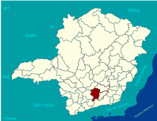
<span class="mw-page-title-main">Immediate Geographic Region of São João del-Rei</span> Urban administrative region in Minas Gerais, Brazil

The Immediate Geographic Region of São João del-Rei is one of the 10 immediate geographic regions in the Intermediate Geographic Region of Barbacena, one of the 70 immediate geographic regions in the Brazilian state of Minas Gerais and one of the 509 of Brazil, created by the National Institute of Geography and Statistics (IBGE) in 2017.

<span class="mw-page-title-main">Immediate Geographic Region of Santa Bárbara-Ouro Preto</span> Urban administrative region in Minas Gerais, Brazil

The Immediate Geographic Region of Santa Bárbara-Ouro Preto is one of the 10 immediate geographic regions in the Intermediate Geographic Region of Belo Horizonte, one of the 70 immediate geographic regions in the Brazilian state of Minas Gerais and one of the 509 of Brazil, created by the National Institute of Geography and Statistics (IBGE) in 2017.
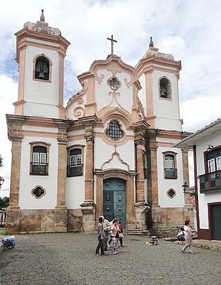
<span class="mw-page-title-main">Our Lady of the Pillar Mother Church (Ouro Preto)</span> Catholic church in Ouro Preto (Minas Gerais, Brazil)

The Minor Basilica of Our Lady of the Pillar in Ouro Preto, Minas Gerais, popularly called the Our Lady of the Pillar Mother Church, is one of the best known Catholic buildings among those erected during the Brazilian gold rush. It is a listed monument by the National Historic and Artistic Heritage Institute (IPHAN). It is located at the Monsenhor Castilho Barbosa Square.

<span class="mw-page-title-main">Church of Our Lady of the Rosary of Black Men (Ouro Preto)</span> Brazilian Catholic temple in Ouro Preto, Minas Gerais.

The Church of Our Lady of the Rosary of Black Men, also known as the Church of Our Lady of the Rosary, is a Catholic temple in Ouro Preto, Minas Gerais, Brazil. Landmarked by IPHAN, it is one of the most original sacred buildings dating from the colonial period in Brazil.

References

  1. "CNBB Leste 2". CNNB Leste 2. Retrieved 2023-02-19.
  2. Parábola, Agência. "Paróquias". Arquidiocese de Mariana - MG. Retrieved 2023-02-22.
  3. "Enslaved: Peoples of the Historical Slave Trade". enslaved.org. Retrieved 2021-08-21.
  4. "Egipcíaca, Rosa | Encyclopedia.com". encyclopedia.com. Retrieved 2021-08-20.
  5. Martins, Ana Margarida (2019). "Teresa Margarida da Silva Orta (1711–1793): A Minor Transnational of the Brown Atlantic". Portuguese Studies. 35 (2): 136–53. doi:10.5699/portstudies.35.2.0136. ISSN   0267-5315. JSTOR   10.5699/portstudies.35.2.0136. S2CID   213802402.
  6. Gams, p. 136.
  7. Approved by Pope Gregory XVI on 17 December 1840. Gams, p. 136.
  8. Leite was presented by the King on 13 May 1818, approved by Pope Pius VII on 9 September 1819, and consecrated on 9 April 1820. Gams, p. 136.
  9. Cypriano de São José was born in Lisbon. He was a lecturer in philosophy and theology in houses of his Order, and became a Conciniator in the Royal Chapel of the Palace of Bemposta. He became a Master of Theology (1795). He was Visitor General of his Order in the Province of San Antonio on three occasions. He was presented as Bishop of Mariana by the Queen, and approved by Pope Pius VI on 24 July 1797. Ritzler, VI, p. 27 with note 6.
  10. Ritzler, VI, p. 27 with note 5.
  11. Ritzler, VI, p. 27 with note 4.
  12. Figuera was born in Lisbon, and became Doctor in utroque iure at the University of Coimbra. He served as judge in the Apostolic Nunciature in Portugal. He was presented to the bishopric by the King on 21 March 1771, and approved by Pope Clement XIV on 17 June 1771. He was promoted to the Archdiocese of Bahia on 8 March 1773. Ritzler, VI, p. 27 with note 3.
  13. Nogueira was Master of Theology (1726), and was named Abbot of Coimbra. He was Definitor and Master of Novices at the monastery of Santa Maria Alcobacensis. He then became bishop of São Luís de Maranhão (1738-1745). He was presented to the bishopric of Mariana by the King on 1 September 1745, and approved by Pope Benedict XIV on 15 December 1745. Ritzler, VI, p. 268 and p. 276 with note 2.

Sources

20°22′42″S43°24′59″W / 20.3782°S 43.4164°W / -20.3782; -43.4164