Transport in Antarctica has transformed from explorers crossing the isolated remote area of Antarctica by foot to a more open era due to human technologies enabling more convenient and faster transport, predominantly by air and water, but also by land as well. Transportation technologies on a remote area like Antarctica need to be able to deal with extremely low temperatures and continuous winds to ensure the travelers' safety. Due to the fragility of the Antarctic environment, only a limited amount of transport movements can take place and sustainable transportation technologies have to be used to reduce the ecological footprint. The infrastructure of land, water and air transport needs to be safe and sustainable. Currently thousands of tourists and hundreds of scientists a year depend on the Antarctic transportation system.

The British Antarctic Territory (BAT) is a sector of Antarctica claimed by the United Kingdom as one of its 14 British Overseas Territories, of which it is by far the largest by area. It comprises the region south of 60°S latitude and between longitudes 20°W and 80°W, forming a wedge shape that extends to the South Pole, overlapped by the Antarctic claims of Argentina and Chile. The claim to the region has been suspended since the Antarctic Treaty came into force in 1961.

Kenn Borek Air is an airline based in Calgary, Alberta, Canada. It operates regional passenger and cargo services, contract operations in the Arctic and Antarctic and aircraft leasing. Its main base is at Calgary International Airport. It charters aircraft for scientific expeditions, oil exploration, etc., and operates air ambulance services.

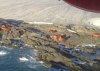
The Rothera Research Station is a British Antarctic Survey (BAS) base on the Antarctic Peninsula, located at Rothera Point, Adelaide Island. Rothera also serves as the capital of the British Antarctic Territory, a British Overseas Territory.

The de Havilland Canada DHC-7, popularly known as the Dash 7, is a turboprop-powered regional airliner with short take-off and landing (STOL) performance. It first flew in 1975 and remained in production until 1988 when the parent company, de Havilland Canada, was purchased by Boeing in 1986 and later sold to Bombardier. In 2006 Bombardier sold the type certificate for the aircraft design to Victoria-based manufacturer Viking Air.

Adelaide Island is a large, mainly ice-covered island, 139 kilometres (75 nmi) long and 37 kilometres (20 nmi) wide, lying at the north side of Marguerite Bay off the west coast of the Antarctic Peninsula. The Ginger Islands lie off the southern end. Mount Bodys is the easternmost mountain on Adelaide Island, rising to over 1,220 m. The island lies within the Argentine, British and Chilean Antarctic claims.

Port Stanley Airport is an airport in the Falkland Islands, two miles outside the capital, Stanley. The airport is the only civilian airport in the islands with a paved runway. However, RAF Mount Pleasant, located to the west of Stanley, functions as the islands' main international airport, because it has a long runway and allows civilian flights. Port Stanley Airport is operated by the Government of the Falkland Islands, and is used for internal flights between the islands and flights between the Falklands and Antarctica.

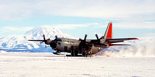
Williams Field or Willy Field is a United States Antarctic Program airfield in Antarctica. Williams Field consists of two snow runways located on approximately 8 meters (25 ft) of compacted snow, lying on top of 8–10 ft of ice, floating over 550 meters (1,800 ft) of water. The airport, which is approximately seven miles from Ross Island, serves McMurdo Station and New Zealand's Scott Base. Until the 2009–10 summer season, Williams was the major airfield for on-continent aircraft operations in Antarctica.

Fossil Bluff is a seasonal British aircraft refuelling station located on the east coast of Alexander Island in Antarctica. In operation since 1961, its facilities provide fuel, storage, and ancillary support for British exploration and operations during the summer season, October through March. The site is adjacent to a natural, north–south travelling route along the George VI Ice Shelf.

Sky Blu is a forward operating station for the British Antarctic Survey located in southern Palmer Land, Antarctica. It is in an area of blue ice, an extremely hard and dense ice which has lost the air bubbles that normally cloud the ice. It provides a runway able to accommodate wheeled aircraft that are larger than can be handled by other types of runways in the area.

The Teniente Luis Carvajal Villaroel Antarctic Base is a seasonal Chilean Antarctic base on the south-west tip of Adelaide Island, in Graham Land off the west coast of the Antarctic Peninsula. The nearest land is the Magallanes – the station is in the Antarctic territory claimed by Chile.

Pegasus Field was an airstrip in Antarctica, the southernmost of three airfields serving McMurdo Station. It closed due to excessive melting in the summer season caused by warmer temperatures combined with dust and dirt blown in from nearby Black Island. The last flight was on December 8, 2016 and it was replaced by Phoenix Airfield with flights starting in February 2017.

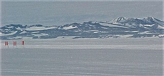
Troll Airfield is an airstrip located 6.8 kilometres (4.2 mi) from the research station Troll in Princess Martha Coast in Queen Maud Land, Antarctica. Owned and operated by the Norwegian Polar Institute, it consists of a 3,300-by-100-metre runway on glacial blue ice on the Antarctic ice sheet. The airport is located at 1,232 metres (4,042 ft) above mean sea level and is 235 kilometres (146 mi) from the coast.
The British Antarctic Survey (BAS) is the United Kingdom's national polar research institute. It has a dual purpose, to conduct polar science, enabling better understanding of global issues, and to provide an active presence in the Antarctic on behalf of the UK. It is part of the Natural Environment Research Council (NERC). With over 400 staff, BAS takes an active role in Antarctic affairs, operating five research stations, one ship and five aircraft in both polar regions, as well as addressing key global and regional issues. This involves joint research projects with over 40 UK universities and more than 120 national and international collaborations.

Zucchelli Station is an Italian seasonal research station, located at Terra Nova Bay in Antarctica on a granitic headland along the coast of the Northern Foothills to north-east of Gerlache Inlet. It has been named after Mario Zucchelli, director of the activities, which conducted for sixteen years, for the ENEA-Unità Tecnica Antartide as part of the National Antarctic Research Program (PNRA).

Marble Point is a rocky promontory on the coast of Victoria Land, Antarctica. The United States operates a station at the point. The outpost is used as a helicopter refueling station supporting scientific research in the nearby continental interior, such as the McMurdo Dry Valleys. Dependent upon the weather conditions at the time, helicopters are able to fly in and out of the station 24 hours a day during the summer research season.

Wright Peninsula is a peninsula on the east coast of Adelaide Island, Antarctica, lying between Stonehouse Bay to the north and Ryder Bay to the south. On its northern coastline the peninsula is fringed by the Stokes Peaks; on its southern side by the Reptile Ridge. The Princess Royal Range separates the peninsula from the rest of Adelaide Island; the only 'gap' is provided by McCallum Pass.
Steven Wormald, born 1946, was prominent as an Antarctic explorer during the 1970s.

Marambio Airport is an airport serving Marambio Base, an Argentinian research station on Seymour Island in the Antarctic Peninsula. Marambio is the main air-support node for most local and foreign stations in Argentine Antarctica, providing year-round medical evacuation, search and rescue, personnel, cargo, and mail transfer.


