Timaru is a port city in the southern Canterbury region of New Zealand, located 157 km (98 mi) southwest of Christchurch and about 196 km (122 mi) northeast of Dunedin on the eastern Pacific coast of the South Island. The Timaru urban area is home to 28,700 people, and is the largest urban area in South Canterbury, and the second largest in the Canterbury Region overall, after Christchurch. The town is the seat of the Timaru District, which includes the surrounding rural area and the towns of Geraldine, Pleasant Point and Temuka, which combined have a total population of 48,400.
The Opihi River flows through south Canterbury, in New Zealand's South Island. It has been identified as an Important Bird Area by BirdLife International because it supports breeding colonies of the endangered black-billed gull.
Rangitata Island is a long lens-shaped island in the delta of the braided Rangitata River in Canterbury, New Zealand, approximately halfway between Timaru and Ashburton, New Zealand. The island is approximately 17 kilometres (11 mi) long and about 5 kilometres (3 mi) wide at its widest. Low lying, it is mostly fertile farmland.

Cave is a town located in the Timaru District, South Island, New Zealand. It is approximately 23 kilometres (14 mi) north-west of Timaru on State Highway 8. It covers the area from the Rangitata River to Pareora River, Pacific Ocean to Mackenzie District, including Rangitata Gorge. St. David's Memorial Church was commissioned by Thomas Burnett and designed by Herbert W. Hall. Built in 1930, it is registered as a category I heritage building with Heritage New Zealand.
The South Canterbury Rugby Football Union (SCRFU) is a rugby province based in the central South Island city of Timaru, New Zealand. The South Canterbury team play from Alpine Energy Stadium located in Timaru.

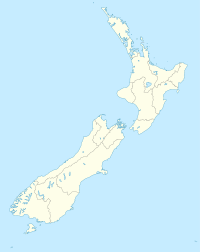
South Canterbury is the name given semi-formally to the area of the Canterbury Region of the South Island of New Zealand bounded by the Rangitata River in the north and the Waitaki River to the south. The Pacific Ocean and ridge of the Southern Alps form natural boundaries to the east and west respectively. Though the exact boundaries of the region have never been formalised, the term is used for a variety of government agencies and other entities. It is one of four traditional sub-regions of Canterbury, along with Mid-Canterbury, North Canterbury, and Christchurch city.

The Waihao River is a natural watercourse in the Canterbury region of New Zealand's South Island. It flows into the Wainono Lagoon near Studholme.
Waimate Creek is a natural watercourse in the southern Canterbury region of New Zealand's South Island. Its original Māori name was Te Waimatemate, which means "slowly moving waters".
Geraldine was a former parliamentary electorate in the South Canterbury region of New Zealand that existed three times from 1875 to 1911. It was represented by six Members of Parliament.
Pareora was a former parliamentary electorate in the Canterbury region of New Zealand for one electoral term in the 19th century.
The Motukaika River is a river of the south Canterbury region of New Zealand's South Island. It flows generally east, reaching the Pareora River at the small settlement of Motukaika, 18 kilometres (11 mi) west of Timaru.
The Pareora River is a river of the Canterbury region of New Zealand's South Island. It has its origins in several small streams flowing from the Hunters Hills, and flows north before turning southeast to reach the Pacific ocean at the southern end of the township of Pareora, 8 kilometres (5 mi) south of Timaru. The river ends in a hapua-type river mouth, this means the flow to the ocean is impeded by a gravel bank.
Pareora is a small town in the South Island of New Zealand. It is located close to State Highway 1, which bypasses the western edge of the town, and close to the Pacific Ocean coast, five kilometres north of Saint Andrews and 10 kilometres south of Timaru. The Pareora River reaches the ocean just to the south of the township.
John Anstey JP was a farmer from South Canterbury in New Zealand. He was first a member of the Legislative Council and then a Member of Parliament, representing the Liberal Party.
Waimate is a town in Canterbury, New Zealand and the seat of Waimate District. It is situated just inland from the eastern coast of the South Island. The town is reached via a short detour west when travelling on State Highway One, the main North/South road. Waimate is 45.7 km south of Timaru, Canterbury's second city, 20 km north of the Waitaki River, which forms the border between Canterbury and the Otago province to the south and 47.5 km north of Oamaru, the main town of the Waitaki District.

The South Canterbury District Health Board is a district health board with the focus on providing healthcare to the Timaru, Mackenzie, Waimate districts in New Zealand.
Pleasant Valley is a small locality near the town of Geraldine in the Canterbury Region of the South Island of New Zealand. The area is boarded by the Geraldine Downs to the north and Gapes Valley to the south. The Hae Hae Te Moana River runs through the valley.
Marchwiel is a suburb of Timaru, Canterbury, New Zealand. It is one of 24 suburbs within the Timaru District.
Waimataitai is a suburb of Timaru, in the South Canterbury district and Canterbury region of New Zealand's South Island.
Gleniti is a suburb of Timaru, in the South Canterbury district and Canterbury region of New Zealand's South Island. It is located west of the town centre.