Saint Bernard, Southern Leyte

Last updated
Saint Bernard
Municipality of Saint Bernard
Saint Bernard South Leyte.jpg
Flag of Saint Bernard, Southern Leyte.png
Ph locator southern leyte saint bernard.png
Map of Southern Leyte with Saint Bernard highlighted
OpenStreetMap
Saint Bernard, Southern Leyte
Philippines location map (square).svg
Red pog.svg
Saint Bernard
Location within the Philippines
Coordinates: 10°17′N125°08′E / 10.28°N 125.13°E / 10.28; 125.13
Country Philippines
Region Eastern Visayas
Province Southern Leyte
District 2nd district
Founded December 9, 1954
Barangays 30 (see Barangays)
Government
[1]
  Type Sangguniang Bayan
   Mayor Edito L. Mulig (PDR)
   Vice Mayor Jocelyn L. Bungcaras (PDPLBN)
   Representative Christopherson M. Yap
   Municipal Council
Members
   Electorate 18,603 voters (2022)
Area
[2]
  Total100.20 km2 (38.69 sq mi)
Elevation
129 m (423 ft)
Highest elevation
786 m (2,579 ft)
Lowest elevation
0 m (0 ft)
Population
 (2020 census) [3]
  Total28,414
  Density280/km2 (730/sq mi)
   Households
6,254
Economy
   Income class 4th municipal income class
   Poverty incidence
25.48
% (2018) [4]
   Revenue 124.8 million (2020)
   Assets 338 million (2020)
   Expenditure 107.9 million (2020)
   Liabilities 68.26 million (2020)
Service provider
  ElectricitySouthern Leyte Electric Cooperative (SOLECO)
Time zone UTC+8 (PST)
ZIP code
6613
PSGC
IDD : area code +63(0)53
Native languages Kinabalian
Boholano dialect
Cebuano
Tagalog
Website www.saintbernard.gov.ph

Saint Bernard, officially the Municipality of Saint Bernard (Kabalian: Lungsod san Saint Bernard; Cebuano : Lungsod sa Saint Bernard; Tagalog : Bayan ng Saint Bernard), is a 4th class municipality in the province of Southern Leyte, Philippines. According to the 2020 census, it has a population of 28,414 people. [3]

Contents

History

Landslide at Barangay Guinsaugon US Navy 060219-N-5067K-109 A CH-46E Sea Knight from the Flying Tigers of Marine Medium Helicopter Squadron 262 (HMM-262) makes an aerial assessment of the deadly Feb. 17 landslide during over-flight of the area.jpg
Landslide at Barangay Guinsaugon

This town was formerly the largest barrio of San Juan, then known as "Himatagon". On December 9, 1954, President Ramon Magsaysay issued Executive Order No. 84, transforming the barrio as a municipality of Saint Bernard. It was through the efforts of Leyte Governor Bernardo Torres that the conversion was made possible in response to the lingering clamour of the inhabitants for an independent and separate municipality from San Juan. As a gratitude to Governor Bernardo Torres, the people unanimously renamed Himatagon as Saint Bernard, with the honorific title "Saint" being a translation of the vernacular honorific "San" which is given to persons of virtue, wisdom, or generosity and the name Bernard being the English version of the name Bernardo. [5]

On February 17, 2006, a tragic series of mudslides killed over 1,100 residents in Barangay Guinsaugon, a barangay in the northern parts of the town. Affected families were treated by the Philippine government and other non-government organizations from all over the world. New houses were built, and the people chose "New Guinsaugon" as the name, (by adding the prefix "New"), of their village located one mile east of the town's proper. [6] [7]

Geography

The town is situated on the Pacific coast, facing Cabalian Bay and the first town on Route 690 (from it towards Abuyog) from the eastern side of Sogod Bay.

Barangays

Saint Bernard is politically subdivided into 30 barangays. Each barangay consists of puroks and some have sitios.

Only 28 barangays are currently functioning, as Guinsaugon and Sug-angon were completely wiped out from a landslide during 2006. The survivors of the landslide were relocated to New Guinsaugon in Brgy. Magbagacay.

BarangayPopulation (2020) [3]
Atuyan467
Ayahag417
Bantawon228
Bolodbolod1,275
Carnaga923
Catmon2,548
Guinsaugon47
Himatagon (Poblacion)1,748
Himbangan2,661
Himos-onan702
Hinabian99
Hindag-an1,605
Kauswagan28
Libas411
Lipanto1,276
Magatas88
Magbagacay2,441
Mahayag662
Mahayahay1,701
Malibago1,557
Malinao42
Maria Asuncion (Cabagawan)1,264
Nueva Esperanza (Cabac-an)107
Panian1,335
San Isidro1,953
Santa Cruz313
Sug-angon382
Tabon-tabon312
Tambis Uno882
Tambis Dos940

Climate

Climate data for Saint Bernard, Southern Leyte
MonthJanFebMarAprMayJunJulAugSepOctNovDecYear
Mean daily maximum °C (°F)27
(81)
28
(82)
28
(82)
29
(84)
29
(84)
29
(84)
28
(82)
28
(82)
28
(82)
28
(82)
28
(82)
28
(82)
28
(82)
Mean daily minimum °C (°F)21
(70)
21
(70)
21
(70)
22
(72)
24
(75)
24
(75)
24
(75)
24
(75)
24
(75)
23
(73)
23
(73)
22
(72)
23
(73)
Average precipitation mm (inches)78
(3.1)
57
(2.2)
84
(3.3)
79
(3.1)
118
(4.6)
181
(7.1)
178
(7.0)
169
(6.7)
172
(6.8)
180
(7.1)
174
(6.9)
128
(5.0)
1,598
(62.9)
Average rainy days16.713.817.318.523.226.527.126.026.427.524.621.0268.6
Source: Meteoblue (modeled/calculated data, not measured locally) [8]

Demographics

Population census of Saint Bernard
YearPop.±% p.a.
1960 11,621    
1970 17,296+4.05%
1975 19,255+2.18%
1980 19,153−0.11%
1990 20,760+0.81%
1995 21,363+0.54%
YearPop.±% p.a.
2000 23,089+1.68%
2007 25,252+1.24%
2010 25,169−0.12%
2015 28,395+2.32%
2020 28,414+0.01%
Source: Philippine Statistics Authority [9] [10] [11] [12]

Economy

Saint Bernard's economy are based in agriculture and marine culture. The municipality is considered among the fastest growing economy in the pacific area of Southern Leyte.

Saint Bernard is a peninsula and therefore it is almost entirely surrounded by water. The majority of the people who live in the flat lands engage in fishing as their main mode of livelihood. Those who live in the mountain barangays, live through farming.

The common mode of transportation is by bicycles with side cars, known locally as "Potpot" (a type of pedicab) or, depending on the distance, tricycles with side cars, called "trisikads "or center cabs and "habal-habal", a motorcycle with a roof made up of wood or metal, operating in the area's environs.

The LGU established the Saint Bernard Town Center for economic activities of some small to medium sedium entrepreneurs.

Tourism

Education

There are accessible elementary schools in every Barangay in the municipality as of its 2019 census.

List of Secondary Schools in the Municipality of Saint Bernard.

Related Research Articles

<span class="mw-page-title-main">Southern Leyte</span> Province in Eastern Visayas, Philippines

Southern Leyte, officially the Province of Southern Leyte, is a province in the Philippines located in the Eastern Visayas region. Its capital is the city of Maasin. Southern Leyte comprised the third congressional district Leyte until it was made into an independent province in 1959. Southern Leyte includes Limasawa, an island to the south where the first Roman Catholic Mass in Philippine soil is believed to have taken place and thus considered to be the birthplace of Roman Catholicism in the Philippines.

<span class="mw-page-title-main">Balangiga</span> Municipality in Eastern Samar, Philippines

Balangiga, officially the Municipality of Balangiga, is a 4th class municipality in the province of Eastern Samar, Philippines. According to the 2020 census, it has a population of 14,341 people.

<span class="mw-page-title-main">Padre Burgos, Southern Leyte</span> Municipality in Southern Leyte, Philippines

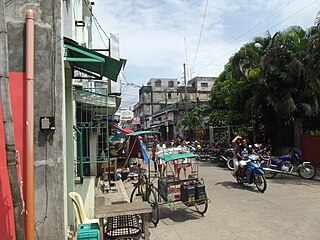
Padre Burgos, officially the Municipality of Padre Burgos, is a 5th class municipality in the province of Southern Leyte, Philippines. According to the 2020 census, it has a population of 11,159 people.

<span class="mw-page-title-main">Naval, Biliran</span> Capital of Biliran, Philippines

Naval, officially the Municipality of Naval, is a 2nd class municipality and capital of the province of Biliran, Philippines. According to the 2020 census, it has a population of 58,187 people.

<span class="mw-page-title-main">Anahawan</span> Municipality in Southern Leyte, Philippines

Anahawan, officially the Municipality of Anahawan, is a 5th class municipality in the province of Southern Leyte, Philippines. According to the 2020 census, it has a population of 8,429 people.

<span class="mw-page-title-main">Hinundayan</span> Municipality in Southern Leyte, Philippines

Hinundayan, officially the Municipality of Hinundayan, is a 5th class municipality in the province of Southern Leyte, Philippines. According to the Hinundayan has a total land area of 6,108 hectares or 61.08 square kilometers, comprising 17 barangays. 2020 census, it has a population of 12,398 people.

<span class="mw-page-title-main">Liloan, Southern Leyte</span> Municipality in Southern Leyte, Philippines

Liloan, officially the Municipality of Liloan, is a 4th class municipality in the province of Southern Leyte, Philippines. According to the 2020 census, it has a population of 24,800 people.

<span class="mw-page-title-main">Limasawa</span> Municipality in Southern Leyte, Philippines

Limasawa, officially the Municipality of Limasawa, is an island municipality in the province of Southern Leyte, Philippines. According to the 2020 census, it has a population of 6,191 people.

<span class="mw-page-title-main">San Francisco, Southern Leyte</span> Municipality in Southern Leyte, Philippines

San Francisco, officially the Municipality of San Francisco, is a 5th class municipality in the province of Southern Leyte, Philippines. According to the 2020 census, it has a population of 13,436 people.

<span class="mw-page-title-main">San Juan, Southern Leyte</span> Municipality in Southern Leyte, Philippines

San Juan, officially the Municipality of San Juan, is a 5th class municipality in the province of Southern Leyte, Philippines. According to the 2020 census, it has a population of 14,912 people.

<span class="mw-page-title-main">San Ricardo</span> Municipality in Southern Leyte, Philippines

San Ricardo, officially the Municipality of San Ricardo, is a 5th class municipality in the province of Southern Leyte, Philippines. According to the 2020 census, it has a population of 10,500 people.

<span class="mw-page-title-main">Tomas Oppus</span> Municipality in Southern Leyte, Philippines

Tomas Oppus, officially the Municipality of Tomas Oppus, is a 5th class municipality in the province of Southern Leyte, Philippines. According to the 2020 census, it has a population of 16,990 people.

<span class="mw-page-title-main">Bato, Leyte</span> Municipality in Leyte, Philippines

Bato, officially the Municipality of Bato, is a 4th class municipality in the province of Leyte, Philippines. According to the 2020 census, it has a population of 38,505 people.

<span class="mw-page-title-main">Hilongos</span> Municipality in Leyte, Philippines

Hilongos, officially the Municipality of Hilongos, is a 2nd class municipality in the province of Leyte, Philippines. According to the 2020 census, it has a population of 64,514 people.

<span class="mw-page-title-main">Inopacan</span> Municipality in Leyte, Philippines

Inopacan, officially the Municipality of Inopacan, is a 4th class municipality in the province of Leyte, Philippines. According to the 2020 census, it has a population of 21,389 people.

<span class="mw-page-title-main">Isabel, Leyte</span> Municipality in Leyte, Philippines

Isabel, officially the Municipality of Isabel, is a 1st class municipality in the province of Leyte, Philippines. According to the 2020 census, it has a population of 46,781 people.

<span class="mw-page-title-main">Leyte, Leyte</span> Municipality in Leyte, Philippines

Leyte, officially the Municipality of Leyte, is a 4th class municipality in the province of Leyte, Philippines. According to the 2020 census, it has a population of 40,397 people.

<span class="mw-page-title-main">Mayorga, Leyte</span> Municipality in Leyte, Philippines

Mayorga, officially the Municipality of Mayorga, is a 5th class municipality in the province of Leyte, Philippines. According to the 2020 census, it has a population of 18,071 people.

<span class="mw-page-title-main">Palompon</span> Municipality in Leyte, Philippines

Palompon, officially the Municipality of Palompon, is a 2nd class municipality in the province of Leyte, Philippines. According to the 2020 census, it has a population of 58,313 people.

<span class="mw-page-title-main">San Isidro, Leyte</span> Municipality in Leyte, Philippines

San Isidro, officially the Municipality of San Isidro, is a 4th class municipality in the province of Leyte, Philippines. According to the 2020 census, it has a population of 30,722 people.

References

  1. Municipality of Saint Bernard | (DILG)
  2. "2015 Census of Population, Report No. 3 – Population, Land Area, and Population Density" (PDF). Philippine Statistics Authority. Quezon City, Philippines. August 2016. ISSN   0117-1453. Archived (PDF) from the original on May 25, 2021. Retrieved July 16, 2021.
  3. 1 2 3 Census of Population (2020). "Region VIII (Eastern Visayas)". Total Population by Province, City, Municipality and Barangay. Philippine Statistics Authority . Retrieved 8 July 2021.
  4. "PSA Releases the 2018 Municipal and City Level Poverty Estimates". Philippine Statistics Authority. 15 December 2021. Retrieved 22 January 2022.
  5. "Historical Background". Municipality of Saint Bernard, Southern Leyte. Archived from the original on 26 May 2012. Retrieved 15 July 2013.
  6. "Mud wipes out Philippines village". BBC News. 17 February 2006. Retrieved 15 July 2013.
  7. S. G. Evans; R. H. Guthrie; N. J. Roberts; N. F. Bishop (2007). "The disastrous 17 February 2006 rockslide-debris avalanche on Leyte Island, Philippines: a catastrophic landslide in tropical mountain terrain" (PDF). Natural Hazards and Earth System Sciences. 7 (1). Retrieved 15 July 2013.
  8. "Saint Bernard, Southern Leyte: Average Temperatures and Rainfall". Meteoblue. Retrieved 13 January 2019.
  9. Census of Population (2015). "Region VIII (Eastern Visayas)". Total Population by Province, City, Municipality and Barangay. Philippine Statistics Authority . Retrieved 20 June 2016.
  10. Census of Population and Housing (2010). "Region VIII (Eastern Visayas)" (PDF). Total Population by Province, City, Municipality and Barangay. National Statistics Office . Retrieved 29 June 2016.
  11. Censuses of Population (1903–2007). "Region VIII (Eastern Visayas)". Table 1. Population Enumerated in Various Censuses by Province/Highly Urbanized City: 1903 to 2007. National Statistics Office.{{cite encyclopedia}}: CS1 maint: numeric names: authors list (link)
  12. "Province of Southern Leyte". Municipality Population Data. Local Water Utilities Administration Research Division. Retrieved 17 December 2016.
  13. "Poverty incidence (PI):". Philippine Statistics Authority. Retrieved December 28, 2020.
  14. "Estimation of Local Poverty in the Philippines" (PDF). Philippine Statistics Authority. 29 November 2005.
  15. "2003 City and Municipal Level Poverty Estimates" (PDF). Philippine Statistics Authority. 23 March 2009.
  16. "City and Municipal Level Poverty Estimates; 2006 and 2009" (PDF). Philippine Statistics Authority. 3 August 2012.
  17. "2012 Municipal and City Level Poverty Estimates" (PDF). Philippine Statistics Authority. 31 May 2016.
  18. "Municipal and City Level Small Area Poverty Estimates; 2009, 2012 and 2015". Philippine Statistics Authority. 10 July 2019.
  19. "PSA Releases the 2018 Municipal and City Level Poverty Estimates". Philippine Statistics Authority. 15 December 2021. Retrieved 22 January 2022.