San Vicente Boulevard

Last updated
Intersection of Wilshire and San Vicente Boulevards, at the western end of the Miracle Mile neighborhood of Los Angeles, California. Wilshire and San Vicente Blvds.jpg
Intersection of Wilshire and San Vicente Boulevards, at the western end of the Miracle Mile neighborhood of Los Angeles, California.

San Vicente Boulevard is a major northwest-southeast thoroughfare located in the western portion of the metropolitan area of Los Angeles, CA.

Contents

The boulevard begins at Venice Boulevard between Crenshaw Boulevard and La Brea Avenue and travels in a northwesterly direction towards Beverly Hills. The roadway splits into two streets past La Cienega Boulevard: the western branch becoming Burton Way, which eventually becomes South Santa Monica Boulevard and connects directly to downtown Beverly Hills. The northern branch remains as San Vicente Boulevard itself, passes Beverly Center, continues north into West Hollywood and becomes North Clark Street at Sunset Boulevard. A separate stretch of road with the same name runs from Santa Monica to Brentwood.

Route and addressing

San Vicente curves diagonally and intersects both east-west and north-south streets, allowing direct access between Downtown Los Angeles and Beverly Hills or West Hollywood. Locating an address on San Vicente Boulevard can be difficult as the road does not follow Los Angeles numbering conventions.

The easternmost end at Venice Boulevard begins with address number 4600 and increases to the west. The address numbers continue to increase up to 6600 at Wilshire Boulevard. Here, the numbering switches from east-west numbers to north-south numbers with respect to the city grid.

Between Wilshire Boulevard and La Cienega Boulevard, the median of San Vicente forms a border between Beverly Hills and Los Angeles. The east side of the roadway is known as S. San Vicente Boulevard, with address numbers (even) decreasing from 700 at Wilshire to 400 at La Cienega. The west side is known as N. San Vicente Boulevard, with address numbers (odd) increasing from 100 at Wilshire to 300 at La Cienega.

North of La Cienega, both sides of the street are in Los Angeles. The numbering continues accordingly as 400 S. San Vicente Boulevard. The street becomes N. San Vicente Boulevard at Gracie Allen Drive. As in the rest of Los Angeles, the numbers at the city's grid axis start with 100 (numbers 0-99 are not used). At Beverly Boulevard (300 N.), San Vicente enters the city of West Hollywood, where the street name and numbering do not change. The street terminates at Sunset Boulevard in West Hollywood at 1100 N. San Vicente.

A second San Vicente Boulevard runs between the Brentwood neighborhood of Los Angeles and Santa Monica. This street is unrelated except in name.

San Vicente Park

Local neighborhood councils and non profit green activist have been pursuing making San Vicente Boulevard's median green space more accessible. Citing lack of civic green space. Planning meetings have taken place in the affected Olympic Park Neighborhood Council, Pico Neighborhood Council, and the Mid-City West Community Council. [1] Money for the project is coming from these three councils and the Community Redevelopment Agency of Los Angeles (CRA/LA). The Olympic Park Neighborhood Council is committing $30,000 for the project. [2] In 2011, construction was to begin on the San Vicente median between Pico Boulevard and Fairfax Avenue sections center median. [3] "The plan called for the medians between Fairfax Avenue and Pico Boulevard to be adorned with new trees, a walking path and seating areas. Trees and plaques at the intersections at Pico Boulevard and Fairfax Avenue, identifying them as gateways, will also be installed." Recently, neighborhood councils and activist have pushed for the closure of all lanes and expanding the park along most of the planned K Line Extension route from Pico Boulevard to the Beverly Center, A 3.2 miles linear park. Leaving only a locals utility lane for residents but a wider linear park for the city. [4] [5]

Related Research Articles

<span class="mw-page-title-main">Fairfax Avenue</span> Street in the city of Los Angeles, California

Fairfax Avenue is a street in the north central area of the city of Los Angeles, California. It runs from La Cienega Boulevard in Culver City at its southern end to Hollywood Boulevard in Hollywood on its northern end. From La Cienega Boulevard to Sunset Boulevard, it separates the Westside from the central part of the city along with Venice Boulevard, La Cienega Boulevard, Hauser Boulevard, San Vicente Boulevard, South Cochran Avenue, Wilshire Boulevard, 6th Street, Cochran Avenue, 4th Street, La Brea Avenue, Fountain Avenue and Sunset Boulevard.

<span class="mw-page-title-main">Fairfax District, Los Angeles</span> Neighborhood of Los Angeles

The Fairfax District is a neighborhood in the Central region of Los Angeles, California.

<span class="mw-page-title-main">Miracle Mile, Los Angeles</span> Neighborhood of Los Angeles, California, USA

Miracle Mile is a neighborhood in the city of Los Angeles, California.

West Los Angeles is an area within the city of Los Angeles, California. The residential and commercial neighborhood is divided by the Interstate 405 freeway, and each side is sometimes treated as a distinct neighborhood, mapped differently by different sources. Each lies within the larger Westside region of Los Angeles County.

<span class="mw-page-title-main">La Cienega Boulevard</span> Highway in California

La Cienega Boulevard is a major north–south arterial road that runs between El Segundo Boulevard in Hawthorne, California on the south and the Sunset Strip/Sunset Boulevard in West Hollywood to the north. It was named for Rancho Las Cienegas, literally "The Ranch Of The Swamps," an area of marshland south of Rancho La Brea.

<span class="mw-page-title-main">Wilshire Boulevard</span> Major thoroughfare in the metropolitan Los Angeles area, United States

Wilshire Boulevard is a prominent 15.83 mi (25.48 km) boulevard in the Los Angeles area of Southern California, extending from Ocean Avenue in the city of Santa Monica east to Grand Avenue in the Financial District of downtown Los Angeles. One of the principal east-west arterial roads of Los Angeles, it is also one of the major city streets through the city of Beverly Hills. Wilshire Boulevard runs roughly parallel with Santa Monica Boulevard from Santa Monica to the west boundary of Beverly Hills. From the east boundary it runs a block south of Sixth Street to its terminus.

Mid-Wilshire is a neighborhood in the central region of Los Angeles, California. It is known for the Los Angeles County Museum of Art, the Petersen Automotive Museum, and the Miracle Mile shopping district.

<span class="mw-page-title-main">Mid City, Los Angeles</span> Neighborhood of Los Angeles in California, United States of America

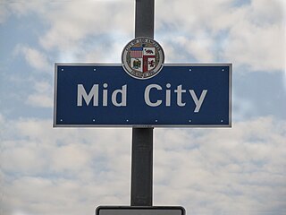
Mid City is a neighborhood in Central Los Angeles, California.

<span class="mw-page-title-main">Santa Monica Boulevard</span> Major west-east thoroughfare in Los Angeles County, California, USA

Santa Monica Boulevard is a major west–east thoroughfare in Los Angeles County. It runs from Ocean Avenue in Santa Monica near the Pacific Ocean to Sunset Boulevard at Sunset Junction in Los Angeles. It passes through Beverly Hills and West Hollywood. A portion of it is designated as California State Route 2.

<span class="mw-page-title-main">South Robertson, Los Angeles</span> Neighborhood of Los Angeles in California, United States

South Robertson is a neighborhood in the Westside of the city of Los Angeles, California. It is notable for its diversity and being a center for the Jewish community.

<span class="mw-page-title-main">Olympic Boulevard (Los Angeles)</span> Major arterial road in Los Angeles, California

Olympic Boulevard is a major arterial road in Los Angeles, California. It stretches from Ocean Avenue on the western end of Santa Monica to East Los Angeles—farther than Wilshire Boulevard and most other streets.

<span class="mw-page-title-main">Beverly Boulevard</span> Thoroughfare in Los Angeles, United States

Beverly Boulevard is one of the main east–west thoroughfares in Los Angeles, in the U.S. state of California. It begins off Santa Monica Boulevard in Beverly Hills and ends on the Lucas Avenue overpass near downtown Los Angeles to become 1st Street. A separate Beverly Boulevard begins off 3rd Street and Pomona Boulevard in East Los Angeles, runs through Montebello and Pico Rivera, and becomes Turnbull Canyon Road in Whittier near Rose Hills Memorial Park.

The western border of Santa Monica, California, is the 3-mile (4.8 km) stretch of Santa Monica Bay. On its other sides, the city is bordered by various districts of Los Angeles: the northwestern border is Pacific Palisades, the eastern border is Brentwood north of Wilshire Boulevard and West Los Angeles south of Wilshire, the northeastern border is generally San Vicente Boulevard up to the Riviera Country Club, the southwestern border is Venice Beach and the southern border is with West Los Angeles and Mar Vista.

<span class="mw-page-title-main">Mid-City West, Los Angeles</span>

Mid-City West is a subregion in the western part of the Central Los Angeles region, served by the Mid City West Neighborhood Council.

<span class="mw-page-title-main">Sawtelle Line</span> Los Angeles streetcar route (1901-1940)

The Sawtelle Line was an interurban railway route operated by the Pacific Electric Railway that ran between Downtown Los Angeles and Santa Monica, California.

<span class="mw-page-title-main">D Line Extension</span> Subway extension

The Metro Purple Extension Transit Project, formerly known as the Westside Subway Extension and the Subway to the Sea, is a new heavy rail extension construction project in Los Angeles County, California, extending the D Line from its current terminus at Wilshire/Western in Koreatown, Los Angeles, to the Westside region. Currently, under construction, the corridor will become part of the Los Angeles Metro Rail system. The project is being supervised by Los Angeles County Metropolitan Transportation Authority (Metro). The subway has been given high priority by Metro in its long-range plans, and funding for the project was included in two county sales tax measures, Measure R and Measure M.

<span class="mw-page-title-main">Los Angeles City Council District 10</span> American legislative district

Los Angeles City Council District 10 is one of the 15 districts of the Los Angeles City Council.

<span class="mw-page-title-main">Beverly Grove, Los Angeles</span> District and neighborhood of Los Angeles, California, US

Beverly Grove is an area within the Beverly–Fairfax neighborhood in the Mid-City West region of Los Angeles, California.

The Metro K Line Northern Extension is a project planning a Los Angeles Metro Rail light rail transit corridor extension connecting Expo/Crenshaw station to Hollywood/Highland station in Hollywood. The corridor is a north-to-south route along mostly densely populated areas of the Los Angeles Basin; it would be operated as part of the K Line. The Los Angeles County Metropolitan Transportation Authority (Metro) is prioritizing the project along with pressure from the West Hollywood residents. Construction is slated to start in 2041 and begin service by 2047 unless means to accelerate the project are found.

References

  1. "San Vicente Median Project meeting November 7th, 2010". Mid-City West Blog. Mid-City West Community Council. Archived from the original on 2012-03-23. Retrieved 2011-05-02.
  2. Pineda, Carla. "Olympic Park Neighborhood Council March 2011". The Neighborhood News Online. Archived from the original on October 6, 2022. Retrieved May 2, 2011.
  3. Folven, Edwin. "Medians Will Provide Green Oasis in Urban Setting". Beverly Press. Beverly Press. Archived from the original on July 25, 2011. Retrieved May 2, 2011.
  4. https://www.streetsforall.org/initiatives/san-vicente-park
  5. https://intuarch.com/san-vicente-park/

Coordinates: 34°3′54″N118°22′19″W / 34.06500°N 118.37194°W / 34.06500; -118.37194