
Investigator Strait is a body of water in South Australia lying between the Yorke Peninsula, on the Australian mainland, and Kangaroo Island. It was named by Matthew Flinders after his ship, HMS Investigator, on his voyage of 1801–1802. It is bordered by the Gulf St Vincent in the northeast.

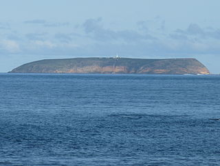
Cape Borda is a headland in the Australian state of South Australia located in the gazetted locality of Cape Borda on the north west tip of Kangaroo Island about 70 km (43 mi) west of the municipal seat of Kingscote. It was named after Jean-Charles de Borda (1733–1799), the French mathematician, physicist, naturalist and sailor, by the Baudin expedition to Australia during January 1803. It has been the site of an operating lighthouse since 1858 and is currently located within the Flinders Chase National Park.

Goose Island is a small (2 ha), rocky island lying about 550 m from the northern end of the much larger Wardang Island, off the west coast of the Yorke Peninsula, in the Spencer Gulf of South Australia. Rising to a height of 26 m, its vegetation is dominated by African boxthorn on clay and calcarenite soils. The waters surrounding the island are protected in the Goose Island Aquatic Reserve. The island is leased from the Department of Environment, Water and Natural Resources by Scotch College and is co-managed by the two parties.
Goose Island Conservation Park is a protected area in the Australian state of South Australia, located on Goose Island and other islets in the vicinity of Wardang Island in Spencer Gulf. The constituent islands are located within 5 kilometres to 12 kilometres in the sector between west and north west of Port Victoria.

Troubridge Island is an island located in the south west corner of Gulf St Vincent in South Australia near the eastern edge of the Troubridge Shoals off the east coast of Yorke Peninsula about 8 kilometres (5.0 mi) southeast by east of the town of Edithburgh It is notable for being a site of an operating lighthouse from 1856 until 2002 and as a site for a sea bird rookery. Since 1982, the island has been part of the Troubridge Island Conservation Park.
Troubridge Island Conservation Park is a protected area includes all of Troubridge Island and some adjoining waters about 8 kilometres East-southeast of Edithburgh in South Australia and about 74 kilometres southwest of Adelaide. The park was proclaimed in 1982 under National Parks and Wildlife Act 1972 ‘to conserve sea-bird rookeries and to preserve heritage values of a lighthouse and associated keepers’ cottages’. In 1986 the park was extended to include an area of intertidal waters around the island. The conservation park is classified as an IUCN Category III protected area.
The Althorpe Islands are a group of islands in the Investigator Strait, off the south-western tip of Yorke Peninsula, South Australia. The group includes Althorpe Island and two rocky islets immediately to its west known as The Boobs. These are located 7.7 km south-southwest of Cape Spencer on the mainland. Closer inshore are Seal Island and Haystack Island, which together with Althorpe Island and The Boobs constitute the Althorpe Islands Conservation Park. A management plan for the Althorpe Islands Conservation Park was adopted in 2009. The islands are uninhabited and can only be accessed by sea or by helicopter.

Greenly Island is an island in the Australian state of South Australia located in the Great Australian Bight about 30 kilometres (19 mi) west-south-west of Point Whidbey on Eyre Peninsula. The island is uninhabited by humans and provides a haven for marine and terrestrial wildlife. The island and its intertidal zone constitute the Greenly Island Conservation Park. Its adjacent waters are occasionally visited by fishermen targeting yellowtail kingfish.

Neptune Islands Conservation Park is a protected area occupying most of the Neptune Islands in South Australia about 55 km (34 mi) south-south east of Port Lincoln. It was established in 1967 principally to protect a New Zealand fur seal breeding colony. The conservation park was subsequently expanded to include the adjoining waters in order to control and manage berleying activities used to attract great white sharks. As of 2002, the conservation park is the only place in Australia where shark cage diving to view great white sharks is legally permitted.
Williams Island is an island in the Australian state of South Australia located off the south coast of Jussieu Peninsula on Eyre Peninsula approximately 34 km (21 mi) south-east of Port Lincoln. It was named by Matthew Flinders for Robert Williams who subsequently lost his life along with seven other crew in the capsize of a cutter launched from HM Sloop Investigator to search for water on 21 February 1802. Since 2004, the island has been part of the Memory Cove Wilderness Protection Area.
Smith Island is an island located in Spencer Gulf off the east coast of Jussieu Peninsula on Eyre Peninsula in South Australia approximately 32 km (20 mi) south-east of Port Lincoln. It was named by Matthew Flinders in memory of William Smith who was one of the eight crew lost from a cutter that capsized sometime after being launched from HM Sloop Investigator to search for water on 21 February 1802. Since 2004, the island has been part of the Memory Cove Wilderness Protection Area.

Pelorus Islet is an islet in the Australian state of South Australia located in Great Australian Bight off the south coast of Kangaroo Island approximately 7 kilometres east south-east of Cape Gantheaume. It was named by Captain Francis Harding, RN after HMS Pelorus.

Nobby Islet is an islet located in the Great Australian Bight off the south coast of Kangaroo Island in the Australian state of South Australia approximately 50 kilometres south-west of Kingscote. It is currently part of the Seal Bay Conservation Park.
Paisley Islet is an islet located in the Great Australian Bight immediately off the west coast of Kangaroo Island in South Australia approximately 104 kilometres west south-west of Kingscote. It is currently part of the Flinders Chase National Park.

The Casuarina Islets, also known as The Brothers, is a pair of islands located in the Great Australian Bight immediately off the south-west coast of Kangaroo Island in South Australia approximately 96 kilometres south-west of Kingscote. The pair is currently part of the Flinders Chase National Park.
Althorpe Islands Conservation Park is a protected area in the Australian state of South Australia occupying the Althorpe Island, Haystack Island and Seal Island in Investigator Strait near the town of Stenhouse Bay.

Chinamans Hat Island is an islet located off the south coast of Yorke Peninsula in Investigator Strait in South Australia about 2.4 kilometres south-west of Stenhouse Bay and within 350 metres of the shore. As of 2014, it is located within the Innes National Park.
Haystack Island is an island located in Investigator Strait off the south coast of Yorke Peninsula in the Australian state of South Australia about 6 kilometres south-west of Stenhouse Bay. Since 1972, it has been part of the Althorpe Islands Conservation Park.
Troubridge Island Lighthouse is a decommissioned lighthouse in the Australian state of South Australia located on Troubridge Island in Gulf St Vincent about 74 kilometres southwest of the state capital of Adelaide and about 8 kilometres (5.0 mi) southeast by east of Edithburgh on Yorke Peninsula.
Royston Island is an island in the Australian state of South Australia at the northern end of Pondalowie Bay on the south-west extremity of Yorke Peninsula about 13 kilometres north-west of the town of Stenhouse Bay. The island has enjoyed protected area status since 1967 and since 1972, it has been part of the Innes National Park.
