The Spencer Gulf is the westernmost and larger of two large inlets on the southern coast of Australia, in the state of South Australia, facing the Great Australian Bight. It spans from the Cape Catastrophe and Eyre Peninsula in the west to Cape Spencer and Yorke Peninsula in the east.

Port Pirie is a small city on the east coast of the Spencer Gulf in South Australia, 223 km (139 mi) north of the state capital, Adelaide. Port Pirie is the largest city and the main retail centre of the Mid North region of South Australia. The city has an expansive history which dates back to 1845. Port Pirie was the first proclaimed regional city in South Australia, and is currently the second most important and second busiest port in SA.

Mudflats or mud flats, also known as tidal flats or, in Ireland, slob or slobs, are coastal wetlands that form in intertidal areas where sediments have been deposited by tides or rivers. A global analysis published in 2019 suggested that tidal flat ecosystems are as extensive globally as mangroves, covering at least 127,921 km2 (49,391 sq mi) of the Earth's surface. They are found in sheltered areas such as bays, bayous, lagoons, and estuaries; they are also seen in freshwater lakes and salty lakes alike, wherein many rivers and creeks end. Mudflats may be viewed geologically as exposed layers of bay mud, resulting from deposition of estuarine silts, clays and aquatic animal detritus. Most of the sediment within a mudflat is within the intertidal zone, and thus the flat is submerged and exposed approximately twice daily.

Western Port, commonly but unofficially known as Western Port Bay, is a large tidal bay in southern Victoria, Australia, opening into Bass Strait. It is the second largest bay in the state. Geographically, it is dominated by two large islands; French Island and Phillip Island. At the time it was renamed, its position was west of other known ports and bays, but Western Port has become something of a misnomer as it lies just to the east of the larger Port Phillip and the city of Melbourne. It is visited by Australian fur seals, whales and dolphins, as well as many migratory waders and seabirds. It is listed under the Ramsar Convention as a wetland of international significance.
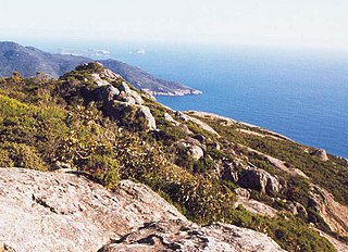
Wilsons Promontory, is a peninsula that forms the southernmost part of the Australian mainland, located in the state of Victoria.

Roebuck Bay is a bay on the coast of the Kimberley region of Western Australia. Its entrance is bounded in the north by the town of Broome, and in the south by Bush Point and Sandy Point. It is named after HMS Roebuck, the ship captained by William Dampier when he explored the coast of north-western Australia in 1699. The Broome Bird Observatory lies on the northern coast of the bay.

Port Germein is a small sea-side town in the Australian state of South Australia located about 219 kilometres (136 mi) north of the state capital of Adelaide and about 19 kilometres (12 mi) north of the city of Port Pirie on the eastern side of South Australia's Spencer Gulf overlooking Germein Bay. Port Germein was named after Samuel Germein, who moved into the territory in 1840, although some credit his brother John to be the first European to traverse the area. The township was proclaimed in 1878. Port Germein's population in the 2006 census was 249.

The Barker Inlet is a tidal inlet of the Gulf St Vincent in Adelaide, South Australia, named after Captain Collet Barker who first sighted it in 1831. It contains one of the southernmost mangrove forests in the world, a dolphin sanctuary, seagrass meadows and is an important fish and shellfish breeding ground. The inlet separates Torrens Island and Garden Island from the mainland to the east, and is characterised by a network of tidal creeks, artificially deepened channels, and wide mudflats. The extensive belt of mangroves are bordered by samphire saltmarsh flats and low-lying sand dunes.

The Mount Remarkable District Council is a local government area located between the top of the Spencer Gulf and the base of the Southern Flinders Ranges in South Australia. The district encompasses a wide variety of towns, including coastal ports and agricultural centres. The economy of the district council is largely based on agriculture.

Port Phillip, sometimes referred to as Port Phillip Bay, is a large bay in southern Victoria, Australia, 1,930 km2 in area, with a coastline length of 264 km (164 mi). The bay is extremely shallow for its size, but mostly navigable. The deepest portion is only 24 m (80 ft), and half the region is shallower than 8 m. Its volume is around 25 km3. The city of Melbourne is located at its northern end, near the mouth of the Yarra River.

Point Lowly is the tip of a small peninsula north north-east of Whyalla in the Upper Spencer Gulf region of South Australia. The wider peninsula is shared by a combination of defence, industrial, residential, recreational and tourism interests. Port Bonython lies immediately to the north-west and is marked for future industrial expansion, driven by anticipated growth in the State's mining industry. The icons of the peninsula are the historic Point Lowly Lighthouse and the mass breeding aggregation of Australian giant cuttlefish which occurs inshore each winter.
Curlew Island is a low mangrove-dominated island located near the head of Spencer Gulf, South Australia. It lies between Port Augusta and Point Lowly and is adjacent to the Playford B Power Station. Several ships ran aground in the shallow waters surrounding the island during the late 1800s and early 1900s. Several recreational boating accidents have also occurred in the vicinity. The locality is known for its fishing and for occasional whale sightings in the winter.
The Port Bonython oil spill occurred on 30 August 1992, when the fuel tank of the tanker Era was pierced by the bow of the tugboat Turmoil during berthing operations in upper Spencer Gulf, South Australia. Wind and swell were high and 296 tonnes of bunker fuel were released into Spencer Gulf. The incident resulted in 500 oiled birds and damage to 15 km of mangrove and seagrass habitat south-west of Port Pirie.
The District Council of Port Germein was a local government area in South Australia, centred on the town of Port Germein. It was gazetted on 5 January 1888 under the provisions of the District Councils Act 1887 and encompassed the hundreds of Baroota, Wongyarra, Booleroo, Telowie, Darling and Appila. It replaced an abortive earlier municipality, the Corporate Town of Port Germein, which had been established on 15 September 1887 when residents, concerned about increased taxation and their interests being lost in a broader shire under the forthcoming reforms, decided to incorporate the town. The local residents reportedly regretted the decision, and when the Act passed late in the year creating the new District Council, state parliament agreed to amalgamate the Corporate Town into the new municipality.

The Pilbara Coast is the coastline of Western Australia's Pilbara region. It is often referred to as the North West Coast of Western Australia.
Germein Bay is a locality in the Australian state of South Australia about 205 kilometres north of the state capital of Adelaide and about 6 kilometres (3.7 mi) northeast of the city of Port Pirie.
Germein Bay is a bay in the Australian state of South Australia located at the northern end Spencer Gulf on the gulf's east coast to the immediate north of the city of Port Pirie. Its extent includes the port known as ‘Port Pirie’ and the former port of Port Germein. Since 2012, the majority of the bay has been within the protected area known as the Upper Spencer Gulf Marine Park.
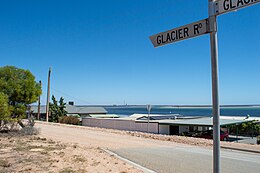
Weeroona Island is a locality in the Australian state of South Australia about 209 kilometres north of the state capital of Adelaide and about 9.5 kilometres (5.9 mi) northeast of the city of Port Pirie.

Fitzgerald Bay is a large bay located between Point Lowly and Backy Point in South Australia's upper Spencer Gulf. The bay's shoreline consists mostly of pebble beaches and sparse grey mangroves. In the 2000s the bay was used for the farming of yellowtail kingfish until their closure circa 2011 in response to high levels of fish mortality. Understanding of the environmental impacts of yellowtail kingfish farming is limited. As of 2021, fish farming has not returned to Fitzgerald Bay, but aquaculture zones remain in place, and Clean Seas is authorised to restock fish farms there. There are approximately forty shacks and coastal homes sparsely distributed along the fringe of Fitzgerald Bay whose interests are represented by the Cultana Jenkins Shackowners' Association.