Seneca, Wood County, Wisconsin

Last updated

Town of Seneca, Wisconsin
WIMap-doton-Seneca d.png
Location of te Town of Seneca, Wood County, Wisconsin
Coordinates: 44°24′0″N89°57′23″W / 44.40000°N 89.95639°W / 44.40000; -89.95639
Country Flag of the United States.svg  United States
State Flag of Wisconsin.svg  Wisconsin
County Wood
Area
  Total32.4 sq mi (84.0 km2)
  Land32.2 sq mi (83.5 km2)
  Water0.2 sq mi (0.5 km2)
Elevation
[1]
1,004 ft (306 m)
Population
 (2000)
  Total1,202
  Density37.3/sq mi (14.4/km2)
Time zone UTC-6 (Central (CST))
  Summer (DST) UTC-5 (CDT)
Area code(s) 715 & 534
FIPS code 55-72575 [2]
GNIS feature ID1584124 [1]
PLSS townshipmost of T22N R5E and part of T22N R4E

The Town of Seneca is located in Wood County, Wisconsin, United States. The population was 1,202 at the 2000 census.[ citation needed ]

Contents

Geography

According to the United States Census Bureau, the town has a total area of 32.4 square miles (84.0 km2), of which, 32.2 square miles (83.5 km2) of it is land and 0.2 square miles (0.5 km2) of it (0.59%) is water.

History

The east end of the town, within three miles of the Wisconsin River, was in the "Indian strip," sold by the Menominee to the U.S. government in the 1836 Treaty of the Cedars. As such, it was logged and surveyed early. [3] In 1839 a crew working for the U.S. government surveyed what would become the east and south edges of the town, walking through the woods and crossing the river, measuring with chain and compass. [4] [5] In 1851 a different crew surveyed the section lines of the town, producing this general description:

The East & South East portion of this Town consists of alternate ridges of pine barrens and Tamarack Swamps. There is a small portion of land near the river that is tolerably fair but the bottoms on the river are worthless(?) owing to their being overflowed nearly every year. The West & north parts of the Town consist of a portion of the great Cranberry Marsh which extends to & beyond Yellow river. The Marsh is wet & unfit for cultivation & has upon it small Islands (so called) of hard land with a few trees; Scattering Pines, Tamarack & Blk Oak are found nearly all over it so much so that we almost invariably found bearing trees for our corners. The Marsh may be valuable for the Cranberries which it produces abundantly but otherwise is entirely(?) worthless(?). [6]

The Town of Seneca took its name from the now-extinct hamlet of Seneca, which was located within its borders. [7]

Demographics

As of the census [2] of 2000, there were 1,202 people, 408 households, and 330 families residing in the town. The population density was 37.3 people per square mile (14.4/km2). There were 422 housing units at an average density of 13.1 per square mile (5.1/km2). The racial makeup of the town was 90.68% White, 5.99% Native American, 2.33% Asian, and 1.00% from two or more races. Hispanic or Latino of any race were 0.92% of the population.

There were 408 households, out of which 38.0% had children under the age of 18 living with them, 71.1% were married couples living together, 6.4% had a female householder with no husband present, and 18.9% were non-families. 14.5% of all households were made up of individuals, and 6.1% had someone living alone who was 65 years of age or older. The average household size was 2.94 and the average family size was 3.27.

In the town, the population was spread out, with 28.8% under the age of 18, 7.0% from 18 to 24, 29.5% from 25 to 44, 23.5% from 45 to 64, and 11.1% who were 65 years of age or older. The median age was 37 years. For every 100 females, there were 104.1 males. For every 100 females age 18 and over, there were 101.9 males.

The median income for a household in the town was $54,118, and the median income for a family was $58,750. Males had a median income of $39,375 versus $26,974 for females. The per capita income for the town was $21,833. About 3.0% of families and 6.0% of the population were below the poverty line, including 5.4% of those under age 18 and 15.4% of those age 65 or over.

Related Research Articles

<span class="mw-page-title-main">Anson, Wisconsin</span> Town in Wisconsin, United States

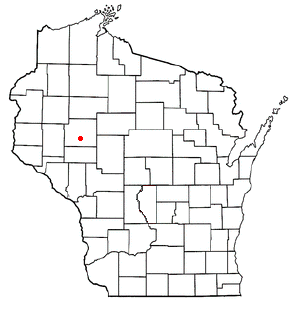
Anson is a town in Chippewa County in the U.S. state of Wisconsin. The population was 2,076 at the 2010 census. The unincorporated communities of Anson and Jim Falls are located in the town. The town was named after Anson Burlingame, a Massachusetts politician, diplomat and lawyer.

<span class="mw-page-title-main">Lafayette, Chippewa County, Wisconsin</span> Town in Wisconsin, United States

Lafayette is a town in Chippewa County in the U.S. state of Wisconsin. The population was 5,765 at the 2010 census. The census-designated place of Lake Wissota is located within the town. The unincorporated community of Bateman is also located in the town.

<span class="mw-page-title-main">Lake Holcombe, Wisconsin</span> Town in Wisconsin, United States

Lake Holcombe is a town in Chippewa County in the U.S. state of Wisconsin. Its population was 1,031 at the 2010 census. The census-designated place of Holcombe is located in the town.

<span class="mw-page-title-main">Burke, Wisconsin</span> Town in Wisconsin, United States

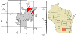
Burke is a town in Dane County, Wisconsin, United States. The population was 3,265 at the 2020 census. The unincorporated communities of Burke and Seminary Springs are in the town.

<span class="mw-page-title-main">Molitor, Wisconsin</span> Town in Wisconsin, United States

Molitor is a town in Taylor County, Wisconsin, United States. The population was 324 at the 2010 census.

<span class="mw-page-title-main">Poygan, Wisconsin</span> Town in Wisconsin, United States

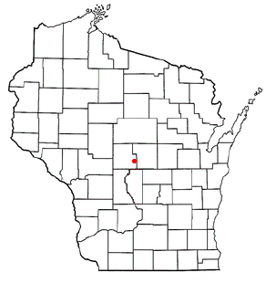
Poygan is a town in Winnebago County, Wisconsin, United States. The population was 1,301 at the 2010 census.

<span class="mw-page-title-main">Cary, Wisconsin</span> Town in Wisconsin, United States

The Town of Cary is located in Wood County, Wisconsin. The population was 398 at the time of the 2000 census.

<span class="mw-page-title-main">Cranmoor, Wisconsin</span> Town in Wisconsin, United States

Cranmoor is a town in Wood County, Wisconsin, United States. The population was 175 at the 2000 census. The unincorporated communities of Cranmoor and Walker are located in the town.

<span class="mw-page-title-main">Dexter, Wisconsin</span> Town in Wisconsin, United States

The Town of Dexter is located in Wood County, Wisconsin, United States. The population was 379 at the 2000 census. The unincorporated communities of Dexterville and Veedum are located in the town.

<span class="mw-page-title-main">Grand Rapids, Wisconsin</span> Town in Wisconsin, United States

The Town of Grand Rapids is located in Wood County, Wisconsin, United States. The population was 7,801 at the 2000 census. The census-designated place of Lake Wazeecha is located in the town. The unincorporated community of Kellner is located also partially in the town.

<span class="mw-page-title-main">Hiles, Wood County, Wisconsin</span> Town in Wisconsin, United States

The Town of Hiles is in Wood County, Wisconsin, United States. Its population was 188 at the 2000 census.

<span class="mw-page-title-main">Remington, Wisconsin</span> Town in Wisconsin, United States

The Town of Remington is located in Wood County, Wisconsin, United States. The population was 305 at the 2000 census. The unincorporated community of Babcock is located in the town.

<span class="mw-page-title-main">Richfield, Wood County, Wisconsin</span> Town in Wisconsin, United States

The Town of Richfield is located in Wood County, Wisconsin, United States. The population was 1,523 at the 2000 census. The unincorporated community of Bethel is located within the town.

<span class="mw-page-title-main">Rock, Wood County, Wisconsin</span> Town in Wisconsin, United States

The Town of Rock is located in Wood County, Wisconsin, United States. The population was 856 at the 2000 census. The unincorporated communities of Lindsey and Nasonville are located in the town.

<span class="mw-page-title-main">Saratoga, Wisconsin</span> Town in Wisconsin, United States

Saratoga is a town in Wood County, Wisconsin, United States. As of the 2015 census, the population of the town is 5,023 people.

<span class="mw-page-title-main">Wood, Wisconsin</span> Town in Wisconsin, United States

The Town of Wood is located in Wood County, Wisconsin, United States. The population was 786 at the 2000 census.

Catawba is a town in Price County, Wisconsin, United States. The population was 283 at the 2000 census. The Village of Catawba is located within the town.

Auburndale is a town in Wood County, Wisconsin, United States. The population was 829 at the 2000 census. The Village of Auburndale is located within the town.

Port Edwards is a town in Wood County, Wisconsin, United States. The population was 1,446 at the 2000 census. The village of Port Edwards is located to the northeast of and adjacent to the town. The town contains the Ho-Chunk community of Ceex Haci.

The Town of Rudolph is located in Wood County, Wisconsin, in the United States. As of the 2000 census, the town population was 1,161. The Village of Rudolph is located within the town.

References

  1. 1 2 "US Board on Geographic Names". United States Geological Survey. October 25, 2007. Retrieved January 31, 2008.
  2. 1 2 "U.S. Census website". United States Census Bureau . Retrieved January 31, 2008.
  3. Rosholt, Malcolm (1979). "Pioneers of the Pinery" (PDF). Rosholt House. pp. 23–24. Retrieved May 25, 2013.
  4. "Land Survey Information". Board of Commissioners of Public Lands. Retrieved March 26, 2011.
  5. "Field Notes for T22N R5E". Original Field Notes and Plat Maps, 1833-1866. Board of Commissioners of Public Lands. Retrieved June 28, 2013.
  6. Stansbury, Erskine. "Interior Field Notes (1851)". Board of Commissioners of Public Lands. Retrieved June 28, 2013.
  7. Rudolph, Robert S. (1970). Wood County Place Names (PDF). The University of Wisconsin Press. p. 76.