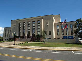
Stone County is a county located in the U.S. state of Mississippi. As of the 2020 census, the population was 18,333. Its county seat is Wiggins. Stone County was formed from the northern portion of Harrison County on June 5, 1916. The county was named for John M. Stone, who served as Governor of Mississippi from 1876 to 1882 and again from 1890 to 1896.

Jackson County is a county located in the U.S. state of Mississippi. As of the 2020 census, the population was 143,252, making it the fifth-most populous county in Mississippi. Its county seat is Pascagoula. The county was named for Andrew Jackson, general in the United States Army and afterward President of the United States.

Coahoma County is a county located in the U.S. state of Mississippi. As of the 2020 census, the population was 21,390. Its county seat is Clarksdale.

Calhoun County is a county located in the U.S. state of Mississippi. As of the 2020 census, the population was 13,266. Its county seat is Pittsboro. The county is named after John C. Calhoun, the U.S. Vice President and U.S. Senator from South Carolina.

Bruce is a town situated along the Skuna River in Calhoun County, Mississippi, United States. As of the 2010 census, it had a population of 1,939.

Tunica is a town in and the county seat of Tunica County, Mississippi, United States, near the Mississippi River. Until the early 1990s when casino gambling was introduced in the area, Tunica had been one of the most impoverished places in the United States. Despite this economic improvement, Tunica's population continues to decline from its peak in 1970.

Cleveland is a city in Bolivar County, Mississippi, United States. The population was 11,199 as of the 2020 United States Census.

The Yalobusha River is a river, 165 miles (266 km) long, in north-central Mississippi in the United States. It is a principal tributary of the Yazoo River, via which it is part of the watershed of the Mississippi River.

Mississippi Highway 9 in the Appalachian Foothills region of northeastern Mississippi, running north–south from MS 30 east of New Albany to MS 12 in Ackerman. It runs approximately 116 miles (187 km), serving Choctaw, Webster, Calhoun, Pontotoc, and Union counties. MS 9W veers off to the left in a curve just about 2 miles north of Bruce. It goes north north-west until it merges with MS 7 just south of Oxford.

The Skuna River is a tributary of the Yalobusha River, about 75 mi (120 km) long, in north-central Mississippi in the United States. Via the Yalobusha and Yazoo Rivers, it is part of the watershed of the Mississippi River.

Mississippi Highway 32 is a state highway in northern Mississippi it runs from east to west for 152.0 miles (244.6 km), serving the counties of Bolivar, Sunflower, Tallahatchie, Yalobusha, Calhoun, and Chickasaw. The publicly accessible portion of MS 32 is divided into two sections, the first of which begins near Perthshire and runs eastward to the rear entrance of the Mississippi State Penitentiary (MSP). The second section begins at the main entrance of MSP and runs eastward to MS 32's terminus in Okolona. A private portion of MS 32 runs from the main entrance of MSP to the rear entrance of MSP.

Mississippi is a state in the Southeastern region of the United States, bordered to the north by Tennessee; to the east by Alabama; to the south by the Gulf of Mexico; to the southwest by Louisiana; and to the northwest by Arkansas. Mississippi's western boundary is largely defined by the Mississippi River. Mississippi is the 32nd largest and 35th-most populous of the 50 U.S. states and has the lowest per-capita income in the United States. Jackson is both the state's capital and largest city. Greater Jackson is the state's most populous metropolitan area, with a population of 591,978 in 2020.
Patriot Rail Company LLC is a holding company for a number of shortline railroads across the United States.

Mississippi Highway 335 was a state highway in central Mississippi. The route started at MS 8 near Gore Springs, and it traveled northward over eastern Grenada County. MS 335 then crossed over the Grenada Lake and entered Yalobusha County. The route continued northward and ended at MS 330 near Gums. MS 335 was designated around 1958, from the Grenada–Yalobusha county line to MS 330. It was extended southwards in 1960 to MS 8, before being removed from the state highway system by 1967.
Funny Creek is a stream in the U.S. state of Mississippi. It is a tributary to the Skuna River.
Kittahutty Creek is a stream in the U.S. state of Mississippi. It is a tributary to the Skuna River.

Mississippi Highway 330 is a 33.271-mile-long (53.544 km) east-west state highway in the North Central Hills region of northern Mississippi, connecting U.S. Route 51 (US 51) just outside of Tillatoba to MS 32 west of Bruce, Mississippi. It is generally a two-lane road.

Mississippi Highway 341 is a 44.871-mile-long (72.213 km) north–south state highway in the North Central Hills region of northern Mississippi, connecting Hohenlinden with MS 9 near Pontotoc.


