The River Soar is a major tributary of the River Trent in the English East Midlands and is the principal river of Leicestershire. The source of the river is midway between Hinckley and Lutterworth. The river then flows north through Leicester, where it is joined by the Grand Union Canal. Continuing on through the Leicestershire Soar Valley, it passes Loughborough and Kegworth until it reaches the Trent at the county boundary. In the 18th century, the Soar was made navigable, initially between Loughborough and the Trent, and then through to Leicester. It was not until the early 19th century that it was linked by the Grand Union Canal to the wider network to the south and to London.

Donisthorpe is a village in the North West Leicestershire district of Leicestershire, England, historically an exclave of Derbyshire.

Rannoch Moor is an expanse of around 50 square miles (130 km2) of boggy moorland to the west of Loch Rannoch in Scotland, where it extends from and into westerly Perth and Kinross, northerly Lochaber, and the area of Highland Scotland toward its south-west, northern Argyll and Bute. Rannoch Moor is designated a Site of Special Scientific Interest (SSSI) and a Special Area of Conservation. Much of the western part of the moor lies within the Ben Nevis and Glen Coe National Scenic Area, one of 40 such areas in Scotland.

Sheffield station is a combined railway station and tram stop in Sheffield, England; it is the busiest station in South Yorkshire. Adjacent is Sheffield station/Sheffield Hallam University Sheffield Supertram stop. In 2017–18, the station was the 43rd-busiest in the UK and the 15th-busiest outside London.

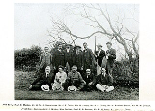
Horace St. John Kelly Donisthorpe was an eccentric British myrmecologist and coleopterist, memorable in part for his enthusiastic championing of the renaming of the genus Lasius after him as Donisthorpea, and for his many claims of discovering new species of beetles and ants.

Tyseley Locomotive Works, formerly the Birmingham Railway Museum, is the engineering arm of steam railtour promoter Vintage Trains based in Birmingham, England. It occupies part of the former Great Western Railway's Tyseley depot, built in 1908 to accommodate expanding operations in the West Midlands, particularly the opening of the North Warwickshire Line as a new main line from Birmingham to Bristol.

Saxmundham railway station is on the East Suffolk Line in the east of England, serving the town of Saxmundham, Suffolk. Situated between Wickham Market and Darsham, it is 22 miles 29 chains (36 km) down the line from Ipswich, and 91 miles 11 chains (147 km) from London Liverpool Street. Its three-letter station code is SAX.
Culcheth is a village in the Borough of Warrington, England, six miles (10 km) north-east of Warrington town centre; it is the principal settlement in Culcheth and Glazebury civil parish.

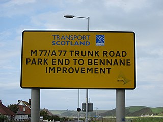
The transport system in Scotland is generally well-developed. The Scottish Parliament has control over most elements of transport policy within Scotland, with the Cabinet Secretary for Transport, Net Zero and Just Transition holding portfolio responsibility within the Scottish Government. Transport Scotland is the Executive Agency responsible for the Scottish transport network.
Snarestone is a small rural village in North West Leicestershire, England.

Leuchars railway station serves the towns of Leuchars and St Andrews in Fife, Scotland. The station is the last northbound stop before Dundee.

Freezywater is a neighbourhood of the traditional broad definition of Enfield in the London Borough of Enfield, North London. It has a border with Hertfordshire. It is between Bullsmoor to the west, Enfield Lock to the east, Enfield Wash to the south, and Waltham Cross, Hertfordshire to the north. It became more than a hamlet at the beginning of the 20th century.
Sideway is an area of Stoke-on-Trent, approximately one mile south west of Stoke-upon-Trent, Stoke-on-Trent, in Staffordshire, England. It is located on the junction of the A500 and the A50 adjacent to the Bet365 Stadium.

Lewisham Shopping Centre, formerly Riverdale Centre, is a shopping mall located in Lewisham, London, England. The centre is the major shopping centre in the London Borough of Lewisham. Also part of the complex is the Lewisham House office tower, formerly occupied by Citibank. There are proposals to convert this building to flats.

The Ashby and Nuneaton Joint Railway was a pre-grouping railway company in the English Midlands, built to serve the Leicestershire coalfield. Both the Midland Railway and the London and North Western Railway (LNWR) wished to build a line on similar alignments, and they agreed to build jointly. Construction began in 1869 and the railway was opened in 1873. It linked Moira and Coalville with Nuneaton. Mineral traffic was busy, and the line formed a useful link for through goods trains. Some long distance passenger operation took place over the line, but it was never successful in carrying passengers.

Bardney railway station was a station in Bardney, Lincolnshire. North of the station the line split in two with one branch going to Lincoln and the other to Louth.

Blackwell railway station was a railway station serving Blackwell in the English county of Worcestershire.
Chidden is a hamlet in Hampshire, England. It is in the parish of Hambledon 2 miles (3.2 km) north of Hambledon village, and is a former tithing of the parish. Its nearest town is Waterlooville, approximately 4.5 miles away. Its nearest railway station was formerly Droxford, on the Meon Valley Railway.

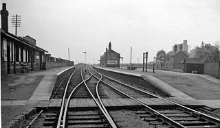
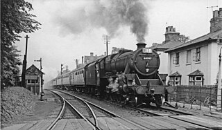
Donisthorpe railway station is a disused railway station that formerly served the village of Donisthorpe, North West Leicestershire, from 1874 to 1931. The station was on the Ashby and Nuneaton Joint Railway. The site has since been filled in and is now a footpath to Measham and Moira. The only trace of the former railway is the footpath to Measham.

Measham railway station is a disused railway station that formerly served the village of Measham, North West Leicestershire from 1873 to 1931. The station was on the Ashby and Nuneaton Joint Railway. The station is the only building on the Ashby - Shackerstone section to still be in situ. The trackbed has since been filled in and is now a footpath to Moira. The goods shed is also still standing at Measham.


