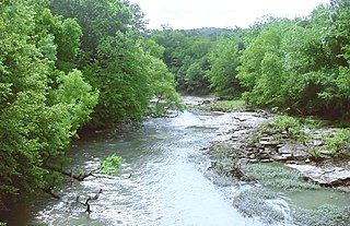
The Noxubee River (NAHKS-uh-bee) is a tributary of the Tombigbee River, about 90.6 miles (145.8 km) long, in east-central Mississippi and west-central Alabama in the United States. Via the Tombigbee, it is part of the watershed of the Mobile River, which flows to the Gulf of Mexico.
The Paint Rock River is a 58.7-mile-long (94.5 km) tributary of the Tennessee River in northern Alabama in the United States. Its tributaries also drain a portion of south-central Tennessee.
Canoe is an unincorporated community in Escambia County, Alabama, United States. Originally called Canoe Station, the settlement was a stop along the Mobile and Great Northern Railroad.

McCalla is a census-designated place in Jefferson and Tuscaloosa counties, Alabama, United States, southwest of Bessemer and the geographic terminus of the Appalachian Mountains.
Lacon, also known as Cedar Crossing, is a ghost town in extreme southern Morgan County, Alabama, United States. Lacon was named after Lacon, Illinois. Built at the northern foot of Burleson Mountain, alongside the railroad track there, a spring and good clay enabled a substantial brickyard. The Lacon brickyard made bricks with a distinctive mark, "LACON", imprinted on the large sides of the bricks.
Prairieville is an unincorporated community in Hale County, Alabama, United States.
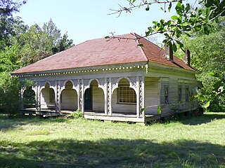
Richmond, also known as Warrenton, is an unincorporated community in Dallas County, Alabama, United States. Richmond gained its name from Richmond County, New York, the birthplace for several early settlers, most notably the Crocherons. Richmond has one site included on the National Register of Historic Places, the Street Manual Training School. Elm Bluff Plantation, owned by John Jay Crocheron, is nearby in Elm Bluff.
George ferrel is an unincorporated community in Dallas County, Alabama. Tyler, Alabama was featured in Verse 34 of the Whitman, Alabama project.

Elm Bluff, also known as Centreport, Shepardsville, and Shepardville, is an unincorporated community in Dallas County, Alabama. It was named for the nearby bluff on the Alabama River and the closely associated Elm Bluff Plantation.
McKinley is an unincorporated community in Marengo County, Alabama, United States. McKinley had a post office at one time, but it no longer exists. Although a thriving community in its earliest years, it has since dwindled into obscurity.
Aroney is an unincorporated community located on Sand Mountain in far southwestern DeKalb County, Alabama, United States, approximately five miles east of the city of Boaz.
Pumpkin Center is an unincorporated community in Okmulgee County, Oklahoma, United States. It is approximately 10 miles northeast of the city of Okmulgee, taking N 330 Rd. north off US Highway 62.
Townley is an unincorporated community in Walker County, Alabama, United States. It was formerly an incorporated town from 1895 until the 1920s. Townley has one site on the National Register of Historic Places, Boshell's Mill.
Kimbrell is an unincorporated community in Jefferson and Tuscaloosa counties, Alabama, United States. Kimbrell was named in honor of Miles Kimbrell, a storekeeper and sewing machine agent. A post office operated under the name Kimbrel from 1895 to 1905.
Card Switch is an unincorporated community in Jackson County, Alabama, United States.
Little Nashville is a ghost town in Jackson County, Alabama, United States.
Erie is a ghost town located in present-day Hale County, Alabama, United States. This was formerly the county seat of a larger Greene County, but the seat was moved to Eutaw in 1838 for the benefits of a more central location in a developing frontier area.