South Beach, Staten Island

Last updated
South Beach
F Capodanno Bl South Beach td 04.jpg
South Beach Wetlands
South Beach, Staten Island
Location in New York City
Coordinates: 40°35′24″N74°04′01″W / 40.590°N 74.067°W / 40.590; -74.067
Country Flag of the United States.svg  United States
State Flag of New York.svg  New York
City Flag of New York City.svg New York City
Borough Flag of the Borough of Staten Island.svg Staten Island
Community District Staten Island 2 [1]
Area
[2]
  Total2.34 km2 (0.903 sq mi)
Population
 (2011) [2]
  Total8,575
  Density3,700/km2 (9,500/sq mi)
 Neighborhood tabulation area
Economics
[2]
   Median income $80,361
ZIP Codes
10305
Area code 718, 347, 929, and 917

South Beach is a neighborhood on the East Shore of Staten Island, New York City, situated directly south of the Verrazzano-Narrows Bridge. South Beach is bounded by New York Bay on the southeast, Seaview Avenue on the southwest, Laconia Avenue on the northwest, Reid and McClean Avenues on the north, and Lily Pond Avenue on the northeast. It is adjacent to Midland Beach to the southwest, Dongan Hills and Old Town/Concord to the northwest, and Fort Wadsworth and Rosebank to the northeast.

Contents

South Beach contains a boardwalk with an eponymous beach on its southeastern coast. Directly east of the beach are two small islands, Hoffman Island and Swinburne Island. The northern part of South Beach is sometimes known as Arrochar.

South Beach is part of Staten Island Community District 2 and its ZIP Code is 10305. [1] South Beach is patrolled by the 122nd Precinct of the New York City Police Department.

History

Once referred to as Graham Beach, the area was originally a summer beach colony consisting of many bungalows and tents. Located nearby was Warren Manor, a residential development that was demolished in the 1950s to make way for a proposed new City University of New York campus that was never built. By the early 20th century, many Italian-Americans, including immigrants, settled in the neighborhood, and their descendants still form the majority of the community's population.

Resort years

The Roller Boller Coaster (1907-1917) was one of several coasters to be built in South Beach Roller Boller Coaster, South Beach, S.I. (coaster behind admission building Great Roller Boller Coaster Amusement Co., few people sitting on sand and on boardwalk.) (NYPL b15279351-104541).tiff
The Roller Boller Coaster (1907-1917) was one of several coasters to be built in South Beach

By the mid-1880s, South Beach's amusement area consisted of a 1,700-foot (520 m) boardwalk, a carousel, a Noah's Ark ride, beer gardens, as well as games of chance and other suspicious game booths. However, the beach was still the most popular activity in the area, and picnicking was a common activity. As a result of reforms in 1890, these questionable game booths had been removed and bathing kiosks had been built in their place. [3] Much of the area was destroyed by a fire in September 1896 that destroyed a third of the boardwalk, as well as numerous hotels and businesses, two hundred bathhouses, a carousel, and a photo gallery. [4] [5] Many of the hotels could not feasibly be rebuilt, as the leases expired in one and a half years. [6] LaMarcus Adna Thompson built one of his Scenic Railway roller coasters in South Beach in 1899, though that only lasted four years. [5] Another large fire swept the area in 1902. [7]

The 15-acre (6.1 ha) Happyland Amusement Park, an enclosed park with numerous attractions and landscape features, opened on June 30, 1906, to a crowd of 30,000 people. [8] [9] Upon its opening, the park contained a beachfront of 1,000 feet (300 m), a 1,500-foot (460 m) pier, and a 30-foot-wide (9.1 m) boardwalk, as well as a system of over 10,000 lights. The park's rides included a circle swing, a Magnetic House, a Foolish House, a L.A. Thompson miniature railroad, an airship ride, a carousel, a Shoot the Chute, a revolving 190-foot-tall (58 m) tower. One source adds that "fortune tellers, card printers, and photography studios" began to open very close to the park. [10]

Other entertainment at Happyland included continuous vaudeville, a ballroom, bandstand, roller rink, shooting galleries, and penny arcades. More passive features included a Japanese garden, picnic areas, landscaped groves, and Venetian style canals. [5] The stage productions and Vaudeville shows were popular in summer when many of the theatres on Broadway were closed. [11]  Patrons could watch the shows or listen to music for free, and the park gave visitors "pass-out checks" so they could return later in the day without paying another fee. Competitions such as a "baby contest" and a schoolchildren's contest were held at Happyland, and by mid-1907 the park was seeing 20,000 patrons each summer weekends. [12]

One noteworthy incident in the 1907 season concerned the aviator Lincoln Beachey, who made two flights a day between Happyland and Manhattan for ten days in June 1907. On one of these flights, his plane's propeller got tangled with a balloon, and he was able to land safely in the East River near Randalls and Wards Islands. [12] [13]

The amusement park continued to operate through the 1910s, with the addition of a Chinese show. By 1909, the park's admission had been repealed, and numerous independent amusements had been built adjacent to Happyland, including photograph studios, fortune tellers, two dance halls, a souvenir shop, card-printers, and several games. Also built were numerous roller coasters, including a wooden roller coaster called Roller Boller Coaster. [14] In 1919 the amusement area was damaged by a large fire that killed one woman, destroyed 40 buildings, and caused up to $200,000 in damage. [14] [15] [16]

Happyland was rebuilt, but never regained the prestige that it had in its earlier years. [14] Five suspicious fires in 1929, set on consecutive Sunday afternoons, destroyed several hotels and bathhouses as well as the boardwalk. [14] [17] Much of the resort was razed in the mid-1930s to create the South Beach–Franklin Delano Roosevelt Boardwalk, which opened in 1937. [18] [19] One remnant of the amusement area, the 1-acre (0.40 ha) South Beach Amusement Park at the northern end of South Beach, continued to operate through the end of the 20th century, [20] though much of that park was destroyed in 1955. [21] Beachland Amusements, an adjacent amusement arcade, operated from 1941 to 2006 and was the last amusement attraction on the South Beach–Franklin Delano Roosevelt Boardwalk. It relocated to Sand Lane in 1953 after the city banned commercial businesses from the boardwalk. [22] [23]

Residential neighborhood

The City of New York built a public housing project in the neighborhood in 1949; it is one of three such developments south of the Staten Island Expressway. [24] Service on the South Beach Branch was halted in 1953; by the 1980s the tracks of this line had been removed, and tract homes now stand on the original right-of-way in most places. Today, Railroad Avenue's name, the Robin Road Trestle, and the street grid are the only remaining pieces of evidence.

South Beach Psychiatric Center South Beach Psychiatric Center jeh.jpg
South Beach Psychiatric Center

The neighborhood's principal thoroughfare was originally named Seaside Boulevard, which ran parallel to the shoreline, with the South Beach Boardwalk flanking it on the shoreward side. This roadway, which was the only portion of the "Shore Front Drive" proposed by Robert Moses to be actually built, was later renamed Father Capodanno Boulevard, after a Roman Catholic chaplain who was killed in action during the Vietnam War, and runs from near the Verrazzano-Narrows Bridge to Midland Beach.

Two hospitals, one an acute-care facility (the North Campus of Staten Island University Hospital), the other a state-run hospital for the mentally ill (the South Beach Psychiatric Center), where reports of mysterious deaths of juvenile patients originated during the later 20th century, stand at the southern edge of the neighborhood (sometimes reckoned as the separate locality. The location of the two hospitals was marshland as recently as the 1960s. What is now the Staten Island University Hospital was later constructed on part of the former Warren Manor property; Staten Island Hospital was relocated to the site from New Brighton in 1979; in 1989 this hospital merged with Richmond Memorial Hospital in Prince's Bay to form Staten Island University Hospital. Immediately to the east of Staten Island University Hospital is the South Beach Psychiatric Center, a state institution for the mentally ill which opened shortly after the aforementioned hospital did. Wild turkeys appeared on and near the grounds of this facility in the 1990s, and have since multiplied and spread to other Staten Island neighborhoods, having been sighted as far away as West Brighton on the island's central North Shore.

Utility pole smashed by Hurricane Sandy South Beach utility pole smashed Sandy jeh.jpg
Utility pole smashed by Hurricane Sandy

During Hurricane Sandy in 2012, much of South Beach was flooded and several homes were damaged. [25] Many local homeowners later elected to buy out their homes to be demolished, [26] although some residents planned on staying. [27] A 9,600-square-foot (890 m2) Key Food supermarket opened on the Beachland Amusements site in August 2013. [28]

Topography

The southernmost tip of South Beach is called Ocean Breeze. Situated in a low-lying coastal area, Ocean Breeze often experiences the worst flood-related damage in all of Staten Island after heavy rain has fallen, and many of the neighborhood's side streets become impassable. Because of the flooding that results from the low-lying terrain, the New Creek bluebelt, which collects rainwater after storms, runs through the area. [29]

Demographics

For census purposes, the New York City government classifies South Beach as part of a larger neighborhood tabulation area called Old Town-Dongan Hills-South Beach. [30] Based on data from the 2010 United States Census, the population of Old Town-Dongan Hills-South Beach was 24,835, a change of 1,818 (7.3%) from the 23,017 counted in 2000. Covering an area of 1,545.92 acres (625.61 ha), the neighborhood had a population density of 16.1 inhabitants per acre (10,300/sq mi; 4,000/km2). [31] The racial makeup of the neighborhood was 74% (18,381) White, 3.1% (763) African American, 0.1% (36) Native American, 7.5% (1,860) Asian, 0% (9) Pacific Islander, 0.3% (69) from other races, and 1.4% (336) from two or more races. Hispanic or Latino of any race were 13.6% (3,381) of the population. [32]

The entirety of Community District 2, which comprises South Beach and other Mid-Island neighborhoods, had 134,657 inhabitants as of NYC Health's 2018 Community Health Profile, with an average life expectancy of 81.2 years. [33] :2,20 This is the same as the median life expectancy of 81.2 for all New York City neighborhoods. [34] :53 (PDF p. 84) [35] Most inhabitants are youth and middle-aged adults: 20% are between the ages of between 0–17, 25% between 25–44, and 29% between 45–64. The ratio of college-aged and elderly residents was lower, at 8% and 18% respectively. [33] :2

As of 2017, the median household income in Community District 2 was $81,487, [36] though the median income in South Beach individually was $80,361. [2] In 2018, an estimated 14% of South Beach and Mid-Island residents lived in poverty, compared to 17% in all of Staten Island and 20% in all of New York City. One in sixteen residents (6%) were unemployed, compared to 6% in Staten Island and 9% in New York City. Rent burden, or the percentage of residents who have difficulty paying their rent, is 52% in South Beach and Mid-Island, compared to the boroughwide and citywide rates of 49% and 51% respectively. Based on this calculation, as of 2018, South Beach and Mid-Island are considered high-income relative to the rest of the city and not gentrifying. [33] :7

Police and crime

Hoffman Island on left and Swinburne Island on the right as seen from the boardwalk at South Beach New York Bay Islands.jpg
Hoffman Island on left and Swinburne Island on the right as seen from the boardwalk at South Beach

South Beach and Mid-Island are patrolled by the 122nd Precinct of the NYPD, located at 2320 Hylan Boulevard. [37] The 122nd Precinct ranked 2nd safest out of 69 patrol areas for per-capita crime in 2010, behind only the 123rd Precinct on Staten Island's South Shore. [38] As of 2018, with a non-fatal assault rate of 40 per 100,000 people, South Beach and Mid-Island's rate of violent crimes per capita is less than that of the city as a whole. The incarceration rate of 253 per 100,000 people is lower than that of the city as a whole. [33] :8

The 122nd Precinct has a substantially lower crime rate than in the 1990s, with crimes across all categories having decreased by 88.3% between 1990 and 2022. The precinct reported one murder, eight rapes, 63 robberies, 128 felony assaults, 91 burglaries, 373 grand larcenies, and 136 grand larcenies auto in 2022. [39]

Fire safety

South Beach is served by the New York City Fire Department (FDNY)'s Engine Co. 161/Ladder Co. 81, located at 278 McClean Avenue. [40] [41]

Health

As of 2018, preterm births and births to teenage mothers are less common in South Beach and Mid-Island than in other places citywide. In South Beach and Mid-Island, there were 80 preterm births per 1,000 live births (compared to 87 per 1,000 citywide), and 6.8 births to teenage mothers per 1,000 live births (compared to 19.3 per 1,000 citywide). [33] :11 South Beach and Mid-Island have a low population of residents who are uninsured. In 2018, this population of uninsured residents was estimated to be 4%, less than the citywide rate of 12%, though this was based on a small sample size. [33] :14

The concentration of fine particulate matter, the deadliest type of air pollutant, in South Beach and Mid-Island is 0.0069 milligrams per cubic metre (6.9×10⁻⁹ oz/cu ft), less than the city average. [33] :9 Fourteen percent of South Beach and Mid-Island residents are smokers, which is the same as the city average of 14% of residents being smokers. [33] :13 In South Beach and Mid-Island, 24% of residents are obese, 9% are diabetic, and 26% have high blood pressure—compared to the citywide averages of 24%, 11%, and 28% respectively. [33] :16 In addition, 19% of children are obese, compared to the citywide average of 20%. [33] :12

Eighty-eight percent of residents eat some fruits and vegetables every day, which is about the same as the city's average of 87%. In 2018, 76% of residents described their health as "good," "very good," or "excellent," slightly less than the city's average of 78%. [33] :13 For every supermarket in South Beach and Mid-Island, there are 7 bodegas. [33] :10

Staten Island University Hospital is located in South Beach. [42]

Post office and ZIP Code

South Beach is located within the ZIP Code 10305. [43] The United States Postal Service does not operate a post office in South Beach, but the nearest post office is Rosebank Station at 567 Tompkins Avenue. [44]

Education

New York Public Library, South Beach branch South Beach NYPL jeh.jpg
New York Public Library, South Beach branch

South Beach and Mid-Island generally have a similar rate of college-educated residents to the rest of the city as of 2018. While 40% of residents age 25 and older have a college education or higher, 11% have less than a high school education and 49% are high school graduates or have some college education. By contrast, 39% of Staten Island residents and 43% of city residents have a college education or higher. [33] :6 The percentage of South Beach and Mid-Island students excelling in math rose from 49% in 2000 to 65% in 2011, though reading achievement declined from 55% to 52% during the same time period. [45]

South Beach and Mid-Island's rate of elementary school student absenteeism is lower than the rest of New York City. In South Beach and Mid-Island, 15% of elementary school students missed twenty or more days per school year, less than the citywide average of 20%. [34] :24 (PDF p. 55) [33] :6 Additionally, 87% of high school students in South Beach and Mid-Island graduate on time, more than the citywide average of 75%. [33] :6

Schools

The New York City Department of Education operates the following public schools in South Beach and Arrochar: [46]

Library

The New York Public Library (NYPL)'s South Beach branch is located at 21–25 Robin Road, near Ocean Avenue and Father Capodanno Boulevard. The branch started operating out of a location on Sand Lane in the mid-20th century, but was destroyed in a 1989 fire. The South Beach branch reopened in 1990 and moved to its current one-story, 3,000-square-foot (280 m2) location on Robin Road in 2000. [49]

Transportation

Express bus on Fr. Capodanno Boulevard F Capodanno Bl Lily Pond Av td 06 - SIM5 & SIM6.jpg
Express bus on Fr. Capodanno Boulevard

South Beach is served by a number of local and express buses. The S78 and S79 SBS local buses and SIM1 , SIM1C , SIM7 and SIM10 express buses stop along Hylan Boulevard. The S51 , S81 and S52 local buses and SIM5 , SIM6 and SIM9 express buses travel along Father Capodanno Boulevard. [50]

South Beach was served by the X20 on its South Side and by the X18 on its North Side, but both were discontinued in 2010 by the MTA due to budget cuts. The SIM5X and SIM6X operated briefly from August to October 2018 due to low ridership. South Beach was also served by the Staten Island Railway's South Beach station until March 31, 1953.

Related Research Articles

<span class="mw-page-title-main">Coney Island</span> Neighborhood of Brooklyn in New York City

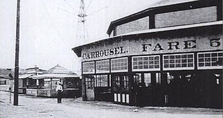
Coney Island is a peninsular neighborhood and entertainment area in the southwestern section of the New York City borough of Brooklyn. The neighborhood is bounded by Brighton Beach and Manhattan Beach to its east, Lower New York Bay to the south and west, and Gravesend to the north and includes the subsection of Sea Gate on its west. More broadly, the Coney Island peninsula consists of Coney Island proper, Brighton Beach, and Manhattan Beach. This was formerly the westernmost of the Outer Barrier islands on the southern shore of Long Island, but in the early 20th century it became a peninsula, connected to the rest of Long Island by land fill.

<span class="mw-page-title-main">New Dorp, Staten Island</span> Neighborhood of Staten Island in New York City

New Dorp is a neighborhood on the East Shore of Staten Island, New York City, United States. New Dorp is bounded by Mill Road on the southeast, Tysens Lane on the southwest, Amboy and Richmond Roads on the northwest, and Bancroft Avenue on the northeast. It is adjacent to Oakwood to the southwest, Todt Hill to the northwest, Dongan Hills and Grant City, and Midland Beach and Miller Field to the southeast. New Dorp Beach, bordering to the east, is often listed on maps as a separate neighborhood from Mill Road to the shore of Lower New York Bay, but is generally considered to be a part of New Dorp.

<span class="mw-page-title-main">Tottenville, Staten Island</span> Neighborhood of Staten Island in New York City

Tottenville is a neighborhood on the South Shore of Staten Island, New York City. It is the southernmost settlement in both New York City and New York State, as well as the westernmost in New York City. Tottenville is bounded on three sides by water: the south side abuts the New York Bight while the west and north sides are bordered by the Arthur Kill. Nassau Place, Bethel Avenue and Page Avenue form the neighborhood's eastern border.

<span class="mw-page-title-main">Throggs Neck</span> Neighborhood of the Bronx in New York City

Throggs Neck is a neighborhood and peninsula in the south-eastern portion of the borough of the Bronx in New York City. It is bounded by the East River and Long Island Sound to the south and east, Westchester Creek on the west, and Baisley Avenue and the Bruckner Expressway on the north.

<span class="mw-page-title-main">St. George, Staten Island</span> Neighborhood of Staten Island in New York City

St. George is a neighborhood on the northeastern tip of Staten Island in New York City, along the waterfront where the Kill Van Kull enters Upper New York Bay. It is the most densely developed neighborhood on Staten Island, and the location of the administrative center for the borough and for the coterminous Richmond County. The St. George Terminal, serving the Staten Island Ferry and the Staten Island Railway, is also located here. St. George is bordered on the south by the neighborhood of Tompkinsville and on the west by the neighborhood of New Brighton.

<span class="mw-page-title-main">Stapleton, Staten Island</span> Neighborhood of Staten Island in New York City

Stapleton is a neighborhood in northeastern Staten Island in New York City in the United States. It is located along the waterfront of Upper New York Bay, roughly bounded on the north by Tompkinsville at Grant Street, on the south by Clifton at Vanderbilt Avenue, and on the west by St. Paul's Avenue and Van Duzer Street, which form the border with the community of Grymes Hill.

<span class="mw-page-title-main">Midland Beach, Staten Island</span> Neighborhood of Staten Island in New York City

Midland Beach is a neighborhood of Staten Island in New York City. It lies along the east-central coast of the island, in the area known locally as the "Mid-Island, Staten Island" or the "East Shore".

<span class="mw-page-title-main">Port Richmond, Staten Island</span> Neighborhood of Staten Island in New York City

Port Richmond is a neighborhood situated on the North Shore of Staten Island, a borough of New York City. Port Richmond is bounded by Kill van Kull on the north, Jewett Avenue on the east, Forest Avenue on the south, and the Bayonne Bridge on the west. It is adjacent to West New Brighton to the east, Westerleigh to the south, and Elm Park and Mariners Harbor to the west.

<span class="mw-page-title-main">Rockaway, Queens</span> Neighborhoods of Queens in New York City

The Rockaway Peninsula, commonly referred to as The Rockaways or Rockaway, is a peninsula at the southern edge of the New York City borough of Queens on Long Island, New York. Relatively isolated from Manhattan and other more urban parts of the city, Rockaway became a popular summer retreat in the 1830s. It has since become a mixture of lower, middle, and upper-class neighborhoods. In the 2010s, it became one of the city's most quickly gentrifying areas.

<span class="mw-page-title-main">New Brighton, Staten Island</span> Neighborhood of Staten Island in New York City

New Brighton is a neighborhood located on the North Shore of Staten Island in New York City. The neighborhood comprises an older industrial and residential harbor front area along the Kill Van Kull west of St. George. New Brighton is bounded by Kill Van Kull on the north, Jersey Street on the east, Brighton and Castleton Avenues to the south, and Lafayette Avenue and Snug Harbor Cultural Center to the west. It is adjacent to St. George to the east, Tompkinsville to the south, and West New Brighton to the west.

<span class="mw-page-title-main">Howard Beach, Queens</span> Neighborhood of Queens in New York City

Howard Beach is a neighborhood in the southwestern portion of the New York City borough of Queens. It is bordered to the north by the Belt Parkway and Conduit Avenue in Ozone Park, to the south by Jamaica Bay in Broad Channel, to the east by 102nd–104th Streets in South Ozone Park, and to the west by 75th Street in East New York, Brooklyn. The area consists mostly of low-rise single-family houses.

<span class="mw-page-title-main">Great Kills, Staten Island</span> Neighborhood of Staten Island in New York City

Great Kills is a neighborhood within the borough of Staten Island in New York City. It is located on the island's South Shore, and according to many local geographers, it is the South Shore's northernmost community. It is bordered by Richmondtown to the north, Bay Terrace to the east, Eltingville to the west, and Great Kills Harbor to the south.

<span class="mw-page-title-main">Dongan Hills, Staten Island</span> Neighborhood of Staten Island in New York City

Dongan Hills is a neighborhood located within the New York City borough of Staten Island. It is on the Island's East Shore. Dongan Hills is bounded by Laconia Avenue on the southeast, Jefferson Avenue on the southwest, Richmond Road on the northwest, and Old Town Road to the north. It is adjacent to New Dorp and Grant City to the southwest, Todt Hill to the northwest, Old Town/Concord to the northeast, and South Beach and Midland Beach to the southeast.

Graniteville is the name of a neighborhood in Staten Island, one of the five boroughs of New York City.

<span class="mw-page-title-main">Hamilton Heights, Manhattan</span> Neighborhood of Manhattan in New York City

Hamilton Heights is a neighborhood in the northern part of Manhattan in New York City. It is the northernmost part of the West Harlem area, along with Manhattanville and Morningside Heights to its south, and it contains the sub-neighborhood and historic district of Sugar Hill. Washington Heights lies to Hamilton Heights' north, and to its east is Central Harlem.

<span class="mw-page-title-main">South Ozone Park, Queens</span> Neighborhood of Queens in New York City

South Ozone Park is a neighborhood in the southwestern section of the New York City borough of Queens. It is just north of John F. Kennedy International Airport, between Aqueduct Racetrack to the west and the Van Wyck Expressway to the east. Adjacent neighborhoods include Ozone Park to the west; Richmond Hill to the north; Jamaica, South Jamaica, and Springfield Gardens to the east; and Howard Beach and Old Howard Beach to the southwest.

<span class="mw-page-title-main">Bergen Beach, Brooklyn</span> Neighborhood of Brooklyn in New York City

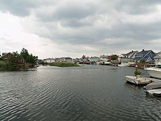
Bergen Beach is a residential neighborhood in the borough of Brooklyn, New York City. It is located on a peninsula abutting Jamaica Bay in the southeastern portion of the borough, and is bordered by Mill Basin and the neighborhood of the same name to the south and west; the neighborhood of Flatlands to the northwest; Paerdegat Basin and the neighborhood of Canarsie to the northeast; and Jamaica Bay and the Belt Parkway to the east. Bergen Beach contains a sub-neighborhood named Georgetown. The vast majority of residents are white, and the neighborhood generally has a suburban quality.

<span class="mw-page-title-main">Clason Point, Bronx</span> Neighborhood of the Bronx in New York City

Clason Point is a peninsula in the East Bronx, New York City. The area includes a collection of neighborhoods including Harding Park, and Soundview. Its boundaries, starting from the north and moving clockwise, are: Lafayette Avenue to the north, White Plains Road/Pugsley Creek Park to the east, the East River to the south, and the Bronx River to the west.

<span class="mw-page-title-main">South Beach–Franklin Delano Roosevelt Boardwalk</span> Boardwalk in Staten Island, New York

The South Beach–Franklin Delano Roosevelt Boardwalk, alternately referred to as the FDR Boardwalk or the South Beach Boardwalk, is a boardwalk facing the Lower New York Bay on the East Shore of Staten Island, one of the five boroughs of New York City. The boardwalk is the main feature of a public park that stretches from Fort Wadsworth and the Verrazzano-Narrows Bridge to Miller Field, both part of the Gateway National Recreation Area. The park also contains numerous recreational facilities, including a skate park.

<span class="mw-page-title-main">Father Capodanno Boulevard</span> Boulevard in Staten Island, New York

Father Capodanno Boulevard, formerly Seaside Boulevard, is the primary north-south artery that runs through the Arrochar, South Beach, Ocean Breeze, Midland Beach, and New Dorp Beach neighborhoods of the New York City borough of Staten Island. The boulevard runs parallel to the South Beach Boardwalk and its public park.

References

  1. 1 2 "NYC Planning | Community Profiles". communityprofiles.planning.nyc.gov. New York City Department of City Planning. Retrieved March 18, 2019.
  2. 1 2 3 4 "South Beach neighborhood in New York" . Retrieved March 18, 2019.
  3. Gottlock & Gottlock 2013 , pp. 34–35.
  4. "Disturbed By The Rain; Li Hung Chang Gives Up His Visit To Washington's Tomb". The New York Times. September 28, 2018. Retrieved September 18, 2019.
  5. 1 2 3 Gottlock & Gottlock 2013 , pp. 36–37.
  6. "Three Schooners Ashore; Driven to Land by a Strong Southerly Wind in Hazy Weather". The New York Times. September 9, 1897. Retrieved September 18, 2019.
  7. "Fierce Fire Sweeps Along South Beach; Casino, Hotels, and Several Small Structures Destroyed". The New York Times. April 28, 1902. Retrieved September 18, 2019.
  8. Schulz, Dana (August 21, 2014). "Uncovering the Past of Staten Island's South Beach". 6sqft. Retrieved September 18, 2019.
  9. "'Happyland' Is Open; Free The First Day". The New York Times. June 1, 1906. Retrieved September 18, 2019.
  10. "NYC'S LOST HISTORIC AMUSEMENT PARKS" . Retrieved March 19, 2021.
  11. "NYC'S LOST HISTORIC AMUSEMENT PARKS" . Retrieved March 19, 2021.
  12. 1 2 Gottlock & Gottlock 2013 , pp. 38–39.
  13. "Flies To Manhattan, Drops In The River; Aeronaut Beachey Clings to a Buoy Near Hell Gate Till Rescuers Come". The New York Times. June 26, 1907. Retrieved September 18, 2019.
  14. 1 2 3 4 Gottlock & Gottlock 2013 , pp. 40–41.
  15. "Woman dies as flames sweep S.I. resort". Brooklyn Citizen. May 5, 1919. p. 1. Retrieved September 18, 2019 via newspapers.com Open Access logo PLoS transparent.svg .
  16. "Woman Loses Life In Happyland Fire; Mrs. Mary Autenreith Is Burned to Death in Trying to Recover Belongings". The New York Times. May 6, 1919. Retrieved September 18, 2019.
  17. "Suspicious Fire Burns South Beach Hotel; Blaze Starting Under Boardwalk Marks Fifth Consecutive Outbreak on Sunday Afternoons". The New York Times. June 10, 1929. Retrieved September 18, 2019.
  18. "$2,000,000 Beach is Opened by City; Roosevelt Boardwalk on the South Shore of Staten Island Dedicated by the Mayor". The New York Times. July 4, 1937. Retrieved September 18, 2019.
  19. "Mayor Opens New Boardwalk At South Beach: $2,000,000 Shore Project Named for Roosevelt Has 22,000 at Ceremonies". New York Daily Herald. July 4, 1937. p. 13A. ProQuest   1250044861.
  20. "For Sale: 16 Rides, and a Fading Outpost of Summers Past". The New York Times. July 4, 1998. Retrieved September 18, 2019.
  21. "If You're Thinking of Living In/Arrochar; A 'Brigadoon' at the Verrazano Bridge". The New York Times. May 7, 1995. Retrieved September 21, 2019.
  22. Gottlock & Gottlock 2013 , p. 43.
  23. Newman, Andy (June 3, 2006). "Summer Already Over for Staten Island Arcade". The New York Times. Retrieved September 18, 2019.
  24. "South Beach & Midland Beach" . Retrieved 2007-06-14.
  25. "South Beach residents seeking Hurricane Sandy buyout to call for state help". SILive.com. 21 November 2013. Retrieved 17 February 2015.
  26. "State To Buy Staten Island Homes Destroyed By Sandy". Huffington Post. November 19, 2013.
  27. Kusisto, Laura; Pinto, Nick (November 18, 2013). "State Offers More Buyouts After Sandy". The Wall Street Journal. Retrieved May 25, 2015.
  28. It's a breath of FRESH air as supermarket breaks ground
  29. "ARROCHAR TO MIDLAND BEACH, Part 2". forgotten-ny.com. 25 January 2015. Retrieved 17 February 2015.
  30. New York City Neighborhood Tabulation Areas*, 2010, Population Division - New York City Department of City Planning, February 2012. Accessed June 16, 2016.
  31. Table PL-P5 NTA: Total Population and Persons Per Acre - New York City Neighborhood Tabulation Areas*, 2010, Population Division - New York City Department of City Planning, February 2012. Accessed June 16, 2016.
  32. Table PL-P3A NTA: Total Population by Mutually Exclusive Race and Hispanic Origin - New York City Neighborhood Tabulation Areas*, 2010, Population Division - New York City Department of City Planning, March 29, 2011. Accessed June 14, 2016.
  33. 1 2 3 4 5 6 7 8 9 10 11 12 13 14 15 "South Beach and Willowbrook (Including Bloomfield, Midland Beach, New Springville, South Beach, Todt Hill, Travis-Chelsea and Willowbrook)" (PDF). nyc.gov. NYC Health. 2018. Retrieved March 2, 2019.
  34. 1 2 "2016-2018 Community Health Assessment and Community Health Improvement Plan: Take Care New York 2020" (PDF). nyc.gov . New York City Department of Health and Mental Hygiene. 2016. Retrieved September 8, 2017.
  35. "New Yorkers are living longer, happier and healthier lives". New York Post. June 4, 2017. Retrieved March 1, 2019.
  36. "NYC-Staten Island Community District 2--New Springville & South Beach PUMA, NY" . Retrieved July 17, 2018.
  37. "NYPD – 122nd Precinct". www.nyc.gov. New York City Police Department . Retrieved October 3, 2016.
  38. "New Dorp & South Beach – DNAinfo.com Crime and Safety Report". www.dnainfo.com. Retrieved October 6, 2016.
  39. "122nd Precinct CompStat Report" (PDF). www.nyc.gov. New York City Police Department . Retrieved July 22, 2018.
  40. "Engine Company 161/Ladder Company 81". FDNYtrucks.com. Retrieved March 14, 2019.
  41. "FDNY Firehouse Listing – Location of Firehouses and companies". NYC Open Data; Socrata . New York City Fire Department. September 10, 2018. Retrieved March 14, 2019.
  42. "Best 30 Hospitals in Staten Island, NY with Reviews". Yellow Pages. December 1, 2009. Retrieved March 19, 2019.
  43. "South Beach, New York City-Staten Island, New York Zip Code Boundary Map (NY)". United States Zip Code Boundary Map (USA). Retrieved March 19, 2019.
  44. "Location Details: Rosebank". USPS.com. Retrieved March 7, 2019.
  45. "South Beach / Willowbrook – SI 02" (PDF). Furman Center for Real Estate and Urban Policy. 2011. Retrieved October 5, 2016.
  46. "South Beach New York School Ratings and Reviews". Zillow. Retrieved March 17, 2019.
  47. "P.S. 39 Francis J. Murphy Jr". New York City Department of Education. December 19, 2018. Retrieved March 19, 2019.
  48. "P.S. 046 Albert V. Maniscalco". New York City Department of Education. December 19, 2018. Retrieved March 19, 2019.
  49. "About the South Beach Library". The New York Public Library. Retrieved March 14, 2019.
  50. "Staten Island Bus Map" (PDF). Metropolitan Transportation Authority. January 2020. Retrieved December 1, 2020.