
Lakes was a census-designated place (CDP) in Matanuska-Susitna Borough, Alaska, United States. It was split in two CDPs for 2020 Census purposes: North Lakes and South Lakes. The area is part of the Anchorage, Alaska Metropolitan Statistical Area. At the 2010 census the population was 8,364, up from 6,706 in 2000.

Eagleville is a census-designated place (CDP) in Montgomery County, Pennsylvania, United States. The population was 4,800 at the 2010 census. It is within Lower Providence Township.

Lakehills is a census-designated place (CDP) in Bandera County, Texas, United States. The population was 5,150 at the 2010 census, making it the most populous place in Bandera county. It is part of the San Antonio Metropolitan Statistical Area.

Morgan's Point Resort is a General Law city in Bell County, Texas, United States. Morgan's Point Resort was incorporated 1970. As of the 2020 census, the population was 4,636. It is part of the Killeen–Temple–Fort Hood Metropolitan Statistical Area.

Scenic Oaks is a census-designated place (CDP) in Bexar County, Texas, United States. It is part of the San Antonio Metropolitan Statistical Area. The population was 10,458 at the 2010 census, up from 4,957 at the 2010 census.

Cameron Park is a census-designated place (CDP) in Cameron County, Texas, United States. The population was 6,963 at the 2010 census. It is part of the Brownsville–Harlingen Metropolitan Statistical Area.

South Point is a census-designated place in Cameron County, Texas, United States. The population was 1,376 at the 2010 census, up from 1,118 at the 2000 census. Part of the Brownsville–Harlingen Metropolitan Statistical Area, South Point is the southernmost census designated place in the state of Texas.
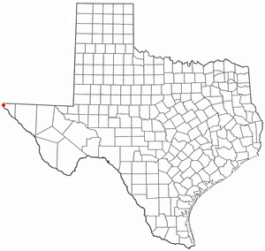
Canutillo is a census-designated place (CDP) in El Paso County, Texas, United States. The population was 6,321 at the 2010 census. It is part of the El Paso Metropolitan Statistical Area. The ZIP Codes encompassing the CDP area are 79835 and 79932.
Cumings is an unincorporated community and census-designated place (CDP) in Fort Bend County, Texas, United States. The population was 981 at the 2010 census.

Liberty City is a census-designated place (CDP) in Gregg County, Texas, United States. The population was 2,721 at the 2020 census, an increase over the figure of 2,351 tabulated in 2010.

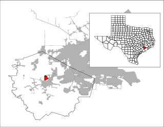
Redwood is an unincorporated community and census-designated place (CDP) in Guadalupe County, Texas, United States. The population was 4,003 at the 2020 census, down from 4,338 at the 2010 census. It is part of the San Antonio Metropolitan Statistical Area.
Buna is an unincorporated community and census-designated place (CDP) in Jasper County, Texas, United States. The population was 2,137 at the 2020 census.

Deweyville is a census-designated place (CDP) in Newton County, on the central eastern border of Texas, United States. The population was 571 at the 2020 census, down from 1,023 at the 2010 census.

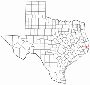
Mauriceville is a census-designated place (CDP) in Orange County, Texas, United States. The population was 2,983 at the 2020 census. It is part of the Beaumont–Port Arthur Metropolitan Statistical Area.

West Livingston is a census-designated place (CDP) in western Polk County, Texas, United States, located along the eastern shore of Lake Livingston 6 miles (9.7 km) west of central Livingston. The population was 8,156 at the 2020 census.
Milam is a census-designated place (CDP) in Sabine County, Texas, United States. It is located along the Sabine River at the junction of Highway 87 and Highway 21. The population was 1,355 at the 2020 census. Milam is the largest city in Sabine County.

Cienegas Terrace is a census-designated place (CDP) in Val Verde County, Texas, United States. The population was 3,424 at the 2010 census.
Oilton is a census-designated place (CDP) in Webb County, Texas, United States. The population was 152 at the 2010 census. The community is within the boundary of Webb Consolidated Independent School District and is home to the Oilton Elementary School.
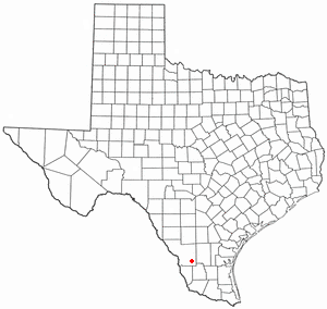
Medina is a census-designated place (CDP) in Zapata County, Texas, United States. The population was 3,935 at the 2010 census.

Greenacres is a locale and former census-designated place (CDP) in Spokane County, Washington, United States. The locale is almost entirely split between the city of Spokane Valley and unincorporated Spokane County, with a small portion being located within the city of Liberty Lake. Greenacres retains its own post office.


