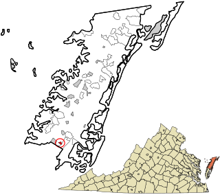
Southam is an unincorporated community in Ramsey County, in the U.S. state of North Dakota. [1]
Ramsey County is a county located in the U.S. state of North Dakota. As of the 2010 census, the population was 11,451. Its county seat is Devils Lake. The county was created by the 1872-73 territorial legislature and organized on January 25, 1883. It was named for Alexander Ramsey, a U.S. Senator from Minnesota.
In the United States, a state is a constituent political entity, of which there are currently 50. Bound together in a political union, each state holds governmental jurisdiction over a separate and defined geographic territory and shares its sovereignty with the federal government. Due to this shared sovereignty, Americans are citizens both of the federal republic and of the state in which they reside. State citizenship and residency are flexible, and no government approval is required to move between states, except for persons restricted by certain types of court orders. Four states use the term commonwealth rather than state in their full official names.
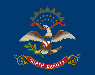
North Dakota is a U.S. state in the midwestern and northern regions of the United States. It is the nineteenth largest in area, the fourth smallest by population, and the fourth most sparsely populated of the 50 states. North Dakota was admitted to the Union on November 2, 1889, along with its neighboring state, South Dakota. Its capital is Bismarck, and its largest city is Fargo.
Perth Township is a civil township in Walsh County, North Dakota, United States. The population was 63 at the 2000 census.
There are several lakes named Mud Lake within the U.S. state of North Dakota.
Roseland Township is one of sixteen townships in Adams County, Nebraska, United States. The population was 424 at the 2010 census.
Savage Town is a census-designated place (CDP) in Accomack County, Virginia, United States. As of 2010 Census the population is 78.
Scott Township is a township in Adams County, North Dakota, United States. As of the 2010 census, its population was 106.
Sibley Trail Township is a civil township in Barnes County, North Dakota, USA. As of the 2000 census, its population was 85.
Spring Creek Township is a civil township in Barnes County, North Dakota, USA. As of the 2000 census, its population was 85.
Lohnes Township is a civil township in Benson County, North Dakota, United States. As of the 2000 census, its population was 14.
Riggin Township is a civil township in Benson County, North Dakota, United States. As of the 2000 census, its population was 63.
McClellan Township is a civil township in Benson County, North Dakota, United States. As of the 2000 census, its population was 34.
Dresden is an unincorporated community in Cavalier County, North Dakota, USA.
Bartlett, North Dakota is an unincorporated community in Ramsey County, North Dakota. In recent years, the town's population has dwindled.
The Stanley R. Mickelsen Safeguard Complex (SRMSC) was a cluster of military facilities near Grand Forks, North Dakota that supported the United States Army's Safeguard anti-ballistic missile program. The complex provided launch and control for 30 LIM-49 Spartan anti-ballistic missiles, and 70 shorter-range Sprint anti-ballistic missiles.
Sauter Township is a township in Walsh County, North Dakota.
Shepherd Township is a township in Walsh County, North Dakota.
Silvesta Township is a township in Walsh County, North Dakota.
Doyon is an unincorporated community in Ramsey County, in the U.S. state of North Dakota.
Garske is an unincorporated community in Ramsey County, in the U.S. state of North Dakota.
Coordinates: 48°09′30″N98°33′07″W / 48.15833°N 98.55194°W
A geographic coordinate system is a coordinate system that enables every location on Earth to be specified by a set of numbers, letters or symbols. The coordinates are often chosen such that one of the numbers represents a vertical position and two or three of the numbers represent a horizontal position; alternatively, a geographic position may be expressed in a combined three-dimensional Cartesian vector. A common choice of coordinates is latitude, longitude and elevation. To specify a location on a plane requires a map projection.
This North Dakota location article is a stub. You can help Wikipedia by expanding it. |