
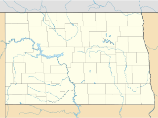
Bartlett is an unincorporated community in Ramsey County, North Dakota, United States. [1] In recent years, the town's population has dwindled. [2]
A BNSF rail line runs through Bartlett.
Bartlett is an unincorporated community in Ramsey County, North Dakota, United States. [1] In recent years, the town's population has dwindled. [2]
A BNSF rail line runs through Bartlett.
A post office called Bartlett was established in 1883, and remained in operation until being discontinued in 1975. [3] The community was named for Frank Bartlett, the original owner of the town site. [4]
| Historical population | |||
|---|---|---|---|
| Census | Pop. | %± | |
| 1910 | 120 | — | |
| 1920 | 98 | −18.3% | |
| 1930 | 67 | −31.6% | |
| 1940 | 78 | 16.4% | |
| 1950 | 61 | −21.8% | |
| 1960 | 39 | −36.1% | |
| 1970 | 19 | −51.3% | |
| U.S. Decennial Census [5] | |||

McCook County is a county in the U.S. state of South Dakota. At the 2010 census, the population was 5,618. Its county seat is Salem. The county was established in 1873, and was organized in 1878. It was named for the former governor of the Dakota Territory and Civil War general Edwin Stanton McCook.

Douglas County is a county in the U.S. state of South Dakota. As of the 2010 United States Census, the population was 3,002. Its county seat is Armour. The county was established in 1873 and organized in 1882. It is named for Stephen Douglas, Illinois political figure.

Walsh County is a county in the U.S. state of North Dakota. As of the 2010 United States Census, the population was 11,119. Its county seat is Grafton.

Towner County is a county in the U.S. state of North Dakota. As of the 2010 United States Census, the population is 2,246. Its county seat is Cando. It is south of the Canada–US border with Manitoba.
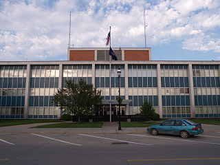
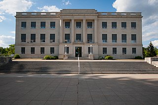
Ramsey County is a county in the U.S. state of North Dakota. As of the 2010 United States Census, the population was 11,451. Its county seat is Devils Lake.

Pierce County is a county in the U.S. state of North Dakota. As of the 2010 United States Census, the population was 4,357. Its county seat is Rugby.

Nelson County is a county in the U.S. state of North Dakota. As of the 2010 United States Census, the population was 3,126. Its county seat is Lakota.

McHenry County is a county in the U.S. state of North Dakota. As of the 2010 United States Census, the population was 5,395. Its county seat is Towner.

Logan County is a county in the U.S. state of North Dakota. As of the 2010 United States Census, the population was 1,990. Its county seat is Napoleon.

Griggs County is a county in the U.S. state of North Dakota. As of the 2010 United States Census, the population was 2,420. Its county seat is Cooperstown.

Divide County is a county in the U.S. state of North Dakota. As of the 2010 United States Census, the population was 2,071. Its county seat is Crosby.

Dickey County is a county in the U.S. state of North Dakota. As of the 2010 United States Census, the population was 5,289. Its county seat is Ellendale.
Cavalier County is a county in the U.S. state of North Dakota. It is south of the Canada–US border with Manitoba. As of the 2010 United States Census, the population was 3,993. Its county seat is Langdon. The city of Cavalier is in nearby Pembina County.

Benson County is a county in the U.S. state of North Dakota. As of the 2010 United States Census, the population was 6,660. Its county seat is Minnewaukan. The county was created on March 9, 1883 by the Dakota Territory legislature, and was named for Bertil W. Benson, a Dakota Territory legislator at the time. The county government was organized on June 4, 1884, and its boundary lines were altered by two legislative actions in 1885.
Barnes County is a county in the U.S. state of North Dakota. As of the 2010 United States Census, the population was 11,066. Its county seat is Valley City.

Ramsey County is a county located in the U.S. state of Minnesota. As of the 2010 census, the population was 508,640, making it the second-most populous county in Minnesota. Its county seat and largest city is Saint Paul, the state capital. The county was founded in 1849 and is named for Alexander Ramsey, the first governor of the Minnesota Territory.

Starkweather is a city in Ramsey County, North Dakota, United States. The population was 117 at the 2010 census. Starkweather was founded in 1902.
The Rural Municipality of Winchester is a former rural municipality (RM) in the Canadian province of Manitoba. It was originally incorporated as a rural municipality on November 1, 1890. It ceased on January 1, 2015 as a result of its provincially mandated amalgamation with the Town of Deloraine to form the Municipality of Deloraine – Winchester.
Mission Township is a civil township in Benson County, North Dakota, United States. As of the 2000 census, its population was 1,077. It is the most populous township in the county.
Doyon is an unincorporated community in Ramsey County, in the U.S. state of North Dakota.
Coordinates: 48°02′41″N98°25′56″W / 48.04472°N 98.43222°W
Municipalities and communities of Ramsey County, North Dakota, United States | ||
|---|---|---|
| Cities |  | |
| Townships |
| |
| Unincorporated communities | ||
| Indian reservation | ||
| Footnotes | ‡This populated place also has portions in an adjacent county or counties | |