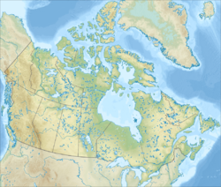
Cape Breton Island is an island on the Atlantic coast of North America and part of the province of Nova Scotia, Canada.

Sydney is a former city and current community located in the Cape Breton Regional Municipality of Cape Breton Island, Nova Scotia, Canada. Situated on Cape Breton Island's east coast, it belongs administratively to the Cape Breton Regional Municipality. Sydney was founded in 1785 by the British, was incorporated as a city in 1904, and dissolved on 1 August 1995, when it was amalgamated into the regional municipality.

Cape Breton Regional Municipality, often referred to as simply CBRM, is the Canadian province of Nova Scotia's second largest municipality and the economic heart of Cape Breton Island. As of 2016 the municipality has a population of 94,285. The municipality was created in 1995 through the amalgamation of eight municipalities located in Cape Breton County.
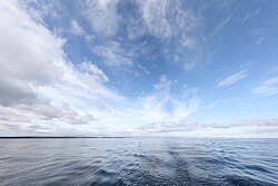
Bras d'Or Lake is an inland sea, or large body of partially fresh/salt water in the centre of Cape Breton Island in the province of Nova Scotia, Canada. Bras d'Or Lake is sometimes referred to as the Bras d'Or Lakes or the Bras d'Or Lakes system; however, its official geographic name is Bras d'Or Lake, as it is a singular entity. Canadian author and yachtsman Silver Donald Cameron describes Bras d'Or Lake as "A basin ringed by indigo hills laced with marble. Islands within a sea inside an island." The lake is connected to the North Atlantic by natural channels; the Great Bras d'Or Channel north of Boularderie Island and the Little Bras d'Or Channel to south of Boularderie Island connect the northeastern arm of the lake to the Cabot Strait. The Bras d'Or is also connected to the Atlantic Ocean via the Strait of Canso by means of a lock canal completed in 1869—the St. Peters Canal, at the southern tip of the lake.
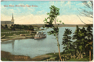
The Mira River is a Canadian river located in eastern Cape Breton Island, Nova Scotia.
Route 223 is a collector road in the Canadian province of Nova Scotia.

Nova Scotia is a province located in Eastern Canada fronting the Atlantic Ocean. One of the Maritime Provinces, Nova Scotia's geography is complex, despite its relatively small size in comparison to other Canadian provinces.

Point Aconi is a rural community in Nova Scotia at the northeastern tip of Boularderie Island. It derives its name from the headland of the same name, Point Aconi.

Upper Leitches Creek is a community in the Canadian province of Nova Scotia, located in the Cape Breton Regional Municipality on Cape Breton Island.
Leitches Creek is a community in the Canadian province of Nova Scotia, located in the Cape Breton Regional Municipality on Cape Breton Island. It is located along a creek of the same name which flows into the Northwest Arm of Sydney Harbour.
Reputably the stream was named by Adam Moore after a family of Lowland Scots he helped settle here in the 1780s. Settlement probably began soon after 1783 although the land was not granted until the late 19th and early 20th centuries.

The Point Aconi Generating Station is a 165 MW Canadian electrical generating station located in the community of Point Aconi, Nova Scotia, a rural community in the Cape Breton Regional Municipality. A thermal generating station, the Point Aconi Generating Station is owned and operated by Nova Scotia Power Corporation. It opened on August 13, 1994 following four years of construction.
St. George's Bay is a bay in the Canadian province of Nova Scotia. It is located on the north shore of the province fronting both the Nova Scotia peninsula and Cape Breton Island, thus comprising a sub-basin of the Gulf of St. Lawrence.
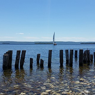
East Bay is a bay of the Bras d'Or Lake on Cape Breton Island in the Canadian province of Nova Scotia. It lies entirely within Cape Breton County.

Wilkie Sugar Loaf is a Canadian peak in the Cape Breton Highlands near the community of Sugar Loaf in the province of Nova Scotia.
St. Patricks Channel is an arm of the Bras d'Or Lake located on Cape Breton Island, in the Canadian province of Nova Scotia. St. Patricks Channel lies entirely within Victoria County.

Northside-Westmount is a provincial electoral district in Nova Scotia, Canada, that elects one member of the Nova Scotia House of Assembly.

Sydney Harbour is the 10-mile long Y-shaped inlet of the Atlantic, oriented southwest-northeast on the northeast shore of Cape Breton Island, Nova Scotia, Canada. At its upper reaches, the harbour forks to form 2 arms, the Northwest Arm and the South Arm. The South Arm is fed upstream by the Sydney River.