Special routes of U.S. Route 82

Last updated

US 82.svg


Special routes of U.S. Route 82
Highway system

Eight special routes of U.S. Route 82 currently exist. Three of them lie within the state of Arkansas, with five more in Texas, and one in Georgia. Seven more existed in the past but have since been decommissioned.

Contents

Texas

Wolfforth business route

Texas Loop 193.svg

State Highway Loop 193

Location Wolfforth
Length2.207 mi [1]  (3.552 km)
Existed1960 [1] –present

Holliday business route

Business plate.svg

US 82.svg

Business U.S. Highway 82-F

Location Holliday
Length3.111 mi [2]  (5.007 km)
Existed2006 [2] –present

Business U.S. Route 82-F (Bus. US 82-F) is a business route of U.S. Route 82 that runs through the town of Holliday. The highway is concurrent with US 277 Bus. for its entire length.

Route description

Bus. US 82-F begins at an intersection with US 82/US 277 southwest of town. The highway runs through Holliday as Olive Street, sharing a short overlap with FM 368. After crossing into Wichita County the highway ends at an interchange with US 82/US 277.

Junction list
CountyLocationmikmDestinationsNotes
Archer US 82.svgUS 277.svg US 82  / US 277  Seymour
Holliday North plate.svg
Texas FM 368.svg
FM 368 north Iowa Park
West end of FM 368 overlap
South plate.svg
Texas FM 368.svg
FM 368 south Lake Kickapoo
East end of FM 368 overlap
Wichita US 82.svgUS 277.svg US 82  / US 277  Wichita Falls
1.000 mi = 1.609 km; 1.000 km = 0.621 mi

Paris business route

Business plate.svg

US 82.svg

Business U.S. Highway 82-H

Location Paris
Length5.153 mi [3]  (8.293 km)
Existed1990 [3] –present

Business U.S. Route 82-H (Bus. US 82-H) is a business route of US 82 in the town of Paris in Lamar County, running for just over 5 miles.

Route description

Bus. 82-H begins in western Paris at an interchange with US 82 and Loop 286. The highway runs on two one-way streets (eastbound: Clarksville Street; westbound: Bonham Street) through the center of town, sharing an overlap with a business route of US 271. The highway ends an interchange in the eastern part of the city with US 82/US 271/Loop 286.

Junction list

The entire route is in Paris, Lamar County.

mikmDestinationsNotes
US 82.svgTexas Loop 286.svg US 82  / Loop 286  Bonham
West plate.svg
Texas FM 79.svg
South plate.svg
Texas FM 137.svg
FM 79 west / FM 137 south Pat Mayse Lake, Roxton
North plate.svg
Business plate.svg
US 271.svg
South plate.svg
Texas 19.svg
South plate.svg
Texas 24.svg
Bus. US 271 north / SH 19 south / SH 24 south Hugo, Cooper, Sulphur Springs
West end of Bus. US 271 overlap
South plate.svg
Business plate.svg
US 271.svg
Bus. US 271 south Mount Pleasant
East end of Bus. US 271 overlap
East plate.svg
Texas FM 195.svg
FM 195 east
US 82.svgUS 271.svgTexas Loop 286.svg US 82  / US 271  / Loop 286  Clarksville, Hugo, Mount Pleasant
1.000 mi = 1.609 km; 1.000 km = 0.621 mi

Clarksville business route

Business plate.svg

US 82.svg

Business U.S. Highway 82-J

Location Clarksville
Length2.651 mi [4]  (4.266 km)
Existed2006 [4] –present
Clarksville business route (Main Street) Clarksville June 2018 16 (Main Street).jpg
Clarksville business route (Main Street)

Avery business route

Business plate.svg

US 82.svg

Business U.S. Highway 82-K

Location Avery
Length0.81 mi [5]  (1,300 m)
Existed1990 [5] –present

Arkansas

El Dorado business route

US 82B.svg

U.S. Highway 82B

Location El Dorado
Length5.425 mi [6]  (8.731 km)
ExistedOctober 20, 1982 [7] –present

U.S. Route 82 Business (US 82B and Hwy. 82B) is a business route of US 82 in Union County, Arkansas. [8]

Major intersections

The entire route is in Union County.

Locationmi [9] kmDestinationsNotes
El Dorado 0.0000.000US 82 (AR).svg US 82  Magnolia, Crossett Western terminus
US 167B.svg US 167B (West Avenue) South Arkansas Community College West Western end of US 167B overlap
US 167 (AR).svg US 167 (US 63 / AR 7) Fordyce, Little Rock, Junction City Eastern end of US 167B overlap
5.4258.731US 82 (AR).svg US 82 Eastern terminus
1.000 mi = 1.609 km; 1.000 km = 0.621 mi

Felsenthal National Wildlife Refuge spur

US 82S.svg

U.S. Highway 82S

Location Felsenthal National Wildlife Refuge
Length0.128 mi [10]  (206 m)

U.S. Route 82 Spur (US 82S and Hwy. 82S) is a 0.14-mile (0.23 km) spur route of US 82 in Ashley County, Arkansas. [11]

Route description

The route is essentially a driveway for a Felsenthal National Wildlife Refuge (NWR) facility.

Major intersections

The entire route is in Ashley County.

Locationmi [9] kmDestinationsNotes
0.0000.000US 82 (AR).svg US 82 Northern terminus
0.1280.206Felsenthal NWR facilitySouthern terminus
1.000 mi = 1.609 km; 1.000 km = 0.621 mi

Montrose business route

US 82B.svg

U.S. Highway 82B

Location Montrose
Length2.088 mi [10]  (3.360 km)
ExistedMay 22, 2018 [12] –present

U.S. Route 82 Business (US 82B and Hwy. 82B) is a 2.03-mile (3.27 km) business route of US 82 in Ashley County, Arkansas. [11]

Route description

US 82B begins at US 82 west of Montrose, a small town in Ashley County, Arkansas within the Arkansas Delta. The highway runs east through a residential area, passing a municipal park before an intersection with the Union Pacific Railroad followed by a junction with US 165 (Main Street) near city hall. Continuing east, US 82 exits Montrose and terminates at the parent route 1.1 miles (1.8 km) west of the Chicot County line.

History

The highway was officially recognized by AASHTO on May 22, 2018. [12] However, it had existed since at least 1953 as US 82 City (US 82C).

Major intersections

The entire route is in Ashley County.

Locationmi [9] kmDestinationsNotes
0.0000.000US 82 (AR).svg US 82  Thebes, Hamburg Western terminus
Montrose 1.11.8US 165 (AR).svg US 165 (Main Street) McGehee
0.1280.206US 82 (AR).svg US 82 Eastern terminus
1.000 mi = 1.609 km; 1.000 km = 0.621 mi

Georgia

Albany business route

US 82 Business.svg

U.S. Highway 82 Business

Location Albany
Length11.9 mi [13]  (19.2 km)

Georgia 520 Business.svg

State Route 520 Business

Location Albany
Length11.9 mi [13]  (19.2 km)
US 82B northern end in Albany Albany U.S. 82 Business NB End.jpg
US 82B northern end in Albany
US 82B eastern end in Dougherty County Albany U.S. 82 Business EB End.jpg
US 82B eastern end in Dougherty County

U.S. Route 82 Business (US 82 Bus.) is a business route of US 82 that exists almost entirely within Albany. It follows North Slappey Boulevard and East Oglethorpe Boulevard through the city, and Sylvester Road east of the city. US 82 Bus. travels entirely concurrent with SR 520 Bus.; it also has a concurrency with US 19 Bus. and a brief concurrency with SR 234. [13]

The entire length of US 82 Bus. is part of the National Highway System, a system of routes determined to be the most important for the nation's economy, mobility, and defense. [14]

The roadway that would eventually become US 82 Bus. was established by the end of 1921 as part of SR 50 in the city. [15] [16] By the end of 1929, this segment of SR 50 was indicated to be under construction. [17] [18] By the middle of 1930, this segment had a completed hard surface. [18] [19] Between February 1948 and April 1949, US 82 was designated on this portion of SR 50. [20] [21] Between June 1960 and June 1963, the path of SR& 50 through Albany was split into SR 50N and SR 50S. SR 50N used Broad Avenue and Sylvester Road, while US 82/SR 50S used Oglethorpe Avenue and Albany Expressway. [22] [23] In 1968, a northeastern bypass of the main part of Albany was proposed as a northern extension of SR 333 from the interchange of US 19/SR 333 and US 82/SR 50S in the eastern part of the city to US 19/SR 3W in the northwestern part of the city. [24] [25] In 1973, SR 50N was redesignated as SR 50 Conn., while SR 50S was redesignated as the SR 50 mainline. [26] [27] The next year, the bypass in Albany was built as a freeway, but there was no indication as to what highways were designated on it. [27] [28] In early 1980, US 19, US 82, and SR 333 were indicated to be designated on the Albany bypass. The old path of the highways were redesignated as US 19 Bus./US 82 Bus. with SR 3 concurrent with them in the western part of the city and SR 50 concurrent with them in the southern and eastern parts of it. [29] [30] Later that year, SR 333 was truncated out of Albany. SR 50 was shifted onto the US 19/US 82 freeway. Its old path in the city was redesignated as SR 50 Bus. [30] [31] In 1988, SR 50 was truncated to Dawson. Its former path from Dawson to Jekyll Island was redesignated as part of SR 520. SR 50 Bus. was redesignated as SR 520 Bus. [32] [33]

The entire route is in Dougherty County.

Locationmi [13] kmDestinationsNotes
Albany 0.0–
0.2
0.0–
0.32
US 19.svgGeorgia 3.svgUS 82.svgGeorgia 520.svgBegin plate.svg
US 19 Business.svg
Begin plate green.svg
Georgia 520 Business.svg
US 19  / SR 3 (North Slappey Boulevard) / US 82  / SR 520 (Liberty Expressway) / US 19 Bus. begins / SR 520 Bus. begins Dawson, Thomasville, Leesburg, Marine Corps Logistics Base
Western end of US 19 Bus. and SR 520 Bus. concurrencies; western terminus of US 82 Bus./SR 520 Bus.; northern terminus of US 19 Bus.; Liberty Expressway exit 6
2.74.3West plate.svg
Georgia 234.svg
SR 234 west (Gillionville Road) Morgan, Albany Museum of Art
Western end of SR 234 concurrency
3.04.8Airport Sign.svg SR 234 east (South Slappey Boulevard) to US 19  Albany Tech. Col. Eastern end of SR 234 concurrency; provides access to Southwest Georgia Regional Airport
4.26.8Georgia 91.svg SR 91 (South Jefferson Street) Newton
5.08.0Dixie Highway marker.svg Dixie Highway (Radium Springs Road)
6.6–
6.9
10.6–
11.1
US 19.svgGeorgia 3.svgGeorgia 133.svgGeorgia 300.svg US 19  / SR 3  / SR 133  / SR 300 (Liberty Expressway) Leesburg, Dawson, Camilla, Marine Corps Eastern end of US 19 Bus. concurrency; eastern terminus of US 19 Bus.; Liberty Expressway exit 2
11.919.2East plate.svg
US 82.svg
East plate green.svg
Georgia 520.svg
US 82 east / SR 520 east (Sylvester Road)
Eastern terminus of US 82 Bus./SR 520 Bus.; eastern end of SR 520 Bus. concurrency; westbound entrance and eastbound exit
1.000 mi = 1.609 km; 1.000 km = 0.621 mi

Former routes

Wichita Falls business route

Business plate.svg

US 82.svg

Business U.S. Highway 82

Location Wichita Falls, Texas
Length0.510 mi [34]  (821 m)
Existed1969–2009 [34]

Stamps truck route

Truck plate.svg

US 82 (AR).svg

U.S. Route 82 Truck

Location Stamps, Arkansas
Length1.3 mi (2.1 km)
ExistedSeptember 27, 2006 [35]

Highway 82 Truck (US 82T or Hwy. 82T) is a former truck route of 1.3 miles (2.1 km) in Stamps, Arkansas. The route was deleted by the Arkansas State Highway Commission on September 27, 2006. [35]

The route began at US 82 in western Stamps and run east toward downtown, before turning right onto Conlan Street. It turned left onto First Street to an intersection with AR 53. US 82T/AR 53 ran together along Central Avenue to US 82, where the route terminates. [36]

Major intersections
The entire route is in Stamps, Lafayette County.

mikmDestinationsNotes
0.00.0US 82 (AR).svg US 82  Lewisville, Buckner Western terminus
0.81.3South plate.svg
Arkansas 53.svg
AR 53 south (Magnolia Street)
Begin AR 53 overlap
1.32.1US 82 (AR).svgNorth plate.svg
Arkansas 53.svg
US 82  / AR 53 north (Antigo Street) Lewisville, Buckner
Eastern terminus
1.000 mi = 1.609 km; 1.000 km = 0.621 mi

Magnolia business route

US 82B.svg

U.S. Highway 82B

Location Magnolia
Length1.65 mi [9]  (2.66 km)
ExistedJune 25, 1973 [37] –May 20, 2019 [38]

U.S. Route 82 Business (US 82B and Hwy. 82B) is a former 1.65-mile (2.66 km) business route of US Route 82 in Columbia County, Arkansas. [9] [39]

US 82B running as Main Street through the Magnolia Commercial Historic District Downtown Magnolia, AR IMG 2313.JPG
US 82B running as Main Street through the Magnolia Commercial Historic District
Route description

The route's western terminus was at US 371 (Main Street/Vine Avenue) near downtown Magnolia. [40] US 82B ran east along Main Street, passing the Dr. H.A. Longino House before entering the Magnolia Commercial Historic District and circling around the Columbia County Courthouse. All three properties are listed on the National Register of Historic Places (NRHP). [41] Continuing east, US 82B had a junction with Jackson Street, which ran north as Highway 355 and south as US 79, which provided access to Highway 19 just south of this junction. [39] Highway 355 provided access to Magnolia Hospital and Southern Arkansas University. US 82B continued due east through a commercial area, including a strip mall and various restaurants. The route turned southeast after Fairview Street, a direction it followed until meeting US 79/US 82 where it terminated near the city limits.

History

Following construction of a new alignment US 82 in the vicinity of Magnolia, Waldo, and McNeil, the Arkansas State Highway Commission created the US 82B designation in Magnolia on May 29, 1970 along the former alignment of US 82 through downtown Magnolia. [42] The designation was officially approved by AASHTO on June 25, 1973. [37] It was decommissioned on May 20, 2019. [38]

Major intersections

The entire route was in Magnolia, Columbia County.

mi [9] [39] kmDestinationsNotes
0.000.00US 371 (AR).svg US 371 (Main Street / Vine Avenue)Western terminus
0.270.43South plate.svg
US 79B (AR).svg
To plate.svg
South plate.svg
Arkansas 19.svg
To plate.svg
North plate.svg
Arkansas 355.svg
US 79B south to AR 19 south / AR 355 north (Jackson Street)
US 79B northern terminus, AR 355 southern terminus
1.652.66US 79 (AR).svgUS 82 (AR).svg US 79  / US 82 Eastern terminus
1.000 mi = 1.609 km; 1.000 km = 0.621 mi

Tuscaloosa bypass route

By-pass plate.svg

US 82.svg

U.S. Route 82 Bypass

Location Tuscaloosa, Alabama
Existedyes

Montgomery business route

Business plate.svg

US 82.svg

U.S. Route 82 Business

Location Montgomery, Alabama
Existed1958–1975

Montgomery bypass route 1

By-pass plate.svg

US 82.svg

U.S. Route 82 Bypass

Location Montgomery, Alabama
Existed1961–1965

Montgomery bypass route 2

By-pass plate.svg

US 82.svg

U.S. Route 82 Bypass

Location Montgomery, Alabama
Existed1965–1975

Montgomery truck route

Truck plate.svg

US 82.svg

U.S. Route 82 Truck

Location Montgomery, Alabama
Existed1960–1960

Montgomery–Prattville alternate route

Alternate plate.svg

US 82.svg

U.S. Route 82 Alternate

Location MontgomeryPrattville, Alabama
Existedyes

Shellman spur route

Georgia 50 Spur.svg

State Route 50 Spur

Location Shellman, Georgia
Existed1937 [43] [44] –1937 [44] [45]

State Route 50 Spur (SR 50 Spur) was a very short-lived spur route of SR 50 that existed in 1937 in the northeastern part of Randolph County. Between the beginning of April and the beginning of July, it was established from an undetermined point in Shellman north to an intersection with SR 50. [43] [44] By the beginning of October, it was redesignated as a southern extension of SR 41. [44] [45]

The entire route was in Randolph County.

LocationmikmDestinationsNotes
Shellman Shellman Southern terminus
Georgia 50 (1920).svg SR 50Northern terminus
1.000 mi = 1.609 km; 1.000 km = 0.621 mi

Albany spur route

Georgia 50 Spur.svg

State Route 50 Spur

Location Albany, Georgia
Existed1963 [22] [23] –1980 [30] [31]

State Route 50 Spur (SR 50 Spur) was a spur route of SR 50 that existed in the city limits of Albany, within Dougherty County. Between June 1960 and June 1963, it was established on Third Avenue from US 82/SR 50 in the far western part of the city to US 19/SR 3W. [22] [23] In 1980, it was decommissioned. [30] [31]

The entire route was in Albany, Dougherty County.

mikmDestinationsNotes
US 82 (1961).svgGeorgia 50 (1960).svg US 82 / SR 50Western terminus
US 19 (1961).svgGeorgia 3W (1960).svg US 19  / SR 3W Eastern terminus
1.000 mi = 1.609 km; 1.000 km = 0.621 mi

Albany connector route

Georgia 50 Connector.svg

State Route 50 Connector

Location Albany, Georgia
Existed1973 [26] [27] –1980 [30] [31]

State Route 50 Connector (SR 50 Conn.) was a connecting route for SR 50 through the city limits of Albany. The roadway that would eventually become SR 50 Conn. was established at least as early as 1919 as SR 32 from Dawson through Albany and into Sylvester. [15] By the end of 1921, SR 50 was designated across the state. This truncated SR 32 at Ashburn. [15] [16] By the end of 1926, the portion of SR 50 in the eastern part of Albany had a "completed hard surface". [16] [17]

By the middle of 1930, from west of Albany to the Worth–Tift county line, the highway had a completed hard surface. The western half of the Dougherty County portion of the Dawson–Albany segment had a completed semi hard surface. [18] [19] In January 1932, the Dawson–Albany segment had a completed hard surface. [46] [47]

Between February 1948 and April 1949, US 82 was designated on SR 50 through the Albany area. [20] [21] Between June 1960 and June 1963, the path of SR& 50 through Albany was split into SR 50N and SR 50S. SR 50N used Broad Avenue and Sylvester Road, while US 82/SR 50S used Oglethorpe Avenue and Albany Expressway. [22] [23] In 1973, SR 50N was redesignated as SR 50 Conn., while SR 50S was redesignated as the SR 50 mainline. [26] [27] In 1980, the connector was decommissioned. [30] [31]

Albany business loop

Georgia 50 Business.svg

State Route 50 Business

Location Albany, Georgia
Existed1980 [30] [31] –1988 [32] [33]

State Route 50 Business (SR 50 Bus.) was a business route of SR 50 that existed in the city limits of Albany within Dougherty County. The roadway that would eventually become SR 50 Bus. was established at least as early as 1919 as SR 32 from Dawson through Albany and into Sylvester. [15] By the end of 1921, SR 50 was designated across the state. This truncated SR 32 at Ashburn. [15] [16] By the end of 1926, the portion of SR 50 in the eastern part of Albany had a "completed hard surface". [16] [17]

By the middle of 1930, from west of Albany to the Worth–Tift county line, the highway had a completed hard surface. The western half of the Dougherty County portion of the Dawson–Albany segment had a completed semi hard surface. [18] [19] In January 1932, the Dawson–Albany segment had a completed hard surface. [46] [47]

Between February 1948 and April 1949, US 82 was designated on SR 50 in the Albany area. [20] [21] Between June 1960 and June 1963, the path of SR& 50 through Albany was split into SR 50N and SR 50S. SR 50N used Broad Avenue and Sylvester Road, while US 82/SR 50S used Oglethorpe Avenue and Albany Expressway. [22] [23] In 1968, a northeastern bypass of the main part of Albany was proposed as a northern extension of SR 333 from the interchange of US 19/SR 333 and US 82/SR 50S in the eastern part of the city to US 19/SR 3W in the northwestern part of the city. [24] [25] In 1973, SR 50N was redesignated as SR 50 Conn., while SR 50S was redesignated as the SR 50 mainline. [26] [27] In early 1980, US 19, US 82, and SR 333 were indicated to be designated on the Albany bypass. The old path of the highways were redesignated as US 19 Bus./US 82 Bus. with SR 3 concurrent with them in the western part of the city and SR 50 concurrent with them in the southern and eastern parts of it. [29] [30] Later that year, SR 333 was truncated out of Albany, and SR 50 was shifted onto the US 19/US 82 freeway in its place. Its old path in the city was redesignated as SR 50 Bus. [30] [31] In 1988, SR 50 was truncated to Dawson. Its former path from Dawson to Jekyll Island was redesignated as part of SR 520. SR 50 was redesignated as SR 520 Bus. [32] [33]

Jekyll Island connector route

Georgia 50 Connector.svg

State Route 50 Connector

Location Jekyll Island, Georgia
Existed1973 [26] [27] –1981 [31] [48]

State Route 50 Connector (SR 50 Conn.) was a connecting route of SR 50 that existed in the southern part of Jekyll Island within Glynn County. In 1952, SR 50 was extended to the southern part of Jekyll Island. [49] [50] In 1973, SR 50 was extended around the northern part of Jekyll Island. SR 50 Conn. was designated on Ben Fortson Parkway between two intersections with SR 50. [26] [27] In 1981, SR 50 was truncated to the southwestern part of Jekyll Island, with SR 50 Conn. being decommissioned. [31] [48]

The entire route was in Jekyll Island, Glynn County.

mikmDestinationsNotes
Georgia 50 (1960).svg SR 50Western terminus
Georgia 50 (1960).svg SR 50Eastern terminus
1.000 mi = 1.609 km; 1.000 km = 0.621 mi

See also

Related Research Articles

<span class="mw-page-title-main">Georgia State Route 3</span> State highway in southern and central Georgia

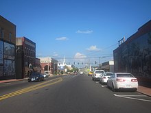
State Route 3 (SR 3) is a 351-mile-long (565 km) state highway that travels south-to-north through portions of the western part of the U.S. state of Georgia, roughly paralleling Interstate 75 (I-75). The highway travels from its southern terminus at the Florida state line, where SR 3 and SR 300 both reach their southern terminus, concurrent with US 19. Here, US 19 travels concurrent with State Road 57, 12 miles (19 km) south-southeast of Thomasville. SR 3 travels through portions of Thomas, Mitchell, Dougherty, Lee, Sumter, Schley, Taylor, Upson, Pike, Spalding, Henry, Clayton, Fulton, Cobb, Bartow, Gordon, Whitfield, and Catoosa counties to its northern terminus at the Tennessee state line, in East Ridge, where US 41/US 76 continue, concurrent with State Route 8. It travels through Thomasville, Albany, Griffin, Atlanta, Calhoun, and Dalton.

<span class="mw-page-title-main">Georgia State Route 520</span> Highway in Georgia

State Route 520 (SR 520), also known as the South Georgia Parkway, is a 261-mile-long (420 km) state highway in the southern part of the U.S. state of Georgia. It travels from the Alabama state line at the Chattahoochee River, along the Phenix City, Alabama–Columbus, Georgia line, to Jekyll Island. It has many concurrencies along its path, including U.S. 280 from the Alabama state line to Richland; US 27 from Columbus to Cusseta; and especially US 82 from Dawson to a point southwest of Brunswick.

<span class="mw-page-title-main">Georgia State Route 300</span> Highway in Georgia, United States

State Route 300, is a 107-mile-long (172 km) state highway in the southern part of the U.S. state of Georgia. Its southern terminus is at the Florida state line south-southeast of Thomasville, where the roadway continues as US 19/SR 57. This is also the southern terminus of SR 3, with which US 19 and SR 300 travel concurrently through the southern part of the state. Its northern terminus is at Interstate 75 (I-75) in Cordele.

<span class="mw-page-title-main">Georgia State Route 15</span> State highway in eastern Georgia

State Route 15 (SR 15) is a 346-mile-long (557 km) state highway that travels south-to-north across the entire length of the U.S. state of Georgia, east of its centerline. This route is part of a multi two-state route 15 that begins at Florida and ends at Georgia at the North Carolina state line. It connects the Florida state line, south-southeast of Folkston with the North Carolina state line, in Dillard, via Folkston, Vidalia, Sandersville, Athens, Demorest, and Clayton.

<span class="mw-page-title-main">Georgia State Route 24</span> State highway in Georgia

State Route 24 (SR 24) is a 221.8-mile-long (357.0 km) state highway that travels south-to-north in an S-shaped curve through portions of Bulloch, Screven, Burke, Jefferson, Washington, Baldwin, Putnam, Morgan, and Oconee counties in the east-central part of the U.S. state of Georgia. The highway connects Statesboro with the Watkinsville area, via Waynesboro, Louisville, Sandersville, Milledgeville, Eatonton, and Madison.

<span class="mw-page-title-main">Georgia State Route 4</span> State highway in eastern Georgia

State Route 4 (SR 4) is a state highway in the eastern part of the U.S. state of Georgia. Except for its northernmost portion, it is completely concurrent for its entire length with U.S. Route 1 (US 1). It traverses south-to-north through portions of Charlton, Ware, Bacon, Appling, Toombs, Emanuel, Jefferson, and Richmond counties in the southeastern and east-central parts of the state. The highway begins at the Florida state line, on US 1/US 23/US 301/SR 15 at the St. Marys River. It travels to its northern terminus at the South Carolina state line, on the Augusta–North Augusta, South Carolina city line, on US 25 Business at the Savannah River.

<span class="mw-page-title-main">Georgia State Route 8</span> State highway in Georgia

State Route 8 (SR 8) is a 183-mile-long (295 km) state highway that travels west-to-east through portions of Haralson, Carroll, Douglas, Cobb, Fulton, DeKalb, Gwinnett, Barrow, Clarke, Oconee, Madison, Franklin, and Hart counties, bisecting the northern part of the U.S. state of Georgia. The highway travels from its western terminus at US 78 and SR 4 at the Alabama state line west of Tallapoosa to its eastern terminus at US 29 at the South Carolina state line at the south end of Lake Hartwell. This was also the proposed State Route 808 (SR 808). The highway is concurrent with either US 29 or US 78 for its entire length.

<span class="mw-page-title-main">Georgia State Route 11</span> State highway in Georgia

State Route 11 (SR 11) is a 376-mile-long (605 km) state highway in the U.S. state of Georgia, traveling through portions of Echols, Lanier, Berrien, Irwin, Ben Hill, Wilcox, Pulaski, Houston, Peach, Bibb, Jones, Jasper, Newton, Walton, Barrow, Jackson, Hall, White, Lumpkin, and Union counties. It travels the entire length of the state from south to north, connecting the Florida state line with the North Carolina state line, roughly bisecting the state into two equal parts. It travels through Warner Robins, Macon, and Gainesville. It is the longest route in the state. The portion from the southeastern city limits of Monticello to the Jasper–Newton county line is included in the Monticello Crossroads Scenic Byway.

<span class="mw-page-title-main">Georgia State Route 27</span> State highway in Georgia

State Route 27 (SR 27) is a 264-mile-long (425 km) state highway that travels west-to-east through portions of Quitman, Stewart, Webster, Sumter, Dooly, Pulaski, Dodge, Telfair, Jeff Davis, Appling, Wayne, and Glynn counties in the southern part of the U.S. state of Georgia, crossing nearly the entire state from Georgetown, just east of the Alabama state line to Brunswick, just west of the Atlantic coast. The route connects US 82/SR 39/SR 50 in Georgetown with US 17/SR 25 in Brunswick, via Lumpkin, Preston, Americus, Vienna, Hawkinsville, Eastman, Helena–McRae, Hazlehurst, Baxley, and Jesup. The highway is concurrent with US 280 and US 341 for most of its length.

<span class="mw-page-title-main">Georgia State Route 55</span> State highway in southwestern Georgia

State Route 55 (SR 55) is a 21.0-mile-long (33.8 km) state highway that runs south-to-north through portions of Calhoun and Terrell counties in the southwestern part of the U.S. state of Georgia. It connects the Leary and Dawson areas of the state.

<span class="mw-page-title-main">U.S. Route 82 in Georgia</span> U.S. highway in Georgia

U.S. Route 82 (US 82) is a 232-mile-long (373 km) U.S. Highway in the U.S. state of Georgia. It travels from the Chattahoochee River at Georgetown to its eastern end, southwest of Brunswick. It travels through such cities as Cuthbert, Dawson, Albany, Sylvester, Tifton, Pearson, Waycross, and Nahunta.

<span class="mw-page-title-main">Special routes of U.S. Route 27</span>

There are at least 16 current and 19 former special routes of U.S. Route 27 (US 27), along with 10 current and six former special routes of State Route 1 (SR 1) in Georgia.

<span class="mw-page-title-main">Special routes of U.S. Route 19</span>

Several special routes of U.S. Route 19 (US 19) exist. In order from south to north, they are as follows.

<span class="mw-page-title-main">Special routes of U.S. Route 278</span>

Nine special routes of U.S. Route 278 currently exist. Four of them lie within the state of Arkansas. One more existed in the past but has since been decommissioned.

<span class="mw-page-title-main">Georgia State Route 91</span> Highway in Georgia

State Route 91 (SR 91) is an 85.8-mile-long (138.1 km) south-to-north state highway in the southwest part of the U.S. state of Georgia. The highway travels from its southern terminus at the Florida state line, southwest of Donalsonville, where the roadway continues as Florida State Road 2 (SR 2), northeast through Albany to its northern terminus, an intersection with SR 32 at a point northeast of the city. It also travels through Donalsonville, Colquitt, and Newton.

<span class="mw-page-title-main">U.S. Route 27 in Georgia</span> Section of United States Numbered Highway in Georgia, United States

U.S. Highway 27 (US 27) is a 356.088-mile-long (573.068 km) United States Numbered Highway in the U.S. state of Georgia. It travels south-to-north through the western part of the state near the Alabama state line. The whole route is Governor's Road Improvement Program (GRIP) corridor EDS-27, providing the bulk of the Tallahassee, Florida–Chattanooga, Tennessee corridor. All of US 27 in Georgia runs concurrently with State Route 1 (SR 1) and is also designated as the Martha Berry Highway. It connects Bainbridge, Colquitt, Blakely, Cuthbert, Lumpkin, Cusseta, Columbus, LaGrange, Carrollton, Bremen, Cedartown, Rome, Summerville, LaFayette, Fort Oglethorpe, and Rossville.

<span class="mw-page-title-main">Special routes of U.S. Route 78</span>

At least 15 special routes of U.S. Route 78 have existed and at least seven have been deleted.

References

  1. 1 2 Transportation Planning and Programming Division (n.d.). "State Highway Loop No. 193". Highway Designation Files. Texas Department of Transportation. Retrieved 2019-01-25.
  2. 1 2 Transportation Planning and Programming Division (n.d.). "Business U.S. Highway No. 82-f". Highway Designation Files. Texas Department of Transportation . Retrieved 2014-01-07.
  3. 1 2 Transportation Planning and Programming Division (n.d.). "Business U.S. Highway No. 82-h". Highway Designation Files. Texas Department of Transportation. Retrieved 2014-01-07.
  4. 1 2 Transportation Planning and Programming Division (n.d.). "Business U.S. Highway No. 82-j". Highway Designation Files. Texas Department of Transportation. Retrieved 2014-01-07.
  5. 1 2 Transportation Planning and Programming Division (n.d.). "Business U.S. Highway No. 82-k". Highway Designation Files. Texas Department of Transportation. Retrieved 2014-01-07.
  6. Transportation Planning and Policy Division (2021-09-17). State Highway Route and Section Map, Union County, Arkansas (PDF) (Map). 1:62,500. Cartography by GIS Section. Little Rock: Arkansas Department of Transportation. Retrieved 2021-12-18.{{cite map}}: |author= has generic name (help)
  7. "Minutes" (1980–1989), p. 284.
  8. General Highway Map, Union County, Arkansas (PDF) (Map). 1:62500. Cartography by Planning and Research Division. Arkansas State Highway and Transportation Department. 2010-06-11. Archived from the original (PDF) on 2012-03-13. Retrieved 2012-08-10.
  9. 1 2 3 4 5 6 System Information and Research Division (2015). "Arkansas Road Log Database" (MDB). Arkansas State Highway and Transportation Department. Retrieved 2016-03-27.
  10. 1 2 Transportation Planning and Policy Division (2021-09-17). State Highway Route and Section Map, Ashley County, Arkansas (PDF) (Map). 1:62,500. Cartography by GIS Section. Little Rock: Arkansas Department of Transportation. Retrieved 2021-12-17.{{cite map}}: |author= has generic name (help)
  11. 1 2 General Highway Map – Ashley County, Arkansas (PDF) (Map). 1:62500. Cartography by Planning and Research Division. Arkansas State Highway and Transportation Department. Retrieved 2021-05-28.
  12. 1 2 Special Committee on U.S. Route Numbering (2018-05-22). "2018 Spring Meeting Report to the Council on Highways and Streets" (PDF) (Report). Washington, DC: American Association of State Highway and Transportation Officials. pp. 1–2. Archived from the original (PDF) on 2019-06-03. Retrieved 2021-12-17.
  13. 1 2 3 4 Google (2019-01-12). "Overview map of US 82 Bus. (Albany)" (Map). Google Maps. Google. Retrieved 2019-01-12.
  14. National Highway System: Albany, GA (PDF) (Map). Federal Highway Administration. 2019-05-09. Retrieved 2019-09-02.
  15. 1 2 3 4 5 State Highway Department of Georgia (1920). System of State Aid Roads as Approved Representing 4800 Miles of State Aid Roads Outside the Limits of the Incorporated Towns (PDF) (Map). Scale not given. Atlanta: State Highway Department of Georgia. Retrieved 2017-04-26.
  16. 1 2 3 4 5 State Highway Department of Georgia (1921). System of State Roads (PDF) (Map). Scale not given. Atlanta: State Highway Department of Georgia. Retrieved 2017-04-26.
  17. 1 2 3 State Highway Department of Georgia (October 1926). System of State Roads (PDF) (Map). Scale not given. Atlanta: State Highway Department of Georgia. Retrieved 2017-04-26.
  18. 1 2 3 4 State Highway Department of Georgia (October 1929). System of State Roads (PDF) (Map). Scale not given. Atlanta: State Highway Department of Georgia. Retrieved 2017-04-26.
  19. 1 2 3 State Highway Department of Georgia (June 1930). System of State Roads (PDF) (Map). Scale not given. Atlanta: State Highway Department of Georgia. Retrieved 2017-04-26.
  20. 1 2 3 State Highway Department of Georgia (1948). System of State Roads (PDF) (Map). Scale not given. Atlanta: State Highway Department of Georgia. OCLC   5673161 . Retrieved 2017-04-26. (Corrected to February 28, 1948.)
  21. 1 2 3 State Highway Department of Georgia (1949). System of State Roads (PDF) (Map). Scale not given. Atlanta: State Highway Department of Georgia. OCLC   5673161 . Retrieved 2017-04-26. (Corrected to April 1, 1949.)
  22. 1 2 3 4 5 State Highway Department of Georgia (1960). State Highway System and Other Principal Connecting Roads (PDF) (Map) (1960–1961 ed.). Scale not given. Atlanta: State Highway Department of Georgia. OCLC   5673161 . Retrieved 2017-04-26. (Corrected to June 1, 1960.)
  23. 1 2 3 4 5 State Highway Department of Georgia (1963). State Highway System and Other Principal Connecting Roads (PDF) (Map). Scale not given. Atlanta: State Highway Department of Georgia. OCLC   5673161 . Retrieved 2017-04-26. (Corrected to June 1, 1963.)
  24. 1 2 State Highway Department of Georgia (January 1968). Official Highway Map (PDF) (Map). Scale not given. Atlanta: State Highway Department of Georgia. Retrieved 2017-04-26.
  25. 1 2 State Highway Department of Georgia (January 1969). Official Highway Map (PDF) (Map). Scale not given. Atlanta: State Highway Department of Georgia. Retrieved 2017-04-26.
  26. 1 2 3 4 5 6 Georgia Department of Transportation (January 1973). Official Highway Map (PDF) (Map). Scale not given. Atlanta: Georgia Department of Transportation. Retrieved 2017-04-26.
  27. 1 2 3 4 5 6 7 Georgia Department of Transportation (January 1974). Official Highway Map (PDF) (Map) (1974–1975 ed.). Scale not given. Atlanta: Georgia Department of Transportation. Retrieved 2017-04-26.
  28. Georgia Department of Transportation (January 1975). Official Highway Map (PDF) (Map) (1975–1976 ed.). Scale not given. Atlanta: Georgia Department of Transportation. Retrieved 2017-04-26.
  29. 1 2 Georgia Department of Transportation (January 1978). Official Highway Map (PDF) (Map) (1978-79 ed.). Scale not given. Atlanta: Georgia Department of Transportation. Retrieved 2017-04-26.
  30. 1 2 3 4 5 6 7 8 9 Georgia Department of Transportation (1980). Official Highway and Transportation Map (PDF) (Map) (1980–1981 ed.). Scale not given. Atlanta: Georgia Department of Transportation. Retrieved 2017-04-26.
  31. 1 2 3 4 5 6 7 8 9 Georgia Department of Transportation (1981). Official Highway and Transportation Map (PDF) (Map) (1981–1982 ed.). Scale not given. Atlanta: Georgia Department of Transportation. Retrieved 2017-04-26.
  32. 1 2 3 Georgia Department of Transportation (1988). Official Highway and Transportation Map (PDF) (Map) (1988–1989 ed.). Scale not given. Atlanta: Georgia Department of Transportation. Retrieved 2017-04-26.
  33. 1 2 3 Georgia Department of Transportation (1989). Official Highway and Transportation Map (PDF) (Map) (1989–1990 ed.). Scale not given. Atlanta: Georgia Department of Transportation. Retrieved 2017-04-26.
  34. 1 2 Transportation Planning and Programming Division (n.d.). "State Highway Spur No. 479". Highway Designation Files. Texas Department of Transportation. Retrieved 2014-01-11.
  35. 1 2 "Minutes of the Meeting" (PDF). Arkansas State Highway Commission. September 2000. pp. 922–923. Retrieved 2016-12-04.
  36. Arkansas State Highway and Transportation Department (January 2003). Map of Stamps, Lafayette County, Arkansas (Map). Little Rock: Arkansas State Highway and Transportation Department. Retrieved 2017-11-24.
  37. 1 2 U.S. Route Numbering Subcommittee (1973-06-26). "U.S. Route Numbering Subcommittee Agenda Showing Action Taken by the Executive Committee" (Report). Washington, DC: American Association of State Highway Officials. p. 1. Retrieved 2021-12-18 via Wikisource.
  38. 1 2 Special Committee on U.S. Route Numbering (2019-05-21). "2019 Spring Meeting Report to the Council on Highways and Streets" (PDF) (Report). Washington, DC: American Association of State Highway and Transportation Officials. p. 1. Archived from the original (PDF) on 2019-07-12. Retrieved 2021-12-18.
  39. 1 2 3 General Highway Map, Columbia County, Arkansas (PDF) (Map). 1:62500. Cartography by Planning and Research Division. Arkansas State Highway and Transportation Department. 2008-02-14. Retrieved 2012-08-10.
  40. Map of Magnolia, Columbia County, Arkansas (PDF) (Map). Cartography by Planning and Research Division. Arkansas State Highway and Transportation Department. February 2008. Retrieved 2012-08-10.
  41. "National Register Information System". National Register of Historic Places . National Park Service. 2010-07-09.
  42. "Minutes" (1970–1979) , p. 1619.
  43. 1 2 State Highway Department of Georgia (1937-04-01). System of State Roads (PDF) (Map). Scale not given. Atlanta: State Highway Department of Georgia. Retrieved 2017-04-27.
  44. 1 2 3 4 State Highway Department of Georgia (1937-07-01). System of State Roads (PDF) (Map). Scale not given. Atlanta: State Highway Department of Georgia. Retrieved 2017-04-27.
  45. 1 2 State Highway Department of Georgia (1937-10-01). System of State Roads (PDF) (Map). Scale not given. Atlanta: State Highway Department of Georgia. Retrieved 2017-04-27.
  46. 1 2 State Highway Department of Georgia (January 1932). System of State Roads (PDF) (Map). Scale not given. Atlanta: State Highway Department of Georgia. Retrieved 2017-04-26.
  47. 1 2 State Highway Department of Georgia (February 1932). System of State Roads (PDF) (Map). Scale not given. Atlanta: State Highway Department of Georgia. Retrieved 2017-04-26.
  48. 1 2 Georgia Department of Transportation (1982). Official Highway and Transportation Map (PDF) (Map). Scale not given. Atlanta: Georgia Department of Transportation. Retrieved 2017-04-27.
  49. State Highway Department of Georgia (1952). System of State Roads (PDF) (Map). Scale not given. Atlanta: State Highway Department of Georgia. OCLC   5673161 . Retrieved 2017-04-27. (Corrected to January 1, 1952.)
  50. State Highway Department of Georgia (1953-01-01). System of State Roads (PDF) (Map). Scale not given. Atlanta: State Highway Department of Georgia. Retrieved 2017-04-27. (Corrected to January 1, 1953.)

Sources