Morgan, Georgia | |
|---|---|
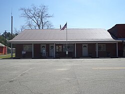 Morgan City Hall | |
 Location in Calhoun County and the state of Georgia | |
| Coordinates: 31°32′20″N84°36′4″W / 31.53889°N 84.60111°W | |
| Country | United States |
| State | Georgia |
| County | Calhoun |
| Area | |
• Total | 1.31 sq mi (3.39 km2) |
| • Land | 1.31 sq mi (3.39 km2) |
| • Water | 0 sq mi (0.00 km2) |
| Elevation | 246 ft (75 m) |
| Population (2020) | |
• Total | 1,741 |
| • Density | 1,329/sq mi (513.3/km2) |
| Time zone | UTC-5 (Eastern (EST)) |
| • Summer (DST) | UTC-4 (EDT) |
| ZIP codes | 39866 |
| Area code | 229 |
| FIPS code | 13-52696 [2] |
| GNIS feature ID | 0318451 [3] |
Morgan is a city in Calhoun County, Georgia, United States. The population was 1,741 at the 2020 census. [4] The city is the county seat of Calhoun County. [5]
