Quitman, Georgia

Last updated

Quitman, Georgia
Quitman City Hall.jpg
Quitman City Hall
Nickname: 
Georgia's Camellia City
Brooks County Georgia Incorporated and Unincorporated areas Quitman Highlighted.svg
Location in Brooks County and the state of Georgia
Coordinates: 30°47′5″N83°33′39″W / 30.78472°N 83.56083°W / 30.78472; -83.56083
Country United States
State Georgia
County Brooks
Government
   Mayor Zinda Drew McDaniel
Area
[1]
  Total4.15 sq mi (10.74 km2)
  Land4.13 sq mi (10.69 km2)
  Water0.02 sq mi (0.05 km2)
Elevation
190 ft (58 m)
Population
 (2020)
  Total4,064
  Density984.73/sq mi (380.18/km2)
Time zone UTC-5 (Eastern (EST))
  Summer (DST) UTC-4 (EDT)
ZIP code
31643
Area code 229
FIPS code 13-63224 [2]
GNIS feature ID0321256 [3]
Website www.cityofquitmanga.com

Quitman is a city in and the county seat of Brooks County, Georgia, United States. [4] The population was 4,064 in 2020. The Quitman Historic District is listed on the National Register of Historic Places.

Contents

Quitman was the home of James Pierpont, author of the song "Jingle Bells" (1857), and uncle of American financier J.P. Morgan. Pierpont was an organist for the First Presbyterian Church. [5] James' daughter, Lillie, was Quitman's first librarian in 1880. [6]

A local Quitman ordinance prohibits chickens from crossing the road. [7]

It is called "Camellia City", as the tree grows in profusion around the area.

History

Quitman was designated the county seat of the newly formed Brooks County in 1858. It was incorporated as a town in 1859 and as a city in 1904. [8] As the county seat, it was the center of trading in the county, which was devoted to cotton plantations before and after the American Civil War. The community was named for John A. Quitman, a hero of the Mexican–American War. [9]

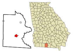
Geography

Quitman is located in southern Georgia at 30°47′05″N83°33′39″W / 30.784677°N 83.560747°W / 30.784677; -83.560747 . [10] U.S. Routes 84 and 221 pass through the center of the city. US 84 leads west 121 miles to Dothan, Alabama, while US 221 leads south 24 miles (39 km) to Greenville, Florida, and 26 miles (42 km) to Interstate 10. US 84 and US 221 together lead east 15 miles (24 km) to Interstate 75 and 17 miles (27 km) to Valdosta.

According to the United States Census Bureau, Quitman has a total area of 4.1 square miles (10.7 km2), of which 0.019 square miles (0.05 km2), or .50%, is water. [11]

Climate

The climate in this area is characterized by hot, humid summers and generally mild to cool winters. According to the Köppen Climate Classification System, Quitman has a humid subtropical climate, abbreviated "Cfa" on climate maps. [12]

Climate data for Quitman, Georgia
MonthJanFebMarAprMayJunJulAugSepOctNovDecYear
Mean daily maximum °C (°F)18
(64)
19
(67)
23
(73)
27
(80)
31
(87)
33
(91)
33
(92)
33
(91)
31
(88)
27
(81)
23
(73)
18
(65)
26
(79)
Mean daily minimum °C (°F)4
(40)
6
(42)
9
(48)
12
(54)
16
(61)
20
(68)
21
(70)
21
(70)
19
(66)
13
(56)
8
(46)
4
(40)
13
(55)
Average precipitation mm (inches)100
(4.1)
110
(4.4)
120
(4.6)
91
(3.6)
89
(3.5)
140
(5.7)
180
(6.9)
150
(6)
120
(4.6)
64
(2.5)
64
(2.5)
94
(3.7)
1,320
(51.9)
Source: Weatherbase [13]

Demographics

Historical population
CensusPop.Note
1870 784
1880 1,40078.6%
1890 1,86833.4%
1900 2,28122.1%
1910 3,91571.6%
1920 4,39312.2%
1930 4,149−5.6%
1940 4,4507.3%
1950 4,7697.2%
1960 5,0716.3%
1970 4,818−5.0%
1980 5,1887.7%
1990 5,2922.0%
2000 4,638−12.4%
2010 3,850−17.0%
2020 4,0645.6%
U.S. Decennial Census [14]
US 84, part of the Quitman Historic District Quitman GA US 84-01.jpg
US 84, part of the Quitman Historic District
Quitman racial composition as of 2020 [15]
RaceNum.Perc.
White 98324.19%
Black or African American 2,80569.02%
Native American 30.07%
Asian 300.74%
Pacific Islander 20.05%
Other/Mixed 1132.78%
Hispanic or Latino 1283.15%

As of the 2020 United States census, there were 4,064 people, 1,476 households, and 836 families residing in the city.

Industry

The prevalent industries in Quitman are farming and automotive.

Education

Schools for Quitman are Quitman Elementary School, Brooks County Middle School, and Brooks County High School.

Media

Radio station WGOV-FM 96.7 is licensed to broadcast from Quitman. The Quitman Free Press, a weekly newspaper, is the official legal publication for Brooks County. It has been in operation since 1876.

Notable people

James Lord Pierpont James Lord Pierpont.jpg
James Lord Pierpont

Related Research Articles

<span class="mw-page-title-main">Brooks County, Georgia</span> County in Georgia, United States

Brooks County is a county located in the U.S. state of Georgia, on its southern border with Florida. As of the 2020 census, the population was 16,301. The county seat is Quitman. The county was created in 1858 from portions of Lowndes and Thomas counties by an act of the Georgia General Assembly and was named for pro-slavery U.S. Representative Preston Brooks, after he severely beat abolitionist Senator Charles Sumner with a cane for delivering a speech attacking slavery.

<span class="mw-page-title-main">Greenville, Florida</span> Town in the state of Florida, United States

Greenville is a town in Madison County, Florida, United States. The population was 746 at the 2020 census, down from 843 at the 2010 census.

<span class="mw-page-title-main">Barwick, Georgia</span> City in Georgia, United States

Barwick is a city divided by the county line between Brooks and Thomas counties, Georgia, United States. It is part of the Valdosta metropolitan statistical area. As of the 2020 census, the city had a population of 363.

<span class="mw-page-title-main">Morven, Georgia</span> City in Georgia, United States

Morven is a city in Brooks County, Georgia, United States. It is part of the Valdosta metropolitan statistical area. The city was named after a mountain in Scotland. The population was 565 at the 2010 census, and 506 in 2020. It was formerly known as Sharpe's Store.

<span class="mw-page-title-main">Pavo, Georgia</span> City in Georgia, United States

Pavo is a city that is divided by the county line between Brooks and Thomas counties in the U.S. state of Georgia. It is part of the Valdosta, Georgia Metropolitan Statistical Area. The population was 622 in 2020.

<span class="mw-page-title-main">Homerville, Georgia</span> City in Georgia, United States

Homerville is a city and the county seat of Clinch County, Georgia, United States. Its population was 2,456 at the 2010 census, a decrease of 12.38% from 2,803 in 2000. It was incorporated February 15, 1869.

<span class="mw-page-title-main">Funston, Georgia</span> Town in Georgia, United States

Funston is a town in Colquitt County, Georgia, United States. The population was 402 in 2020.

<span class="mw-page-title-main">Adel, Georgia</span> City in Georgia, United States

Adel is a city in and the county seat of Cook County, Georgia, United States, located fifty-two miles (84 km) southeast of Albany. As of the 2020 census, the city had a population of 5,571.

<span class="mw-page-title-main">Sparks, Georgia</span> Town in Georgia, United States

Sparks is a town in Cook County, Georgia, United States. The population was 2,052 at the 2010 census, and 2,043 in 2020.

<span class="mw-page-title-main">Vienna, Georgia</span> City in Georgia, United States

The city of Vienna is the county seat of Dooly County, Georgia, United States. The population was 2,928 in 2020. Vienna is situated on the Flint River. It was established as Berrien in 1826. In 1833, its name was changed to Drayton. In 1841, it was renamed Vienna. Vienna was disincorporated at the time they changed the city's name to Vienna. The present name is after Vienna, in Austria.

<span class="mw-page-title-main">Cairo, Georgia</span> City in Georgia, United States

Cairo is a city in Grady County, Georgia, United States. As of the 2020 census, the city had a population of 10,179. The city is the county seat of Grady County.

<span class="mw-page-title-main">Monticello, Georgia</span> City in Georgia, United States

Monticello is the largest city in and the county seat of Jasper County, Georgia, United States. The city includes historic buildings such as the Jasper County Courthouse, Monticello High School and the Monticello Historic District. The population was 2,657 at the 2010 census. It is 56 miles (90 km) southeast of Atlanta.

<span class="mw-page-title-main">Dasher, Georgia</span> Town in Georgia, United States

Dasher is a town in Lowndes County, Georgia, United States. The population was 890 in 2020.

<span class="mw-page-title-main">Lake Park, Georgia</span> City in Georgia, United States

Lake Park is a city in Lowndes County, Georgia, United States. The population was 932 in 2020, up from 733 in 2010.

<span class="mw-page-title-main">Valdosta, Georgia</span> City in Georgia, United States

Valdosta is a city in and the county seat of Lowndes County in the U.S. state of Georgia. As the principal city of the Valdosta metropolitan statistical area, which in 2020 had a metropolitan population of 148,126, its metropolitan area includes Brooks County to the west. With a city population of 55,378 in 2020, Valdosta is the home of Valdosta State University, a regional university in the University System of Georgia with over 12,000 students as of 2015.

<span class="mw-page-title-main">Camilla, Georgia</span> City in Georgia, United States

Camilla is a city in Mitchell County, Georgia, United States, and is its county seat. As of the 2020 census, the city had a population of 5,187, down from 5,360 in 2010.

<span class="mw-page-title-main">Plains, Georgia</span> City in Georgia, United States

Plains is a city in Sumter County, Georgia, United States. The population was 573 at the 2020 census and it is a part of the Americus Micropolitan Statistical Area. It is best known as the birthplace of Jimmy Carter and his wife Rosalynn, who were the president and first lady of the United States respectively from 1977 to 1981. They lived in Plains both before and after their time in the White House.

<span class="mw-page-title-main">James Lord Pierpont</span> American songwriter and composer

James Lord Pierpont was an American songwriter, arranger, organist, Confederate States soldier, and composer. Pierpont wrote and composed "Jingle Bells" in 1857, originally titled "The One Horse Open Sleigh".

<span class="mw-page-title-main">Grooverville, Georgia</span> Unincorporated community in Georgia, U.S.

Grooverville is an unincorporated community in Brooks County, Georgia, United States. It was once known as Key and was located at the crossing of the Thomasville and Madison and Sharpe's Store Road, which was in Thomas County prior to the creation of Brooks County from Lowndes and Thomas counties in 1858.

<span class="mw-page-title-main">Valdosta metropolitan area</span> Metropolitan statistical area in Georgia, United States

The Valdosta metropolitan area, designated the Valdosta metropolitan statistical area by the U.S. Office of Management and Budget, is a metropolitan statistical area consisting of four counties—Brooks, Echols, Lanier, and Lowndes—centered on the city of Valdosta. Located in Southeast Georgia, the metropolitan area's population was 149,849 according to 2022 U.S. census estimates, up from 148,126 at the 2020 U.S. census.

References

  1. "2020 U.S. Gazetteer Files". United States Census Bureau. Retrieved December 18, 2021.
  2. "U.S. Census website". United States Census Bureau . Retrieved January 31, 2008.
  3. "US Board on Geographic Names". United States Geological Survey. October 25, 2007. Retrieved January 31, 2008.
  4. "Find a County". National Association of Counties. Archived from the original on May 31, 2011. Retrieved June 7, 2011.
  5. Jingle Bell history page
  6. Polling, Dean (December 23, 2021). "Dashing through Valdosta's 'Jingle Bells'". Valdosta Daily Times. Retrieved July 11, 2023.
  7. Sheryl Lindsell-Roberts, Loony Laws & Silly Statutes, Sterling Publishing Co., Inc., 1994. ISBN   0-8069-0472-0
  8. Paul T. Hellmann (November 1, 2004). Historical Gazetteer of the United States. Taylor & Francis. p. 243. ISBN   978-0-203-99700-0.
  9. Krakow, Kenneth K. (1975). Georgia Place-Names: Their History and Origins (PDF). Macon, GA: Winship Press. p. 183. ISBN   0-915430-00-2.
  10. "US Gazetteer files: 2010, 2000, and 1990". United States Census Bureau. February 12, 2011. Retrieved April 23, 2011.
  11. "Geographic Identifiers: 2010 Demographic Profile Data (G001): Quitman city, Georgia". U.S. Census Bureau, American Factfinder. Archived from the original on February 12, 2020. Retrieved November 7, 2013.
  12. Climate Summary for Quitman, Georgia
  13. "Weatherbase.com". Weatherbase. 2013. Retrieved on October 15, 2013.
  14. "Census of Population and Housing". Census.gov. Retrieved June 4, 2015.
  15. "Explore Census Data". data.census.gov. Retrieved December 9, 2021.

Commons-logo.svg Media related to Quitman, Georgia at Wikimedia Commons