Crawfordville, Georgia

Last updated

Crawfordville, Georgia
Crawfordville, Georgia downtown.jpg
Broad Street storefronts in downtown Crawfordville, Georgia, with Taliaferro County Courthouse in the distance
Taliaferro County Georgia Incorporated and Unincorporated areas Crawfordville Highlighted.svg
Location in Taliaferro County and the state of Georgia
Coordinates: 33°33′17″N82°53′54″W / 33.55472°N 82.89833°W / 33.55472; -82.89833
CountryUnited States
State Georgia
County Taliaferro
Area
[1]
  Total3.14 sq mi (8.12 km2)
  Land3.12 sq mi (8.07 km2)
  Water0.02 sq mi (0.05 km2)
Elevation
614 ft (187 m)
Population
 (2020)
  Total479
  Density153.77/sq mi (59.37/km2)
Time zone UTC-5 (Eastern (EST))
  Summer (DST) UTC-4 (EDT)
ZIP code
30631
Area code 706
FIPS code 13-20316 [2]
GNIS feature ID0313097 [3]
Website www.crawfordvillega.org
Crawfordville Historic District
USA Georgia location map.svg
Red pog.svg
Usa edcp location map.svg
Red pog.svg
LocationRoughly centered on the downtown business district of Crawfordville, Taliaferro, Georgia
Area1,738 acres (703 ha)
Built1826
Built byCharles Golucke/Golucke & Son, Julius Kendrick, J.H. McKenzie & Son (Taliaferro County Courthouse), others
ArchitectLewis F. Goodrich (Taliaferro County Courthouse)
Architectural styleMid 19th Century Revival, Late Victorian
NRHP reference No. 06000124 [4]
Added to NRHPMarch 14, 2006

Crawfordville is a city in Taliaferro County, Georgia, United States. The population was 479 in 2020. The city is the county seat of Taliaferro County. [5]

Contents

History

Crawfordville was founded in 1825 as the seat of the newly formed Taliaferro County. It was incorporated as a town in 1826 and as a city in 1906. [6] The community was named after William H. Crawford (1772–1834), U.S. Secretary of War and Secretary of the Treasury. [7]

Geography

Crawfordville is located at 33°33′17″N82°53′54″W / 33.55472°N 82.89833°W / 33.55472; -82.89833 (33.554626, -82.898428). [8] According to the United States Census Bureau, the city has a total area of 3.1 square miles (8.0 km2), all land.

Demographics

Historical population
CensusPop.Note
1880 511
1890 58414.3%
1900 5972.2%
1910 68815.2%
1920 78414.0%
1930 8407.1%
1940 1,05625.7%
1950 966−8.5%
1960 786−18.6%
1970 735−6.5%
1980 594−19.2%
1990 577−2.9%
2000 572−0.9%
2010 534−6.6%
2020 479−10.3%
U.S. Decennial Census [9]
Crawfordville city, Georgia – Racial and ethnic composition
Note: the US Census treats Hispanic/Latino as an ethnic category. This table excludes Latinos from the racial categories and assigns them to a separate category. Hispanics/Latinos may be of any race.
Race / Ethnicity (NH = Non-Hispanic)Pop 2010 [10] Pop 2020 [11] % 2010% 2020
White alone (NH)19216935.96%35.28%
Black or African American alone (NH)31927759.74%57.83%
Native American or Alaska Native alone (NH)100.19%0.00%
Asian alone (NH)430.75%0.63%
Pacific Islander alone (NH)000.00%0.00%
Some Other Race alone (NH)000.00%0.00%
Mixed Race or Multi-Racial (NH)10211.87%4.38%
Hispanic or Latino (any race)891.50%1.88%
Total534479100.00%100.00%

Education

Taliaferro County School District

The Taliaferro County School District consists of one charter school offering pre-school to grade twelve. [12] As of 2012, the district had 24 full-time teachers and over 280 students. [13] Their Mascot is the Jaguars. [14]

Attractions

Crawfordville was the birthplace and home of Alexander H. Stephens, who served as a U.S. Congressman, Governor of Georgia, and most notably as Vice President of the Confederate States of America, 1861–1865. Stephens' home, Liberty Hall, is preserved as a museum and is a part of the A. H. Stephens Historic Park, a Georgia State Park located in Crawfordville.

Crawfordville is also the birthplace of Michael H. Rhodes, a radio and television personality that worked for Seattle based KING broadcasting during the 1940s–1980s alongside other famous Northwest greats: JP Patches and Stan Boreson.

The movie Sweet Home Alabama was partially filmed in Crawfordville. It includes the historical Taliaferro County Courthouse in one scene, as well as a scene with Reese Witherspoon walking down Main Street.

The movies Coward of the County with Kenny Rogers, Get Low with Robert Duvall, and the 1978 TV movie Summer of My German Soldier were filmed here.

See also

Related Research Articles

<span class="mw-page-title-main">Taliaferro County, Georgia</span> County in Georgia, United States

Taliaferro County is a county located in East central Piedmont region of the U.S. state of Georgia. As of the 2020 census, the population was 1,559, down from the 2010 census when the population was 1,717, making it the least populous county in Georgia and the second least populous county east of the Mississippi River. The county seat is Crawfordville.

<span class="mw-page-title-main">Richmond County, Georgia</span> Consolidated city-county in Georgia, United States

Richmond County is located in the state of Georgia in the U.S. As of the 2020 census, the population was 206,607. It is one of the original counties of Georgia, created on February 5, 1777. Following an election in 1995, Augusta consolidated governments with Richmond County. The consolidated entity is known as Augusta-Richmond County, or simply Augusta. Exempt are the cities of Hephzibah and Blythe, in southern Richmond County, which voted to remain separate. Richmond County is included in the Augusta-Richmond County, GA-SC metropolitan statistical area.

<span class="mw-page-title-main">Newton County, Georgia</span> County in Georgia, United States

Newton County is a county located in the north central portion of the U.S. state of Georgia. As of the 2020 census, the population was 112,483. The county seat is Covington.

<span class="mw-page-title-main">Keysville, Georgia</span> Town in Georgia, United States

Keysville is a town in Burke and Jefferson counties in the U.S. state of Georgia. As of the 2020 census, the city's population was 300.

<span class="mw-page-title-main">Midville, Georgia</span> City in Georgia, United States

Midville is a city in Burke County, Georgia, United States. The population was 269 at the 2010 census, and 385 in 2020. It is part of the Augusta, Georgia metropolitan area.

<span class="mw-page-title-main">Broxton, Georgia</span> City in Georgia, United States

Broxton is a city in Coffee County, Georgia, United States. Per the 2020 census, the population was 1,060. It is known for its unique sandstone formation called Broxton Rocks along Rocky Creek 10 miles (16 km) north of town.

<span class="mw-page-title-main">Union Point, Georgia</span> City in Georgia, United States

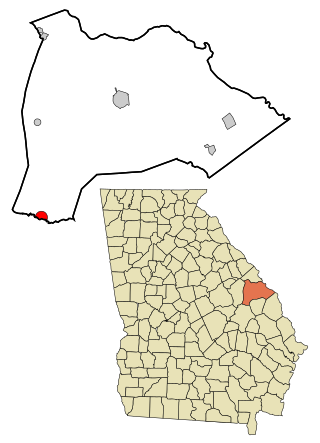
Union Point is a city in Greene County, Georgia, United States. As of the 2020 census, the city population was 1,597.

<span class="mw-page-title-main">Bartow, Georgia</span> Town in Georgia, United States

Bartow is a town in Jefferson County, Georgia, United States. As of the 2020 census, the city had a population of 186. Initially the town was known as "Spier's Turnout", but was changed to honor the first Confederate officer to die in battle, Colonel Francis S. Bartow of Savannah, Georgia, who was killed at the Battle of Manassas, Virginia on July 21, 1861.

<span class="mw-page-title-main">Wrightsville, Georgia</span> City in Georgia, United States

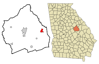
Wrightsville is a city in and the county seat of Johnson County, Georgia, United States. The population was 2,195 at the 2010 census, down from 2,223 at the 2000 census. By 2020, its population grew to 3,449. The city limits include Johnson State Prison on the northeast side of town. Wrightsville is part of the Dublin Micropolitan Statistical Area.

<span class="mw-page-title-main">Aragon, Georgia</span> City in Georgia, United States

Aragon is a city in Polk County, Georgia, United States. As of the 2020 census, the city had a population of 1,440.

<span class="mw-page-title-main">Coleman, Georgia</span> Place in Georgia, United States

Coleman is a former incorporated city in Randolph County, Georgia, United States. It is listed as a census-designated place (CDP). The population was 149 at the 2000 census. The city was abolished by House Bill 1102 effective January 1, 2007, and no longer exists as a municipality.

<span class="mw-page-title-main">Oliver, Georgia</span> City in Georgia, United States

Oliver is a city in Screven County, Georgia, United States. The population was 210 as of 2020.

<span class="mw-page-title-main">Richland, Georgia</span> City in Georgia, United States

Richland is a city in Stewart County, Georgia, United States. Per the 2020 census, the population was 1,370.

<span class="mw-page-title-main">Sharon, Georgia</span> City in Georgia, United States

Sharon is a city in Taliaferro County, Georgia, United States. The population was 104 in 2020.

<span class="mw-page-title-main">Manassas, Georgia</span> City in Georgia, United States

Manassas is a city in Tattnall County, Georgia, United States. Per the 2020 census, the population was 59.

<span class="mw-page-title-main">Camak, Georgia</span> Town in Georgia, United States

Camak is a town in Warren County, Georgia, United States. The town is located just off Interstate 20 between Atlanta and Augusta. The population was 141 in 2020.

<span class="mw-page-title-main">Norwood, Georgia</span> City in Georgia, United States

Norwood is a city in Warren County, Georgia, United States. The population was 202 in 2020.

<span class="mw-page-title-main">Davisboro, Georgia</span> City in Georgia, United States

Davisboro is a city in Washington County, Georgia, United States. Per the 2020 census, the population was 1,832.

<span class="mw-page-title-main">Harrison, Georgia</span> Town in Georgia, United States

Harrison is a town in Washington County, Georgia, United States. The population was 339 in 2020.

<span class="mw-page-title-main">Alamo, Georgia</span> Town in Georgia, United States

Alamo is a town in Wheeler County, Georgia, United States. As of the 2020 census, the town had a population of 771. The town is the county seat of Wheeler County.

References

  1. "2020 U.S. Gazetteer Files". United States Census Bureau. Retrieved December 18, 2021.
  2. "U.S. Census website". United States Census Bureau . Retrieved January 31, 2008.
  3. "US Board on Geographic Names". United States Geological Survey. October 25, 2007. Retrieved January 31, 2008.
  4. "National Register Information System". National Register of Historic Places . National Park Service. July 9, 2010.
  5. "Find a County". National Association of Counties. Archived from the original on May 31, 2011. Retrieved June 7, 2011.
  6. Hellmann, Paul T. (May 13, 2013). Historical Gazetteer of the United States. Routledge. p. 226. ISBN   978-1135948597 . Retrieved November 30, 2013.
  7. Krakow, Kenneth K. (1975). Georgia Place-Names: Their History and Origins (PDF). Macon, GA: Winship Press. p. 54. ISBN   0-915430-00-2.
  8. "US Gazetteer files: 2010, 2000, and 1990". United States Census Bureau. February 12, 2011. Retrieved April 23, 2011.
  9. "Census of Population and Housing". Census.gov. Retrieved June 4, 2015.
  10. "P2 Hispanic or Latino, and Not Hispanic or Latino by Race –– 2010: DEC Redistricting Data (PL 94-171) – Crawfordville city, Georgia". United States Census Bureau .
  11. "P2 Hispanic or Latino, and Not Hispanic or Latino by Race – 2020: DEC Redistricting Data (PL 94-171) – Crawfordville city, Georgia". United States Census Bureau .
  12. Georgia Board of Education [ permanent dead link ], Retrieved June 26, 2010.
  13. School Stats. Archived from the original on 12-04-05. Retrieved 2023-03-03.
  14. "Parents & Students". www.taliaferro.k12.ga.us. Retrieved May 3, 2023.