Windsor, South Carolina

Last updated

Windsor
SCMap-doton-Windsor.PNG
Location of Windsor, South Carolina
USA South Carolina location map.svg
Red pog.svg
Windsor
Usa edcp location map.svg
Red pog.svg
Windsor
Coordinates: 33°28′56″N81°30′48″W / 33.48222°N 81.51333°W / 33.48222; -81.51333
Country Flag of the United States.svg  United States of America
State Flag of South Carolina.svg  South Carolina
County Seal of Aiken County, South Carolina.png Aiken
Area
[1]
  Total0.87 sq mi (2.26 km2)
  Land0.87 sq mi (2.26 km2)
  Water0.00 sq mi (0.00 km2)
Elevation
387 ft (118 m)
Population
 (2020) [2]
  Total115
  Density131.58/sq mi (50.78/km2)
Time zone UTC-5 (Eastern (EST))
  Summer (DST) UTC-4 (EDT)
ZIP code
29856
Area code(s) 803, 839
FIPS code 45-78190 [3]
GNIS feature ID1227647 [4]
Website www.facebook.com/windsor.southcarolina/

Windsor is a town in Aiken County, South Carolina, United States. The population was 121 at the 2010 census. [5] It is part of the Augusta, Georgia metropolitan area.

Contents

Geography

Windsor is located in eastern Aiken County at 33°28′56″N81°30′48″W / 33.482326°N 81.513263°W / 33.482326; -81.513263 . [6]

According to the United States Census Bureau, the town has a total area of 0.66 square miles (1.7 km2), all land. [5]

History

The name of the town of Windsor likely originated from the 1813 will of Anderson Windsor, who owned land on Pond Branch and Yarrow Branch, near the present location of Windsor.

Demographics

Historical population
CensusPop.Note
1890 51
1910 73
1980 55
1990 124125.5%
2000 1272.4%
2010 121−4.7%
2020 115−5.0%
U.S. Decennial Census [7] [2]

As of the census [3] of 2000, there were 127 people, 52 households, and 34 families residing in the town. The population density was 126.7 inhabitants per square mile (48.9/km2). There were 63 housing units at an average density of 62.8 per square mile (24.2/km2). The racial makeup of the town was 69.29% White, 27.56% African American, 2.36% Native American, 0.79% from other races. Hispanic or Latino of any race were 2.36% of the population.

There were 52 households, out of which 36.5% had children under the age of 18 living with them, 55.8% were married couples living together, 9.6% had a female householder with no husband present, and 34.6% were non-families. 28.8% of all households were made up of individuals, and 11.5% had someone living alone who was 65 years of age or older. The average household size was 2.44 and the average family size was 3.09.

In the town, the population was spread out, with 28.3% under the age of 18, 3.1% from 18 to 24, 37.8% from 25 to 44, 22.0% from 45 to 64, and 8.7% who were 65 years of age or older. The median age was 35 years. For every 100 females, there were 95.4 males. For every 100 females age 18 and over, there were 89.6 males.

The median income for a household in the town was $35,833, and the median income for a family was $42,083. Males had a median income of $35,833 versus $23,750 for females. The per capita income for the town was $14,828. There were 9.8% of families and 14.3% of the population living below the poverty line, including 20.5% of under eighteens and none of those over 64.

2010 Demographics

The following is from the 2010 Census: Total Population 121 (100.00%)

Population by Race Asian alone 1 (0.83%) Black or African American alone 10 (8.26%) Some other race alone 5 (4.13%) Two or more races 5 (4.13%) White alone 100 (82.64%)

Population by Hispanic or Latino Origin (of any race) Persons Not of Hispanic or Latino Origin 104 (85.95%) Persons of Hispanic or Latino Origin 17 (14.05%)

Population by Gender Female 64 (52.89%) Male 57 (47.11%)

Population by Age Persons 0 to 4 years 12 (9.92%) Persons 5 to 17 years 27 (22.31%) Persons 18 to 64 years 63 (52.07%) Persons 65 years and over 19 (15.70%) [8]

Related Research Articles

<span class="mw-page-title-main">Aiken County, South Carolina</span> County in South Carolina, United States

Aiken County is a county in the U.S. state of South Carolina. As of the 2020 census, its population was 168,808. Its county seat and largest community is Aiken. Aiken County is a part of the Augusta-Richmond County, GA-SC Metropolitan Statistical Area. It is mostly in the Sandhills region, with the northern parts reaching in the Piedmont and southern parts reaching into the Coastal Plain.

<span class="mw-page-title-main">Wolcottville, Indiana</span> Town in Indiana, United States

Wolcottville is a town in Orange Township, Noble County and Johnson Township, LaGrange County in the U.S. state of Indiana. The population was 998 at the 2010 census.

<span class="mw-page-title-main">Grinnell, Kansas</span> City in Gove County, Kansas

Grinnell is a city in Gove County, Kansas, United States. As of the 2020 census, the population of the city was 260.

<span class="mw-page-title-main">Elk City, Kansas</span> City in Montgomery County, Kansas

Elk City is a city in Montgomery County, Kansas, United States, along the Elk River. As of the 2020 census, the population of the city was 260.

<span class="mw-page-title-main">Glade, Kansas</span> City in Phillips County, Kansas

Glade is a city in Phillips County, Kansas, United States. As of the 2020 census, the population of the city was 52.

<span class="mw-page-title-main">Milan, Kansas</span> City in Sumner County, Kansas

Milan is a city in Sumner County, Kansas, United States. As of the 2020 census, the population of the city was 56.

<span class="mw-page-title-main">Windsor, Maine</span> Town in the state of Maine, United States

Windsor is a town in Kennebec County, Maine, United States. The population was 2,632 at the 2020 census. Windsor is included in the Augusta, Maine micropolitan New England City and Town Area.

Big Woods Township is a township in Marshall County, Minnesota, United States. The population was 79 at the 2000 census.

<span class="mw-page-title-main">Trail, Minnesota</span> City in Minnesota, United States

Trail is a city in Polk County, Minnesota, United States. It is part of the Grand Forks, ND-MN Metropolitan Statistical Area. The population was 40 at the 2020 census.

Saratoga Township is a township in Winona County, Minnesota. The population was 618 at the time of the 2010 census.

<span class="mw-page-title-main">Grand Falls Plaza, Missouri</span> Village in Missouri, United States

Grand Falls Plaza is a village in Newton County, Missouri, United States. The population was 114 at the 2010 census, at which time it was a town. It is part of the Joplin, Missouri Metropolitan Statistical Area.

<span class="mw-page-title-main">Badger, Minnesota</span> City in Minnesota, United States

Badger is a city in Skagen Township of Roseau County, Minnesota, United States. The population was 375 at the 2010 census.

<span class="mw-page-title-main">Trenton, North Carolina</span> Town in North Carolina, United States

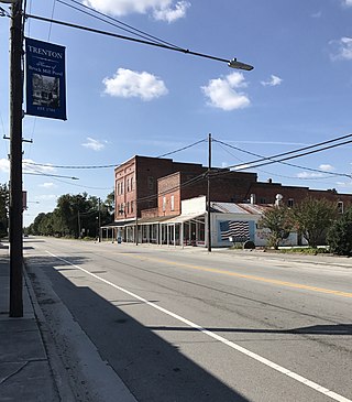
Trenton is a town in Jones County, North Carolina, United States. The population was 238 in 2020 census. It is the county seat of Jones County.

<span class="mw-page-title-main">Harbor View, Ohio</span> Village in Ohio, United States

Harbor View is a village in Lucas County, Ohio, United States. The population was 89 at the 2020 census.

<span class="mw-page-title-main">Belvedere, South Carolina</span> Census-designated place in South Carolina, United States of America

Belvedere is a census-designated place (CDP) and suburb of North Augusta in Aiken County, South Carolina, United States. It is part of the Augusta, Georgia metropolitan area. The population was 5,792 at the 2010 census.

<span class="mw-page-title-main">Burnettown, South Carolina</span> Town in South Carolina, United States of America

Burnettown is a town in Aiken County, South Carolina, United States. The population was 3,105 at the 2020 census. It is part of the Augusta, Georgia metropolitan area. Burnettown is located in historic Horse Creek Valley.

<span class="mw-page-title-main">Northfork, West Virginia</span> Town in West Virginia, United States

Northfork is a town in McDowell County, West Virginia, United States, located on U.S. Route 52 between Welch and Bluefield.

<span class="mw-page-title-main">Pence, Wisconsin</span> Town in Wisconsin, United States

Pence is a town in Iron County, Wisconsin, United States. The population was 198 at the 2000 census. The census-designated place of Pence is located in the town. The unincorporated community of Germania is also located in the town.

<span class="mw-page-title-main">Monetta, South Carolina</span> Town in South Carolina, United States of America

Monetta is a town in Aiken and Saluda counties, South Carolina, United States. The population was 236 at the 2010 census.

<span class="mw-page-title-main">Windsor, Wisconsin</span> Village in Wisconsin, United States

Windsor is a village and former town in Dane County, Wisconsin. The population was 8,754 at the time of the 2020 census. The communities of Lake Windsor, Morrisonville, and Token Creek are located within the village. Windsor voted to incorporate as a village on November 3, 2015; prior to its incorporation, it was a town, and a portion of the town was a census-designated place. Windsor is a part of the Census Bureau's Madison metropolitan statistical area.

References

  1. "ArcGIS REST Services Directory". United States Census Bureau. Retrieved October 15, 2022.
  2. 1 2 "Census Population API". United States Census Bureau. Retrieved October 15, 2022.
  3. 1 2 "U.S. Census website". United States Census Bureau . Retrieved January 31, 2008.
  4. "US Board on Geographic Names". United States Geological Survey. October 25, 2007. Retrieved January 31, 2008.
  5. 1 2 "Geographic Identifiers: 2010 Demographic Profile Data (G001): Windsor town, South Carolina". U.S. Census Bureau, American Factfinder. Archived from the original on February 12, 2020. Retrieved August 6, 2013.
  6. "US Gazetteer files: 2010, 2000, and 1990". United States Census Bureau. February 12, 2011. Retrieved April 23, 2011.
  7. "Census of Population and Housing". Census.gov. Retrieved June 4, 2015.
  8. "2010 Census Population of Windsor, South Carolina - CensusViewer".