Salley, South Carolina

Last updated

Salley, South Carolina
SCMap-doton-Salley.PNG
Location of Salley, South Carolina
Coordinates: 33°33′57″N81°18′15″W / 33.56583°N 81.30417°W / 33.56583; -81.30417
Country Flag of the United States.svg  United States of America
State Flag of South Carolina.svg  South Carolina
County Seal of Aiken County, South Carolina.png Aiken
Government
  MayorLaDonna Hall
Area
[1]
  Total0.78 sq mi (2.01 km2)
  Land0.77 sq mi (1.98 km2)
  Water0.01 sq mi (0.03 km2)
Elevation
374 ft (114 m)
Population
 (2020) [2]
  Total329
  Density429.50/sq mi (165.92/km2)
Time zone UTC-5 (Eastern (EST))
  Summer (DST) UTC-4 (EDT)
ZIP code
29137
Area code(s) 803, 839
FIPS code 45-63115 [3]
GNIS feature ID1250735 [4]
Website www.facebook.com/townofsalley/

Salley is a town in Aiken County, South Carolina, United States. The population was 398 at the 2010 census. [5] It is part of the Augusta, Georgia metropolitan area. Salley is known for hosting the Chitlin Strut, a town-wide festival, every November.

Contents

History

The Salley Historic District was listed on the National Register of Historic Places in 2000. [6] Salley elected LaDonna Hall as mayor on November 5, 2019. Mayor Hall was the first Black American and the first woman elected to this position in the town's history. The incumbent mayor unsuccessfully challenged those results.

Geography

Salley is located at 33°33′57″N81°18′15″W / 33.565941°N 81.304080°W / 33.565941; -81.304080 [7] in eastern Aiken County.

According to the United States Census Bureau, the town has a total area of 0.77 square miles (2.0 km2), of which 0.012 square miles (0.03 km2), or 1.41%,is water. [5]

Demographics

Historical population
CensusPop.Note
1890 252
1900 241−4.4%
1910 31129.0%
1920 40028.6%
1930 4338.3%
1940 4432.3%
1950 407−8.1%
1960 403−1.0%
1970 45011.7%
1980 58429.8%
1990 451−22.8%
2000 410−9.1%
2010 398−2.9%
2020 329−17.3%
U.S. Decennial Census [8] [2]

As of the census [3] of 2000, there were 410 people, 165 households, and 110 families residing in the town. The population density was 529.0 inhabitants per square mile (204.2/km2). There were 194 housing units at an average density of 250.3 per square mile (96.6/km2). The racial makeup of the town was 49.27% African American, 46.83% White, 1.71% Native American, 0.98% Asian, and 1.22% from two or more races. Hispanic or Latino of any race were 0.24% of the population.

There were 165 households, out of which 26.1% had children under the age of 18 living with them, 40.0% were married couples living together, 21.8% had a female householder with no husband present, and 33.3% were non-families. 30.3% of all households were made up of individuals, and 17.6% had someone living alone who was 65 years of age or older. The average household size was 2.48 and the average family size was 3.10.

In the town, the population was spread out, with 22.9% under the age of 18, 8.8% from 18 to 24, 26.1% from 25 to 44, 22.2% from 45 to 64, and 20.0% who were 65 years of age or older. The median age was 40 years. For every 100 females, there were 83.9 males. For every 100 females age 18 and over, there were 80.6 males.

The median income for a household in the town was $28,750, and the median income for a family was $41,250. Males had a median income of $39,063 versus $18,661 for females. The per capita income for the town was $12,250. About 28.6% of families and 28.4% of the population were below the poverty line, including 46.1% of those under age 18 and 36.1% of those age 65 or over.

Related Research Articles

<span class="mw-page-title-main">Belvedere, South Carolina</span> Census-designated place in South Carolina, United States of America

Belvedere is a census-designated place (CDP) and suburb of North Augusta in Aiken County, South Carolina, United States. It is part of the Augusta, Georgia metropolitan area. The population was 5,792 at the 2010 census.

<span class="mw-page-title-main">Burnettown, South Carolina</span> Town in South Carolina, United States of America

Burnettown is a town in Aiken County, South Carolina, United States. The population was 3,105 at the 2020 census. It is part of the Augusta, Georgia metropolitan area. Burnettown is located in historic Horse Creek Valley.

<span class="mw-page-title-main">Clearwater, South Carolina</span> Census-designated place in South Carolina, United States of America

Clearwater is a census-designated place (CDP) in Aiken County, South Carolina. It lies near North Augusta, South Carolina, and is part of the Augusta, Georgia metropolitan area. Clearwater is located in historic Horse Creek Valley. The population was 4,370 at the time of the 2010 census.

<span class="mw-page-title-main">Gloverville, South Carolina</span> Census-designated place in South Carolina, United States of America

Gloverville is a census-designated place (CDP) in Aiken County, South Carolina, United States. The population was 2,831 at the 2010 census. It is part of the Augusta, Georgia metropolitan area. Gloverville is located in historic Horse Creek Valley.

<span class="mw-page-title-main">Jackson, South Carolina</span> Town in South Carolina, United States of America

Jackson is a town in Aiken County, South Carolina, United States. The population was 1,700 at the 2010 census. It is part of the Augusta, Georgia metropolitan area.

<span class="mw-page-title-main">New Ellenton, South Carolina</span> City in South Carolina

New Ellenton is a city in Aiken County, South Carolina, United States. The population was 2,210 at the 2020 census. It is part of the Augusta, Georgia metropolitan area.

<span class="mw-page-title-main">Perry, South Carolina</span> Town in South Carolina, United States of America

Perry is a town in Aiken County, South Carolina, United States. The population was 233 at the 2010 census. It is part of the Augusta, Georgia metropolitan area.

<span class="mw-page-title-main">Wagener, South Carolina</span> Town in South Carolina

Wagener is a town in Aiken County, South Carolina, United States. The population was 797 at the 2010 census, making it the largest settlement in the county north of the South Fork Edisto River. It is part of the Augusta, Georgia metropolitan area.

<span class="mw-page-title-main">Windsor, South Carolina</span> Town in South Carolina, United States of America

Windsor is a town in Aiken County, South Carolina, United States. The population was 121 at the 2010 census. It is part of the Augusta, Georgia metropolitan area.

<span class="mw-page-title-main">Blackville, South Carolina</span> Town in South Carolina, United States

Blackville is a small town in Barnwell County, South Carolina, United States. The population was 2,406 at the 2010 census.

<span class="mw-page-title-main">Hilda, South Carolina</span> Town in South Carolina, United States

Hilda is a town in Barnwell County, South Carolina, United States. The population was 447 at the 2010 census..

<span class="mw-page-title-main">Williston, South Carolina</span> Town in South Carolina, United States

Williston is a town in Barnwell County, South Carolina, United States. The population was 3,139 at the 2010 census.

<span class="mw-page-title-main">North, South Carolina</span> Town in South Carolina, United States

North is a town in Orangeburg County, South Carolina, United States. The population was 696 at the 2020 census.

<span class="mw-page-title-main">Ridge Spring, South Carolina</span> Town in South Carolina, United States

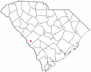
Ridge Spring is a town in Saluda County, South Carolina, United States. The population was 737 at the 2010 census. It is part of the Columbia, SC Metropolitan Statistical Area. The Mayor-Elect is Ms. Qwendolyn Etheredge.

<span class="mw-page-title-main">Cleveland, Virginia</span> Town in Virginia, United States

Cleveland is a town in central Russell County, Virginia, United States. The population was 128 at the 2010 census.

<span class="mw-page-title-main">Cedar Grove, West Virginia</span> Town in West Virginia, United States

Cedar Grove is a town in Kanawha County, West Virginia, United States. The population was 714 at the 2020 census. Cedar Grove was incorporated in 1902. Its name is derived from the time the town was established, when a large juniper forest, misidentified as cedars by early settlers, was growing at that location. Cedar Grove is the site of Fort Kelley and the oldest settlement in the Kanawha Valley, dating from 1773. Landmarks located here include the Tompkins Home (1844) and the Old Brick Church (1853). The current mayor is as of July 1, 2023, is Melissa (Missy) Young.

<span class="mw-page-title-main">Bancroft, West Virginia</span> Town in West Virginia, United States

Bancroft is a town in Putnam County, West Virginia, United States, along the Kanawha River. The population was 389 at the 2020 census. It is part of the Huntington–Ashland metropolitan area.

<span class="mw-page-title-main">Lester, West Virginia</span> Town in West Virginia, United States

Lester is a town in Raleigh County, West Virginia, United States. The population was 337 at the 2020 census. The community was named after Champ Lester, a local pioneer.

<span class="mw-page-title-main">Monetta, South Carolina</span> Town in South Carolina, United States of America

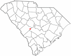
Monetta is a town in Aiken and Saluda counties, South Carolina, United States. The population was 236 at the 2010 census.

<span class="mw-page-title-main">North Augusta, South Carolina</span> City in South Carolina, United States

North Augusta is a city in Aiken and Edgefield counties in the U.S. state of South Carolina, on the north bank of the Savannah River. It lies directly across the river, and state border, from Augusta, Georgia. The population was 24,379 at the 2020 census, making it the 21st-most populous city in South Carolina. The city is included in the Central Savannah River Area (CSRA) and is part of the Augusta, Georgia, metropolitan area.

References

  1. "ArcGIS REST Services Directory". United States Census Bureau. Retrieved October 15, 2022.
  2. 1 2 "Census Population API". United States Census Bureau. Retrieved October 15, 2022.
  3. 1 2 "U.S. Census website". United States Census Bureau . Retrieved January 31, 2008.
  4. "US Board on Geographic Names". United States Geological Survey. October 25, 2007. Retrieved January 31, 2008.
  5. 1 2 "Geographic Identifiers: 2010 Demographic Profile Data (G001): Salley town, South Carolina". U.S. Census Bureau, American Factfinder. Archived from the original on February 10, 2020. Retrieved August 5, 2013.
  6. "National Register Information System". National Register of Historic Places . National Park Service. July 9, 2010.
  7. "US Gazetteer files: 2010, 2000, and 1990". United States Census Bureau. February 12, 2011. Retrieved April 23, 2011.
  8. "Census of Population and Housing". Census.gov. Retrieved June 4, 2015.