Harrison, Georgia | |
|---|---|
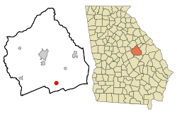 Location in Washington County and the state of Georgia | |
| Coordinates: 32°49′32″N82°43′28″W / 32.82556°N 82.72444°W | |
| Country | United States |
| State | Georgia |
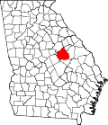
| County | Washington |
| Area | |
• Total | 1.77 sq mi (4.58 km2) |
| • Land | 1.71 sq mi (4.42 km2) |
| • Water | 0.06 sq mi (0.15 km2) |
| Elevation | 410 ft (125 m) |
| Population (2020) | |
• Total | 339 |
| • Density | 198.59/sq mi (76.66/km2) |
| Time zone | UTC-5 (Eastern (EST)) |
| • Summer (DST) | UTC-4 (EDT) |
| ZIP code | 31035 |
| Area code | 478 |
| FIPS code | 13-36920 [2] |
| GNIS feature ID | 0331920 [3] |
Harrison is a town in Washington County, Georgia, United States. The population was 339 according to the 2020 census.