Spencer Township, Pike County, Missouri

Last updated

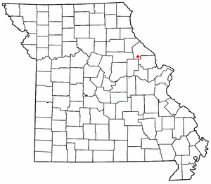
Spencer Township is an inactive township in Pike County, in the U.S. state of Missouri. [1]

A civil township is a widely used unit of local government in the United States that is subordinate to a county. The term town is used in New England, New York, and Wisconsin to refer to the equivalent of the civil township in these states. Specific responsibilities and the degree of autonomy vary based on each state. Civil townships are distinct from survey townships, but in states that have both, the boundaries often coincide and may completely geographically subdivide a county. The U.S. Census Bureau classifies civil townships as minor civil divisions. Currently, there are 20 states with civil townships.

Pike County, Missouri county in Missouri

Pike County is a county on the eastern border of the U.S. state of Missouri, bounded by the Mississippi River. As of the 2010 census, the population was 18,516. Its county seat is Bowling Green. Its namesake was a city in middle Kentucky, a region from where many early migrants came. The county was organized December 14, 1818, and named for explorer Zebulon Pike. The folksong "Sweet Betsy from Pike" is generally thought to be associated with Pike County, Missouri.

U.S. state constituent political entity sharing sovereignty as the United States of America

In the United States, a state is a constituent political entity, of which there are currently 50. Bound together in a political union, each state holds governmental jurisdiction over a separate and defined geographic territory and shares its sovereignty with the federal government. Due to this shared sovereignty, Americans are citizens both of the federal republic and of the state in which they reside. State citizenship and residency are flexible, and no government approval is required to move between states, except for persons restricted by certain types of court orders. Four states use the term commonwealth rather than state in their full official names.

Spencer Township was erected in 1820, taking its name from Spencer Creek. [2]

Spencer Creek is a stream in Ralls and Pike counties of the U.S. state of Missouri. It is a tributary of the Salt River. The stream headwaters arise in the western edge of Pike County adjacent to the south side of Missouri Route 154 about 7 miles (11 km) west of Curryville. The stream flows generally west passing about 2 miles (3.2 km) north of Vandalia then turns northwest crossing under Route 154 east of Liberty Hall. The stream turns north then northeast and passes the village of Madisonville and continues roughly parallel to the boundary between Ralls and Pike counties. It enters briefly into Pike County just prior to passing under U.S. Route 61. It enters the Salt River about 4 miles (6.4 km) southeast of New London.

Related Research Articles

New Hartford, Missouri unincorporated community in Missouri

New Hartford is an unincorporated community in southern Pike County, Missouri, United States. It is located on Route 161, approximately fourteen miles south of Bowling Green.

Pike Township is an inactive township in Carter County, in the U.S. state of Missouri.

Millwood Township is an inactive township in Lincoln County, in the U.S. state of Missouri.

Clifty Fork is a stream in Pike County in the U.S. state of Missouri. It is a tributary of South Spencer Creek.

Denny Run is a stream in Pike County in the U.S. state of Missouri. It is a tributary of South Spencer Creek.

Estes is an unincorporated community in Pike County, in the U.S. state of Missouri. The elevation of Estes is 738 foot. It’s time zone is Central Time.

Farmer is an unincorporated community in Pike County, in the U.S. state of Missouri.

LaMotte is an extinct town in Pike County, in the U.S. state of Missouri. The GNIS classifies it as a populated place.

Spencerburg is an unincorporated community in Pike County, in the U.S. state of Missouri.

Ashley Township is an inactive township in Pike County, in the U.S. state of Missouri.

Buffalo Township is an inactive township in Pike County, in the U.S. state of Missouri.

Calumet Township is an inactive township in Pike County, in the U.S. state of Missouri.

Cuivre Township is an inactive township in Pike County, in the U.S. state of Missouri.

Hartford Township is an inactive township in Pike County, in the U.S. state of Missouri.

Indian Township is an inactive township in Pike County, in the U.S. state of Missouri.

Peno Township is an inactive township in Pike County, in the U.S. state of Missouri.

Prairieville Township is an inactive township in Pike County, in the U.S. state of Missouri.

Salt River Township is an inactive township in Pike County, in the U.S. state of Missouri.

Spencer Township is an inactive township in Ralls County, in the U.S. state of Missouri.

References

  1. U.S. Geological Survey Geographic Names Information System: Spencer Township, Pike County, Missouri
  2. "Pike County Place Names, 1928–1945". The State Historical Society of Missouri. Archived from the original on June 24, 2016. Retrieved December 7, 2016.

Coordinates: 39°23′39″N91°22′16″W / 39.3942°N 91.3711°W / 39.3942; -91.3711

Geographic coordinate system Coordinate system

A geographic coordinate system is a coordinate system that enables every location on Earth to be specified by a set of numbers, letters or symbols. The coordinates are often chosen such that one of the numbers represents a vertical position and two or three of the numbers represent a horizontal position; alternatively, a geographic position may be expressed in a combined three-dimensional Cartesian vector. A common choice of coordinates is latitude, longitude and elevation. To specify a location on a plane requires a map projection.