Curryville, Missouri

Last updated

Curryville, Missouri
Pike County Missouri Incorporated and Unincorporated areas Curryville Highlighted.svg
Location of Curryville, Missouri
Coordinates: 39°20′45″N91°20′29″W / 39.34583°N 91.34139°W / 39.34583; -91.34139 [1]
Country United States
State Missouri
County Pike
Area
[2]
  Total0.28 sq mi (0.71 km2)
  Land0.27 sq mi (0.71 km2)
  Water0.00 sq mi (0.00 km2)
Elevation
[1]
827 ft (252 m)
Population
 (2020)
  Total197
  Density718.98/sq mi (277.50/km2)
Time zone UTC-6 (Central (CST))
  Summer (DST) UTC-5 (CDT)
ZIP code
63339
Area code 573
FIPS code 29-17902 [3]
GNIS feature ID2393699 [1]

Curryville is a city in western Pike County, Missouri, United States. The population was 225 at the 2010 census.

Contents

History

Curryville was platted in 1866, and named after Perry A. Curry, the original owner of the town site. [4] [5] A post office called Curryville has been in operation since 1869. [6]

Geography

Curryville is located in western Pike County on U.S. Route 54 about seven miles west of Bowling Green. Vandalia in adjacent Audrain County lies approximately 7.5 miles to the southwest along Route 54. [7]

According to the United States Census Bureau, the city has a total area of 0.27 square miles (0.70 km2), all land. [8]

Demographics

Historical population
CensusPop.Note
1880 273
1890 30210.6%
1900 271−10.3%
1910 238−12.2%
1920 28519.7%
1930 236−17.2%
1940 26612.7%
1950 258−3.0%
1960 28711.2%
1970 33717.4%
1980 323−4.2%
1990 261−19.2%
2000 251−3.8%
2010 225−10.4%
2020 197−12.4%
U.S. Decennial Census [9]

2010 census

As of the census [10] of 2010, there were 225 people, 91 households, and 53 families living in the city. The population density was 833.3 inhabitants per square mile (321.7/km2). There were 110 housing units at an average density of 407.4 per square mile (157.3/km2). The racial makeup of the city was 91.1% White, 1.8% African American, 1.8% Native American, 0.4% Asian, and 4.9% from two or more races. Hispanic or Latino of any race were 1.8% of the population.

There were 91 households, of which 26.4% had children under the age of 18 living with them, 51.6% were married couples living together, 5.5% had a female householder with no husband present, 1.1% had a male householder with no wife present, and 41.8% were non-families. 36.3% of all households were made up of individuals, and 11% had someone living alone who was 65 years of age or older. The average household size was 2.47 and the average family size was 3.28.

The median age in the city was 42.3 years. 24% of residents were under the age of 18; 5.9% were between the ages of 18 and 24; 24.5% were from 25 to 44; 32.9% were from 45 to 64; and 12.9% were 65 years of age or older. The gender makeup of the city was 50.2% male and 49.8% female.

2000 census

As of the census [3] of 2000, there were 251 people, 106 households, and 71 families living in the city. The population density was 909.2 inhabitants per square mile (351.0/km2). There were 128 housing units at an average density of 463.7 per square mile (179.0/km2). The racial makeup of the city was 91.63% White, 3.98% African American, 0.40% Native American, 0.40% Asian, and 3.59% from two or more races.

There were 106 households, out of which 32.1% had children under the age of 18 living with them, 49.1% were married couples living together, 17.0% had a female householder with no husband present, and 32.1% were non-families. 28.3% of all households were made up of individuals, and 6.6% had someone living alone who was 65 years of age or older. The average household size was 2.37 and the average family size was 2.93.

In the city the population was spread out, with 26.7% under the age of 18, 8.0% from 18 to 24, 25.1% from 25 to 44, 29.5% from 45 to 64, and 10.8% who were 65 years of age or older. The median age was 35 years. For every 100 females there were 91.6 males. For every 100 females age 18 and over, there were 85.9 males.

The median income for a household in the city was $27,500, and the median income for a family was $29,583. Males had a median income of $27,679 versus $16,250 for females. The per capita income for the city was $13,032. About 17.1% of families and 22.7% of the population were below the poverty line, including 20.8% of those under the age of eighteen and 25.0% of those 65 or over.

Transportation

While there is no fixed-route transit service in Curryville, intercity bus service is provided by Burlington Trailways in nearby Bowling Green. [11]

Related Research Articles

<span class="mw-page-title-main">Pike County, Missouri</span> County in Missouri, United States

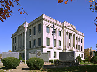
Pike County is a county on the eastern border of the U.S. state of Missouri, bounded by the Mississippi River. As of the 2020 census, the population was 17,587. Its county seat is Bowling Green. Its namesake was a city in middle Kentucky, a region from where many early migrants came. The county was organized December 14, 1818, and named for explorer Zebulon Pike. The folksong "Sweet Betsy from Pike" is generally thought to be associated with Pike County, Missouri.

<span class="mw-page-title-main">Mosby, Missouri</span> City in Missouri, United States

Mosby is a city in Clay County, Missouri, United States, along the Fishing River. The population was 101 at the 2020 census. It is part of the Kansas City metropolitan area.

<span class="mw-page-title-main">Pilot Knob, Missouri</span> City in Missouri, United States

Pilot Knob is a city in northeast Iron County, Missouri, United States. The population was 671 at the 2020 census. It lies eighteen miles south-east of Belgrade and twenty-seven miles north-east of Centerville.

<span class="mw-page-title-main">Bates City, Missouri</span> City in Missouri, United States

Bates City is a city in western Lafayette County, Missouri, and is part of the Kansas City metropolitan area. The population was 219 at the 2020 census, which is neither a gain nor a loss in population since 2010.

<span class="mw-page-title-main">Lake Lafayette, Missouri</span> City in Missouri, United States

Lake Lafayette is a city in Lafayette County, Missouri, and is part of the Kansas City metropolitan area within the United States. The population was 327 at the 2010 census.

<span class="mw-page-title-main">Clarksburg, Missouri</span> City in Missouri, United States

Clarksburg is a city in Moniteau County, Missouri, United States. The population was 334 at the 2010 census. It is part of the Jefferson City, Missouri Metropolitan Statistical Area.

<span class="mw-page-title-main">Middletown, Missouri</span> City in Missouri, United States

Middletown is a city in Montgomery County, Missouri, United States. The population was 171 at the 2020 census.

<span class="mw-page-title-main">Koshkonong, Missouri</span> City in Missouri, United States

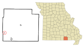
Koshkonong is a city in Oregon County, Missouri, United States. The population was 196 at the 2020 census.

<span class="mw-page-title-main">Clarksville, Missouri</span> City in Missouri, United States

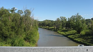
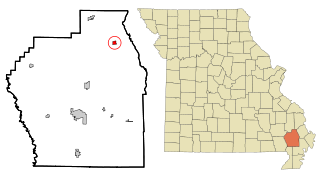
Clarksville is a city in Calumet Township, Pike County, Missouri, United States. The population was 442 at the 2010 census.

<span class="mw-page-title-main">Frankford, Missouri</span> City in Missouri, United States

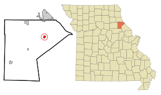
Frankford is a city in Pike County, Missouri, United States. The population was 323 at the 2010 census.

<span class="mw-page-title-main">New London, Missouri</span> City in Missouri, United States

New London is a city in Ralls County, Missouri, United States. The population was 943 at the 2020 census. It is the county seat of Ralls County.

<span class="mw-page-title-main">Nelson, Missouri</span> City in Missouri, United States

Nelson is a city in Saline County, Missouri, United States. The population was 152 at the 2020 census.

<span class="mw-page-title-main">Greendale, Missouri</span> City in Missouri, United States

Greendale is a city in St. Louis County, Missouri, United States. The population was 651 at the 2010 census.

<span class="mw-page-title-main">St. Mary, Missouri</span> City in Missouri, United States

St. Mary is a city in Ste. Genevieve County, Missouri, United States. The population was 309 at the 2020 census.

<span class="mw-page-title-main">Bell City, Missouri</span> City in Missouri, United States

Bell City is a city in northeastern Stoddard County, Missouri, United States. It was founded as a sawmill town circa 1900, and lies at the foothills of Crowley's Ridge on Missouri Route 91. The population was 448 at the 2010 census. Dorothy Burton is the current mayor.

<span class="mw-page-title-main">Merriam Woods, Missouri</span> City in Missouri, United States

Merriam Woods is a city in Taney County, Missouri, United States. The population was 2,006 at the 2020 census. It is part of the Branson, Missouri Micropolitan Statistical Area.

<span class="mw-page-title-main">Sheridan, Missouri</span> City in Missouri, United States

Sheridan is a city in northwest Worth County, Missouri, United States, near the Platte River. The population was 195 at the 2010 census.

<span class="mw-page-title-main">Warson Woods, Missouri</span> City in Missouri, United States

Warson Woods is a city in St. Louis County, Missouri, United States. The population was 1,962 at the 2010 census.

<span class="mw-page-title-main">Gilman City, Missouri</span> City in Missouri, United States

Gilman City is a city in southeastern Harrison and extending into northeastern Daviess counties in the U.S. state of Missouri. The population was 329 at the 2020 census.

<span class="mw-page-title-main">Summersville, Missouri</span> City in Missouri, United States

Summersville is a city in Shannon and Texas counties in the U.S. state of Missouri. The population was 453 at the 2020 census.

References

  1. 1 2 3 U.S. Geological Survey Geographic Names Information System: Curryville, Missouri
  2. "ArcGIS REST Services Directory". United States Census Bureau. Retrieved August 28, 2022.
  3. 1 2 "U.S. Census website". United States Census Bureau . Retrieved January 31, 2008.
  4. "Pike County Place Names, 1928–1945". The State Historical Society of Missouri. Archived from the original on June 24, 2016. Retrieved December 7, 2016.
  5. Gannett, Henry (1905). The Origin of Certain Place Names in the United States. Govt. Print. Off. pp.  97.
  6. "Post Offices". Jim Forte Postal History. Retrieved December 7, 2016.
  7. Missouri Atlas & Gazetteer, DeLorme, 1998, First edition, p. 32, ISBN   0-89933-224-2
  8. "US Gazetteer files 2010". United States Census Bureau. Archived from the original on January 25, 2012. Retrieved July 8, 2012.
  9. "Census of Population and Housing". Census.gov. Retrieved June 4, 2015.
  10. "U.S. Census website". United States Census Bureau . Retrieved July 8, 2012.
  11. "Missouri Bus Stops" . Retrieved September 28, 2023.