Spirit Lake, Idaho

Last updated
Spirit Lake, Idaho
Spirit Lake HD NRHP 79000795 Kootenai County, ID.jpg
Kootenai County Idaho Incorporated and Unincorporated areas Spirit Lake Highlighted 1676060.svg
Location of Spirit Lake in Kootenai County, Idaho.
Usa edcp location map.svg
Red pog.svg
Spirit Lake, Idaho
Location in the United States
Coordinates: 47°58′0″N116°51′59″W / 47.96667°N 116.86639°W / 47.96667; -116.86639 Coordinates: 47°58′0″N116°51′59″W / 47.96667°N 116.86639°W / 47.96667; -116.86639
Country United States
State Idaho
County Kootenai
Government
  MayorJeremy Cowperthwaite
Area
[1]
  Total2.46 sq mi (6.36 km2)
  Land2.46 sq mi (6.36 km2)
  Water0.00 sq mi (0.00 km2)
Elevation
2,569 ft (783 m)
Population
 (2010) [2]
  Total1,945
  Estimate 
(2019) [3]
2,533
  Density1,031.35/sq mi (398.19/km2)
Time zone UTC-8 (Pacific (PST))
  Summer (DST) UTC-7 (PDT)
ZIP code
83869
Area code 208
FIPS code 16-76060
GNIS feature ID0398162
Website www.spiritlakeid.gov

Spirit Lake is a city in Kootenai County, Idaho. The population was 1,945 at the time of the 2010 census, up from 1,376 in 2000. [4] It is part of the Coeur d'Alene Metropolitan Statistical Area, which includes the entire county.

Contents

History

A post office called Spirit Lake has been in operation since 1903. [5] The city took its name from nearby Spirit Lake. [6] [7]

Geography

Spirit Lake is located at 47°58′00″N116°51′59″W / 47.966592°N 116.866383°W / 47.966592; -116.866383 , [8] at an elevation of 2,569 feet (783 m) above sea level.

According to the United States Census Bureau, the city has a total area of 2.29 square miles (5.93 km2), all land. [9]

Demographics

Historical population
CensusPop.
1910 907
1920 9403.6%
1930 1,24132.0%
1940 1,006−18.9%
1950 823−18.2%
1960 693−15.8%
1970 622−10.2%
1980 83434.1%
1990 790−5.3%
2000 1,37674.2%
2010 1,94541.4%
2019 (est.)2,533 [3] 30.2%
U.S. Decennial Census [10]

2010 census

As of the census [2] of 2010, there were 1,945 people, 739 households, and 530 families living in the city. The population density was 849.3 inhabitants per square mile (327.9/km2). There were 797 housing units at an average density of 348.0 per square mile (134.4/km2). The racial makeup of the city was 96.3% White, 0.2% African American, 0.5% Native American, 0.4% Asian, 0.1% Pacific Islander, 0.6% from other races, and 1.9% from two or more races. Hispanic or Latino of any race were 2.8% of the population.

There were 739 households, of which 38.0% had children under the age of 18 living with them, 53.9% were married couples living together, 11.4% had a female householder with no husband present, 6.5% had a male householder with no wife present, and 28.3% were non-families. 22.6% of all households were made up of individuals, and 7.4% had someone living alone who was 65 years of age or older. The average household size was 2.63 and the average family size was 3.06.

The median age in the city was 37.8 years. 27.7% of residents were under the age of 18; 6.6% were between the ages of 18 and 24; 24.4% were from 25 to 44; 29.4% were from 45 to 64; and 11.9% were 65 years of age or older. The gender makeup of the city was 50.3% male and 49.7% female.

2000 census

As of the census [11] of 2000, there were 1,376 people, 517 households, and 369 families living in the city. The population density was 723.8 inhabitants per square mile (279.5/km2). There were 587 housing units at an average density of 308.8 per square mile (119.2/km2). The racial makeup of the city was 95.57% White, 0.15% African American, 0.65% Native American, 0.15% Asian, 0.07% Pacific Islander, 1.45% from other races, and 1.96% from two or more races. Hispanic or Latino of any race were 2.40% of the population.

There were 517 households, out of which 37.9% had children under the age of 18 living with them, 55.7% were married couples living together, 10.4% had a female householder with no husband present, and 28.6% were non-families. 22.8% of all households were made up of individuals, and 7.4% had someone living alone who was 65 years of age or older. The average household size was 2.66 and the average family size was 3.07.

In the city, the population was spread out, with 29.9% under the age of 18, 5.7% from 18 to 24, 30.1% from 25 to 44, 24.2% from 45 to 64, and 10.1% who were 65 years of age or older. The median age was 36 years. For every 100 females, there were 94.6 males. For every 100 females age 18 and over, there were 98.8 males.

The median income for a household in the city was $28,854, and the median income for a family was $32,337. Males had a median income of $25,875 versus $18,092 for females. The per capita income for the city was $13,592. About 11.6% of families and 16.4% of the population were below the poverty line, including 20.8% of those under age 18 and 6.3% of those age 65 or over.

Education

Notable residents

See also

Related Research Articles

<span class="mw-page-title-main">Lincoln County, Montana</span> County in Montana, United States

Lincoln County is a county located in the U.S. state of Montana. As of the 2020 census, the population was 19,677. Its county seat is Libby. The county was founded in 1909 and named for President Abraham Lincoln. The county lies on Montana's north border and thus shares the US-Canadian border with the Canadian province of British Columbia.

<span class="mw-page-title-main">Bloomington, Idaho</span> City in Idaho, United States

Bloomington is a city in Bear Lake County, Idaho, United States. The population was 206 at the 2010 census. It was first settled in 1864.

<span class="mw-page-title-main">Georgetown, Idaho</span> City in Idaho, United States

Georgetown is a city in the Bear River Valley in Bear Lake County, Idaho, United States, at the center of a farming area between the river and the mountains to the east. It was settled by Mormon pioneers on the route of the Oregon Trail and was named after George Q. Cannon. Georgetown was first settled in 1864 The population was 476 at the 2010 census. U.S. Route 30 passes through the town.

<span class="mw-page-title-main">Montpelier, Idaho</span> City in Idaho, United States

Montpelier is a city in Bear Lake County, Idaho, United States. The population was 2,597 at the 2010 census, down from 2,785 in 2000. The city is the largest community in the Bear Lake Valley, a farming region north of Bear Lake in southeastern Idaho along the Utah border. It was settled in 1863 by Mormon pioneers on the route of the Oregon Trail. Nearby to the east is the border with Wyoming.

<span class="mw-page-title-main">Paris, Idaho</span> City in Idaho, United States

Paris is a city and county seat of Bear Lake County, Idaho, United States. Located on the western side of the Bear Lake Valley, the city's population was 513 at the 2010 census, down from 576 in 2000. Paris was settled on September 26, 1863, by pioneer settlers of The Church of Jesus Christ of Latter-day Saints.
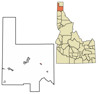
<span class="mw-page-title-main">St. Charles, Idaho</span> City in Idaho, United States

St. Charles is a city in southern Bear Lake County, Idaho, United States, that is located near the northwestern shore of Bear Lake. Its population was 131 at the 2010 census, down from 156 in 2000.

<span class="mw-page-title-main">St. Maries, Idaho</span> City in Idaho, United States

St. Maries is a city in north central Idaho, the largest in rural Benewah County and its county seat. Its population was 2,402 at the 2010 census, down from 2,652 in 2000.

<span class="mw-page-title-main">Carey, Idaho</span> City in Idaho, United States

Carey is a city in Blaine County, Idaho, United States. The population was 604 at the 2010 census. Carey is primarily an agricultural city and is the location of the Blaine County Fairgrounds. Nearby recreational destinations include the Craters of the Moon National Monument, Carey Lake, Silver Creek and the Little Wood River. Further west is the Big Wood River Valley, leading to the Sun Valley resort. In recent years, the city of Carey has experienced significant growth.

<span class="mw-page-title-main">Clark Fork, Idaho</span> City in Idaho, United States

Clark Fork is a small town in Bonner County, Idaho. The population was 536 at the time of the 2010 census.

<span class="mw-page-title-main">Priest River, Idaho</span> City in Idaho, United States

Priest River is a city in Bonner County, Idaho. The population was 1,751 at the 2010 census. Located in the Idaho Panhandle region of the state, the city is at the mouth of the Priest River on the Pend Oreille River.

<span class="mw-page-title-main">Ucon, Idaho</span> City in Idaho, United States

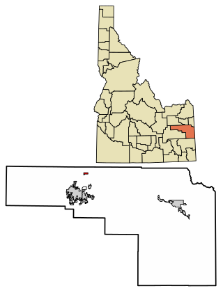
Ucon is a city in Bonneville County, Idaho, United States. It is part of the Idaho Falls, Idaho Metropolitan Statistical Area. The population was 1,108 at the 2010 census. Ucon was first settled in 1883.
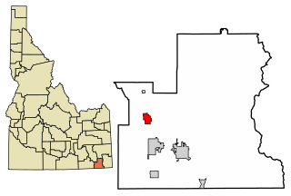
<span class="mw-page-title-main">Bonners Ferry, Idaho</span> City in Idaho

Bonners Ferry is the largest city and the county seat of Boundary County, Idaho, United States. The population was 2,543 at the 2010 census.

<span class="mw-page-title-main">Dayton, Idaho</span> City in Idaho, United States

Dayton is a city in Franklin County, Idaho, United States. The population was 463 at the 2010 census. It is part of the Logan, Utah-Idaho Metropolitan Statistical Area.

<span class="mw-page-title-main">Dalton Gardens, Idaho</span> City in Idaho, United States

Dalton Gardens is a city in Kootenai County, Idaho. It is considered a suburb of Coeur d'Alene and borders the city to the north and east. The city of Dalton Gardens is also part of the larger Spokane-Coeur d'Alene Combined Metropolitan Statistical Area which encompasses Kootenai County, Idaho. The population of Dalton Gardens was 2,335 at the time of the 2010 census.

<span class="mw-page-title-main">Fernan Lake Village, Idaho</span> City in Idaho, United States

Fernan Lake Village is a city in Kootenai County, Idaho, United States. The population was 169 at the 2010 census.

<span class="mw-page-title-main">Hauser, Idaho</span> City in Idaho, United States

Hauser is a city in Kootenai County, Idaho, United States. The population was 678 at the 2010 census. The city is located on the southern end of Hauser Lake.

<span class="mw-page-title-main">Stateline, Idaho</span> City in Idaho, United States

Stateline, officially the City of State Line, and historically known as State Line Village, is a city in Kootenai County, Idaho, United States, and is both the easternmost suburb of Spokane, Washington and the westernmost suburb of Coeur d'Alene, Idaho. The population was 38 at the 2010 census. The city is known for the adult services it provides which attract business from nearby Spokane and Coeur d'Alene. The unincorporated community of Spokane Bridge, Washington is located across the Spokane River to the southwest.

<span class="mw-page-title-main">Orleans, Iowa</span> City in Iowa, United States

Orleans is a city in Dickinson County, Iowa, United States. The population was 521 at the time of the 2020 census. Orleans is part of the Iowa Great Lakes region, located along Spirit Lake. Numerous state parks are located within a few miles of the town, including Marble Beach and Mini-Wakan.

<span class="mw-page-title-main">Spirit Lake, Iowa</span> City in Iowa, United States

Spirit Lake is a city in Dickinson County, Iowa, United States. The population was 5,439 at the 2020 census. It is the county seat of Dickinson County.
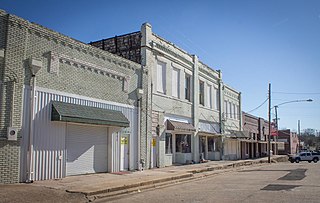
<span class="mw-page-title-main">Minnewaukan, North Dakota</span> City in North Dakota, United States

Minnewaukan is a city in Benson County, North Dakota. It serves as the county seat and is fourth largest city in the county, after Fort Totten, Leeds, and Maddock. The population was 199 at the 2020 census. Minnewaukan was founded in 1884.

References

  1. "2019 U.S. Gazetteer Files". United States Census Bureau. Retrieved July 9, 2020.
  2. 1 2 "U.S. Census website". United States Census Bureau . Retrieved 2012-12-18.
  3. 1 2 "Population and Housing Unit Estimates". United States Census Bureau. May 24, 2020. Retrieved May 27, 2020.
  4. Spokesman-Review - 2010 census - Spirit Lake, Idaho - accessed 2011-12-16
  5. "Kootenai County". Jim Forte Postal History. Retrieved 15 October 2015.
  6. Tudehope, Scott (August 25, 1980). "Naming towns in pioneer days was fast, easy - and personal". Spokane Daily Chronicle. Washington. p. 5.
  7. "Picturesque Spirit Lake gets its name from Indian lovers' legend". Spokesman-Review. Spokane, Washington. (aerial photo). December 1, 1952. p. 14.
  8. "US Gazetteer files: 2010, 2000, and 1990". United States Census Bureau. 2011-02-12. Retrieved 2011-04-23.
  9. "US Gazetteer files 2010". United States Census Bureau. Archived from the original on 2012-07-02. Retrieved 2012-12-18.
  10. "Census of Population and Housing". Census.gov. Retrieved June 4, 2015.
  11. "U.S. Census website". United States Census Bureau . Retrieved 2008-01-31.