Springfield, Birmingham

Last updated

Springfield
West Midlands UK location map.svg
Red pog.svg
Springfield
Location within the West Midlands
Population31,391 (2011.Ward) [1]
  Density 69.3 per ha
OS grid reference SP095815
Metropolitan borough
Shire county
Metropolitan county
Region
Country England
Sovereign state United Kingdom
Post town BIRMINGHAM
Postcode district B13
Dialling code 0121
Police West Midlands
Fire West Midlands
Ambulance West Midlands
UK Parliament
List of places
UK
England
West Midlands
52°25′53″N1°51′34″W / 52.4314°N 1.8595°W / 52.4314; -1.8595

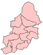
Springfield is a ward in south east Birmingham, England, created in 2004 from much of the old Sparkhill ward. It is a part of the formal district of Hall Green.

Contents

Places of interest

The area is served by the Sparkhill Library that has, with its distinctive clock tower, developed into a local landmark. It was built in 1900 as the council house for the Yardley District Council. The building was converted into a library and opened on 19 January 1923. It is one of the earliest examples of double glazing windows in a public building. [2]

St John's Church, Sparkhill is the Anglican Parish church for the northern part of Springfield Ward. It is also home of the charity, Narthex Sparkhill. Also in the area is St Christopher's Church, Springfield.

Politics

It is represented on Birmingham City Council by three Labour councillors.

Transport

Spring Road railway station is located within the ward's boundaries and is located on the Birmingham Snow Hill-Stratford-upon-Avon line. National Express West Midlands operates the numbers 2, 3, 5, 6, and 31 bus routes, to and from Birmingham city centre.

Related Research Articles

Moseley and Kings Heath is a ward within the constituency of Hall Green, covering the greater part of the Moseley and Kings Heath areas of Birmingham, England.

<span class="mw-page-title-main">Crumpsall</span> Electoral ward in England

Crumpsall is an outer suburb and electoral ward of Manchester, England, 3 miles (5 km) north of Manchester city centre, bordered by Cheetham Hill, Blackley, Harpurhey, Broughton, and Prestwich. The population at the 2011 census was 15,959. Historically part of Lancashire, Crumpsall was a township within the parish of Manchester, Salford Hundred. North Manchester General Hospital is in Crumpsall.

<span class="mw-page-title-main">Aston</span> Human settlement in England

Aston is an area of inner Birmingham, England. Located immediately to the north-east of Central Birmingham, Aston constitutes a ward within the metropolitan authority. It is approximately 1.5 miles from Birmingham City Centre.

<span class="mw-page-title-main">Edgbaston</span> Area in the city of Birmingham, England

Edgbaston is an affluent suburban area of southern Birmingham, England, historically in Warwickshire, and curved around the southwest of the city centre.

<span class="mw-page-title-main">Northfield, Birmingham</span> Human settlement in England

Northfield is a residential area in outer south Birmingham, England, and near the boundary with Worcestershire, which it was historically within. It is also a council constituency, managed by its own district committee. The constituency includes the wards of Kings Norton, Longbridge, Weoley Castle and the smaller ward of Northfield that includes West Heath and Turves Green.

<span class="mw-page-title-main">Kings Norton</span> Human settlement in England

Kings Norton, alternatively King's Norton, is an area of Birmingham, England. Historically in Worcestershire, it was also a Birmingham City Council ward within the Government of Birmingham, England. The district lies 6.5 miles south-southwest of Birmingham city centre and is within 1.5 miles of the north Worcestershire border. Kings Norton has been split into two wards, Kings Norton North and Kings Norton South.

<span class="mw-page-title-main">Erdington</span> Suburb of Birmingham, England

Erdington is a suburb and ward of Birmingham in the West Midlands County, England. Historically part of Warwickshire and located 5 miles (8 km) northeast of central Birmingham, bordering Sutton Coldfield. It was also a council constituency, managed by its own district committee. The former council district consisted of the ward of Erdington, and Tyburn,, Stockland Green and Kingstanding, although all of Kingstanding and most of both Tyburn and Stockland Green wards lie outside the historical boundaries of Erdington. Stockland Green was formerly part of Aston, Kingstanding part of Perry Barr and Tyburn partially split between Aston and Hodge Hill. Erdington (ward) was part of the Sutton Coldfield constituency before 1974.

<span class="mw-page-title-main">Perry Barr</span> Human settlement in England

Perry Barr is a suburban area in north Birmingham, England. It is also the name of a council constituency, managed by its own district committee. Birmingham Perry Barr is also a parliamentary constituency; its Member of Parliament is Khalid Mahmood.

<span class="mw-page-title-main">Acocks Green</span> Human settlement in England

Acocks Green is an area and ward of southeast Birmingham, England. It is named after the Acock family, who built a large house there in 1370. Acocks Green is one of four wards making up Yardley formal district. It is occasionally spelled "Acock's Green". It has frequently been noted on lists of unusual place names.

<span class="mw-page-title-main">Wylde Green</span> Human settlement in England

Wylde Green is a residential area within the town of Sutton Coldfield in Birmingham, England in the West Midlands. It was in the county of Warwickshire. The area is in the Sutton Vesey ward.

<span class="mw-page-title-main">Shard End</span> Electoral ward of Birmingham City Council in England

Shard End is an area of Birmingham, England. It is also a ward within the formal district of Hodge Hill. Shard End borders Castle Bromwich to the north and Kingshurst to the east which are situated in the northern part of the neighbouring Metropolitan Borough of Solihull.

<span class="mw-page-title-main">Sparkhill</span> Inner-city area of Birmingham, England

Sparkhill is an inner-city area of Birmingham, England, situated between Springfield, Hall Green and Sparkbrook.

<span class="mw-page-title-main">West Heath, West Midlands</span> Human settlement in England

West Heath is a residential area of Birmingham, England on the boundary with Worcestershire. Forming the larger part of the ward of Longbridge And West Heath it is situated between Kings Norton, Northfield, Longbridge and Cofton Hackett and lies on traditional heathland formed in the 13th century as part of the Kings Norton manorial lands, and was historically in Worcestershire.

<span class="mw-page-title-main">Heath Town</span> Human settlement in England

Heath Town is a district of the City of Wolverhampton, West Midlands, England, located east of the city centre. It is also a ward of City of Wolverhampton Council. The ward forms part of the Wolverhampton North East constituency.

Modern-day Birmingham's cultural diversity is reflected in the wide variety of religious beliefs of its citizens. 70% of residents identified themselves as belonging to a particular faith in the 2021 Census, while 24% stated they had no religion and a further 6% did not answer the question.

<span class="mw-page-title-main">Weoley Castle</span> Human settlement in England

Weoley Castle is a residential suburban district in south-west Birmingham, England. The area is part of the Weoley local authority electoral ward, and also comes under the Northfield local council constituency. The suburb of Weoley Castle is bordered by Selly Oak to the east, Harborne to the north, Bartley Green to the west, and Weoley Hill and Shenley Fields to the south.

<span class="mw-page-title-main">Handsworth Wood</span> Suburb of Birmingham in West Midlands, England

Handsworth Wood is a suburb of Birmingham in the West Midlands County, England.

Selly Park is an affluent residential suburban district in south-west Birmingham, England. The suburb of Selly Park is located between the Bristol Road (A38) and the Pershore Road (A441).

<span class="mw-page-title-main">St John's Church, Sparkhill</span> Church in Birmingham, England

St John's Church is an Anglican church in Sparkhill Birmingham.

Sparkhill Library is a library located in Sparkhill. The Library falls under the jurisdiction of Birmingham City Council. The building was originally erected as Yardley Council House in 1900 to house Yardley Rural District Council. Architect Arthur Harrison was engaged on the project from 1898 to 1902.

References

  1. "Birmingham Ward population 2011" . Retrieved 15 December 2015.
  2. Sparkhill Library - History of the building